| Home | City Bus | Maps | Villages | Cities | Rail | Tourist Places | School | College | Pin Codes | Corona Cases Count |
| Distance Calculator Bus Services IFSC Codes Trace Mobile Number Weather Search Place Trace IP Available Cash ATM/Banks Locate Polling Booth Report an Error contact People |
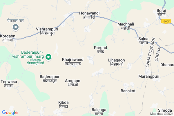
Sargipal
Sargipal Map
EDIT Map
Add Your House
 ..
..
Current Corona Virus Infected Patients Count in Bastar District
| City Name | District Name | Total Covid cases |
|---|
Locality Name :
Sargipal
( सरगीपाल )
Tehsil Name : Baderajpur
District : Bastar
State : Chattisgarh
Language : Oriya and Hindi
Current Time 01:10 AM
Date: Sunday , May 04,2025 (IST)
Time zone: IST (UTC+5:30)
Elevation / Altitude: 325 meters. Above Seal level
Telephone Code / Std Code: 07848
Assembly constituency : Keshkal assembly constituency
Assembly MLA : Neelkanth Tekam
Lok Sabha constituency : Kanker parliamentary constituency
Parliament MP : MOHAN MANDAVI
Serpanch Name :
Main Village Name : Sargipal
Commodities Prices : Vishrampur Market / Mandi
Sargipal Live Weather
Temperature: 23.3 °C
clear sky
Humidity: 71%
Wind : 2.96 mt/sec towards S
StationName : "KÄ\u0081nker"
observed on 1 Hours Back
Temperature: 23.3 °C
clear sky
Humidity: 71%
Wind : 2.96 mt/sec towards S
StationName : "KÄ\u0081nker"
observed on 1 Hours Back
Sargipal Weather Forecast for Next 5 days
04-05-2025
23.0°C to 23.3°C
scattered clouds
23.0°C to 23.3°C
scattered clouds
05-05-2025
21.9°C to 37.3°C
few clouds, clear sky, light rain, broken clouds, scattered clouds
21.9°C to 37.3°C
few clouds, clear sky, light rain, broken clouds, scattered clouds
06-05-2025
24.1°C to 37.0°C
broken clouds, scattered clouds, light rain, clear sky
24.1°C to 37.0°C
broken clouds, scattered clouds, light rain, clear sky
07-05-2025
23.5°C to 36.9°C
few clouds, scattered clouds, broken clouds
23.5°C to 36.9°C
few clouds, scattered clouds, broken clouds
08-05-2025
23.7°C to 36.7°C
scattered clouds, overcast clouds, broken clouds, few clouds
23.7°C to 36.7°C
scattered clouds, overcast clouds, broken clouds, few clouds
National Highways Reachable To Sargipal
Nationa High Way :NH130C
Nationa High Way :NH130C
Rivers Near Sargipal
Nala
Burgor Nadi :Burgor Nadi
Nala
Burgor Nadi :Burgor Nadi
About Sargipal
Correct below Info and add more info about SargipalSargipal is a small Village/hamlet in Baderajpur Tehsil in Bastar District of Chattisgarh State, India. It comes under Sargipal Panchayath. It is located 108 KM towards North from District head quarters Jagdalpur. 160 KM from State capital Raipur
Sargipal is surrounded by Keshkal Tehsil towards west , Raighar Tehsil towards East , Pharasgaon Tehsil towards South , Makdi Tehsil towards South .
Kanker , Kondagaon , Umarkote , Dhamtari are the near by Cities to Sargipal.
Sargipal 2011 Census Details
Sargipal Local Language is Oriya. Sargipal Village Total population is 426 and number of houses are 97. Female Population is 46.7%. Village literacy rate is 60.8% and the Female Literacy rate is 21.8%.
Population
| Census Parameter | Census Data |
| Total Population | 426 |
| Total No of Houses | 97 |
| Female Population % | 46.7 % ( 199) |
| Total Literacy rate % | 60.8 % ( 259) |
| Female Literacy rate | 21.8 % ( 93) |
| Scheduled Tribes Population % | 80.8 % ( 344) |
| Scheduled Caste Population % | 1.4 % ( 6) |
| Working Population % | 66.2 % |
| Child(0 -6) Population by 2011 | 38 |
| Girl Child(0 -6) Population % by 2011 | 31.6 % ( 12) |
Sargipal Census More Deatils.
Politics in Sargipal
INC , Bharatiya Janata Party , BJP , BJP , INC are the major political parties in this area.Polling Stations /Booths near Sargipal
1)Pande Athgaon2)Lihagaon
3)Lanjodha- 1
4)Keshkal ~ 4
5)Mainpur
HOW TO REACH Sargipal
By Rail
There is no railway station near to Sargipal in less than 10 km.Pincodes near Sargipal
494347 ( Vishrampuri ) , 494331 ( Keshkal ) , 494228 ( Pharasgaon )Colleges near Sargipal
Higher Secondary School Gamhari
Address : Gamhari .kondagaon Road
Schools near Sargipal
P.s. Bhawardiha
Address : amgaon , baderajpur , baster , Chattisgarh . PIN- 494347 , Post - Vishrampuri
Ups Khaspara
Address : harwel , baderajpur , baster , Chattisgarh . PIN- 494228 , Post - Pharasgaon
M.s. Maharajganj
Address : kuldadiha , baderajpur , baster , Chattisgarh . PIN- 494347 , Post - Vishrampuri
Primary School
Address : baijanpuri , baderajpur , baster , Chattisgarh . PIN- 494347 , Post - Vishrampuri
Govt Health Centers near Sargipal
1) Parond , Sub Health Centre , Salna ,2) Khajrawand , Sub Health Centre , Vishrampuri ,
3) Balenga , Sub Health Centre , Banskot ,
Sub Villages in Sargipal
Electronic Shops in Sargipal,Baderajpur
Super Markets in Sargipal,Baderajpur
Local Parks in Sargipal,Baderajpur
Police Stations near Sargipal,Baderajpur
About Sargipal &
History
How to reach Sargipal
Tourist Places Near By Sargipal
Schools in Sargipal
Colleges in Sargipal
Temperature & weather of Sargipal
places in Sargipal
Sargipal photos
More Information
How to reach Sargipal
Tourist Places Near By Sargipal
Schools in Sargipal
Colleges in Sargipal
Temperature & weather of Sargipal
places in Sargipal
Sargipal photos
More Information
Village Talk
Post News or Events about this Village
Near Cities
Kanker 46 KM near
Kondagaon 55 KM near
Umarkote 67 KM near
Dhamtari 91 KM near
Kanker 46 KM near
Kondagaon 55 KM near
Umarkote 67 KM near
Dhamtari 91 KM near
Near By Taluks
Baderajpur 0 KM near
Keshkal 22 KM near
Raighar 29 KM near
Pharasgaon 37 KM near
Baderajpur 0 KM near
Keshkal 22 KM near
Raighar 29 KM near
Pharasgaon 37 KM near
Near By Air Ports
Raipur Airport 143 KM near
Vishakhapatnam Airport 332 KM near
Sonegaon Airport 344 KM near
Rajahmundry Airport 363 KM near
Raipur Airport 143 KM near
Vishakhapatnam Airport 332 KM near
Sonegaon Airport 344 KM near
Rajahmundry Airport 363 KM near
Near By Tourist Places
Kanker 45 KM near
Dhamtari 89 KM near
Bastar 118 KM near
Jagdalpur 121 KM near
Mahasamund 138 KM near
Kanker 45 KM near
Dhamtari 89 KM near
Bastar 118 KM near
Jagdalpur 121 KM near
Mahasamund 138 KM near
Near By Districts
Kanker 46 KM near
Narayanpur 72 KM near
Dhamtari 88 KM near
Bastar 104 KM near
Kanker 46 KM near
Narayanpur 72 KM near
Dhamtari 88 KM near
Bastar 104 KM near
Near By RailWay Station
Khariar Road Rail Way Station 137 KM near
Mahasamund Rail Way Station 139 KM near
Khariar Road Rail Way Station 137 KM near
Mahasamund Rail Way Station 139 KM near