| Home | City Bus | Maps | Villages | Cities | Rail | Tourist Places | School | College | Pin Codes | Corona Cases Count |
| Distance Calculator Bus Services IFSC Codes Trace Mobile Number Weather Search Place Trace IP Available Cash ATM/Banks Locate Polling Booth Report an Error contact People |
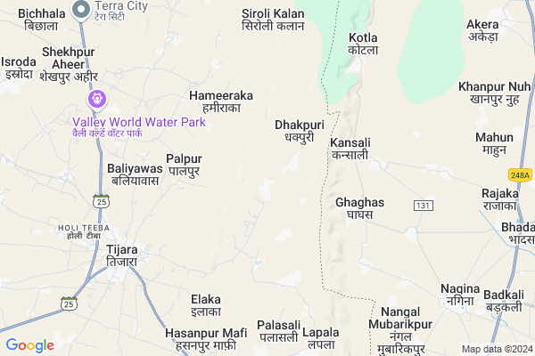
Nangal Map
EDIT Map
Add Your House
 ..
..
Current Corona Virus Infected Patients Count in Alwar District
| City Name | District Name | Total Covid cases |
|---|---|---|
| Alwar District | Alwar | 7 |
Locality Name :
Nangal
( नांगल )
Tehsil Name : Tijara
District : Alwar
State : Rajasthan
Division : Jaipur
Language : Rajasthani
Current Time 12:16 AM
Date: Sunday , May 04,2025 (IST)
Time zone: IST (UTC+5:30)
Elevation / Altitude: 286 meters. Above Seal level
Telephone Code / Std Code: 01493
Assembly constituency : Tijara assembly constituency
Assembly MLA : Mahant Balak Nath
Lok Sabha constituency : Alwar parliamentary constituency
Parliament MP : Balak Nath
Serpanch Name :
Pin Code : 301411
Post Office Name : Tizara
Main Village Name : Nangal
Commodities Prices : Khairthal Market / Mandi
Nangal Live Weather
Temperature: 25.6 °C
overcast clouds
Humidity: 37%
Wind : 3.44 mt/sec towards NE
StationName : "TijÄ\u0081ra"
observed on 2 Hours Back
Temperature: 25.6 °C
overcast clouds
Humidity: 37%
Wind : 3.44 mt/sec towards NE
StationName : "TijÄ\u0081ra"
observed on 2 Hours Back
Nangal Weather Forecast for Next 5 days
04-05-2025
25.0°C to 25.1°C
overcast clouds
25.0°C to 25.1°C
overcast clouds
05-05-2025
25.0°C to 37.2°C
broken clouds, scattered clouds, overcast clouds
25.0°C to 37.2°C
broken clouds, scattered clouds, overcast clouds
06-05-2025
25.9°C to 34.1°C
overcast clouds, light rain, broken clouds
25.9°C to 34.1°C
overcast clouds, light rain, broken clouds
07-05-2025
25.4°C to 38.2°C
overcast clouds, broken clouds, few clouds, scattered clouds, clear sky
25.4°C to 38.2°C
overcast clouds, broken clouds, few clouds, scattered clouds, clear sky
08-05-2025
26.1°C to 38.3°C
clear sky, overcast clouds, broken clouds
26.1°C to 38.3°C
clear sky, overcast clouds, broken clouds
National Highways Reachable To Nangal
Nationa High Way :NH48
Nationa High Way :NH24
Nationa High Way :NH48
Nationa High Way :NH24
About Nangal
Correct below Info and add more info about NangalNangal is a small Village/hamlet in Tijara Tehsil in Alwar District of Rajasthan State, India. It comes under Nangal Panchayath. It belongs to Jaipur Division . It is located 62 KM towards North from District head quarters Alwar. 10 KM from Tijara. 185 KM from State capital Jaipur
Nangal Pin code is 301411 and postal head office is Tizara .
Palpur ( 4 KM ) , Sarheta ( 5 KM ) , Tijara ( 8 KM ) , Hasanpurmaffi ( 8 KM ) , Luhadera ( 9 KM ) are the nearby Villages to Nangal. Nangal is surrounded by Nagina Tehsil towards East , Mewat Tehsil towards North , Ferozepur Jhirka Tehsil towards South , Kotkasim Tehsil towards west .
Bawal , Sohna , Rewari , Palwal are the near by Cities to Nangal.
This Place is in the border of the Alwar District and Mewat District. Mewat District Nagina is East towards this place . It is near to the Haryana State Border.
Nangal 2011 Census Details
Nangal Local Language is Rajasthani. Nangal Village Total population is 313 and number of houses are 42. Female Population is 52.7%. Village literacy rate is 31.6% and the Female Literacy rate is 11.5%.
Population
| Census Parameter | Census Data |
| Total Population | 313 |
| Total No of Houses | 42 |
| Female Population % | 52.7 % ( 165) |
| Total Literacy rate % | 31.6 % ( 99) |
| Female Literacy rate | 11.5 % ( 36) |
| Scheduled Tribes Population % | 0.0 % ( 0) |
| Scheduled Caste Population % | 0.0 % ( 0) |
| Working Population % | 49.5 % |
| Child(0 -6) Population by 2011 | 95 |
| Girl Child(0 -6) Population % by 2011 | 56.8 % ( 54) |
Nangal Census More Deatils.
Politics in Nangal
Bharatiya Janata Party , BJP , BSP , INC are the major political parties in this area.Polling Stations /Booths near Nangal
1)Govt. Senior Secondary School Mayapur2)Govt. Secondary School Gandhola
3)Govt. Upper Primary School Sarkanpur
4)Govt. Senior Secondary School Bichhala East Side Room No. 1
5)Govt. Upper Primary School Muradbas Room No. 1
HOW TO REACH Nangal
By Rail
There is no railway station near to Nangal in less than 10 km.Colleges near Nangal
Anibesaint Girls College
Address :
Rajasthan Degree Girls College Tapukra
Address :
Modern Institute Of Tecnology & Reserch Institute
Address : Sirmoli Road,6 Th Mile Stone, Delhi - Tijara High
Schools in Nangal
Govt. Ps Nagal
Address : nangal , tizara , alwar , Rajasthan . PIN- 301411 , Post - Tizara
Govt Health Centers near Nangal
1) Teouwas , teouwas , jodiya , kotkasim2) Jodiya , jodiya , jodiya , kotkasim
3) Nasopur , nasopur , jodiya , kotkasim
Sub Villages in Nangal
Hospitals in Nangal,Tijara
Dr Wazid Khan ghaghas
122108; RD Complex; U-3; Sector 3; Avas Vikas Colony; Sikandra; Agra; Rajasthan 282004; India
4.1 KM distance Detail
Sonography & Diagnostic Center
Opp. Doctor's Residence (Mahal Baag); Tijara; Rajasthan 301018; India
7.2 KM distance Detail
more ..
Petrol Bunks in Nangal,Tijara
Jain Dharamkanta
near by indian oil petrol pump ward no. 2; Alwar - Bhiwadi Rd; India
7.4 KM distance Detail
iocl petrol pump
Tijara Rd; Ward 2; Ibrahimpur at Virampur; Rajasthan 301411; India
7.5 KM distance Detail
more ..
Colleges in Nangal,Tijara
Chandra Prubhu Digmer Jain College Tijara
301411; RD Complex; U-3; Unnamed Rd; Sector 3; Avas Vikas Colony; Sikandra; Agra; Rajasthan 282004; India
6.1 KM distance Detail
CPD Jain Kanya PG College
Rd to ChandraPrabhu Jain Temple; Tijara; Rajasthan 301411; India
6.7 KM distance Detail
Block Elementary Education Office
Shri Ram Colony; Tijara; Rajasthan 301411; India
7.4 KM distance Detail
more ..
Electronic Shops in Nangal,Tijara
Bhawani Sound & Electrical
Ghivarvaid Mohalla; Tijara; Rajasthan 301411; India
6.9 KM distance Detail
Praveen E-mitra
Mahaver Wadi Mohalla; Khuntala Mohalla; Tijara; Rajasthan 301411; India
6.9 KM distance Detail
Rama Electricals
Chawand Wali Gali; Mahaver Wadi Mohalla; Khuntala Mohalla; Tijara; Rajasthan 301411; India
7.0 KM distance Detail
Local Parks in Nangal,Tijara
Tirangaa Park Shaheed Park
khedla mod; nuh;; Jakohpur; Haryana 122107; India
20.0 KM distance Detail
Governement Offices near Nangal,Tijara
Assistant Engineer Office
Alwar-Tijara Rd; Shastri Nagar; Tijara; Rajasthan 301411; India
7.4 KM distance Detail
Panchayat Samiti Office
Alwar-Tijara Rd; Shri Ram Colony; Tijara; Rajasthan 301411; India
7.5 KM distance Detail
About Nangal &
History
How to reach Nangal
Tourist Places Near By Nangal
Schools in Nangal
Colleges in Nangal
Temperature & weather of Nangal
places in Nangal
Nangal photos
More Information
How to reach Nangal
Tourist Places Near By Nangal
Schools in Nangal
Colleges in Nangal
Temperature & weather of Nangal
places in Nangal
Nangal photos
More Information
Village Talk
Post News or Events about this Village
Near Cities
Bawal 39 KM near
Sohna 39 KM near
Rewari 42 KM near
Palwal 50 KM near
Bawal 39 KM near
Sohna 39 KM near
Rewari 42 KM near
Palwal 50 KM near
Near By Taluks
Tijara 10 KM near
Nagina 13 KM near
Mewat 20 KM near
Ferozepur Jhirka 23 KM near
Tijara 10 KM near
Nagina 13 KM near
Mewat 20 KM near
Ferozepur Jhirka 23 KM near
Near By Air Ports
Indira Gandhi International Airport 77 KM near
Kheria Airport 153 KM near
Sanganeer Airport 187 KM near
Muzaffarnagar Airport 201 KM near
Indira Gandhi International Airport 77 KM near
Kheria Airport 153 KM near
Sanganeer Airport 187 KM near
Muzaffarnagar Airport 201 KM near
Near By Tourist Places
Nuh 20 KM near
Sohna 40 KM near
Manesar 49 KM near
Dabchick 51 KM near
Alwar 59 KM near
Nuh 20 KM near
Sohna 40 KM near
Manesar 49 KM near
Dabchick 51 KM near
Alwar 59 KM near
Near By Districts
Mewat 20 KM near
Rewari 44 KM near
Palwal 50 KM near
Alwar 59 KM near
Mewat 20 KM near
Rewari 44 KM near
Palwal 50 KM near
Alwar 59 KM near
Near By RailWay Station
Khairthal Rail Way Station 35 KM near
Rewari Junction Rail Way Station 44 KM near
Khairthal Rail Way Station 35 KM near
Rewari Junction Rail Way Station 44 KM near