| Home | City Bus | Maps | Villages | Cities | Rail | Tourist Places | School | College | Pin Codes | Corona Cases Count |
| Distance Calculator Bus Services IFSC Codes Trace Mobile Number Weather Search Place Trace IP Available Cash ATM/Banks Locate Polling Booth Report an Error contact People |
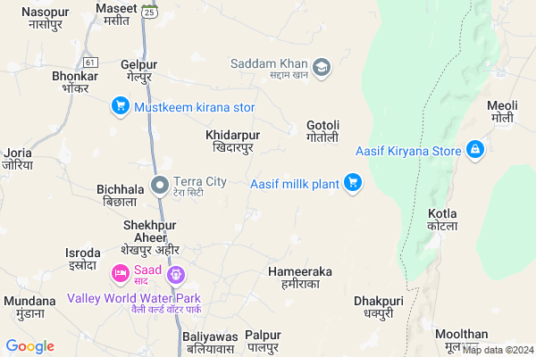
Bhatkol Map
EDIT Map
Add Your House
 ..
..
Current Corona Virus Infected Patients Count in Alwar District
| City Name | District Name | Total Covid cases |
|---|---|---|
| Alwar District | Alwar | 7 |
Locality Name :
Bhatkol
( भटकल )
Tehsil Name : Tijara
District : Alwar
State : Rajasthan
Division : Jaipur
Language : Rajasthani
Current Time 12:34 AM
Date: Sunday , May 04,2025 (IST)
Time zone: IST (UTC+5:30)
Elevation / Altitude: 286 meters. Above Seal level
Telephone Code / Std Code: 01493
Assembly constituency : Tijara assembly constituency
Assembly MLA : Mahant Balak Nath
Lok Sabha constituency : Alwar parliamentary constituency
Parliament MP : Balak Nath
Serpanch Name :
Pin Code : 301411
Post Office Name : Tizara
Main Village Name : Bhatkol
Commodities Prices : Rewari Market / Mandi
Bhatkol Live Weather
Temperature: 25.6 °C
overcast clouds
Humidity: 37%
Wind : 3.44 mt/sec towards NE
StationName : "TijÄ\u0081ra"
observed on 2 Hours Back
Temperature: 25.6 °C
overcast clouds
Humidity: 37%
Wind : 3.44 mt/sec towards NE
StationName : "TijÄ\u0081ra"
observed on 2 Hours Back
Bhatkol Weather Forecast for Next 5 days
04-05-2025
25.0°C to 25.1°C
overcast clouds
25.0°C to 25.1°C
overcast clouds
05-05-2025
25.0°C to 37.2°C
broken clouds, scattered clouds, overcast clouds
25.0°C to 37.2°C
broken clouds, scattered clouds, overcast clouds
06-05-2025
25.9°C to 34.1°C
overcast clouds, light rain, broken clouds
25.9°C to 34.1°C
overcast clouds, light rain, broken clouds
07-05-2025
25.4°C to 38.2°C
overcast clouds, broken clouds, few clouds, scattered clouds, clear sky
25.4°C to 38.2°C
overcast clouds, broken clouds, few clouds, scattered clouds, clear sky
08-05-2025
26.1°C to 38.3°C
clear sky, overcast clouds, broken clouds
26.1°C to 38.3°C
clear sky, overcast clouds, broken clouds
Edit below overview about Bhatkol
Edit below overview about Bhatkol
OverView of Bhatkol
all muslims live in seprate side and all non muslims live on another side in this village.Non muslims colony called RANDABAAS and muslims colony called MUKHYA ABADI.There are 3 mosques in this village called pavtiya wali masjid,mangli wali masjid and ganv wali masjid.Edit below overview about Bhatkol
National Highways Reachable To Bhatkol
Nationa High Way :NH48
Nationa High Way :NH24
Nationa High Way :NH48
Nationa High Way :NH24
About Bhatkol
Bhatkol is a small Village/hamlet in Tijara Tehsil in Alwar District of Rajasthan State, India. It comes under Bhatkol Panchayath. It belongs to Jaipur Division . It is located 66 KM towards North from District head quarters Alwar. 3 KM from Tijara. 188 KM from State capital Jaipur
Bhatkol Pin code is 301411 and postal head office is Tizara .
Rabhana ( 4 KM ) , Palpur ( 6 KM ) , Ishroda ( 7 KM ) , Luhadera ( 8 KM ) , Roopbas ( 9 KM ) are the nearby Villages to Bhatkol. Bhatkol is surrounded by Mewat Tehsil towards East , Nagina Tehsil towards East , Kotkasim Tehsil towards west , Nuh Tehsil towards East .
Bawal , Sohna , Rewari , Palwal are the near by Cities to Bhatkol.
This Place is in the border of the Alwar District and Mewat District. Mewat District Nagina is East towards this place . It is near to the Haryana State Border.
Bhatkol 2011 Census Details
Bhatkol Local Language is Rajasthani. Bhatkol Village Total population is 908 and number of houses are 148. Female Population is 49.3%. Village literacy rate is 45.0% and the Female Literacy rate is 14.1%.
Population
| Census Parameter | Census Data |
| Total Population | 908 |
| Total No of Houses | 148 |
| Female Population % | 49.3 % ( 448) |
| Total Literacy rate % | 45.0 % ( 409) |
| Female Literacy rate | 14.1 % ( 128) |
| Scheduled Tribes Population % | 0.0 % ( 0) |
| Scheduled Caste Population % | 0.0 % ( 0) |
| Working Population % | 51.3 % |
| Child(0 -6) Population by 2011 | 183 |
| Girl Child(0 -6) Population % by 2011 | 55.2 % ( 101) |
Bhatkol Census More Deatils.
Politics in Bhatkol
Bharatiya Janata Party , BJP , BSP , INC are the major political parties in this area.Polling Stations /Booths near Bhatkol
1)Govt. Primary School Harijan Basti South Side Tijara2)Govt. Secondary School Mundana
3)Govt. Primary School Bilaheri
4)Govt. Primary School Middle Side Nangaliya
5)Govt. Upper Primary School Indore
HOW TO REACH Bhatkol
By Rail
There is no railway station near to Bhatkol in less than 10 km.Colleges near Bhatkol
Anibesaint Girls College
Address :
Rajasthan Degree Girls College Tapukra
Address :
Modern Institute Of Tecnology & Reserch Institute
Address : Sirmoli Road,6 Th Mile Stone, Delhi - Tijara High
Schools in Bhatkol
Govt. Pri Sch,bhatkol
Address : bhatkol , tizara , alwar , Rajasthan . PIN- 301411 , Post - Tizara
Govt Health Centers near Bhatkol
1) Nasopur , nasopur , jodiya , kotkasim2) Teouwas , teouwas , jodiya , kotkasim
3) Jodiya , jodiya , jodiya , kotkasim
Sub Villages in Bhatkol
Petrol Bunks in Bhatkol,Tijara
iocl petrol pump
Tijara Rd; Ward 2; Ibrahimpur at Virampur; Rajasthan 301411; India
10.2 KM distance Detail
more ..
Colleges in Bhatkol,Tijara
Chandra Prubhu Digmer Jain College Tijara
301411; RD Complex; U-3; Unnamed Rd; Sector 3; Avas Vikas Colony; Sikandra; Agra; Rajasthan 282004; India
10.4 KM distance Detail
CPD Jain Kanya PG College
Rd to ChandraPrabhu Jain Temple; Tijara; Rajasthan 301411; India
10.9 KM distance Detail
more ..
Super Markets in Bhatkol,Tijara
palak communation vodafone distrubuter
Khiderpur Road; Khidarpur; Rajasthan 301707; India
6.3 KM distance Detail
Police Stations near Bhatkol,Tijara
Women Police Station
civil lines;; Ward Number 1; Hamid Colony; Nuh; Haryana 122107; India
17.1 KM distance Detail
Governement Offices near Bhatkol,Tijara
RAJASTHAN BOOK AND E MITRA CENTRE
Alwar Bhiwadi Road; Gelpur; Rajasthan 301707; India
7.5 KM distance Detail
About Bhatkol &
History
How to reach Bhatkol
Tourist Places Near By Bhatkol
Schools in Bhatkol
Colleges in Bhatkol
Temperature & weather of Bhatkol
places in Bhatkol
Bhatkol photos
More Information
How to reach Bhatkol
Tourist Places Near By Bhatkol
Schools in Bhatkol
Colleges in Bhatkol
Temperature & weather of Bhatkol
places in Bhatkol
Bhatkol photos
More Information
Village Talk
Post News or Events about this Village
Near Cities
Bawal 33 KM near
Sohna 35 KM near
Rewari 35 KM near
Palwal 50 KM near
Bawal 33 KM near
Sohna 35 KM near
Rewari 35 KM near
Palwal 50 KM near
Near By Taluks
Tijara 3 KM near
Mewat 16 KM near
Nagina 19 KM near
Kotkasim 20 KM near
Tijara 3 KM near
Mewat 16 KM near
Nagina 19 KM near
Kotkasim 20 KM near
Near By Air Ports
Indira Gandhi International Airport 71 KM near
Kheria Airport 160 KM near
Sanganeer Airport 191 KM near
Muzaffarnagar Airport 195 KM near
Indira Gandhi International Airport 71 KM near
Kheria Airport 160 KM near
Sanganeer Airport 191 KM near
Muzaffarnagar Airport 195 KM near
Near By Tourist Places
Nuh 17 KM near
Sohna 35 KM near
Manesar 42 KM near
Dabchick 55 KM near
Gurgaon 58 KM near
Nuh 17 KM near
Sohna 35 KM near
Manesar 42 KM near
Dabchick 55 KM near
Gurgaon 58 KM near
Near By Districts
Mewat 16 KM near
Rewari 37 KM near
Palwal 50 KM near
Gurgaon 56 KM near
Mewat 16 KM near
Rewari 37 KM near
Palwal 50 KM near
Gurgaon 56 KM near
Near By RailWay Station
Rewari Junction Rail Way Station 37 KM near
Khairthal Rail Way Station 37 KM near
Rewari Junction Rail Way Station 37 KM near
Khairthal Rail Way Station 37 KM near