| Home | City Bus | Maps | Villages | Cities | Rail | Tourist Places | School | College | Pin Codes | Corona Cases Count |
| Distance Calculator Bus Services IFSC Codes Trace Mobile Number Weather Search Place Trace IP Available Cash ATM/Banks Locate Polling Booth Report an Error contact People |
Dhupe
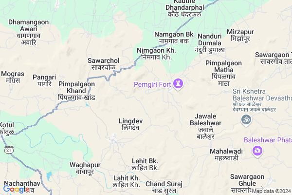
Dhupe Map
EDIT Map
Add Your House
 ..
..
Current Corona Virus Infected Patients Count in Ahmednagar District
| City Name | District Name | Total Covid cases |
|---|
Locality Name :
Dhupe
( धुपे )
Taluka Name : Sangamner
District : Ahmednagar
State : Maharashtra
Region : Khandesh and Northern Maharashtra
Division : Nashik
Language : English and Hindi, Marathi, Urdu
Current Time 03:11 AM
Date: Saturday , May 03,2025 (IST)
Time zone: IST (UTC+5:30)
Elevation / Altitude: 509 meters. Above Seal level
Telephone Code / Std Code: 02425
Assembly constituency : Akole assembly constituency
Assembly MLA : Dr. Kiran Yamaji Lahamate
Lok Sabha constituency : Shirdi parliamentary constituency
Parliament MP : SADASHIV KISAN LOKHANDE
Serpanch Name :
Pin Code : 422603
Post Office Name : Dhandharphal
Main Village Name : Dhupe
Commodities Prices : Akole Market / Mandi
National Highways Reachable To Dhupe
Nationa High Way :NH61
Nationa High Way :NH60
Nationa High Way :NH61
Nationa High Way :NH60
Rivers Near Dhupe
Pravara :प्रवरा
Pravara :प्रवरा
Pravara :प्रवरा
Pravara :प्रवरा
About Dhupe
Correct below Info and add more info about DhupeDhupe is a small Village/hamlet in Sangamner Taluka in Ahmednagar District of Maharashtra State, India. It comes under Dhupe Panchayath. It belongs to Khandesh and Northern Maharashtra region . It belongs to Nashik Division . It is located 92 KM towards west from District head quarters Ahmednagar. 20 KM from Sangamner. 160 KM from State capital Mumbai
Dhupe Pin code is 422603 and postal head office is Dhandharphal .
Jawale Baleshwar ( 5 KM ) , Sawarchol ( 5 KM ) , Kalas Budruk ( 5 KM ) , Pimpalgaon Khand ( 6 KM ) , Pimpalgaon Matha ( 7 KM ) are the nearby Villages to Dhupe. Dhupe is surrounded by Sangamner Taluka towards East , Junnar Taluka towards South , Sinnar Taluka towards North , Rahata Taluka towards East .
Sangamner , Junnar , Sinnar , Manchar are the near by Cities to Dhupe.
Dhupe 2011 Census Details
Dhupe Local Language is English. Dhupe Village Total population is 264 and number of houses are 56. Female Population is 45.1%. Village literacy rate is 72.3% and the Female Literacy rate is 26.5%.
Population
| Census Parameter | Census Data |
| Total Population | 264 |
| Total No of Houses | 56 |
| Female Population % | 45.1 % ( 119) |
| Total Literacy rate % | 72.3 % ( 191) |
| Female Literacy rate | 26.5 % ( 70) |
| Scheduled Tribes Population % | 98.9 % ( 261) |
| Scheduled Caste Population % | 0.0 % ( 0) |
| Working Population % | 64.8 % |
| Child(0 -6) Population by 2011 | 17 |
| Girl Child(0 -6) Population % by 2011 | 35.3 % ( 6) |
Dhupe Census More Deatils.
Politics in Dhupe
RPI(A) , NCP , Shivsena , SHS , INC are the major political parties in this area.Polling Stations /Booths near Dhupe
1)Lavhali Otur Z.p.school2)Lingdev Z.p.school South Parteast West Building Room No.3 From West
3)Sherankhel Z.p.school North South Building Room No.3 From South
4)Ladgaon Z.p.school Building Which Has One Room
5)Jamgaon Z.p.school East West Building Room No.1 From West
HOW TO REACH Dhupe
By Road
Sangamner is the Nearest Town to Dhupe. Sangamner is 26 km from Dhupe. Road connectivity is there from Sangamner to Dhupe.By Rail
There is no railway station near to Dhupe in less than 10 km.Colleges near Dhupe
Shramshakti College Of Agriculture, Maldad
Address :
Ramesh Phirodia College Of Arts Commerece And Science
Address :
Virbhadra Junior College
Address :
B.b.t. Junior College Nanduri Dumala
Address :
Yashwant Vidyalaya Nimon
Address :
Schools in Dhupe
Z.p.p.school Dhupe
Address : dhupe , sangamner , ahmadnagar , Maharashtra . PIN- 422603 , Post - Dhandharphal
Govt Health Centers near Dhupe
1) Pemgiri , Pemgiri , 0 , Near zp school Road2) Lingdev , Sub Center Lingdev , 0 , 0
3) Jawale Baleshwar , primary Health Center Jawale Baleshwar , 0 , near water tank
Sub Villages in Dhupe
Petrol Bunks in Dhupe,Sangamner
Indian Oil Petrol Pump
Ahmadnagar; SH-44; Rahuri Sangamner Road; Akola; Akola; Maharashtra 422601; India
8.7 KM distance Detail
Indian Oil Petrol Pump
Ahmadnagar; SH-44; Rahuri Sangamner Road; Akola; Akola; Maharashtra 422601; India
9.3 KM distance Detail
Vasantrao Balsaraf Reliance Fule Sales
Ahmednagar; Maharashtra 422601; India
11.4 KM distance Detail
BPCL M/S. Deshmukh Petroleum
Near Pwd guest house; Akole Rd; Kotul; Maharashtra 422610; India
12.0 KM distance Detail
more ..
Colleges in Dhupe,Sangamner
Rajmudra Computers; Akole
Near ST Bus Stand; Behind Matoshri Medical;; Akole; Maharashtra 422601; India
12.9 KM distance Detail
Modern High School and Jr. College
At Post Akole; Ahmednagar; Akole; Maharashtra 422601; India
13.1 KM distance Detail
more ..
Schools in Dhupe,Sangamner
Shri Dnyaneshwari English School;nimgoan
Nimgaon Bk; Maharashtra 422603; India
4.9 KM distance Detail
Electronic Shops in Dhupe,Sangamner
Prasad Mobile Reparing center
Dr. Babasaheb Ambedkar Nagar SH44; Kalas; Maharashtra 422603; India
8.8 KM distance Detail
Local Parks in Dhupe,Sangamner
Nehru Garden
Police Station Rd; Police Colony; Sangamner; Maharashtra 422605; India
21.9 KM distance Detail
Savitribai Phule Garden
Sadashanker nagar BOB colony; Sangamner; Maharashtra 422605; India
22.2 KM distance Detail
Police Stations near Dhupe,Sangamner
Akole Police Station
Dhumalwadi Road; Amrut Nagar; Akole; Maharashtra 422601; India
13.1 KM distance Detail
SANGAMNER CITY POLICE STATION
Police Station Road; Punjabi Colony; Sangamner; Maharashtra 422605; India
22.0 KM distance Detail
About Dhupe &
History
How to reach Dhupe
Tourist Places Near By Dhupe
Schools in Dhupe
Colleges in Dhupe
Temperature & weather of Dhupe
places in Dhupe
Dhupe photos
More Information
How to reach Dhupe
Tourist Places Near By Dhupe
Schools in Dhupe
Colleges in Dhupe
Temperature & weather of Dhupe
places in Dhupe
Dhupe photos
More Information
Village Talk
Post News or Events about this Village
Near Cities
Sangamner 20 KM near
Junnar 39 KM near
Sinnar 48 KM near
Manchar 59 KM near
Sangamner 20 KM near
Junnar 39 KM near
Sinnar 48 KM near
Manchar 59 KM near
Near By Taluks
Akole 18 KM near
Sangamner 19 KM near
Junnar 37 KM near
Sinnar 44 KM near
Akole 18 KM near
Sangamner 19 KM near
Junnar 37 KM near
Sinnar 44 KM near
Near By Air Ports
Gandhinagar Airport 70 KM near
Lohegaon Airport 110 KM near
Chhatrapati Shivaji International Airport 147 KM near
Chikkalthana Airport 163 KM near
Gandhinagar Airport 70 KM near
Lohegaon Airport 110 KM near
Chhatrapati Shivaji International Airport 147 KM near
Chikkalthana Airport 163 KM near
Near By Tourist Places
Ozar 36 KM near
Malshej Ghat 38 KM near
Junnar 39 KM near
Ratanwadi 43 KM near
Shirdi 61 KM near
Ozar 36 KM near
Malshej Ghat 38 KM near
Junnar 39 KM near
Ratanwadi 43 KM near
Shirdi 61 KM near
Near By Districts
Nashik 72 KM near
Ahmednagar 89 KM near
Pune 118 KM near
Thane 138 KM near
Nashik 72 KM near
Ahmednagar 89 KM near
Pune 118 KM near
Thane 138 KM near
Near By RailWay Station
Devlali Rail Way Station 61 KM near
Sainagar Shirdi Rail Way Station 62 KM near
Devlali Rail Way Station 61 KM near
Sainagar Shirdi Rail Way Station 62 KM near