| Home | City Bus | Maps | Villages | Cities | Rail | Tourist Places | School | College | Pin Codes | Corona Cases Count |
| Distance Calculator Bus Services IFSC Codes Trace Mobile Number Weather Search Place Trace IP Available Cash ATM/Banks Locate Polling Booth Report an Error contact People |
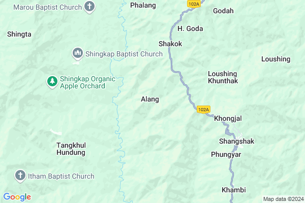
S. Tusom Map
EDIT Map
Add Your House
 ..
..
Current Corona Virus Infected Patients Count in Ukhrul District
| City Name | District Name | Total Covid cases |
|---|
Locality Name :
S. Tusom
( S. तुसम )
Tehsil Name : Phungyar
District : Ukhrul
State : Manipur
Language : Meiteilon (manipuri)
Current Time 12:34 AM
Date: Sunday , May 04,2025 (IST)
Time zone: IST (UTC+5:30)
Telephone Code / Std Code: 03870
Assembly constituency : Phungyar assembly constituency
Assembly MLA : Leishiyo Keishing
Lok Sabha constituency : Outer Manipur parliamentary constituency
Parliament MP : Lorho S. Pfoze
Serpanch Name :
Commodities Prices : Lamlong Bazaar Market / Mandi
National Highways Reachable To S. Tusom
Nationa High Way :NH37
Nationa High Way :NH2
Nationa High Way :NH37
Nationa High Way :NH2
Rivers Near S. Tusom
Imphal River
Iring
Imphal River
Iring
About S. Tusom
Correct below Info and add more info about S. TusomS. Tusom is a Village in Phungyar Tehsil in Ukhrul District of Manipur State, India. It is located 37 KM towards South from District head quarters Ukhrul. 41 KM from State capital Imphal
S. Tusom is surrounded by Kamjong Tehsil towards East , Kasom Khullen Tehsil towards South , Ukhrul Tehsil towards North , Saikul Tehsil towards west .
Imphal , Thoubal , Lilong , Mayang Imphal are the near by Cities to S. Tusom.
Demographics of S. Tusom
Meiteilon (manipuri) is the Local Language here.Politics in S. Tusom
NPF , Naga Peoples Front , BJP , NCP , PDA , INC are the major political parties in this area.Polling Stations /Booths near S. Tusom
1)Aishi2)Shingcha
3)Ramrei
4)Phalang
5)T. Natyang
HOW TO REACH S. Tusom
By Rail
There is no railway station near to S. Tusom in less than 10 km.Pincodes near S. Tusom
795145 ( Litan ) , 795149 ( Yairipok ) , 795010 ( Lamlong )Schools near S. Tusom
Phungyar Hs
Address : phungyar , phungyar , ukhrul , Manipur . PIN- 795010 , Post - Lamlong
Hill Christian Academy School
Address : riha , phungyar , ukhrul , Manipur . PIN- 795145 , Post - Litan
Thawai Hs
Address : thawai , phungyar , ukhrul , Manipur . PIN- 795145 , Post - Litan
Shingkap Hs
Address : shingkap , phungyar , ukhrul , Manipur . PIN- 795145 , Post - Litan
Govt Health Centers near S. Tusom
1) PHSC Seijang , , Sunurok Road , Near Yaingangpokpi Market2) Nongpok Keithelmanbi PHC , Nongpok Keithelmanbi PHC , , Nongpok Keithelmanbi Turel Maya
3) PHSC Chandrakhong , , ,
Electronic Shops in S. Tusom,Phungyar
Super Markets in S. Tusom,Phungyar
Local Parks in S. Tusom,Phungyar
Police Stations near S. Tusom,Phungyar
Governement Offices near S. Tusom,Phungyar
About S. Tusom &
History
How to reach S. Tusom
Tourist Places Near By S. Tusom
Schools in S. Tusom
Colleges in S. Tusom
Temperature & weather of S. Tusom
places in S. Tusom
S. Tusom photos
More Information
How to reach S. Tusom
Tourist Places Near By S. Tusom
Schools in S. Tusom
Colleges in S. Tusom
Temperature & weather of S. Tusom
places in S. Tusom
S. Tusom photos
More Information
Village Talk
Post News or Events about this Village
Near Cities
Imphal 40 KM near
Thoubal 40 KM near
Lilong 44 KM near
Mayang Imphal 54 KM near
Imphal 40 KM near
Thoubal 40 KM near
Lilong 44 KM near
Mayang Imphal 54 KM near
Near By Taluks
Phungyar 0 KM near
Kamjong 24 KM near
Kasom Khullen 25 KM near
Ukhrul 27 KM near
Phungyar 0 KM near
Kamjong 24 KM near
Kasom Khullen 25 KM near
Ukhrul 27 KM near
Near By Air Ports
Imphal Municipal Airport 46 KM near
Dimapur Airport 142 KM near
Kumbhirgram Airport 149 KM near
Aizawl Airport 227 KM near
Imphal Municipal Airport 46 KM near
Dimapur Airport 142 KM near
Kumbhirgram Airport 149 KM near
Aizawl Airport 227 KM near
Near By Tourist Places
Imphal 40 KM near
Thoubal 41 KM near
Chandel 72 KM near
Tamenglong 92 KM near
Kohima 105 KM near
Imphal 40 KM near
Thoubal 41 KM near
Chandel 72 KM near
Tamenglong 92 KM near
Kohima 105 KM near
Near By Districts
Ukhrul 36 KM near
Imphal East 39 KM near
Thoubal 40 KM near
Imphal West 51 KM near
Ukhrul 36 KM near
Imphal East 39 KM near
Thoubal 40 KM near
Imphal West 51 KM near
Near By RailWay Station
Dimapur Rail Way Station 147 KM near
Diphu Rail Way Station 157 KM near
Dimapur Rail Way Station 147 KM near
Diphu Rail Way Station 157 KM near