| Home | City Bus | Maps | Villages | Cities | Rail | Tourist Places | School | College | Pin Codes | Corona Cases Count |
| Distance Calculator Bus Services IFSC Codes Trace Mobile Number Weather Search Place Trace IP Available Cash ATM/Banks Locate Polling Booth Report an Error contact People |
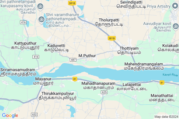
M.puthur
M.puthur Map
EDIT Map
Add Your House
 ..
..
Current Corona Virus Infected Patients Count in Tiruchirappalli District
| City Name | District Name | Total Covid cases |
|---|---|---|
| Tiruchirappalli District | Tiruchirappalli | 51 |
Locality Name :
M.puthur
( M.புத்தூர் )
Block Name : Thottiam
District : Tiruchirappalli
State : Tamil Nadu
Language : Tamil
Current Time 10:17 PM
Date: Thursday , May 01,2025 (IST)
Time zone: IST (UTC+5:30)
Elevation / Altitude: 106 meters. Above Seal level
Telephone Code / Std Code: 04323
Assembly constituency : Musiri assembly constituency
Assembly MLA : N. Thiyagarajan
Lok Sabha constituency : Perambalur parliamentary constituency
Parliament MP : Dr.PAARIVENDHAR, T. R
Serpanch Name :
Pin Code : 621203
Post Office Name : Balasamudram (Tiruchirappalli)
Alternate Village Name : Mputhur , M Puthur
Commodities Prices : Namakkal Market / Mandi
M.puthur Live Weather
Temperature: 31.3 °C
overcast clouds
Humidity: 58%
Wind : 2.72 mt/sec towards SE
StationName : "KÄ\u0081ttupputtÅ«r"
observed on 1 Hours Back
Temperature: 31.3 °C
overcast clouds
Humidity: 58%
Wind : 2.72 mt/sec towards SE
StationName : "KÄ\u0081ttupputtÅ«r"
observed on 1 Hours Back
M.puthur Weather Forecast for Next 5 days
02-05-2025
27.2°C to 30.4°C
light rain, overcast clouds
27.2°C to 30.4°C
light rain, overcast clouds
03-05-2025
27.2°C to 39.1°C
light rain, overcast clouds, broken clouds
27.2°C to 39.1°C
light rain, overcast clouds, broken clouds
04-05-2025
27.6°C to 39.5°C
overcast clouds, broken clouds, few clouds, scattered clouds, light rain
27.6°C to 39.5°C
overcast clouds, broken clouds, few clouds, scattered clouds, light rain
05-05-2025
27.3°C to 37.4°C
overcast clouds, broken clouds, scattered clouds, few clouds, light rain
27.3°C to 37.4°C
overcast clouds, broken clouds, scattered clouds, few clouds, light rain
06-05-2025
27.1°C to 39.6°C
broken clouds, overcast clouds, light rain
27.1°C to 39.6°C
broken clouds, overcast clouds, light rain
Edit below overview about M.puthur
Edit below overview about M.puthur
OverView of M.puthur
m. puther very powerful god sri mahamariamman temple, bhagavathi amman, main street, near mayan perumal, veeramathi amman, sri thandumariamman temple is there.Edit below overview about M.puthur
National Highways Reachable To M.puthur
Nationa High Way :NH81
Nationa High Way :NH44
Nationa High Way :NH81
Nationa High Way :NH44
Rivers Near M.puthur
Kaveri :কাবেরী নদী :Kaveri river :कावेरी नदी :ಕಾವೇರಿ ನದಿ :കാവേരി :कावेरी नदी :காவிரி ஆறு :కావేరి నది
Kaveri :কাবেরী নদী :Kaveri river :कावेरी नदी :ಕಾವೇರಿ ನದಿ :കാവേരി :कावेरी नदी :காவிரி ஆறு :కావేరి నది
Kaveri :কাবেরী নদী :Kaveri river :कावेरी नदी :ಕಾವೇರಿ ನದಿ :കാവേരി :कावेरी नदी :காவிரி ஆறு :కావేరి నది
Kaveri :কাবেরী নদী :Kaveri river :कावेरी नदी :ಕಾವೇರಿ ನದಿ :കാവേരി :कावेरी नदी :காவிரி ஆறு :కావేరి నది
About M.puthur
M.puthur is a Village in Thottiam Block in Tiruchirappalli District of Tamil Nadu State, India. It is located 57 KM towards west from District head quarters Tiruchirapalli. 3 KM from Thottiam. 367 KM from State capital Chennai
M.puthur Pin code is 621203 and postal head office is Balasamudram (Tiruchirappalli).
Arasalur ( 3 KM ) , Kaduvetti ( 4 KM ) , Elurpatti ( 4 KM ) , Tholurpatti ( 4 KM ) , Seelaipillaiyarputhur ( 6 KM ) are the nearby Villages to M.puthur. M.puthur is surrounded by Krishnarayapuram Block towards South , Kulittalai Block towards East , Erumapatty Block towards North , Tattayyangarpettai Block towards East .
Karur , Punjaipugalur , Namakkal , Thuraiyur are the near by Cities to M.puthur.
This Place is in the border of the Tiruchirappalli District and Karur District. Karur District Krishnarayapuram is South towards this place . Also it is in the Border of other district Namakkal .
Demographics of M.puthur
Tamil is the Local Language here.Politics in M.puthur
DMK , AIADMK , INC , ADMK are the major political parties in this area.Polling Stations /Booths near M.puthur
1)Adi Dravidar Welfare Ele.school M.kalathur2)Adi Dravidar Welfare Middle School M.puthur
3)Panchayat Union Ele. School Thirueengoimalai
4)Panchayat Union Ele. School Karaikkadu
5)Panchayat Union Ele. School Murungai
HOW TO REACH M.puthur
By Rail
Sithalavai Rail Way Station , Mahadanapuram Rail Way Station are the very nearby railway stations to M.puthur.Colleges near M.puthur
Vetri Vinayaha College Of Engineering And Technology
Address : Namakkal - Trichy Main Road, Tholurpatti Village,
Schools in M.puthur
A.d.w.m.s,m.puthur
Address : m.puthur , thottiam , tiruchirappalli , Tamil Nadu . PIN- 621203 , Post - Balasamudram (Tiruchirappalli)
Govt Health Centers near M.puthur
1) THOTTIYAM , GOVT HOSPITAL THOTTIAM , THOTTIAM , NEAR POLICE STATION & MARKET2) Kulithalai , GOVERNMENT HOSPITAL , TRICHY MAIN ROAD ,
3) RAKA NURSING HOME , 17H/2 , TRICHY MAIN ROAD , TRICHY MAIN ROAD
Sub Villages in M.puthur
Hospitals in M.puthur,Thottiam
Gvernment Primary Healthcare centre
Mettuthirukkampuliyur; Tamil Nadu 639102; India
5.5 KM distance Detail
more ..
Colleges in M.puthur,Thottiam
Vetri Vinayaha Polytechnic College-Main Gate
Tholurpatti; Tamil Nadu 621215; India
4.6 KM distance Detail
Kongunadu College of Engineering and Technology
Namakkal-Trichy Main Road; Thottiam Taluk; Dist Trichy; Tholurpatti; Tamil Nadu 621215; India
4.6 KM distance Detail
more ..
Schools in M.puthur,Thottiam
Sowmya Public School
Viralimalai Road; Manapparai; Tiruchirapallai; Tamilnadu; Tiruchirapalli; Tamil Nadu 621306; India
2.8 KM distance Detail
Government Higher Secondary School
Krishnarayapuram; Tamil Nadu 639102; India
3.6 KM distance Detail
Super Markets in M.puthur,Thottiam
Muthu Digital Xerox & Podu Savai Maiyam
Balasamudram; Tamil Nadu 621203; India
4.8 KM distance Detail
Dhanushya Supermarket
Tiruchengode - Namakkal - Trichy Rd; Balasamudram; Tamil Nadu 621203; India
4.9 KM distance Detail
Local Parks in M.puthur,Thottiam
Pookkarar Thottam; Mahalipatty
Mahalipatty; Elurpatti; Tamil Nadu 621215; India
5.2 KM distance Detail
CSVK Garden
13/234;Mela chandalavadi; (TK); 639105; Krishnarayapuram; Tamil Nadu; India
5.2 KM distance Detail
Police Stations near M.puthur,Thottiam
Police Station - Lalapet
Kulithali-Karur Main Road; Lalapettai; Tamil Nadu 639105; India
7.4 KM distance Detail
Governement Offices near M.puthur,Thottiam
Krishnarayapuram Matrimonial - Kalyana Vaibogam Matrimony
No. 143/11 Main Road Krishnarayapuram; Karur; Tamil Nadu 639102; India
3.3 KM distance Detail
Sro
Nagapattinam - Coimbatore - Gundlupet Hwy; Krishnarayapuram; Tamil Nadu 639102; India
3.4 KM distance Detail
Krishnarayapuram Taluk Office.
Nagapattinam - Coimbatore - Gundlupet Hwy; Tamil Nadu 639102; India
4.4 KM distance Detail
About M.puthur &
History
How to reach M.puthur
Tourist Places Near By M.puthur
Schools in M.puthur
Colleges in M.puthur
Temperature & weather of M.puthur
places in M.puthur
M.puthur photos
More Information
How to reach M.puthur
Tourist Places Near By M.puthur
Schools in M.puthur
Colleges in M.puthur
Temperature & weather of M.puthur
places in M.puthur
M.puthur photos
More Information
Village Talk
Post News or Events about this Village
Near Cities
Karur 26 KM near
Punjaipugalur 35 KM near
Namakkal 35 KM near
Thuraiyur 46 KM near
Karur 26 KM near
Punjaipugalur 35 KM near
Namakkal 35 KM near
Thuraiyur 46 KM near
Near By Taluks
Thottiam 3 KM near
Krishnarayapuram 5 KM near
Kulittalai 18 KM near
Tattayyangarpettai 21 KM near
Thottiam 3 KM near
Krishnarayapuram 5 KM near
Kulittalai 18 KM near
Tattayyangarpettai 21 KM near
Near By Air Ports
Civil Airport 57 KM near
Salem Airport 84 KM near
Madurai Airport 144 KM near
Peelamedu Airport 153 KM near
Civil Airport 57 KM near
Salem Airport 84 KM near
Madurai Airport 144 KM near
Peelamedu Airport 153 KM near
Near By Tourist Places
Namakkal 33 KM near
Tiruchy 55 KM near
Erode 82 KM near
Dindigul 85 KM near
Yercaud 99 KM near
Namakkal 33 KM near
Tiruchy 55 KM near
Erode 82 KM near
Dindigul 85 KM near
Yercaud 99 KM near
Near By Districts
Karur 25 KM near
Namakkal 35 KM near
Tiruchirappalli 54 KM near
Perambalur 77 KM near
Karur 25 KM near
Namakkal 35 KM near
Tiruchirappalli 54 KM near
Perambalur 77 KM near
Near By RailWay Station
Sithalavai Rail Way Station 3.5 KM near
Mahadanapuram Rail Way Station 3.6 KM near
Lalapet Rail Way Station 7.3 KM near
Karur Junction Rail Way Station 25 KM near
Pugalur Rail Way Station 37 KM near
Sithalavai Rail Way Station 3.5 KM near
Mahadanapuram Rail Way Station 3.6 KM near
Lalapet Rail Way Station 7.3 KM near
Karur Junction Rail Way Station 25 KM near
Pugalur Rail Way Station 37 KM near