| Home | City Bus | Maps | Villages | Cities | Rail | Tourist Places | School | College | Pin Codes | Corona Cases Count |
| Distance Calculator Bus Services IFSC Codes Trace Mobile Number Weather Search Place Trace IP Available Cash ATM/Banks Locate Polling Booth Report an Error contact People |
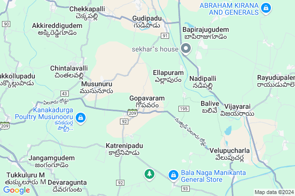
Gopavaram
Gopavaram Map
EDIT Map
Add Your House
 ..
..
Current Corona Virus Infected Patients Count in Krishna District
| City Name | District Name | Total Covid cases |
|---|---|---|
| Krishna District | Krishna | 159 |
| Vijayawada | Krishna | 18 |
| Ranihari Thotta | Krishna | 1 |
| Payakapuram | Krishna | 1 |
| Machilipatnam | Krishna | 1 |
Locality Name :
Gopavaram
( గోపవరం )
Mandal Name : Musunuru
District : Krishna
State : Andhra Pradesh
Region : Andhra
Language : Telugu
Current Time 02:37 AM
Date: Sunday , May 04,2025 (IST)
Time zone: IST (UTC+5:30)
Elevation / Altitude: 16 meters. Above Seal level
Telephone Code / Std Code: 08656
Assembly constituency : assembly constituency
Assembly MLA : Meka Venkata Pratap Apparao
Lok Sabha constituency : parliamentary constituency
Parliament MP : KOTAGIRI SRIDHAR
Serpanch Name :
Pin Code : 521207
Post Office Name : Musunuru
Commodities Prices : Chintalapudi Market / Mandi
Edit below overview about Gopavaram
Edit below overview about Gopavaram
OverView of Gopavaram
gopavaram near towns nuzvid and eluru, nuzvid to gopavaram distence 13km from nuzvid bustop, eluru to goparam distence 18km from eluru new bustand, in gopavaram lord venkateswara temple is very femusEdit below overview about Gopavaram
National Highways Reachable To Gopavaram
Nationa High Way :NH216A
Nationa High Way :NH5
Nationa High Way :NH216A
Nationa High Way :NH5
About Gopavaram
Gopavaram is a Village in Musunuru Mandal in Krishna District of Andhra Pradesh State, India. It belongs to Andhra region . It is located 85 KM towards North from District head quarters Machilipatnam. 3 KM from Musunuru. 317 KM from State capital Hyderabad
Gopavaram Pin code is 521207 and postal head office is Musunuru .
Musunuru ( 4 KM ) , Katrenipadu ( 4 KM ) , Balive ( 5 KM ) , Valasapalli ( 6 KM ) , Chintalavalli ( 7 KM ) are the nearby Villages to Gopavaram. Gopavaram is surrounded by Pedavegi Mandal towards East , Nuzvid Mandal towards west , Lingapalem Mandal towards North , Eluru Mandal towards East .
Nuzvid , Eluru , Hanuman Junction , Gudivada are the near by Cities to Gopavaram.
This Place is in the border of the Krishna District and West Godavari District. West Godavari District Lingapalem is North towards this place .
Demographics of Gopavaram
Telugu is the Local Language here. Total population of Gopavaram is 6134 .Males are 3139 and Females are 2,995 living in 1614 Houses. Total area of Gopavaram is 1566 hectares.HOW TO REACH Gopavaram
By Road
Nuzvid is the Nearest Town to Gopavaram. Nuzvid is 15 km from Gopavaram. Road connectivity is there from Nuzvid to Gopavaram.By Rail
There is no railway station near to Gopavaram in less than 10 km.By Bus
Vijayrai APSRTC Bus Station , Dharmajigudem APSRTC Bus Station , Nuzvid APSRTC Bus Station are the nearby by Bus Stations to Gopavaram .APSRTC runs Number of busses from major cities to here.Colleges near Gopavaram
Sri Vagdevi College
Address : Nuzved
Schools in Gopavaram
Zphs Gopavaram
Address : gopavaram , musunuru , krishna , Andhra Pradesh . PIN- 521207 , Post - Musunuru
Govt Health Centers near Gopavaram
1) Gopavaram , 3-151 , kaikaluru mainroad , near panchayathi2) Gopavaram , Feb-63 , Main Road , RAMALAYAM STREET
3) Venkatapuram , 8-Mar , MAINROAD , NEAR DAIRY MILK
Sub Villages in Gopavaram
Hospitals in Gopavaram,Musunuru
Sai Karthika Diagnostics
SH 43; Dharmaji Gudem; Andhra Pradesh 534462; India
10.2 KM distance Detail
more ..
Petrol Bunks in Gopavaram,Musunuru
Sarvani ..Indian Oil Filling Station
Eluru Rd; Gopavaram; Andhra Pradesh 521207; India
1.3 KM distance Detail
Sri Lakshmi Filling Station Indian Oil Petrol Pump
Nadipalli; West Godavari; SH-43; Gangaram Chintalapudi Road; Pedivegi; Pedivegi; Andhra Pradesh 534475; India
5.0 KM distance Detail
more ..
Colleges in Gopavaram,Musunuru
Gram Panchayat Office Dharmajigudem
Dharmaji Gudem; Andhra Pradesh 534462; India
10.0 KM distance Detail
more ..
Schools in Gopavaram,Musunuru
New Little Flower (em) School
kamma bajjar nuzvid mondal dt; Meerjapuram; Andhra Pradesh; India
3.4 KM distance Detail
Devineni Manikyam & Dasara Venkata Subbaiah ZPH School
Musunuru; Andhra Pradesh 521207; India
4.8 KM distance Detail
Electronic Shops in Gopavaram,Musunuru
kareem electrical works
Gogulampadu Road; Chekkapalli; Andhra Pradesh 521207; India
9.4 KM distance Detail
Police Stations near Gopavaram,Musunuru
Dharmajigudem Police Station
Chintalapudi - Eluru Rd; Dharmaji Gudem; Andhra Pradesh 534462; India
9.8 KM distance Detail
Governement Offices near Gopavaram,Musunuru
MeeSeva Center
Chintalapudi - Eluru Rd; Vijayarai; Andhra Pradesh 534475; India
8.3 KM distance Detail
Mee Seva
Velpucherla; Musunuru M.d; Krishna D.t; Eluru Rd; Velupucharla; Andhra Pradesh 521207; India
8.7 KM distance Detail
About Gopavaram &
History
How to reach Gopavaram
Tourist Places Near By Gopavaram
Schools in Gopavaram
Colleges in Gopavaram
Temperature & weather of Gopavaram
places in Gopavaram
Gopavaram photos
More Information
How to reach Gopavaram
Tourist Places Near By Gopavaram
Schools in Gopavaram
Colleges in Gopavaram
Temperature & weather of Gopavaram
places in Gopavaram
Gopavaram photos
More Information
Village Talk
Post News or Events about this Village
Near Cities
Nuzvid 14 KM near
Eluru 22 KM near
Hanuman Junction 23 KM near
Gudivada 47 KM near
Nuzvid 14 KM near
Eluru 22 KM near
Hanuman Junction 23 KM near
Gudivada 47 KM near
Near By Taluks
Musunuru 3 KM near
Pedavegi 14 KM near
Nuzvid 15 KM near
Lingapalem 16 KM near
Musunuru 3 KM near
Pedavegi 14 KM near
Nuzvid 15 KM near
Lingapalem 16 KM near
Near By Air Ports
Vijayawada Airport 41 KM near
Rajahmundry Airport 107 KM near
Vishakhapatnam Airport 291 KM near
Rajiv Gandhi International Airport 307 KM near
Vijayawada Airport 41 KM near
Rajahmundry Airport 107 KM near
Vishakhapatnam Airport 291 KM near
Rajiv Gandhi International Airport 307 KM near
Near By Tourist Places
Vijayawada 55 KM near
Amaravathi 78 KM near
Machelipatnam 81 KM near
Guntur 90 KM near
Rajahamundry 98 KM near
Vijayawada 55 KM near
Amaravathi 78 KM near
Machelipatnam 81 KM near
Guntur 90 KM near
Rajahamundry 98 KM near
Near By Districts
West Godavari 21 KM near
Krishna 82 KM near
Guntur 91 KM near
Khammam 111 KM near
West Godavari 21 KM near
Krishna 82 KM near
Guntur 91 KM near
Khammam 111 KM near
Near By RailWay Station
Nuzvid Rail Way Station 20 KM near
Eluru Rail Way Station 21 KM near
Nuzvid Rail Way Station 20 KM near
Eluru Rail Way Station 21 KM near