| Home | City Bus | Maps | Villages | Cities | Rail | Tourist Places | School | College | Pin Codes | Corona Cases Count |
| Distance Calculator Bus Services IFSC Codes Trace Mobile Number Weather Search Place Trace IP Available Cash ATM/Banks Locate Polling Booth Report an Error contact People |
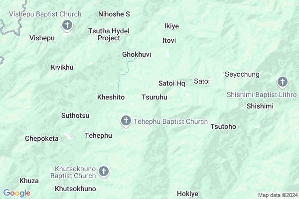
Tsuruhu Map
EDIT Map
Add Your House
 ..
..
Current Corona Virus Infected Patients Count in Zunheboto District
| City Name | District Name | Total Covid cases |
|---|
Locality Name :
Tsuruhu
( तसुरहु )
Tehsil Name : Satakha
District : Zunheboto
State : Nagaland
Language : English and Khasi, Garo
Current Time 05:23 AM
Date: Saturday , May 03,2025 (IST)
Time zone: IST (UTC+5:30)
Assembly constituency : assembly constituency
Assembly MLA :
Lok Sabha constituency : parliamentary constituency
Parliament MP :
Serpanch Name :
Pin Code : 797108
Post Office Name : Phek
Commodities Prices : Ghathashi Market / Mandi
Rivers Near Tsuruhu
Zunki
Tizu River
Zunki
Tizu River
About Tsuruhu
Correct below Info and add more info about TsuruhuTsuruhu is a Village in Satakha Tehsil in Zunheboto District of Nagaland State, India. It is located 24 KM towards South from District head quarters Zunheboto. 15 KM from . 313 KM from State capital Shillong
Tsuruhu Pin code is 797108 and postal head office is Phek .
Satoi ( 3 KM ) , Ghokhuvi ( 3 KM ) , Itovi ( 4 KM ) , Ikiye ( 5 KM ) , Tsutoho ( 6 KM ) are the nearby Villages to Tsuruhu. Tsuruhu is surrounded by Satakha Tehsil towards North , Sekruzu Tehsil towards west , Phek Tehsil towards South , Tokiye Tehsil towards North .
Zunheboto , Wokha , Kohima , Tuensang are the near by Cities to Tsuruhu.
This Place is in the border of the Zunheboto District and Phek District. Phek District Sekruzu is west towards this place . Also it is in the Border of other district Kohima . It is near to the Nagaland State Border.
Tsuruhu 2011 Census Details
Tsuruhu Local Language is English. Tsuruhu Village Total population is 265 and number of houses are 50. Female Population is 47.9%. Village literacy rate is 49.1% and the Female Literacy rate is 20.0%.
Population
| Census Parameter | Census Data |
| Total Population | 265 |
| Total No of Houses | 50 |
| Female Population % | 47.9 % ( 127) |
| Total Literacy rate % | 49.1 % ( 130) |
| Female Literacy rate | 20.0 % ( 53) |
| Scheduled Tribes Population % | 97.4 % ( 258) |
| Scheduled Caste Population % | 0.0 % ( 0) |
| Working Population % | 39.2 % |
| Child(0 -6) Population by 2011 | 68 |
| Girl Child(0 -6) Population % by 2011 | 50.0 % ( 34) |
Tsuruhu Census More Deatils.
HOW TO REACH Tsuruhu
By Rail
There is no railway station near to Tsuruhu in less than 10 km.Schools near Tsuruhu
Super Markets in Tsuruhu,Satakha
Local Parks in Tsuruhu,Satakha
About Tsuruhu &
History
How to reach Tsuruhu
Tourist Places Near By Tsuruhu
Schools in Tsuruhu
Colleges in Tsuruhu
Temperature & weather of Tsuruhu
places in Tsuruhu
Tsuruhu photos
More Information
How to reach Tsuruhu
Tourist Places Near By Tsuruhu
Schools in Tsuruhu
Colleges in Tsuruhu
Temperature & weather of Tsuruhu
places in Tsuruhu
Tsuruhu photos
More Information
Village Talk
Post News or Events about this Village
Near Cities
Zunheboto 18 KM near
Wokha 46 KM near
Kohima 51 KM near
Tuensang 60 KM near
Zunheboto 18 KM near
Wokha 46 KM near
Kohima 51 KM near
Tuensang 60 KM near
Near By Taluks
Sitimi 14 KM near
Satakha 14 KM near
Sekruzu 20 KM near
Phek 21 KM near
Sitimi 14 KM near
Satakha 14 KM near
Sekruzu 20 KM near
Phek 21 KM near
Near By Air Ports
Dimapur Airport 86 KM near
Rowriah Airport 120 KM near
Imphal Municipal Airport 150 KM near
Lilabari Airport 189 KM near
Dimapur Airport 86 KM near
Rowriah Airport 120 KM near
Imphal Municipal Airport 150 KM near
Lilabari Airport 189 KM near
Near By Tourist Places
Phek 19 KM near
Wokha 46 KM near
Kohima 50 KM near
Tuensang 60 KM near
Mokokchung 62 KM near
Phek 19 KM near
Wokha 46 KM near
Kohima 50 KM near
Tuensang 60 KM near
Mokokchung 62 KM near
Near By Districts
Phek 17 KM near
Zunheboto 23 KM near
Kiphire 28 KM near
Wokha 47 KM near
Phek 17 KM near
Zunheboto 23 KM near
Kiphire 28 KM near
Wokha 47 KM near
Near By RailWay Station
Bokajan Rail Way Station 88 KM near
Sarupathar Rail Way Station 89 KM near
Bokajan Rail Way Station 88 KM near
Sarupathar Rail Way Station 89 KM near