| Home | City Bus | Maps | Villages | Cities | Rail | Tourist Places | School | College | Pin Codes | Corona Cases Count |
| Distance Calculator Bus Services IFSC Codes Trace Mobile Number Weather Search Place Trace IP Available Cash ATM/Banks Locate Polling Booth Report an Error contact People |
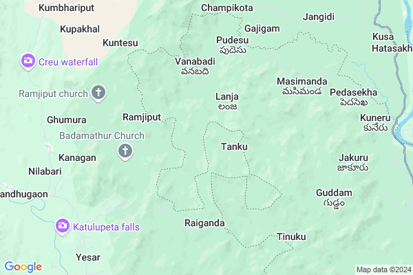
Kuntesu
Kuntesu Map
EDIT Map
Add Your House
 ..
..
Current Corona Virus Infected Patients Count in Vizianagaram District
| City Name | District Name | Total Covid cases |
|---|
Locality Name :
Kuntesu
( కుంటేసు )
Mandal Name : Komarada
District : Vizianagaram
State : Andhra Pradesh
Region : Andhra
Language : Telugu
Current Time 03:16 AM
Date: Saturday , May 03,2025 (IST)
Time zone: IST (UTC+5:30)
Elevation / Altitude: 135 meters. Above Seal level
Telephone Code / Std Code: 08963
Assembly constituency : Kamalapuram assembly constituency
Assembly MLA : POCHIMAREDDY RAVINDRANATH REDDY
Lok Sabha constituency : Kurnool parliamentary constituency
Parliament MP : AYUSHMAN DOCTOR SANJEEV KUMAR
Serpanch Name :
Pin Code : 535521
Post Office Name : Komarada
Commodities Prices : Rayagada Market / Mandi
Kuntesu Live Weather
Temperature: 24.3 °C
few clouds
Humidity: 92%
Wind : 1.16 mt/sec towards S
StationName : "RÄ\u0081yagada"
observed on Now
Temperature: 24.3 °C
few clouds
Humidity: 92%
Wind : 1.16 mt/sec towards S
StationName : "RÄ\u0081yagada"
observed on Now
Kuntesu Weather Forecast for Next 5 days
04-05-2025
22.9°C to 33.4°C
few clouds, broken clouds, scattered clouds, light rain
22.9°C to 33.4°C
few clouds, broken clouds, scattered clouds, light rain
05-05-2025
23.4°C to 36.3°C
scattered clouds, few clouds, light rain, broken clouds
23.4°C to 36.3°C
scattered clouds, few clouds, light rain, broken clouds
06-05-2025
23.1°C to 37.0°C
broken clouds, few clouds, light rain
23.1°C to 37.0°C
broken clouds, few clouds, light rain
07-05-2025
24.9°C to 39.2°C
scattered clouds, broken clouds, overcast clouds
24.9°C to 39.2°C
scattered clouds, broken clouds, overcast clouds
Rivers Near Kuntesu
Indravati
Boduru Gedda
Indravati
Boduru Gedda
About Kuntesu
Correct below Info and add more info about KuntesuKuntesu is a Village in Komarada Mandal in Vizianagaram District of Andhra Pradesh State, India. It belongs to Andhra region . It is located 109 KM towards North from District head quarters Vizianagaram. 11 KM from Komarada. 635 KM from State capital Hyderabad
Kuntesu Pin code is 535521 and postal head office is Komarada .
Masimanda ( 6 KM ) , Naya ( 7 KM ) , Pedasekha ( 8 KM ) , Ulipiri ( 12 KM ) , Chinakerjala ( 12 KM ) are the nearby Villages to Kuntesu. Kuntesu is surrounded by Komarada Mandal towards East , Rayagada Mandal towards North , Parvathipuram Mandal towards South , Narayan Patana Mandal towards west .
Parvathipuram , Rayagada , Bobbili , Gunupur are the near by Cities to Kuntesu.
Kuntesu 2011 Census Details
Kuntesu Local Language is Telugu. Kuntesu Village Total population is 501 and number of houses are 130. Female Population is 51.1%. Village literacy rate is 18.8% and the Female Literacy rate is 5.6%.
Population
| Census Parameter | Census Data |
| Total Population | 501 |
| Total No of Houses | 130 |
| Female Population % | 51.1 % ( 256) |
| Total Literacy rate % | 18.8 % ( 94) |
| Female Literacy rate | 5.6 % ( 28) |
| Scheduled Tribes Population % | 64.1 % ( 321) |
| Scheduled Caste Population % | 31.1 % ( 156) |
| Working Population % | 58.7 % |
| Child(0 -6) Population by 2011 | 74 |
| Girl Child(0 -6) Population % by 2011 | 47.3 % ( 35) |
Kuntesu Census More Deatils.
Politics in Kuntesu
TDP , YSRC , Yuvajana Sramika Rythu Congress Party , YSRCP , INC are the major political parties in this area.Polling Stations /Booths near Kuntesu
1)Bayanapalli2)Narasaramaiahgari Palle
3)Balupalle
4)Diguvapalli
5)Nazeerbegpalli
HOW TO REACH Kuntesu
By Road
Parvathipuram is the Nearest Town to Kuntesu. Parvathipuram is 28 km from Kuntesu. Road connectivity is there from Parvathipuram to Kuntesu.By Rail
Kuneru Rail Way Station is the very nearby railway stations to Kuntesu. Also you can consider railway Stations from Near By town Parvathipuram. Parvatipuram Town Rail Way Station , Parvatipuram Rail Way Station are the railway Stations near to Parvathipuram. You can reach from Parvathipuram to Kuntesu by road after .By Bus
Parvathipuram APSRTC Bus Station , Bobbili APSRTC Bus Station , Battili APSRTC Bus Station are the nearby by Bus Stations to Kuntesu .APSRTC runs Number of busses from major cities to here.Colleges near Kuntesu
Govt Junior College Komarada
Address : Govt Junior College Komarada
Schools in Kuntesu
G.v.v.k. Gunakallu
Address : kuntesu , komarada , vizianagaram , Andhra Pradesh . PIN- 535521 , Post - Komarada
Mpps Kuntesu
Address : kuntesu , komarada , vizianagaram , Andhra Pradesh . PIN- 535521 , Post - Komarada
Govt Health Centers near Kuntesu
1) Yendabadra , , ST STREET , OPP WATER TANK2) Pedasekha , , ST KOTTA STREET , NEAR PANCHYAT OFF
3) KRB Puram , , Main road , ST COLONY
Electronic Shops in Kuntesu,Komarada
Super Markets in Kuntesu,Komarada
Local Parks in Kuntesu,Komarada
Police Stations near Kuntesu,Komarada
Governement Offices near Kuntesu,Komarada
About Kuntesu &
History
How to reach Kuntesu
Tourist Places Near By Kuntesu
Schools in Kuntesu
Colleges in Kuntesu
Temperature & weather of Kuntesu
places in Kuntesu
Kuntesu photos
More Information
How to reach Kuntesu
Tourist Places Near By Kuntesu
Schools in Kuntesu
Colleges in Kuntesu
Temperature & weather of Kuntesu
places in Kuntesu
Kuntesu photos
More Information
Village Talk
Post News or Events about this Village
Near Cities
Parvathipuram 24 KM near
Rayagada 27 KM near
Bobbili 47 KM near
Gunupur 57 KM near
Parvathipuram 24 KM near
Rayagada 27 KM near
Bobbili 47 KM near
Gunupur 57 KM near
Near By Taluks
Bandhugaon 6 KM near
Komarada 11 KM near
Rayagada 22 KM near
Parvathipuram 24 KM near
Bandhugaon 6 KM near
Komarada 11 KM near
Rayagada 22 KM near
Parvathipuram 24 KM near
Near By Air Ports
Vishakhapatnam Airport 154 KM near
Rajahmundry Airport 293 KM near
Bhubaneswar Airport 331 KM near
Raipur Airport 334 KM near
Vishakhapatnam Airport 154 KM near
Rajahmundry Airport 293 KM near
Bhubaneswar Airport 331 KM near
Raipur Airport 334 KM near
Near By Tourist Places
Jeypore 93 KM near
Araku Valley 96 KM near
Ananthagiri 96 KM near
Vizayanagaram 106 KM near
Kalahandi 113 KM near
Jeypore 93 KM near
Araku Valley 96 KM near
Ananthagiri 96 KM near
Vizayanagaram 106 KM near
Kalahandi 113 KM near
Near By Districts
Rayagada 26 KM near
Koraput 77 KM near
Gajapati 95 KM near
Nabarangpur 99 KM near
Rayagada 26 KM near
Koraput 77 KM near
Gajapati 95 KM near
Nabarangpur 99 KM near
Near By RailWay Station
Parvatipuram Town Rail Way Station 23 KM near
Parvatipuram Rail Way Station 25 KM near
Parvatipuram Town Rail Way Station 23 KM near
Parvatipuram Rail Way Station 25 KM near