| Home | City Bus | Maps | Villages | Cities | Rail | Tourist Places | School | College | Pin Codes | Corona Cases Count |
| Distance Calculator Bus Services IFSC Codes Trace Mobile Number Weather Search Place Trace IP Available Cash ATM/Banks Locate Polling Booth Report an Error contact People |
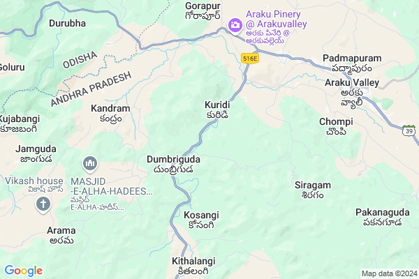
Laseruguda
Laseruguda Map
EDIT Map
Add Your House
 ..
..
Current Corona Virus Infected Patients Count in Visakhapatanam District
| City Name | District Name | Total Covid cases |
|---|---|---|
| Visakhapatnam District | Visakhapatnam | 14 |
| Narsipatnam | Visakhapatnam | 2 |
| Visakhapatnam | Visakhapatnam | 2 |
| Akkayyapelem | Visakhapatnam | 2 |
| Visakapatnam | Visakhapatnam | 1 |
| Gajuwaka | Visakhapatnam | 1 |
Locality Name :
Laseruguda
( లాజరుగుద )
Mandal Name : Dumbriguda
District : Visakhapatanam
State : Andhra Pradesh
Region : Andhra
Language : Telugu
Current Time 09:27 PM
Date: Friday , May 02,2025 (IST)
Time zone: IST (UTC+5:30)
Elevation / Altitude: 910 meters. Above Seal level
Telephone Code / Std Code: 08936
Assembly constituency : Alur assembly constituency
Assembly MLA : P Jayaram
Lok Sabha constituency : Kurnool parliamentary constituency
Parliament MP : AYUSHMAN DOCTOR SANJEEV KUMAR
Serpanch Name :
Pin Code : 531151
Post Office Name : Araku Rs
Main Village Name : Kandrum
Commodities Prices : Koraput(Semilguda) Market / Mandi
Laseruguda Live Weather
Temperature: 23.3 °C
scattered clouds
Humidity: 63%
Wind : 2.42 mt/sec towards E
StationName : "MÄ\u0081dugula"
observed on 2 Hours Back
Temperature: 23.3 °C
scattered clouds
Humidity: 63%
Wind : 2.42 mt/sec towards E
StationName : "MÄ\u0081dugula"
observed on 2 Hours Back
Laseruguda Weather Forecast for Next 5 days
03-05-2025
20.8°C to 22.4°C
light rain, scattered clouds, few clouds
20.8°C to 22.4°C
light rain, scattered clouds, few clouds
04-05-2025
20.3°C to 32.3°C
clear sky, light rain, broken clouds, few clouds
20.3°C to 32.3°C
clear sky, light rain, broken clouds, few clouds
05-05-2025
21.8°C to 32.9°C
few clouds, scattered clouds, light rain
21.8°C to 32.9°C
few clouds, scattered clouds, light rain
06-05-2025
21.6°C to 32.6°C
scattered clouds, few clouds, light rain, moderate rain, overcast clouds, broken clouds
21.6°C to 32.6°C
scattered clouds, few clouds, light rain, moderate rain, overcast clouds, broken clouds
07-05-2025
21.3°C to 32.4°C
broken clouds, light rain
21.3°C to 32.4°C
broken clouds, light rain
Rivers Near Laseruguda
Champavati
Potula Gedda
Champavati
Potula Gedda
About Laseruguda
Correct below Info and add more info about LaserugudaLaseruguda is a small Village/hamlet in Dumbriguda Mandal in Visakhapatanam District of Andhra Pradesh State, India. It comes under Kandrum Panchayath. It belongs to Andhra region . It is located 93 KM towards North from District head quarters Vishakhapatnam. 548 KM from State capital Hyderabad
Laseruguda Pin code is 531151 and postal head office is Araku Rs .
Laseruguda is surrounded by Araku Valley Mandal towards East , Hukumpeta Mandal towards South , Nandapur Mandal towards North , Ananthagiri Mandal towards East .
Sunabeda , Salur , Koraput , Bobbili are the near by Cities to Laseruguda.
Demographics of Laseruguda
Telugu is the Local Language here. Total population of Laseruguda is 977 .Males are 451 and Females are 526 living in 225 Houses. Total area of Laseruguda is 1179 hectares.Politics in Laseruguda
TDP , YSRC , Yuvajana Sramika Rythu Congress Party , PRAP , YSRCP , INC are the major political parties in this area.Polling Stations /Booths near Laseruguda
1)M.kottala2)Nitravatti
3)P.kotakonda
4)P.kotakonda-
5)P.kotakonda-
HOW TO REACH Laseruguda
By Road
Vizianagaram is the Nearest Town to Laseruguda. Vizianagaram is 97 km from Laseruguda. Road connectivity is there from Vizianagaram to Laseruguda.By Rail
Gorapur Rail Way Station , Araku Rail Way Station are the very nearby railway stations to Laseruguda. Also you can consider railway Stations from Near By town Vizianagaram. Vizianagaram Junction Rail Way Station , Nellimarla Rail Way Station are the railway Stations near to Vizianagaram. You can reach from Vizianagaram to Laseruguda by road after .By Bus
Arakuvalley APSRTC Bus Station , Araku APSRTC Bus Station , Borra Caves APSRTC Bus Station are the nearby by Bus Stations to Laseruguda .APSRTC runs Number of busses from major cities to here.Colleges near Laseruguda
A P T W R Jr College Araku Valley Vizag
Address : A P T W R Jr College Araku Valley Vizag
Shanti Niketan Degree College
Address : Ttc Buildings, Arakuvalley, Visakhapatnam Dist.,
Schools in Laseruguda
Govt Ups Kandrum
Address : kandrum , dumbriguda , visakhapatnam , Andhra Pradesh . PIN- 531151 , Post - Araku Rs
Govt Health Centers near Laseruguda
1) Dumbriguda , Govt Hospital , santhavalasa , dumbriguda2) Dumbriguda , , santhavalasa , Dumbriguda
3) Fareedpeta , , Peddaveedhi , Behind Ramamandiram
Hospitals in Laseruguda,Dumbriguda
Life Line Health Center;Araku Village
Visakhapatnam; Andhra Pradesh 531151; India
6.9 KM distance Detail
Unity for charity office ; Life Line health center Araku main road
Visakhapatnam; Andhra Pradesh 531151; India
6.9 KM distance Detail
more ..
Petrol Bunks in Laseruguda,Dumbriguda
HP PETROL PUMP - PATRO FILLING STATION
HP Petrol Pump AT Padua Post Padua; Sambalpur; Odisha 764038; India
19.1 KM distance Detail
more ..
Colleges in Laseruguda,Dumbriguda
Radha Krishna Junior College Padwa
Vizag; semililguda Road; Dorasubalar; Odisha 764038; India
21.3 KM distance Detail
more ..
Schools in Laseruguda,Dumbriguda
M.P. Elementary School; Gattaraguda
Visakapatnam; Gattaraguda; Andhra Pradesh 531149; India
17.2 KM distance Detail
Local Parks in Laseruguda,Dumbriguda
Padmapuram Garden
Padmapuram village; Arakuvalley; ITDA Paderu; Araku; Andhra Pradesh 531151; India
9.9 KM distance Detail
Shangrilla Eco Gardens & Farm Stays
Padmapuram Gardens - Ranajilleda Waterfalls Road; Araku; Andhra Pradesh 531141; India
10.8 KM distance Detail
Governement Offices near Laseruguda,Dumbriguda
MeeSeva Center
1-30; Dumbriguda (Block); Araku Santa;Araku; Araku - Visakhapatnam Rd; Andhra Pradesh 531151; India
6.8 KM distance Detail
MeeSeva Center
Yendapallivalasa;; Araku - Visakhapatnam Rd; Araku; Andhra Pradesh 531151; India
8.5 KM distance Detail
MeeSeva Center
Near RTC Complex; Araku - Visakhapatnam Rd; Araku; Andhra Pradesh 531149; India
9.0 KM distance Detail
About Laseruguda &
History
How to reach Laseruguda
Tourist Places Near By Laseruguda
Schools in Laseruguda
Colleges in Laseruguda
Temperature & weather of Laseruguda
places in Laseruguda
Laseruguda photos
More Information
How to reach Laseruguda
Tourist Places Near By Laseruguda
Schools in Laseruguda
Colleges in Laseruguda
Temperature & weather of Laseruguda
places in Laseruguda
Laseruguda photos
More Information
Village Talk
Post News or Events about this Village
Near Cities
Sunabeda 53 KM near
Salur 54 KM near
Koraput 66 KM near
Bobbili 72 KM near
Sunabeda 53 KM near
Salur 54 KM near
Koraput 66 KM near
Bobbili 72 KM near
Near By Taluks
Dumbriguda 0 KM near
Araku Valley 17 KM near
Hukumpeta 21 KM near
Nandapur 25 KM near
Dumbriguda 0 KM near
Araku Valley 17 KM near
Hukumpeta 21 KM near
Nandapur 25 KM near
Near By Air Ports
Vishakhapatnam Airport 86 KM near
Rajahmundry Airport 189 KM near
Vijayawada Airport 325 KM near
Raipur Airport 380 KM near
Vishakhapatnam Airport 86 KM near
Rajahmundry Airport 189 KM near
Vijayawada Airport 325 KM near
Raipur Airport 380 KM near
Near By Tourist Places
Ananthagiri 7 KM near
Araku Valley 7 KM near
Vizayanagaram 73 KM near
Jeypore 76 KM near
Simhachalam 84 KM near
Ananthagiri 7 KM near
Araku Valley 7 KM near
Vizayanagaram 73 KM near
Jeypore 76 KM near
Simhachalam 84 KM near
Near By Districts
Koraput 64 KM near
Vizianagaram 74 KM near
Visakhapatanam 89 KM near
Malkangiri 108 KM near
Koraput 64 KM near
Vizianagaram 74 KM near
Visakhapatanam 89 KM near
Malkangiri 108 KM near
Near By RailWay Station
Gorapur Rail Way Station 6.4 KM near
Araku Rail Way Station 7.8 KM near
Koraput Junction Rail Way Station 62 KM near
Kottavalasa Junction Rail Way Station 67 KM near
Gorapur Rail Way Station 6.4 KM near
Araku Rail Way Station 7.8 KM near
Koraput Junction Rail Way Station 62 KM near
Kottavalasa Junction Rail Way Station 67 KM near