| Home | City Bus | Maps | Villages | Cities | Rail | Tourist Places | School | College | Pin Codes | Corona Cases Count |
| Distance Calculator Bus Services IFSC Codes Trace Mobile Number Weather Search Place Trace IP Available Cash ATM/Banks Locate Polling Booth Report an Error contact People |
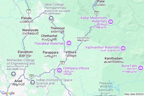
Maruthamala
Maruthamala Map
EDIT Map
Add Your House
 ..
..
Current Corona Virus Infected Patients Count in Thiruvananthapuram District
| City Name | District Name | Total Covid cases |
|---|---|---|
| Thiruvananthapuram District | Thiruvananthapuram | 11 |
| Thiruvananthapuram | Thiruvananthapuram | 2 |
| Varkala | Thiruvananthapuram | 1 |
| Nedumangad | Thiruvananthapuram | 1 |
Locality Name :
Maruthamala
( മര്ത്ഥമല്ല )
Block Name : Vellanad
District : Thiruvananthapuram
State : Kerala
Division : South Kerala
Language : Malayalam and English, Tamil, Hindi, Tulu, Konkani
Current Time 11:57 PM
Date: Saturday , May 03,2025 (IST)
Time zone: IST (UTC+5:30)
Elevation / Altitude: 28 meters. Above Seal level
Telephone Code / Std Code: 04728
Assembly constituency : Aruvikkara assembly constituency
Assembly MLA : Adv. G. Steephen
Lok Sabha constituency : Attingal parliamentary constituency
Parliament MP : Adv. ADOOR PRAKASH
Serpanch Name :
Pin Code : 695551
Post Office Name : Vithura
Main Village Name : Vithura
Commodities Prices : Nedumangadu Market / Mandi
Maruthamala Live Weather
Temperature: 24.9 °C
overcast clouds
Humidity: 98%
Wind : 1.73 mt/sec towards NW
StationName : "NedumangÄ\u0081d"
observed on Now
Temperature: 24.9 °C
overcast clouds
Humidity: 98%
Wind : 1.73 mt/sec towards NW
StationName : "NedumangÄ\u0081d"
observed on Now
Maruthamala Weather Forecast for Next 5 days
04-05-2025
23.9°C to 26.9°C
overcast clouds
23.9°C to 26.9°C
overcast clouds
05-05-2025
23.1°C to 33.8°C
overcast clouds, light rain, broken clouds
23.1°C to 33.8°C
overcast clouds, light rain, broken clouds
06-05-2025
24.7°C to 33.6°C
overcast clouds, broken clouds, light rain, moderate rain
24.7°C to 33.6°C
overcast clouds, broken clouds, light rain, moderate rain
07-05-2025
24.3°C to 31.6°C
light rain, overcast clouds
24.3°C to 31.6°C
light rain, overcast clouds
08-05-2025
23.8°C to 31.6°C
light rain, broken clouds
23.8°C to 31.6°C
light rain, broken clouds
National Highways Reachable To Maruthamala
Nationa High Way :NH44
Nationa High Way :NH66
Nationa High Way :NH44
Nationa High Way :NH66
Rivers Near Maruthamala
Kazhuthurutty River
Mamam river
Kazhuthurutty River
Mamam river
About Maruthamala
Correct below Info and add more info about MaruthamalaMaruthamala is a small Village/hamlet in Vellanad Block in Thiruvananthapuram District of Kerala State, India. It comes under Vithura Panchayath. It belongs to South Kerala Division . It is located 30 KM towards North from District head quarters Thiruvananthapuram. 14 KM from Vellanad. 30 KM from State capital Thiruvananthapuram
Maruthamala Pin code is 695551 and postal head office is Vithura .
Maruthamala is surrounded by Nedumangad Block towards west , Vamanapuram Block towards west , Thiruvananthapuram Block towards South , Nemom Block towards South .
Nedumangad , Attingal , Thiruvananthapuram , Neyyattinkara are the near by Cities to Maruthamala.
Demographics of Maruthamala
Malayalam is the Local Language here.Politics in Maruthamala
CPM , Indian National Congress , RSP , INC are the major political parties in this area.Polling Stations /Booths near Maruthamala
1)Govt U P S Vithura Old Building East End2)Govt U P S Vellanadu East Building Middle Portion
3)Govt U P S Vithura North End
4)Govt V H S S Vellanadu South Building North Portion
5)Govt L P S Chayam East Building West End
HOW TO REACH Maruthamala
By Rail
There is no railway station near to Maruthamala in less than 10 km.Colleges near Maruthamala
Sarabhai Institute Of Science & Technology
Address : Vellanad. P.o., Thiruvananthapuram, Kerala
Lourdes Matha Institute Of Hotel Management And Catering Technology
Address : Lourdes Matha Institute Of Hotel Management And Ca
Schools in Maruthamala
Govt. Vhss Vithura
Address : vithura , palode , thiruvananthapuram , Kerala . PIN- 695551 , Post - Vithura
Govt. Hs Anappara
Address : vithura , palode , thiruvananthapuram , Kerala . PIN- 695551 , Post - Vithura
Gups Vithura
Address : vithura , palode , thiruvananthapuram , Kerala . PIN- 695551 , Post - Vithura
Govt Health Centers near Maruthamala
1) PHC CHITTAR , Chittar Community health centre , Chittar Maniyar road , police stationHospitals in Maruthamala,Vellanad
Vithura Government Homoeo Dispensary
Thiruvananthapuram - Ponmudi Rd; Vithura; Kerala 695551; India
0.8 KM distance Detail
more ..
Petrol Bunks in Maruthamala,Vellanad
Hindustan Petroleum
Tholikodu; Tholicode-Adamuzhy Road; Vithura; Kerala 695547; India
1.0 KM distance Detail
more ..
Colleges in Maruthamala,Vellanad
Indian Institute of Space Science and Technology
Valiamala Road; Valiamala; Thiruvananthapuram; Kerala 695547; India
10.0 KM distance Detail
more ..
Schools in Maruthamala,Vellanad
Govt. V H S S Vithura
Vithura High School Road; Vithura; Thiruvananthapuram; Kerala 695551; India
1.3 KM distance Detail
Govt. UP School വിതുര U P സ്കൂൾ
Vithura High School Rd; Vithura; Kerala 695551; India
1.3 KM distance Detail
Electronic Shops in Maruthamala,Vellanad
Regal Studio
Market Junction; Vithura Po; M G Road; M G Road; Thiruvananthapuram; Kerala 695001; India
0.9 KM distance Detail
Local Parks in Maruthamala,Vellanad
Childrens Park L P S Nedumangad
Nedumangad Town Rd; Pazhakutty; Pazhavadi; Nedumangad; Kerala 695541; India
14.7 KM distance Detail
Police Stations near Maruthamala,Vellanad
Janamaithri Police Station Palode
Palode; Near Government Community Health Center; Thiruvananthapuram; Kerala 695562; India
9.1 KM distance Detail
About Maruthamala &
History
How to reach Maruthamala
Tourist Places Near By Maruthamala
Schools in Maruthamala
Colleges in Maruthamala
Temperature & weather of Maruthamala
places in Maruthamala
Maruthamala photos
More Information
How to reach Maruthamala
Tourist Places Near By Maruthamala
Schools in Maruthamala
Colleges in Maruthamala
Temperature & weather of Maruthamala
places in Maruthamala
Maruthamala photos
More Information
Village Talk
Post News or Events about this Village
Near Cities
Nedumangad 15 KM near
Attingal 32 KM near
Thiruvananthapuram 32 KM near
Neyyattinkara 35 KM near
Nedumangad 15 KM near
Attingal 32 KM near
Thiruvananthapuram 32 KM near
Neyyattinkara 35 KM near
Near By Taluks
Vellanad 14 KM near
Nedumangad 14 KM near
Vamanapuram 17 KM near
Thiruvananthapuram 27 KM near
Vellanad 14 KM near
Nedumangad 14 KM near
Vamanapuram 17 KM near
Thiruvananthapuram 27 KM near
Near By Air Ports
Trivandrum International Airport 32 KM near
Tuticorin Airport 116 KM near
Madurai Airport 189 KM near
Kochi Airport 202 KM near
Trivandrum International Airport 32 KM near
Tuticorin Airport 116 KM near
Madurai Airport 189 KM near
Kochi Airport 202 KM near
Near By Tourist Places
Ponmudi 10 KM near
Trivandrum 29 KM near
Thenmala 34 KM near
Kovalam 37 KM near
Courtallam 38 KM near
Ponmudi 10 KM near
Trivandrum 29 KM near
Thenmala 34 KM near
Kovalam 37 KM near
Courtallam 38 KM near
Near By Districts
Thiruvananthapuram 29 KM near
Kollam 68 KM near
Tirunelveli 72 KM near
Kanniyakumari 76 KM near
Thiruvananthapuram 29 KM near
Kollam 68 KM near
Tirunelveli 72 KM near
Kanniyakumari 76 KM near
Near By RailWay Station
Thiruvananthapuram Central Rail Way Station 29 KM near
Thiruvananthapuram Pettah Rail Way Station 30 KM near
Thiruvananthapuram Central Rail Way Station 29 KM near
Thiruvananthapuram Pettah Rail Way Station 30 KM near