| Home | City Bus | Maps | Villages | Cities | Rail | Tourist Places | School | College | Pin Codes | Corona Cases Count |
| Distance Calculator Bus Services IFSC Codes Trace Mobile Number Weather Search Place Trace IP Available Cash ATM/Banks Locate Polling Booth Report an Error contact People |
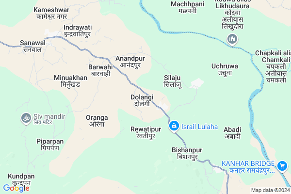
Dolangi
Dolangi Map
EDIT Map
Add Your House
 ..
..
Current Corona Virus Infected Patients Count in Surguja District
| City Name | District Name | Total Covid cases |
|---|
Locality Name :
Dolangi
( डोलांगी )
Tehsil Name : Ramchandrapur
District : Surguja
State : Chattisgarh
Language : Chhattisgarhi and Hindi, Bharia
Current Time 07:12 AM
Date: Saturday , May 03,2025 (IST)
Time zone: IST (UTC+5:30)
Elevation / Altitude: 533 meters. Above Seal level
Telephone Code / Std Code: 07779
Assembly constituency : Ramanujganj assembly constituency
Assembly MLA : Ram Vichar Netam
Lok Sabha constituency : Surguja parliamentary constituency
Parliament MP : Renuka Singh Saruta
Serpanch Name :
Pin Code : 497225
Post Office Name : Wadrafnagar
Commodities Prices : Dudhi Market / Mandi
Rivers Near Dolangi
Rihand
Danru
Rihand
Danru
About Dolangi
Correct below Info and add more info about DolangiDolangi is a Village in Ramchandrapur Tehsil in Surguja District of Chattisgarh State, India. It is located 116 KM towards North from District head quarters Ambikapur. 14 KM from Ramchadrapur. 418 KM from State capital Raipur
Dolangi Pin code is 497225 and postal head office is Wadrafnagar .
Silaju ( 3 KM ) , Oranga ( 4 KM ) , Barwahi ( 4 KM ) , Bishunpur ( 6 KM ) , Indrawatipur ( 6 KM ) are the nearby Villages to Dolangi. Dolangi is surrounded by Chinia Tehsil towards East , Dhurki Tehsil towards North , Dandai Tehsil towards East , Dudhi Tehsil towards North .
Garhwa , Renukoot , Kota , Daltonganj are the near by Cities to Dolangi.
This Place is in the border of the Surguja District and Garhwa District. Garhwa District Chinia is East towards this place . It is near to the Jharkhand State Border.
Dolangi 2011 Census Details
Dolangi Local Language is Chhattisgarhi. Dolangi Village Total population is 1423 and number of houses are 277. Female Population is 50.7%. Village literacy rate is 45.5% and the Female Literacy rate is 17.8%.
Population
| Census Parameter | Census Data |
| Total Population | 1423 |
| Total No of Houses | 277 |
| Female Population % | 50.7 % ( 722) |
| Total Literacy rate % | 45.5 % ( 648) |
| Female Literacy rate | 17.8 % ( 253) |
| Scheduled Tribes Population % | 26.4 % ( 376) |
| Scheduled Caste Population % | 0.0 % ( 0) |
| Working Population % | 51.9 % |
| Child(0 -6) Population by 2011 | 329 |
| Girl Child(0 -6) Population % by 2011 | 50.8 % ( 167) |
Dolangi Census More Deatils.
Politics in Dolangi
Bharatiya Janata Party , BJP , INC are the major political parties in this area.Polling Stations /Booths near Dolangi
1)Obri2)Dindo -k
3)Ranahat ~2
4)Barooli
5)Indarpur
HOW TO REACH Dolangi
By Rail
There is no railway station near to Dolangi in less than 10 km.Colleges near Dolangi
Gorment Up Collage Ramchandrapur
Address : Village+post Ramchandrapur
Gorment Iti Ramchandrapur
Address : Village+post+ps+tehsil Ramchandrapur
Schools in Dolangi
M.s.dolangi
Address : dolangi , ramchandrapur , surguja , Chattisgarh . PIN- 497220 , Post - Ramanujganj
Govt Health Centers near Dolangi
1) SHC Dolangi , , VILLAGE-DOLANGI ,2) SHC Barwahi , , VILLAGE-BARWAHI ,
3) SHC Oranga , , VILLAGE-ORANGA ,
Hospitals in Dolangi,Ramchandrapur
Chc Dhurki Hospital
नगर उँटारी - धुरकी - चिनिया रोड; Tendra alias Dhurki; Jharkhand 822128; India
18.6 KM distance Detail
more ..
Petrol Bunks in Dolangi,Ramchandrapur
Maa Fancy Vastralaya Dhurki
न�¤?र �¤?�¤?�¤?ार�¥? - ध�¥?र�¤?�¥? - �¤?िनिया र�¥?ड; Tendra alias Dhurki; Jharkhand 822128; India
18.1 KM distance Detail
more ..
Schools in Dolangi,Ramchandrapur
Govt Upgraded Middle School
Libra alias Paras pani Kalan; Jharkhand 822121; India
13.3 KM distance Detail
Electronic Shops in Dolangi,Ramchandrapur
Dinesh Mobil kair And Sadi Kard Printing Press
Tendra alias Dhurki; Jharkhand 822128; India
18.0 KM distance Detail
Super Markets in Dolangi,Ramchandrapur
Pawan Jewelars And Bartan Dukan
; Belri alias Chinia; Jharkhand 822125; India
23.3 KM distance Detail
Local Parks in Dolangi,Ramchandrapur
Police Stations near Dolangi,Ramchandrapur
Governement Offices near Dolangi,Ramchandrapur
About Dolangi &
History
How to reach Dolangi
Tourist Places Near By Dolangi
Schools in Dolangi
Colleges in Dolangi
Temperature & weather of Dolangi
places in Dolangi
Dolangi photos
More Information
How to reach Dolangi
Tourist Places Near By Dolangi
Schools in Dolangi
Colleges in Dolangi
Temperature & weather of Dolangi
places in Dolangi
Dolangi photos
More Information
Village Talk
Post News or Events about this Village
Near Cities
Garhwa 46 KM near
Renukoot 52 KM near
Kota 66 KM near
Daltonganj 72 KM near
Garhwa 46 KM near
Renukoot 52 KM near
Kota 66 KM near
Daltonganj 72 KM near
Near By Taluks
Ramchandrapur 14 KM near
Chinia 20 KM near
Dhurki 25 KM near
Dandai 26 KM near
Ramchandrapur 14 KM near
Chinia 20 KM near
Dhurki 25 KM near
Dandai 26 KM near
Near By Air Ports
Varanasi Airport 192 KM near
Gaya Airport 194 KM near
Ranchi Airport 230 KM near
Bamrauli Airport 263 KM near
Varanasi Airport 192 KM near
Gaya Airport 194 KM near
Ranchi Airport 230 KM near
Bamrauli Airport 263 KM near
Near By Tourist Places
Sarguja 86 KM near
Betla National Park 89 KM near
Rohtasgarh Fort 93 KM near
Palamu 97 KM near
Ambikapur 113 KM near
Sarguja 86 KM near
Betla National Park 89 KM near
Rohtasgarh Fort 93 KM near
Palamu 97 KM near
Ambikapur 113 KM near
Near By Districts
Garhwa 46 KM near
Palamu 71 KM near
Singrauli 89 KM near
Sonbhadra 94 KM near
Garhwa 46 KM near
Palamu 71 KM near
Singrauli 89 KM near
Sonbhadra 94 KM near
Near By RailWay Station
Wyndhamganj Rail Way Station 33 KM near
Duddhinagar Rail Way Station 35 KM near
Wyndhamganj Rail Way Station 33 KM near
Duddhinagar Rail Way Station 35 KM near