| Home | City Bus | Maps | Villages | Cities | Rail | Tourist Places | School | College | Pin Codes | Corona Cases Count |
| Distance Calculator Bus Services IFSC Codes Trace Mobile Number Weather Search Place Trace IP Available Cash ATM/Banks Locate Polling Booth Report an Error contact People |
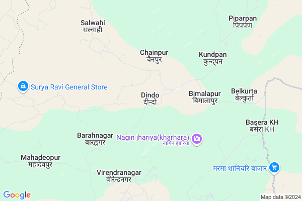
Dindo
Dindo Map
EDIT Map
Add Your House
 ..
..
Current Corona Virus Infected Patients Count in Surguja District
| City Name | District Name | Total Covid cases |
|---|
Locality Name :
Dindo
( डिण्डो )
Tehsil Name : Ramchandrapur
District : Surguja
State : Chattisgarh
Language : Chhattisgarhi and Hindi, Bharia
Current Time 08:12 AM
Date: Saturday , May 03,2025 (IST)
Time zone: IST (UTC+5:30)
Elevation / Altitude: 533 meters. Above Seal level
Telephone Code / Std Code: 07779
Assembly constituency : Ramanujganj assembly constituency
Assembly MLA : Ram Vichar Netam
Lok Sabha constituency : Surguja parliamentary constituency
Parliament MP : Renuka Singh Saruta
Serpanch Name :
Pin Code : 497225
Post Office Name : Wadrafnagar
Commodities Prices : Dudhi Market / Mandi
Dindo Live Weather
Temperature: 29.6 °C
clear sky
Humidity: 37%
Wind : 3.19 mt/sec towards SW
StationName : "DÅ«dhi"
observed on 18 Mins Back
Temperature: 29.6 °C
clear sky
Humidity: 37%
Wind : 3.19 mt/sec towards SW
StationName : "DÅ«dhi"
observed on 18 Mins Back
Dindo Weather Forecast for Next 5 days
04-05-2025
25.6°C to 37.1°C
light rain, clear sky, broken clouds, scattered clouds, few clouds
25.6°C to 37.1°C
light rain, clear sky, broken clouds, scattered clouds, few clouds
05-05-2025
24.1°C to 40.3°C
clear sky, scattered clouds, light rain, broken clouds
24.1°C to 40.3°C
clear sky, scattered clouds, light rain, broken clouds
06-05-2025
24.7°C to 40.1°C
scattered clouds, few clouds, light rain, broken clouds
24.7°C to 40.1°C
scattered clouds, few clouds, light rain, broken clouds
07-05-2025
25.9°C to 39.8°C
few clouds, clear sky, broken clouds, light rain, scattered clouds
25.9°C to 39.8°C
few clouds, clear sky, broken clouds, light rain, scattered clouds
08-05-2025
25.9°C to 41.1°C
clear sky
25.9°C to 41.1°C
clear sky
Rivers Near Dindo
Rihand
Danru
Rihand
Danru
About Dindo
Correct below Info and add more info about DindoDindo is a Village in Ramchandrapur Tehsil in Surguja District of Chattisgarh State, India. It is located 103 KM towards North from District head quarters Ambikapur. 16 KM from Ramchadrapur. 401 KM from State capital Raipur
Dindo Pin code is 497225 and postal head office is Wadrafnagar .
Bimalpur ( 4 KM ) , Kurludih ( 6 KM ) , Kundpan ( 6 KM ) , Virendranagar ( 6 KM ) , Chera ( 6 KM ) are the nearby Villages to Dindo. Dindo is surrounded by Babhani Tehsil towards west , Wadrafnagar Tehsil towards west , Chinia Tehsil towards East , Dudhi Tehsil towards North .
Renukoot , Garhwa , Kota , Obra are the near by Cities to Dindo.
This Place is in the border of the Surguja District and Garhwa District. Garhwa District Chinia is East towards this place . It is near to the Jharkhand State Border.
Dindo 2011 Census Details
Dindo Local Language is Chhattisgarhi. Dindo Village Total population is 2322 and number of houses are 421. Female Population is 51.9%. Village literacy rate is 49.7% and the Female Literacy rate is 22.6%.
Population
| Census Parameter | Census Data |
| Total Population | 2322 |
| Total No of Houses | 421 |
| Female Population % | 51.9 % ( 1205) |
| Total Literacy rate % | 49.7 % ( 1154) |
| Female Literacy rate | 22.6 % ( 525) |
| Scheduled Tribes Population % | 58.1 % ( 1348) |
| Scheduled Caste Population % | 11.0 % ( 255) |
| Working Population % | 47.8 % |
| Child(0 -6) Population by 2011 | 437 |
| Girl Child(0 -6) Population % by 2011 | 49.2 % ( 215) |
Dindo Census More Deatils.
Politics in Dindo
Bharatiya Janata Party , BJP , INC are the major political parties in this area.Polling Stations /Booths near Dindo
1)Dindo2)Dhouli
3)Tatapani
4)Sagarpur
5)Vijyanagar 3
HOW TO REACH Dindo
By Rail
There is no railway station near to Dindo in less than 10 km.Colleges near Dindo
Gorment Up Collage Ramchandrapur
Address : Village+post Ramchandrapur
Gorment Iti Ramchandrapur
Address : Village+post+ps+tehsil Ramchandrapur
Schools in Dindo
M.s.dindo
Address : dindo , ramchandrapur , surguja , Chattisgarh . PIN- 497220 , Post - Ramanujganj
Govt Health Centers near Dindo
1) SHC Salwahi , , VILLAGE-SALWAHI ,2) SHC Pachawal , , VILLAGE-PACHAWAL ,
3) SHC Talkeshwerpur , , VILLAGE-TALKESHWARPUR ,
Local Parks in Dindo,Ramchandrapur
Governement Offices near Dindo,Ramchandrapur
About Dindo &
History
How to reach Dindo
Tourist Places Near By Dindo
Schools in Dindo
Colleges in Dindo
Temperature & weather of Dindo
places in Dindo
Dindo photos
More Information
How to reach Dindo
Tourist Places Near By Dindo
Schools in Dindo
Colleges in Dindo
Temperature & weather of Dindo
places in Dindo
Dindo photos
More Information
Village Talk
Post News or Events about this Village
Near Cities
Renukoot 47 KM near
Garhwa 64 KM near
Kota 69 KM near
Obra 72 KM near
Renukoot 47 KM near
Garhwa 64 KM near
Kota 69 KM near
Obra 72 KM near
Near By Taluks
Ramchandrapur 15 KM near
Babhani 21 KM near
Wadrafnagar 21 KM near
Chinia 36 KM near
Ramchandrapur 15 KM near
Babhani 21 KM near
Wadrafnagar 21 KM near
Chinia 36 KM near
Near By Air Ports
Varanasi Airport 197 KM near
Gaya Airport 212 KM near
Ranchi Airport 241 KM near
Bamrauli Airport 259 KM near
Varanasi Airport 197 KM near
Gaya Airport 212 KM near
Ranchi Airport 241 KM near
Bamrauli Airport 259 KM near
Near By Tourist Places
Sarguja 72 KM near
Ambikapur 100 KM near
Betla National Park 103 KM near
Rohtasgarh Fort 110 KM near
Palamu 111 KM near
Sarguja 72 KM near
Ambikapur 100 KM near
Betla National Park 103 KM near
Rohtasgarh Fort 110 KM near
Palamu 111 KM near
Near By Districts
Garhwa 64 KM near
Singrauli 79 KM near
Palamu 87 KM near
Sonbhadra 98 KM near
Garhwa 64 KM near
Singrauli 79 KM near
Palamu 87 KM near
Sonbhadra 98 KM near
Near By RailWay Station
Duddhinagar Rail Way Station 36 KM near
Wyndhamganj Rail Way Station 44 KM near
Duddhinagar Rail Way Station 36 KM near
Wyndhamganj Rail Way Station 44 KM near