| Home | City Bus | Maps | Villages | Cities | Rail | Tourist Places | School | College | Pin Codes | Corona Cases Count |
| Distance Calculator Bus Services IFSC Codes Trace Mobile Number Weather Search Place Trace IP Available Cash ATM/Banks Locate Polling Booth Report an Error contact People |
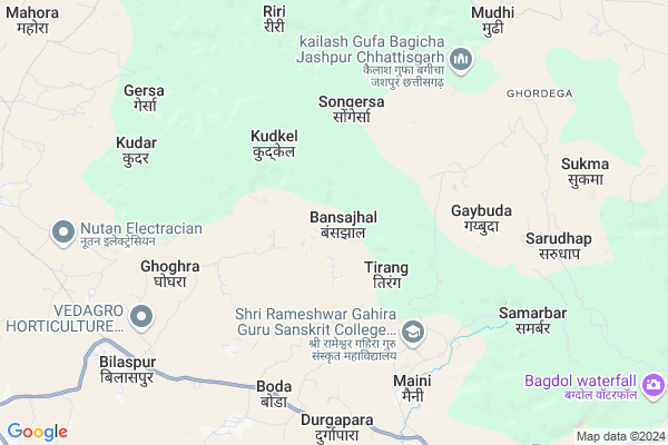
Bansajhal
Bansajhal Map
EDIT Map
Add Your House
 ..
..
Current Corona Virus Infected Patients Count in Surguja District
| City Name | District Name | Total Covid cases |
|---|
Locality Name :
Bansajhal
( बांसाझाल )
Tehsil Name : Batauli
District : Surguja
State : Chattisgarh
Language : Chhattisgarhi and Hindi, Bharia
Current Time 01:54 AM
Date: Sunday , May 04,2025 (IST)
Time zone: IST (UTC+5:30)
Elevation / Altitude: 619 meters. Above Seal level
Telephone Code / Std Code: 07769
Assembly constituency : Sitapur assembly constituency
Assembly MLA : Poorv Sainik Ramkumar Toppo
Lok Sabha constituency : Surguja parliamentary constituency
Parliament MP : Renuka Singh Saruta
Serpanch Name :
Pin Code : 497101
Post Office Name : Batouli
Commodities Prices : Kakni Market / Mandi
Bansajhal Live Weather
Temperature: 23.7 °C
clear sky
Humidity: 49%
Wind : 2.37 mt/sec towards SE
StationName : "AmbikÄ\u0081pur"
observed on 1 Hours Back
Temperature: 23.7 °C
clear sky
Humidity: 49%
Wind : 2.37 mt/sec towards SE
StationName : "AmbikÄ\u0081pur"
observed on 1 Hours Back
Bansajhal Weather Forecast for Next 5 days
04-05-2025
21.7°C to 23.6°C
few clouds
21.7°C to 23.6°C
few clouds
05-05-2025
21.4°C to 37.3°C
few clouds, clear sky, broken clouds, light rain, overcast clouds
21.4°C to 37.3°C
few clouds, clear sky, broken clouds, light rain, overcast clouds
06-05-2025
24.6°C to 36.9°C
overcast clouds, broken clouds, scattered clouds, light rain, few clouds
24.6°C to 36.9°C
overcast clouds, broken clouds, scattered clouds, light rain, few clouds
07-05-2025
23.7°C to 37.3°C
scattered clouds, few clouds, clear sky
23.7°C to 37.3°C
scattered clouds, few clouds, clear sky
08-05-2025
26.1°C to 38.5°C
scattered clouds, few clouds, broken clouds
26.1°C to 38.5°C
scattered clouds, few clouds, broken clouds
National Highways Reachable To Bansajhal
Nationa High Way :NH343
Nationa High Way :NH343
Rivers Near Bansajhal
Samarsuta
Ib
Samarsuta
Ib
About Bansajhal
Correct below Info and add more info about BansajhalBansajhal is a Village in Batauli Tehsil in Surguja District of Chattisgarh State, India. It is located 40 KM towards East from District head quarters Ambikapur. 12 KM from Batauli. 324 KM from State capital Raipur
Bansajhal Pin code is 497101 and postal head office is Batouli .
Salehadih ( 4 KM ) , Boda ( 6 KM ) , Kudar ( 8 KM ) , Ghoghara ( 8 KM ) , Jarakela ( 8 KM ) are the nearby Villages to Bansajhal. Bansajhal is surrounded by Lundra Tehsil towards North , Bagicha Tehsil towards East , Sitapur Tehsil towards South , Mainpat Tehsil towards South .
Ambikapur , Jashpurnagar , Gumla , Korba are the near by Cities to Bansajhal.
Bansajhal 2011 Census Details
Bansajhal Local Language is Chhattisgarhi. Bansajhal Village Total population is 1637 and number of houses are 373. Female Population is 48.3%. Village literacy rate is 46.1% and the Female Literacy rate is 17.2%.
Population
| Census Parameter | Census Data |
| Total Population | 1637 |
| Total No of Houses | 373 |
| Female Population % | 48.3 % ( 791) |
| Total Literacy rate % | 46.1 % ( 755) |
| Female Literacy rate | 17.2 % ( 281) |
| Scheduled Tribes Population % | 84.5 % ( 1383) |
| Scheduled Caste Population % | 1.0 % ( 17) |
| Working Population % | 64.4 % |
| Child(0 -6) Population by 2011 | 268 |
| Girl Child(0 -6) Population % by 2011 | 48.1 % ( 129) |
Bansajhal Census More Deatils.
Politics in Bansajhal
Bharatiya Janata Party , BJP , INC are the major political parties in this area.Polling Stations /Booths near Bansajhal
1)Vagdholi2)Kunmera 1
3)Tendudand
4)Chalta
5)Salainagar
HOW TO REACH Bansajhal
By Rail
There is no railway station near to Bansajhal in less than 10 km.Colleges near Bansajhal
Shri Sai Baba Aadarsh Mahavidyalaya,ambikapur
Address :
Govt. College Silphili
Address :
K.d Collage Pratapur
Address :
Government Iti
Address :
Gorment Up Collage Ramchandrapur
Address : Village+post Ramchandrapur
Schools in Bansajhal
M.s. Kadmahuya
Address : bansajhal , bataoli , surguja , Chattisgarh . PIN- 497101 , Post - Batouli
Ashram Bansajhal
Address : bansajhal , bataoli , surguja , Chattisgarh . PIN- 497101 , Post - Batouli
M.s.bansajhal
Address : bansajhal , bataoli , surguja , Chattisgarh . PIN- 497101 , Post - Batouli
Govt Health Centers near Bansajhal
1) Basajhhal , Basajhhal , Basajhhal , Basajhhal2) SHC Gaibuda , Sub Health Center , village- Gaibuda , Tahsil- Bagicha
3) PHC Maini , primary health center , Village- Maini , Tahsil- Bagicha
Petrol Bunks in Bansajhal,Batauli
HP Petrol Pump - Samrath Petrol Pump
Village Batoli Tehsil Sitapur District Sarguja; NH 78; Raipur; Chhattisgarh 497101; India
15.0 KM distance Detail
Hindustan Petroleum
Batauli; Surguja; NH-78; Ambikapur Highway; Batali; Batali; Chhattisgarh 497111; India
15.0 KM distance Detail
more ..
Colleges in Bansajhal,Batauli
Shri Rameshwar Gahira Guru Sanskrit College Samarbar; Jashpur
Samarbar; Maini; Chhattisgarh 496224; India
5.5 KM distance Detail
Naveen Government College
Santipara; Shantipara; Surguja; NH-78; Ambikapur Highway; Sitapur; Sitapur; Chhattisgarh 497111; India
14.5 KM distance Detail
more ..
Schools in Bansajhal,Batauli
श्री रामेश्वर गहिरा गुरु उ;माध्यमिक विद्यालय-सामरबार
गांव- सामरबार पोस्ट दुर्गापारा तह- बगीचा दिसत; Maini; Chhattisgarh 496224; India
6.0 KM distance Detail
Local Parks in Bansajhal,Batauli
शासकीय उधान बेलकोटा Belkota Narsari
Bargidih; Road; Belkota; Chhattisgarh 497101; India
15.3 KM distance Detail
About Bansajhal &
History
How to reach Bansajhal
Tourist Places Near By Bansajhal
Schools in Bansajhal
Colleges in Bansajhal
Temperature & weather of Bansajhal
places in Bansajhal
Bansajhal photos
More Information
How to reach Bansajhal
Tourist Places Near By Bansajhal
Schools in Bansajhal
Colleges in Bansajhal
Temperature & weather of Bansajhal
places in Bansajhal
Bansajhal photos
More Information
Village Talk
Post News or Events about this Village
Near Cities
Ambikapur 38 KM near
Jashpurnagar 74 KM near
Gumla 117 KM near
Korba 118 KM near
Ambikapur 38 KM near
Jashpurnagar 74 KM near
Gumla 117 KM near
Korba 118 KM near
Near By Taluks
Batauli 11 KM near
Lundra 17 KM near
Bagicha 21 KM near
Sitapur 31 KM near
Batauli 11 KM near
Lundra 17 KM near
Bagicha 21 KM near
Sitapur 31 KM near
Near By Air Ports
Ranchi Airport 209 KM near
Gaya Airport 268 KM near
Raipur Airport 308 KM near
Varanasi Airport 310 KM near
Ranchi Airport 209 KM near
Gaya Airport 268 KM near
Raipur Airport 308 KM near
Varanasi Airport 310 KM near
Near By Tourist Places
Ambikapur 38 KM near
Sarguja 53 KM near
Jashpur 73 KM near
Netarhat 102 KM near
Baikunthpur 114 KM near
Ambikapur 38 KM near
Sarguja 53 KM near
Jashpur 73 KM near
Netarhat 102 KM near
Baikunthpur 114 KM near
Near By Districts
Surguja 38 KM near
Jashpur 73 KM near
Korea 113 KM near
Gumla 117 KM near
Surguja 38 KM near
Jashpur 73 KM near
Korea 113 KM near
Gumla 117 KM near
Near By RailWay Station
Barwadih Junction Rail Way Station 122 KM near
Kharsia Rail Way Station 138 KM near
Barwadih Junction Rail Way Station 122 KM near
Kharsia Rail Way Station 138 KM near