| Home | City Bus | Maps | Villages | Cities | Rail | Tourist Places | School | College | Pin Codes | Corona Cases Count |
| Distance Calculator Bus Services IFSC Codes Trace Mobile Number Weather Search Place Trace IP Available Cash ATM/Banks Locate Polling Booth Report an Error contact People |
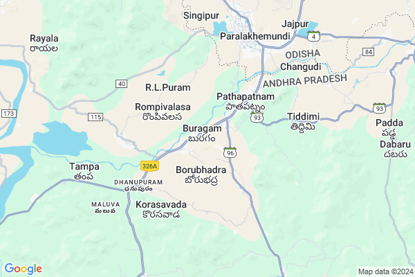
Labarapeta Ui
Labarapeta Ui Map
EDIT Map
Add Your House
 ..
..
Current Corona Virus Infected Patients Count in Srikakulam District
| City Name | District Name | Total Covid cases |
|---|---|---|
| Srikakulam District | Srikakulam | 3 |
Locality Name :
Labarapeta Ui
( లాభరపేట ఉయ్ )
Mandal Name : Pathapatnam
District : Srikakulam
State : Andhra Pradesh
Region : Andhra
Language : Telugu
Current Time 02:39 AM
Date: Sunday , May 04,2025 (IST)
Time zone: IST (UTC+5:30)
Elevation / Altitude: 68 meters. Above Seal level
Telephone Code / Std Code: 08946
Assembly constituency : Udayagiri assembly constituency
Assembly MLA : REDDY SHANTHI
Lok Sabha constituency : Anantapur parliamentary constituency
Parliament MP : KINJARAPU RAM MOHAN NAIDU
Serpanch Name :
Pin Code : 532201
Post Office Name : Tekkali
Main Village Name : Temburu
Commodities Prices : Parlakhemundi Market / Mandi
Labarapeta Ui Live Weather
Temperature: 26.4 °C
few clouds
Humidity: 77%
Wind : 0.73 mt/sec towards N
StationName : "ParlÄ\u0081kimidi"
observed on 1 Hours Back
Temperature: 26.4 °C
few clouds
Humidity: 77%
Wind : 0.73 mt/sec towards N
StationName : "ParlÄ\u0081kimidi"
observed on 1 Hours Back
Labarapeta Ui Weather Forecast for Next 5 days
04-05-2025
26.4°C to 26.4°C
broken clouds
26.4°C to 26.4°C
broken clouds
05-05-2025
25.7°C to 38.4°C
scattered clouds, few clouds, clear sky, light rain
25.7°C to 38.4°C
scattered clouds, few clouds, clear sky, light rain
06-05-2025
26.9°C to 38.4°C
scattered clouds, few clouds, clear sky, moderate rain, light rain, overcast clouds, broken clouds
26.9°C to 38.4°C
scattered clouds, few clouds, clear sky, moderate rain, light rain, overcast clouds, broken clouds
07-05-2025
26.3°C to 40.0°C
overcast clouds, broken clouds, clear sky, light rain
26.3°C to 40.0°C
overcast clouds, broken clouds, clear sky, light rain
08-05-2025
28.0°C to 39.3°C
overcast clouds, broken clouds, scattered clouds, light rain
28.0°C to 39.3°C
overcast clouds, broken clouds, scattered clouds, light rain
Rivers Near Labarapeta Ui
Bendi Gedda
Vamsadhara
Bendi Gedda
Vamsadhara
About Labarapeta Ui
Correct below Info and add more info about Labarapeta UiLabarapeta Ui is a small Village/hamlet in Pathapatnam Mandal in Srikakulam District of Andhra Pradesh State, India. It comes under Temburu Panchayath. It belongs to Andhra region . It is located 60 KM towards North from District head quarters Srikakulam. 712 KM from State capital Hyderabad
Labarapeta Ui Pin code is 532201 and postal head office is Tekkali .
Labarapeta Ui is surrounded by Hiramandalam Mandal towards west , Meliaputti Mandal towards East , Saravakota Mandal towards South , Kotturu Mandal towards west .
Parlakhemundi , Palasa Kasibugga , Amadalavalasa , Gunupur are the near by Cities to Labarapeta Ui.
This Place is in the border of the Srikakulam District and Gajapati District. Gajapati District Gosani is East towards this place . It is near to the Odisha State Border.
Demographics of Labarapeta Ui
Telugu is the Local Language here. Total population of Labarapeta Ui is 3594 .Males are 1770 and Females are 1,824 living in 873 Houses. Total area of Labarapeta Ui is 742 hectares.Politics in Labarapeta Ui
TD , TDP , YSRC , Yuvajana Sramika Rythu Congress Party , YSRCP , INC are the major political parties in this area.Polling Stations /Booths near Labarapeta Ui
1)Jaladanki2)Jammalapalem
3)Kummara Kondur
4)L.r.agraharam
5)Veligandla
HOW TO REACH Labarapeta Ui
By Road
Palasa Kasibugga is the Nearest Town to Labarapeta Ui. Palasa Kasibugga is 31 km from Labarapeta Ui. Road connectivity is there from Palasa Kasibugga to Labarapeta Ui.By Rail
Pathapatnam Rail Way Station , Paralakhemundi Rail Way Station are the very nearby railway stations to Labarapeta Ui. Also you can consider railway Stations from Near By town Palasa Kasibugga. Kotabommali Rail Way Station , Dindu Gopala Puram Halt Rail Way Station are the railway Stations near to Palasa Kasibugga. You can reach from Palasa Kasibugga to Labarapeta Ui by road after .By Bus
Patapatnam(Boarder) APSRTC Bus Station , Parlakimidi APSRTC Bus Station , Kotturu APSRTC Bus Station are the nearby by Bus Stations to Labarapeta Ui .APSRTC runs Number of busses from major cities to here.Colleges near Labarapeta Ui
Sri Vidyaniketan Jr College, Pathapatnam
Address : Pathapatnam
A P S W R Jr. College, Pathapatnam
Address : Pathapatnam
Kiranmayi Jr College, Pathapatnam
Address : Pathapatnam
Mahendra Jr College, Pathapatnam
Address : Pathapatnam
Govt Junior College Pathapatnam
Address : Govt Junior College Pathapatnam
Schools near Labarapeta Ui
Apswrs Pathapatnam
Address : pathapatnam , pathapatnam , srikakulam , Andhra Pradesh . PIN- 532213 , Post - Pathapatnam
Kmps Pathapatnam
Address : pathapatnam , pathapatnam , srikakulam , Andhra Pradesh . PIN- 532213 , Post - Pathapatnam
Vignan High Scholl
Address : pathapatnam , pathapatnam , srikakulam , Andhra Pradesh . PIN- 532213 , Post - Pathapatnam
K.g.b.v School
Address : pathapatnam , pathapatnam , srikakulam , Andhra Pradesh . PIN- 532213 , Post - Pathapatnam
Govt Health Centers near Labarapeta Ui
1) Booragam , 1-120 , MAIN STRET , MAIN STRET2) Meliaputti , Main Road, , Opp. MRO Office , MELIAPUTTI
3) Labara , , Kapu street , Near Rama Mandir
Hospitals in Labarapeta Ui,Pathapatnam
sumani medical
పర్లాకిమిడి నరస్సన్నపేట రహదారి; Korasawada; Andhra Pradesh 532214; India
1.6 KM distance Detail
Vijayadurga Dental Care
Kotaguddi Colony; Pathapatnam; Andhra Pradesh 532213; India
3.0 KM distance Detail
more ..
Petrol Bunks in Labarapeta Ui,Pathapatnam
Hindustan Petroleum
Srikakulam; SH-4; Kotabommali Road; Patha Patnam; Patha Patnam; Andhra Pradesh 532213; India
1.3 KM distance Detail
SRI NEELAMANI DURGA F/S - HPCL
Parlakhemundi - Narasannapeta Rd; Pathapatnam; Andhra Pradesh 532213; India
1.3 KM distance Detail
HP PETROL PUMP - HP AUTO CARE CENTRE PATHAPATNAM
Hpcl Dealers S.NO.99/19; Praharajapalem Village Pathapatnam Mandal; Visakhapatnam; Andhra Pradesh 532213; India
1.4 KM distance Detail
Subakari Enterprises Indian Oil Petrol Pump
Korasavada; Srikakulam; SH-4; Kotabommali Road; Patha Patnam; Patha Patnam; Andhra Pradesh 532213; India
3.0 KM distance Detail
more ..
Colleges in Labarapeta Ui,Pathapatnam
Womens College
Jawahar Navodaya School Road; Friends Colony; Paralakhemundi; Odisha 761201; India
6.1 KM distance Detail
Centurion University Of Technology And Management;M S Swaminathan School Of Agricultural
paralakhemudi; Odisha 761200; India
6.9 KM distance Detail
Sri Krushna Chandra Gajapati College
Paralakhemundi; Gajapati; Odisha 761200; India
6.9 KM distance Detail
more ..
Schools in Labarapeta Ui,Pathapatnam
APSWREIS JUNIOR COLLEGE PATHAPATNAM
Atisurikaviti; Andhra Pradesh 532213; India
1.7 KM distance Detail
Sri Sai Gayatri School
Srikakulam; SH-4; Kotabommali Road; Patha Patnam; Patha Patnam; Andhra Pradesh 532213; India
1.8 KM distance Detail
Electronic Shops in Labarapeta Ui,Pathapatnam
Home needs enterprises
Kotaguddi Colony; Pathapatnam; Andhra Pradesh 532213; India
3.1 KM distance Detail
Sri Madhu Enterprises
Main Road; Pathapatnam; Srikakulam; Andhra Pradesh 532213; India
3.3 KM distance Detail
SSS(Sri Surya Solutions)
All Andhra Road; Pathapatnam; Andhra Pradesh 532213; India
3.3 KM distance Detail
Super Markets in Labarapeta Ui,Pathapatnam
Prasoona Super Market
Shivashankar Colony; Changudi; Andhra Pradesh 532213; India
2.9 KM distance Detail
General Store
Treasury to Hospital Connecting Rd; Paralakhemundi; Odisha 761200; India
6.5 KM distance Detail
Police Stations near Labarapeta Ui,Pathapatnam
Police Vigilance Unit
Brindavan Palace Road; Paralakhemundi; Andhra Pradesh 761200; India
6.7 KM distance Detail
Governement Offices near Labarapeta Ui,Pathapatnam
District Agriculture Office
Srikakulam; SH-4; Kotabommali Road; Patha Patnam; Patha Patnam; Andhra Pradesh 532213; India
2.5 KM distance Detail
Sub Treasury Office
Srikakulam; SH-4; Kotabommali Road; Patha Patnam; Patha Patnam; Andhra Pradesh 532213; India
2.6 KM distance Detail
MRO Office
Srikakulam; SH-4; Kotabommali Road; Patha Patnam; Patha Patnam; Andhra Pradesh 532213; India
2.6 KM distance Detail
About Labarapeta Ui &
History
How to reach Labarapeta Ui
Tourist Places Near By Labarapeta Ui
Schools in Labarapeta Ui
Colleges in Labarapeta Ui
Temperature & weather of Labarapeta Ui
places in Labarapeta Ui
Labarapeta Ui photos
More Information
How to reach Labarapeta Ui
Tourist Places Near By Labarapeta Ui
Schools in Labarapeta Ui
Colleges in Labarapeta Ui
Temperature & weather of Labarapeta Ui
places in Labarapeta Ui
Labarapeta Ui photos
More Information
Village Talk
Post News or Events about this Village
Near Cities
Parlakhemundi 17 KM near
Palasa Kasibugga 39 KM near
Amadalavalasa 45 KM near
Gunupur 53 KM near
Parlakhemundi 17 KM near
Palasa Kasibugga 39 KM near
Amadalavalasa 45 KM near
Gunupur 53 KM near
Near By Taluks
Pathapatnam 0 KM near
Hiramandalam 14 KM near
Meliaputti 17 KM near
Kotturu 18 KM near
Pathapatnam 0 KM near
Hiramandalam 14 KM near
Meliaputti 17 KM near
Kotturu 18 KM near
Near By Air Ports
Vishakhapatnam Airport 159 KM near
Bhubaneswar Airport 279 KM near
Rajahmundry Airport 334 KM near
Raipur Airport 409 KM near
Vishakhapatnam Airport 159 KM near
Bhubaneswar Airport 279 KM near
Rajahmundry Airport 334 KM near
Raipur Airport 409 KM near
Near By Tourist Places
Vizayanagaram 111 KM near
Berhampur 112 KM near
Gopalpur 118 KM near
Araku Valley 150 KM near
Ananthagiri 150 KM near
Vizayanagaram 111 KM near
Berhampur 112 KM near
Gopalpur 118 KM near
Araku Valley 150 KM near
Ananthagiri 150 KM near
Near By Districts
Srikakulam 57 KM near
Gajapati 59 KM near
Rayagada 94 KM near
Vizianagaram 108 KM near
Srikakulam 57 KM near
Gajapati 59 KM near
Rayagada 94 KM near
Vizianagaram 108 KM near
Near By RailWay Station
Pathapatnam Rail Way Station 1.8 KM near
Paralakhemundi Rail Way Station 7.5 KM near
Ganguwada Rail Way Station 9.3 KM near
Naupada Junction Rail Way Station 31 KM near
Palasa Rail Way Station 41 KM near
Pathapatnam Rail Way Station 1.8 KM near
Paralakhemundi Rail Way Station 7.5 KM near
Ganguwada Rail Way Station 9.3 KM near
Naupada Junction Rail Way Station 31 KM near
Palasa Rail Way Station 41 KM near