| Home | City Bus | Maps | Villages | Cities | Rail | Tourist Places | School | College | Pin Codes | Corona Cases Count |
| Distance Calculator Bus Services IFSC Codes Trace Mobile Number Weather Search Place Trace IP Available Cash ATM/Banks Locate Polling Booth Report an Error contact People |
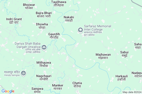
Horilapur
Horilapur Map
EDIT Map
Add Your House
 ..
..
Current Corona Virus Infected Patients Count in Siddharth Nagar District
| City Name | District Name | Total Covid cases |
|---|
Locality Name :
Horilapur
( होरिलापुर )
Block Name : Khuniyaon
District : Siddharth Nagar
State : Uttar Pradesh
Division : Basti
Language : Hindi and Urdu
Current Time 06:56 AM
Date: Saturday , May 03,2025 (IST)
Time zone: IST (UTC+5:30)
Elevation / Altitude: 99 meters. Above Seal level
Telephone Code / Std Code: 05541
Assembly constituency : Itwa assembly constituency
Assembly MLA : Mata Prasad Pandey
Lok Sabha constituency : Domariyaganj parliamentary constituency
Parliament MP : JAGDAMBIKA PAL
Serpanch Name :
Commodities Prices : Soharatgarh Market / Mandi
Rivers Near Horilapur
Rapti River
Jamwar Nadi
Rapti River
Jamwar Nadi
About Horilapur
Correct below Info and add more info about HorilapurHorilapur is a Village in Khuniyaon Block in Siddharth Nagar District of Uttar Pradesh State, India. It belongs to Basti Division . It is located 23 KM towards west from District head quarters Navgarh. 15 KM from Khuniyaon. 232 KM from State capital Lucknow
Madhwapur Kalan ( 1 KM ) , Bhaisahawa ( 1 KM ) , Mahui ( 2 KM ) , Bidra ( 2 KM ) , Urwaliya ( 2 KM ) are the nearby Villages to Horilapur. Horilapur is surrounded by Jogia Block towards East , Shoharatgarh Block towards North , Khuniyaon Block towards west , Naugarh Block towards East .
Tetri Bazar , Utraula , Nautanwa , Tulsipur are the near by Cities to Horilapur.
Horilapur 2011 Census Details
Horilapur Local Language is Hindi. Horilapur Village Total population is 1235 and number of houses are 196. Female Population is 50.4%. Village literacy rate is 37.5% and the Female Literacy rate is 14.4%.
Population
| Census Parameter | Census Data |
| Total Population | 1235 |
| Total No of Houses | 196 |
| Female Population % | 50.4 % ( 623) |
| Total Literacy rate % | 37.5 % ( 463) |
| Female Literacy rate | 14.4 % ( 178) |
| Scheduled Tribes Population % | 0.0 % ( 0) |
| Scheduled Caste Population % | 3.7 % ( 46) |
| Working Population % | 34.3 % |
| Child(0 -6) Population by 2011 | 244 |
| Girl Child(0 -6) Population % by 2011 | 47.5 % ( 116) |
Horilapur Census More Deatils.
Politics in Horilapur
BJP , SP , BSP , INC are the major political parties in this area.Polling Stations /Booths near Horilapur
1)Patila2)Sohana
3)Mishrauliya Grant
4)Dhobaha
5)Sonauli Nankar
HOW TO REACH Horilapur
By Rail
There is no railway station near to Horilapur in less than 10 km.Pincodes near Horilapur
272204 ( Udairajganj ) , 272153 ( Bansi ) , 272205 ( Shoharatgarh )Colleges near Horilapur
Sana Islamic School
Address :
Schools in Horilapur
J.h.s. Horilapur
Address : horilapur , khuniyanv , siddharthnagar , Uttar Pradesh . PIN- 272189 , Post - Domariaganj
Govt Health Centers near Horilapur
1) Babhani Yat lalpur , , ,2) Babhani Bazar , , ,
3) Madhwapur , NPHC Madhwapur , ,
Sub Villages in Horilapur
Hospitals in Horilapur,Khuniyaon
वर्मा मेडिकल स्टोर चेतिया बाजार सिद्धार्थनगर
Chetia; Uttar Pradesh 272153; India
6.5 KM distance Detail
more ..
Petrol Bunks in Horilapur,Khuniyaon
Chaudhary Hp Gas Gramin Vitrak Chetia Siddhartha Nagar
Chetia; Uttar Pradesh 272153; India
6.5 KM distance Detail
Govind Parsad Building Matyreal
Pakari Chauraha - Pakari Lala Rd; Uttar Pradesh 272205; India
7.4 KM distance Detail
more ..
Colleges in Horilapur,Khuniyaon
Pt. Deen Dayal Upadhyay Kanya Inter College
Mithauwa Bazaar; Itwa -Chetia Road; Mithauwa; Uttar Pradesh 272192; India
5.3 KM distance Detail
Government Junior and Primary School
Siddharthnagar; Uttar Pradesh 272205; India
7.2 KM distance Detail
Surya Girl Inter College
Burhnaiya; Pakri Bazar; Jogia; U.P; Shohratgarh; Uttar Pradesh 272205; India
7.5 KM distance Detail
Chaudhary Subash Chandra Gramoday Inter College
Ankara; Uttar Pradesh 272205; India
8.0 KM distance Detail
more ..
Schools in Horilapur,Khuniyaon
AL Hiqma intermediate college
madhwapurkala bidra siddharthnagar; Jamlajot; Uttar Pradesh 272153; India
2.0 KM distance Detail
Governement Offices near Horilapur,Khuniyaon
Aadhaar Card Kendra
Near Jai Kisan Inter College Sanai Chauraha Aj Savitri Information Center; Uttar Pradesh 272207; India
13.5 KM distance Detail
About Horilapur &
History
How to reach Horilapur
Tourist Places Near By Horilapur
Schools in Horilapur
Colleges in Horilapur
Temperature & weather of Horilapur
places in Horilapur
Horilapur photos
More Information
How to reach Horilapur
Tourist Places Near By Horilapur
Schools in Horilapur
Colleges in Horilapur
Temperature & weather of Horilapur
places in Horilapur
Horilapur photos
More Information
Village Talk
Post News or Events about this Village
Near Cities
Tetri Bazar 21 KM near
Utraula 52 KM near
Nautanwa 60 KM near
Tulsipur 60 KM near
Tetri Bazar 21 KM near
Utraula 52 KM near
Nautanwa 60 KM near
Tulsipur 60 KM near
Near By Taluks
Jogia 11 KM near
Bansi 12 KM near
Shoharatgarh 13 KM near
Khuniyaon 15 KM near
Jogia 11 KM near
Bansi 12 KM near
Shoharatgarh 13 KM near
Khuniyaon 15 KM near
Near By Air Ports
Gorakhpur Airport 93 KM near
Varanasi Airport 231 KM near
Amausi Airport 232 KM near
Bamrauli Airport 266 KM near
Gorakhpur Airport 93 KM near
Varanasi Airport 231 KM near
Amausi Airport 232 KM near
Bamrauli Airport 266 KM near
Near By Tourist Places
Kapilvastu 44 KM near
Basti 62 KM near
Gorakhpur 87 KM near
Ayodhya 99 KM near
Sravasti 105 KM near
Kapilvastu 44 KM near
Basti 62 KM near
Gorakhpur 87 KM near
Ayodhya 99 KM near
Sravasti 105 KM near
Near By Districts
Siddharth Nagar 22 KM near
Basti 66 KM near
Sant Kabeer Nagar 68 KM near
Maharajganj 77 KM near
Siddharth Nagar 22 KM near
Basti 66 KM near
Sant Kabeer Nagar 68 KM near
Maharajganj 77 KM near
Near By RailWay Station
Shohratgarh Rail Way Station 12 KM near
Naugarh Rail Way Station 22 KM near
Shohratgarh Rail Way Station 12 KM near
Naugarh Rail Way Station 22 KM near