| Home | City Bus | Maps | Villages | Cities | Rail | Tourist Places | School | College | Pin Codes | Corona Cases Count |
| Distance Calculator Bus Services IFSC Codes Trace Mobile Number Weather Search Place Trace IP Available Cash ATM/Banks Locate Polling Booth Report an Error contact People |
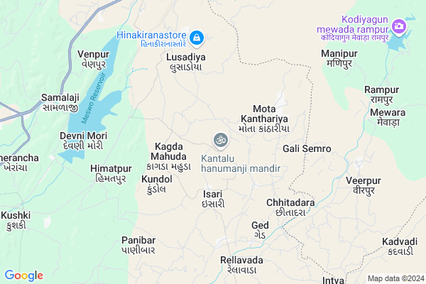
Kantalu
Kantalu Map
EDIT Map
Add Your House
 ..
..
Current Corona Virus Infected Patients Count in Sabar Kantha District
| City Name | District Name | Total Covid cases |
|---|
Locality Name :
Kantalu
( કંટાળું )
Taluka Name : Meghraj
District : Sabar Kantha
State : Gujarat
Language : Gujarati and Hindi
Current Time 08:45 AM
Date: Saturday , May 03,2025 (IST)
Time zone: IST (UTC+5:30)
Elevation / Altitude: 149 meters. Above Seal level
Telephone Code / Std Code: 02773
Assembly constituency : Bhiloda assembly constituency
Assembly MLA : P.C.Baranda
Lok Sabha constituency : Sabarkantha parliamentary constituency
Parliament MP : RATHOD DIPSINH SHANKARSINH
Serpanch Name :
Pin Code : 383251
Post Office Name : Lusadia
Commodities Prices : Modasa(Tintoi) Market / Mandi
Kantalu Live Weather
Temperature: 30.6 °C
scattered clouds
Humidity: 32%
Wind : 4.13 mt/sec towards W
StationName : "Bichhiwara"
observed on Now
Temperature: 30.6 °C
scattered clouds
Humidity: 32%
Wind : 4.13 mt/sec towards W
StationName : "Bichhiwara"
observed on Now
Kantalu Weather Forecast for Next 5 days
04-05-2025
28.3°C to 40.8°C
scattered clouds, few clouds, clear sky, broken clouds
28.3°C to 40.8°C
scattered clouds, few clouds, clear sky, broken clouds
05-05-2025
26.1°C to 39.6°C
scattered clouds, few clouds, clear sky, light rain, overcast clouds
26.1°C to 39.6°C
scattered clouds, few clouds, clear sky, light rain, overcast clouds
06-05-2025
26.4°C to 39.2°C
overcast clouds, scattered clouds, few clouds, clear sky, light rain
26.4°C to 39.2°C
overcast clouds, scattered clouds, few clouds, clear sky, light rain
07-05-2025
21.9°C to 34.1°C
few clouds, scattered clouds, light rain, moderate rain, overcast clouds
21.9°C to 34.1°C
few clouds, scattered clouds, light rain, moderate rain, overcast clouds
08-05-2025
22.3°C to 32.4°C
light rain, overcast clouds, heavy intensity rain
22.3°C to 32.4°C
light rain, overcast clouds, heavy intensity rain
National Highways Reachable To Kantalu
Nationa High Way :NH48
Nationa High Way :NH 76A
Nationa High Way :NH48
Nationa High Way :NH 76A
Rivers Near Kantalu
Bhim Kuha Nala
Ghuvai
Bhim Kuha Nala
Ghuvai
About Kantalu
Correct below Info and add more info about KantaluKantalu is a Village in Meghraj Taluka in Sabar Kantha District of Gujarat State, India. It is located 60 KM towards East from District head quarters Himmatnagar. 18 KM from . 112 KM from State capital Gandhinagar
Kantalu Pin code is 383251 and postal head office is Lusadia .
Kagda Mahuda ( 2 KM ) , Isari ( 3 KM ) , Ramera ( 3 KM ) , Nana Kanthariya ( 4 KM ) , Mota Kanthariya ( 4 KM ) are the nearby Villages to Kantalu. Kantalu is surrounded by Bhiloda Taluka towards west , Bichiwara Taluka towards North , Modasa Taluka towards South , Malpur Taluka towards South .
Modasa , Idar , Himatnagar , Ramngarh are the near by Cities to Kantalu.
Kantalu 2011 Census Details
Kantalu Local Language is Gujarati. Kantalu Village Total population is 1592 and number of houses are 268. Female Population is 49.2%. Village literacy rate is 62.9% and the Female Literacy rate is 26.4%.
Population
| Census Parameter | Census Data |
| Total Population | 1592 |
| Total No of Houses | 268 |
| Female Population % | 49.2 % ( 783) |
| Total Literacy rate % | 62.9 % ( 1002) |
| Female Literacy rate | 26.4 % ( 420) |
| Scheduled Tribes Population % | 99.4 % ( 1582) |
| Scheduled Caste Population % | 0.0 % ( 0) |
| Working Population % | 48.2 % |
| Child(0 -6) Population by 2011 | 270 |
| Girl Child(0 -6) Population % by 2011 | 49.3 % ( 133) |
Kantalu Census More Deatils.
Politics in Kantalu
Bharatiya Janata Party , BJP , INC are the major political parties in this area.Polling Stations /Booths near Kantalu
1)Chiboda2)Motimori
3)Mottakantharia-1
4)Kamthadiya
5)Kantalu-1
HOW TO REACH Kantalu
By Rail
There is no railway station near to Kantalu in less than 10 km.Colleges near Kantalu
Govt. B.ed. College, Meghraj
Address :
Schools in Kantalu
Kantalu Ashram Sala
Address : kantalu , meghraj , sabar kantha , Gujarat . PIN- 383251 , Post - Lusadia
Kantalu
Address : kantalu , meghraj , sabar kantha , Gujarat . PIN- 383251 , Post - Lusadia
Khanpur Sch
Address : kantalu , meghraj , sabar kantha , Gujarat . PIN- 383251 , Post - Lusadia
Govt Health Centers near Kantalu
1) Bamna , Primary health centre , BAMNA PHC , Near Bus Stand2) Sadatpura , Sub Centre Sadatpura , ,
3) Govt. Hospital Lulavada , , godhra highway road , Govt. Hospital.Lulavada
Sub Villages in Kantalu
Hospitals in Kantalu,Meghraj
Life Line Medical & Provision Stores
Navagam Rd; Kantalu; Gujarat 383250; India
3.4 KM distance Detail
Maruti Patho Lab
Sitaram Complex; No.42 Samalaji Temple Rd; Samalaji; Gujarat 383355; India
9.0 KM distance Detail
more ..
Petrol Bunks in Kantalu,Meghraj
Reliance Petroleum
SURVEY NO. NH 8; NAVA VENPUR; SHAMLAJI; TALUKA : BHILODA; DIST; Samalaji; Gujarat 383355; India
9.0 KM distance Detail
more ..
Schools in Kantalu,Meghraj
Sant Shri Asharamji Gurukul
Kagdamahuda Taluka Bhiloda District Arvalli; Sarkilimdi; Gujarat 383251; India
2.1 KM distance Detail
Electronic Shops in Kantalu,Meghraj
BABLU BHAI TYRE SERVICE
Gujarat State Highway 145; Bhavanpur; Gujarat 383250; India
11.1 KM distance Detail
Police Stations near Kantalu,Meghraj
Police Station Ratanpur
Ratanpur; Dungarpur; NH-8; Dungarpur; Dungarpur; Rajasthan 314801; India
12.1 KM distance Detail
Governement Offices near Kantalu,Meghraj
RTO Office
Aravalli; NH-8; Sabarkath Road; Chiteriya; Chiteriya; Gujarat 383001; India
9.9 KM distance Detail
District Transport Office
Ratanpur; Dungarpur; NH-8; Dungarpur; Dungarpur; Rajasthan 314801; India
12.1 KM distance Detail
About Kantalu &
History
How to reach Kantalu
Tourist Places Near By Kantalu
Schools in Kantalu
Colleges in Kantalu
Temperature & weather of Kantalu
places in Kantalu
Kantalu photos
More Information
How to reach Kantalu
Tourist Places Near By Kantalu
Schools in Kantalu
Colleges in Kantalu
Temperature & weather of Kantalu
places in Kantalu
Kantalu photos
More Information
Village Talk
Post News or Events about this Village
Near Cities
Modasa 31 KM near
Idar 56 KM near
Himatnagar 57 KM near
Ramngarh 63 KM near
Modasa 31 KM near
Idar 56 KM near
Himatnagar 57 KM near
Ramngarh 63 KM near
Near By Taluks
Bhiloda 17 KM near
Meghraj 18 KM near
Bichiwara 20 KM near
Modasa 28 KM near
Bhiloda 17 KM near
Meghraj 18 KM near
Bichiwara 20 KM near
Modasa 28 KM near
Near By Air Ports
Ahmedabad Airport 121 KM near
Dabok Airport 127 KM near
Vadodara Airport 169 KM near
Bhavnagar Airport 279 KM near
Ahmedabad Airport 121 KM near
Dabok Airport 127 KM near
Vadodara Airport 169 KM near
Bhavnagar Airport 279 KM near
Near By Tourist Places
Dungarpur 36 KM near
Sabarkantha 58 KM near
Danta Ambaji 103 KM near
Gandhinagar 107 KM near
Ambaji 107 KM near
Dungarpur 36 KM near
Sabarkantha 58 KM near
Danta Ambaji 103 KM near
Gandhinagar 107 KM near
Ambaji 107 KM near
Near By Districts
Dungarpur 36 KM near
Sabar Kantha 57 KM near
Gandhinagar 107 KM near
Panch Mahals 113 KM near
Dungarpur 36 KM near
Sabar Kantha 57 KM near
Gandhinagar 107 KM near
Panch Mahals 113 KM near
Near By RailWay Station
Godhra Junction Rail Way Station 112 KM near
Udaipur City Rail Way Station 115 KM near
Godhra Junction Rail Way Station 112 KM near
Udaipur City Rail Way Station 115 KM near