| Home | City Bus | Maps | Villages | Cities | Rail | Tourist Places | School | College | Pin Codes | Corona Cases Count |
| Distance Calculator Bus Services IFSC Codes Trace Mobile Number Weather Search Place Trace IP Available Cash ATM/Banks Locate Polling Booth Report an Error contact People |
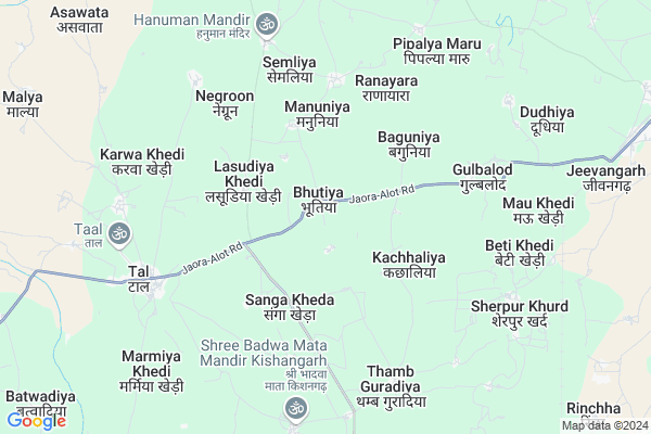
Bhutiya
Bhutiya Map
EDIT Map
Add Your House
 ..
..
Current Corona Virus Infected Patients Count in Ratlam District
| City Name | District Name | Total Covid cases |
|---|---|---|
| Ratlam District | Ratlam | 15 |
Locality Name :
Bhutiya
( भूतिया )
Tehsil Name : Alot
District : Ratlam
State : Madhya Pradesh
Division : Ujjain
Language : Malwi and Hindi, English
Current Time 10:27 PM
Date: Friday , May 02,2025 (IST)
Time zone: IST (UTC+5:30)
Elevation / Altitude: 443 meters. Above Seal level
Telephone Code / Std Code: 07410
Assembly constituency : Alot assembly constituency
Assembly MLA : Dr. Chintamani Malviya
Lok Sabha constituency : Ujjain parliamentary constituency
Parliament MP : ANIL FIROJIYA
Serpanch Name :
Pin Code : 457114
Post Office Name : Alote
Commodities Prices : Taal Market / Mandi
Bhutiya Live Weather
Temperature: 35.9 °C
few clouds
Humidity: 12%
Wind : 5.03 mt/sec towards W
StationName : "TÄ\u0081l"
observed on 1 Hours Back
Temperature: 35.9 °C
few clouds
Humidity: 12%
Wind : 5.03 mt/sec towards W
StationName : "TÄ\u0081l"
observed on 1 Hours Back
Bhutiya Weather Forecast for Next 5 days
03-05-2025
30.3°C to 35.2°C
clear sky
30.3°C to 35.2°C
clear sky
04-05-2025
28.3°C to 40.5°C
clear sky, scattered clouds
28.3°C to 40.5°C
clear sky, scattered clouds
05-05-2025
26.4°C to 38.0°C
scattered clouds, few clouds, broken clouds, light rain, overcast clouds
26.4°C to 38.0°C
scattered clouds, few clouds, broken clouds, light rain, overcast clouds
06-05-2025
26.3°C to 37.8°C
overcast clouds, broken clouds, scattered clouds, clear sky, light rain
26.3°C to 37.8°C
overcast clouds, broken clouds, scattered clouds, clear sky, light rain
07-05-2025
26.3°C to 38.1°C
overcast clouds, broken clouds, clear sky, light rain, scattered clouds
26.3°C to 38.1°C
overcast clouds, broken clouds, clear sky, light rain, scattered clouds
Rivers Near Bhutiya
Pingla
Shivna Nadi
Pingla
Shivna Nadi
About Bhutiya
Correct below Info and add more info about BhutiyaBhutiya is a Village in Alot Tehsil in Ratlam District of Madhya Pradesh State, India. It belongs to Ujjain Division . It is located 72 KM towards North from District head quarters Ratlam. 6 KM from Alot. 243 KM from State capital Bhopal
Bhutiya Pin code is 457114 and postal head office is Alote .
Manuniya ( 3 KM ) , Baguniya ( 3 KM ) , Sangakheda ( 4 KM ) , Kharwakhurd ( 5 KM ) , Gulbalod ( 5 KM ) are the nearby Villages to Bhutiya. Bhutiya is surrounded by Jaora Tehsil towards west , Sitamau Tehsil towards North , Khacharod Tehsil towards South , Mahidpur Tehsil towards East .
Mahidpur , Shamgarh , Mandsaur , Ratlam are the near by Cities to Bhutiya.
Bhutiya 2011 Census Details
Bhutiya Local Language is Malwi. Bhutiya Village Total population is 1091 and number of houses are 224. Female Population is 47.5%. Village literacy rate is 58.7% and the Female Literacy rate is 21.9%.
Population
| Census Parameter | Census Data |
| Total Population | 1091 |
| Total No of Houses | 224 |
| Female Population % | 47.5 % ( 518) |
| Total Literacy rate % | 58.7 % ( 640) |
| Female Literacy rate | 21.9 % ( 239) |
| Scheduled Tribes Population % | 0.0 % ( 0) |
| Scheduled Caste Population % | 14.7 % ( 160) |
| Working Population % | 43.0 % |
| Child(0 -6) Population by 2011 | 145 |
| Girl Child(0 -6) Population % by 2011 | 47.6 % ( 69) |
Bhutiya Census More Deatils.
Politics in Bhutiya
Bharatiya Janata Party , BJP , INC are the major political parties in this area.Polling Stations /Booths near Bhutiya
1)Kachhaliya2)Kabriyakhedi
3)Mandaval
4)Badodiya
5)Lasudiya Suraj Mal
HOW TO REACH Bhutiya
By Rail
Vikramgarh Alot Rail Way Station is the very nearby railway stations to Bhutiya.Colleges near Bhutiya
Shivang College Of Physiotherapy
Address : Shivang College Of Physiotherapy 274,katju Nagar R
G.t.polytechnic College
Address : G.t.polytechnic College (aicte Approved) Pahadia R
Pt. Sivshaktilal Sharma Ay Mahavidyalaya
Address : Pt. Sivshaktilal Sharma Ay Mahavidyalaya, Ratlam,
Dr M.b. Sharma Nursing College
Address : Dr M.b. Sharma Nursing College,474, Katju Nagar Ra
Pandit Shivshaktilal Ayurvedic Medical College
Address : Pandit Shivshaktilal Ayurvedic Medical College 497
Schools in Bhutiya
M.s. Bhutiya
Address : bhutiya , alot , ratlam , Madhya Pradesh . PIN- 457114 , Post - Alote
Govt Health Centers near Bhutiya
1) SHC Ranayara , shc ranayara , TAL , nearest School2) SHC Thamguradiya , SHC THAMGURADIYA , RICHCHA , nearest ANHANWADI CENTAR
3) CHC Tal , CHC Tal , Tal , Tal
Hospitals in Bhutiya,Alot
Sub Health Centre
Ratlam; SH-41; Alot Road; Gulablod; Gulablod; Madhya Pradesh 457118; India
5.4 KM distance Detail
Chaturvedi Clinic; Alote
Hitendar Chaturvedi; Bus statend;; Alote; Madhya Pradesh 457114; India
13.6 KM distance Detail
more ..
Petrol Bunks in Bhutiya,Alot
MAA ASHAPURA FILLING STATION
TAL;GRAM TAL;RATLAM; RATLAM; Madhya Pradesh 457118; India
2.9 KM distance Detail
Bharat Petroleum
Ratlam; SH-41; Alot Road; Gogapur; Gogapur; Madhya Pradesh 457118; India
4.8 KM distance Detail
more ..
Colleges in Bhutiya,Alot
Government College Alote
station Road; opposite Government Higher secondary school; Vikramgarh Alote; Madhya Pradesh 457114; India
12.9 KM distance Detail
more ..
Schools in Bhutiya,Alot
Government Primary School
Ratlam; SH-41; Alot Road; Bhutia; Bhutia; Madhya Pradesh 457118; India
0.7 KM distance Detail
Government Middle School
Bhutiya; Ratlam; SH-41; Alot Road; Bhutia; Bhutia; Madhya Pradesh 457118; India
0.8 KM distance Detail
Super Markets in Bhutiya,Alot
Shyam Mirchi श्याम मिर्ची सेंटर
Ranipura; Alote; Madhya Pradesh 457114; India
13.7 KM distance Detail
Local Parks in Bhutiya,Alot
Nakshatra Garden
Station Rd; VIP Colony; Vikramgarh Alote; Madhya Pradesh 457114; India
11.7 KM distance Detail
Governement Offices near Bhutiya,Alot
Office Of Anuvibhagiya Officer
Alot; College Road; Ratlam; SH-41; Alot; Alote; Madhya Pradesh 457114; India
11.8 KM distance Detail
About Bhutiya &
History
How to reach Bhutiya
Tourist Places Near By Bhutiya
Schools in Bhutiya
Colleges in Bhutiya
Temperature & weather of Bhutiya
places in Bhutiya
Bhutiya photos
More Information
How to reach Bhutiya
Tourist Places Near By Bhutiya
Schools in Bhutiya
Colleges in Bhutiya
Temperature & weather of Bhutiya
places in Bhutiya
Bhutiya photos
More Information
Village Talk
Post News or Events about this Village
Near Cities
Mahidpur 39 KM near
Shamgarh 59 KM near
Mandsaur 59 KM near
Ratlam 68 KM near
Mahidpur 39 KM near
Shamgarh 59 KM near
Mandsaur 59 KM near
Ratlam 68 KM near
Near By Taluks
Alot 6 KM near
Jaora 30 KM near
Sitamau 38 KM near
Khacharod 40 KM near
Alot 6 KM near
Jaora 30 KM near
Sitamau 38 KM near
Khacharod 40 KM near
Near By Air Ports
Indore Airport 132 KM near
Dabok Airport 207 KM near
Bhopal Airport 224 KM near
Vadodara Airport 309 KM near
Indore Airport 132 KM near
Dabok Airport 207 KM near
Bhopal Airport 224 KM near
Vadodara Airport 309 KM near
Near By Tourist Places
Ratlam 68 KM near
Ujjain 80 KM near
Neemuch 111 KM near
Banswara 116 KM near
Jhalawar 116 KM near
Ratlam 68 KM near
Ujjain 80 KM near
Neemuch 111 KM near
Banswara 116 KM near
Jhalawar 116 KM near
Near By Districts
Mandsaur 59 KM near
Ratlam 69 KM near
Ujjain 81 KM near
Pratapgarh 82 KM near
Mandsaur 59 KM near
Ratlam 69 KM near
Ujjain 81 KM near
Pratapgarh 82 KM near
Near By RailWay Station
Vikramgarh Alot Rail Way Station 11 KM near
Mahidpur Road Rail Way Station 22 KM near
Vikramgarh Alot Rail Way Station 11 KM near
Mahidpur Road Rail Way Station 22 KM near