| Home | City Bus | Maps | Villages | Cities | Rail | Tourist Places | School | College | Pin Codes | Corona Cases Count |
| Distance Calculator Bus Services IFSC Codes Trace Mobile Number Weather Search Place Trace IP Available Cash ATM/Banks Locate Polling Booth Report an Error contact People |
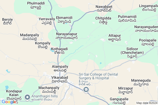
Kottamgutta Tanda
Kottamgutta Tanda Map
EDIT Map
Add Your House
 ..
..
Current Corona Virus Infected Patients Count in Rangareddi District
| City Name | District Name | Total Covid cases |
|---|---|---|
| Vikarabad District | Vikarabad | 37 |
| Ranga Reddy District | Ranga Reddy | 25 |
| Medchal Malkajgiri District | Medchal Malkajgiri | 8 |
| Nagarkurnool District | Nagarkurnool | 2 |
| Qutbullapur | Medchal Malkajgiri | 1 |
| Kokapet | Ranga Reddy | 1 |
| Chandanagar | Ranga Reddy | 1 |
Locality Name :
Kottamgutta Tanda
( కొట్టంగుట్ట తండా )
Mandal Name : Vikarabad
District : Rangareddi
State : Telangana
Region : Telangana
Language : Telugu and Urdu
Current Time 04:22 PM
Date: Friday , May 02,2025 (IST)
Time zone: IST (UTC+5:30)
Elevation / Altitude: 633 meters. Above Seal level
Telephone Code / Std Code: 08416
Assembly constituency : Vikarabad assembly constituency
Assembly MLA : Gaddam Prasad Kumar
Lok Sabha constituency : Chelvella parliamentary constituency
Parliament MP : Dr. G. Ranjith Reddy
Serpanch Name :
Pin Code : 501102
Post Office Name :
Main Village Name : Girgetpally
Commodities Prices : Vikarabad Market / Mandi
Kottamgutta Tanda Live Weather
Temperature: 38.9 °C
few clouds
Humidity: 14%
Wind : 4.55 mt/sec towards N
StationName : "VikÄ\u0081rÄ\u0081bÄ\u0081d"
observed on 2 Hours Back
Temperature: 38.9 °C
few clouds
Humidity: 14%
Wind : 4.55 mt/sec towards N
StationName : "VikÄ\u0081rÄ\u0081bÄ\u0081d"
observed on 2 Hours Back
Kottamgutta Tanda Weather Forecast for Next 5 days
03-05-2025
29.0°C to 39.0°C
few clouds, scattered clouds
29.0°C to 39.0°C
few clouds, scattered clouds
04-05-2025
27.6°C to 38.1°C
broken clouds, clear sky, light rain, overcast clouds
27.6°C to 38.1°C
broken clouds, clear sky, light rain, overcast clouds
05-05-2025
28.6°C to 39.9°C
broken clouds, few clouds, clear sky, scattered clouds
28.6°C to 39.9°C
broken clouds, few clouds, clear sky, scattered clouds
06-05-2025
27.4°C to 39.5°C
broken clouds, few clouds, clear sky, overcast clouds
27.4°C to 39.5°C
broken clouds, few clouds, clear sky, overcast clouds
07-05-2025
26.7°C to 39.0°C
broken clouds, scattered clouds, few clouds, overcast clouds
26.7°C to 39.0°C
broken clouds, scattered clouds, few clouds, overcast clouds
National Highways Reachable To Kottamgutta Tanda
Nationa High Way :Old NH7
Nationa High Way :NH765
Nationa High Way :Old NH7
Nationa High Way :NH765
Rivers Near Kottamgutta Tanda
Musi River :మూసి
Musi River :మూసి
About Kottamgutta Tanda
Correct below Info and add more info about Kottamgutta TandaKottamgutta Tanda is a small Village/hamlet in Vikarabad Mandal in Rangareddi District of Telangana State, India. It comes under Girgetpally Panchayath. It belongs to Telangana region . As part Telangana Districts re-organisation , Kottamgutta Tanda Village Vikarabad Mandal re organised from Rangareddi District to Vikarabad district. It is located 24 KM towards west from District head quarters Hyderabad. 2 KM from Vikarabad.
Kottamgutta Tanda Pin code is 501102 and postal head office is .
Kottamgutta Tanda is surrounded by Nawabpet Mandal towards North , Mominpet Mandal towards North , Pudur Mandal towards South , Dharur Mandal towards west .
Vicarabad , Singapur , Sadasivpet , Sangareddy are the near by Cities to Kottamgutta Tanda.
Demographics of Kottamgutta Tanda
Telugu is the Local Language here. Total population of Kottamgutta Tanda is 1848 .Males are 948 and Females are 900 living in 341 Houses. Total area of Kottamgutta Tanda is 1364 hectares.Politics in Kottamgutta Tanda
INC , TDP , TRS , TDP , INC are the major political parties in this area.Polling Stations /Booths near Kottamgutta Tanda
1)Kal Koda2)Nagsmander
3)Kotalagudem
4)Kothagadi
5)Panchalingal
HOW TO REACH Kottamgutta Tanda
By Road
Vikarabad is the Nearest Town to Kottamgutta Tanda. Vikarabad is 5 km from Kottamgutta Tanda. Road connectivity is there from Vikarabad to Kottamgutta Tanda.By Rail
Vikarabad Junction Rail Way Station , Chitgidda Rail Way Station are the very nearby railway stations to Kottamgutta Tanda. Also you can consider railway Stations from Near By town Vikarabad. Vikarabad Junction Rail Way Station , Godamgura Rail Way Station are the railway Stations near to Vikarabad. You can reach from Vikarabad to Kottamgutta Tanda by road after .Colleges near Kottamgutta Tanda
Takshashila Degree College
Address :
Sri Saraswathi Vidyalaya Jr Coll, Vikarabad
Address : Vikarabad
Vikas Jr Coll Vikarabad
Address : Vikas Jr Coll Vikarabad
Mary A Knotts Jr Coll(co-edu), Vikarabad
Address : Vikarabad
Siddhartha Jr College Vikarabad
Address : Siddhartha Jr College Vikarabad
Schools in Kottamgutta Tanda
Mpups Girgetpalle
Address : girgetpalle , vikarabad , rangareddi , Andhra Pradesh . PIN- 501101 , Post - Vikarabad
Govt Health Centers near Kottamgutta Tanda
1) SubCentre, Alampally , , 4th Ward , Near to Anantha Swamy Temple2) SubCentre, Dhannaram , , BC Colony , Opp. Dwakra Building
3) SubCentre, Ekmamidi , , Near Grampanchayath , Beside Primary School
Hospitals in Kottamgutta Tanda,Vikarabad
Sri Ananth Hospital
Afsar Jung Colony Rd; Alampally; Vikarabad; Telangana 501101; India
4.5 KM distance Detail
more ..
Petrol Bunks in Kottamgutta Tanda,Vikarabad
Royal Service Indian Oil Petrol Pump
Allampally; Rangareddy; SH-4; Hyderabad Vikarabad Road; Vikarabad; Vikarabad; Telangana 501101; India
4.3 KM distance Detail
more ..
Colleges in Kottamgutta Tanda,Vikarabad
Anwar Ul Uloom College Of Engineering And Technology
Burhanpalle; Telangana 501101; India
4.1 KM distance Detail
St. Judes College of Education
4-1-263/3; EDLA BAZAAR;; VIKARABAD; Telangana 501101; India
4.4 KM distance Detail
St. Judes School and B.Ed College
Alampally; Vikarabad; Telangana 501101; India
4.4 KM distance Detail
more ..
Schools in Kottamgutta Tanda,Vikarabad
Siddhartha School of Excellence
Near Cattle market; Vikarabad; Telangana 501101; India
3.0 KM distance Detail
New Narayana High School
Vikarabad Near Rythu Bazar Vikarabad Pin; no 501102; India
4.0 KM distance Detail
Electronic Shops in Kottamgutta Tanda,Vikarabad
Murad Motors
Vikarabad - Alampally Rd; Alampally; Vikarabad; Telangana 501102; India
4.3 KM distance Detail
Shiva Shakthi Agencies
Vikarabad Rd; Alampally; Vikarabad; Telangana 501101; India
4.3 KM distance Detail
Super Markets in Kottamgutta Tanda,Vikarabad
Sri Racharaya General Store
New Gunj; Alampally; Vikarabad; Telangana 501102; India
4.8 KM distance Detail
LAGISETTY ASHOK KUMAR Agriculture commission agent లగిశెట్టి అశోక్ కుమార్ కమిషన్ ఏజెంట్
4-1-202; New Gunj; Alampally; New Gunj; Vikarabad; Telangana 501101; India
4.8 KM distance Detail
Police Stations near Kottamgutta Tanda,Vikarabad
Superintendent of Police Vikarabad dist office
Vikarabad Road; Vikarabad; Telangana 501101; India
5.3 KM distance Detail
Governement Offices near Kottamgutta Tanda,Vikarabad
MeeSeva Center
Mutheragalla Shekar;7-5-6; ; Kothagadi; Opp: Zilla Parishad High School; Kothagadi(V);; Kothagadi; Telangana 501101; India
3.2 KM distance Detail
MeeSeva Center
Harshith Online Center(MEE SEVA); DIET Rd; MIG Colony Phase1; Alampally; Vikarabad; Telangana 501101; India
4.4 KM distance Detail
About Kottamgutta Tanda &
History
How to reach Kottamgutta Tanda
Tourist Places Near By Kottamgutta Tanda
Schools in Kottamgutta Tanda
Colleges in Kottamgutta Tanda
Temperature & weather of Kottamgutta Tanda
places in Kottamgutta Tanda
Kottamgutta Tanda photos
More Information
How to reach Kottamgutta Tanda
Tourist Places Near By Kottamgutta Tanda
Schools in Kottamgutta Tanda
Colleges in Kottamgutta Tanda
Temperature & weather of Kottamgutta Tanda
places in Kottamgutta Tanda
Kottamgutta Tanda photos
More Information
Village Talk
Post News or Events about this Village
Near Cities
Vicarabad 6 KM near
Singapur 26 KM near
Sadasivpet 31 KM near
Sangareddy 38 KM near
Vicarabad 6 KM near
Singapur 26 KM near
Sadasivpet 31 KM near
Sangareddy 38 KM near
Near By Taluks
Vikarabad 2 KM near
Nawabpet 9 KM near
Mominpet 15 KM near
Pudur 16 KM near
Vikarabad 2 KM near
Nawabpet 9 KM near
Mominpet 15 KM near
Pudur 16 KM near
Near By Air Ports
Rajiv Gandhi International Airport 61 KM near
Latur Airport 216 KM near
Nanded Airport 237 KM near
Sholapur Airport 239 KM near
Rajiv Gandhi International Airport 61 KM near
Latur Airport 216 KM near
Nanded Airport 237 KM near
Sholapur Airport 239 KM near
Near By Tourist Places
Hyderabad 66 KM near
Bidar 79 KM near
Medak 93 KM near
Gulbarga 130 KM near
Mantralayam 187 KM near
Hyderabad 66 KM near
Bidar 79 KM near
Medak 93 KM near
Gulbarga 130 KM near
Mantralayam 187 KM near
Near By Districts
Rangareddi 23 KM near
Medak 36 KM near
Hyderabad 64 KM near
Mahbubnagar 78 KM near
Rangareddi 23 KM near
Medak 36 KM near
Hyderabad 64 KM near
Mahbubnagar 78 KM near
Near By RailWay Station
Vikarabad Junction Rail Way Station 4.8 KM near
Chitgidda Rail Way Station 6.3 KM near
Shankarpalli Rail Way Station 25 KM near
Vikarabad Junction Rail Way Station 4.8 KM near
Chitgidda Rail Way Station 6.3 KM near
Shankarpalli Rail Way Station 25 KM near