| Home | City Bus | Maps | Villages | Cities | Rail | Tourist Places | School | College | Pin Codes | Corona Cases Count |
| Distance Calculator Bus Services IFSC Codes Trace Mobile Number Weather Search Place Trace IP Available Cash ATM/Banks Locate Polling Booth Report an Error contact People |
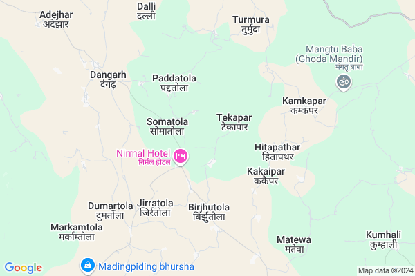
Paddatola
Paddatola Map
EDIT Map
Add Your House
 ..
..
Current Corona Virus Infected Patients Count in Rajnandgaon District
| City Name | District Name | Total Covid cases |
|---|---|---|
| Rajnandgaon | Rajnandgaon | 1 |
Locality Name :
Paddatola
( पडताला )
Tehsil Name : Mohala (td)
District : Rajnandgaon
State : Chattisgarh
Language : Chhattisgarhi and Hindi
Current Time 01:56 AM
Date: Saturday , May 03,2025 (IST)
Time zone: IST (UTC+5:30)
Elevation / Altitude: 412 meters. Above Seal level
Telephone Code / Std Code: 07747
Assembly constituency : Mohla-Manpur assembly constituency
Assembly MLA : Indrashah Mandavi
Lok Sabha constituency : Rajnandgaon parliamentary constituency
Parliament MP : SANTOSH PANDEY
Serpanch Name :
Pin Code : 491666
Post Office Name : Mohla
Main Village Name : Paddatola
Commodities Prices : Bandhabazar Market / Mandi
Rivers Near Paddatola
Mahanadi :تهر مهاندي :Mahanadi River :महानदी :ಮಹಾನದೀ :دریائے مہاندی :مهاندي
Nani
Mahanadi :تهر مهاندي :Mahanadi River :महानदी :ಮಹಾನದೀ :دریائے مہاندی :مهاندي
Nani
About Paddatola
Correct below Info and add more info about PaddatolaPaddatola is a small Village/hamlet in Mohala (td) Tehsil in Rajnandgaon District of Chattisgarh State, India. It comes under Paddatola Panchayath. It is located 59 KM towards South from District head quarters Rajnandgaon. 9 KM from Mohala (Td). 121 KM from State capital Raipur
Paddatola Pin code is 491666 and postal head office is Mohla .
Kakaipar ( 4 KM ) , Birjhutola ( 4 KM ) , Jobtola ( 4 KM ) , Pidingpar ( 5 KM ) , Dumartola ( 6 KM ) are the nearby Villages to Paddatola. Paddatola is surrounded by A.Chowki (Td) Tehsil towards west , Dalli-Rajhara Tehsil towards East , Dondilohara Tehsil towards East , Manpur (Td) Tehsil towards South .
Dalli-Rajhara , Balod , Rajnandgaon , Dongargarh are the near by Cities to Paddatola.
Paddatola 2011 Census Details
Paddatola Local Language is Chhattisgarhi. Paddatola Village Total population is 597 and number of houses are 103. Female Population is 52.8%. Village literacy rate is 64.7% and the Female Literacy rate is 31.3%.
Population
| Census Parameter | Census Data |
| Total Population | 597 |
| Total No of Houses | 103 |
| Female Population % | 52.8 % ( 315) |
| Total Literacy rate % | 64.7 % ( 386) |
| Female Literacy rate | 31.3 % ( 187) |
| Scheduled Tribes Population % | 88.1 % ( 526) |
| Scheduled Caste Population % | 4.5 % ( 27) |
| Working Population % | 56.3 % |
| Child(0 -6) Population by 2011 | 109 |
| Girl Child(0 -6) Population % by 2011 | 51.4 % ( 56) |
Paddatola Census More Deatils.
Politics in Paddatola
Bharatiya Janata Party , BJP , INC are the major political parties in this area.Polling Stations /Booths near Paddatola
1)Alkanhar2)Sivni
3)Paangari
4)Gaulitola
5)Mungadih
HOW TO REACH Paddatola
By Rail
There is no railway station near to Paddatola in less than 10 km.Colleges near Paddatola
Chhatishgarh Ayurved Medical Collage
Address :
Kunjbihari Chaube Govt. Collage
Address :
Rani Avanti Bai Lodhi Collage.
Address :
Indira Kala Sangeet University
Address : Khairagarhchhattisgarhindia
Chhattisgarh Institute Of Management Studies (cims)
Address : G.e. Road,rajnandgaon (c.g.)
Schools in Paddatola
M.s. (new) Paddatola
Address : paddatola , mohla , rajnandgaon , Chattisgarh . PIN- 491666 , Post - Mohla
P.s. Paddatola
Address : paddatola , mohla , rajnandgaon , Chattisgarh . PIN- 491666 , Post - Mohla
Govt Health Centers near Paddatola
1) SHC Somatola , Sub Health Center Somatola , ,2) SHC Karrigaon , SHC Karrigaon , Dondi Lohara ,
3) SHC Dugatola , Sub Health Center Dugatola , ,
Sub Villages in Paddatola
Hospitals in Paddatola,Mohala (td)
Government Hospital Mangchuva
Sanjari Rd; Turmuda; Chhattisgarh 491665; India
9.5 KM distance Detail
more ..
Local Parks in Paddatola,Mohala (td)
Governement Offices near Paddatola,Mohala (td)
Senior Agriculture Development Officer Mohala
Manpur Mohla Rd; Mohala; Chhattisgarh 491666; India
17.4 KM distance Detail
About Paddatola &
History
How to reach Paddatola
Tourist Places Near By Paddatola
Schools in Paddatola
Colleges in Paddatola
Temperature & weather of Paddatola
places in Paddatola
Paddatola photos
More Information
How to reach Paddatola
Tourist Places Near By Paddatola
Schools in Paddatola
Colleges in Paddatola
Temperature & weather of Paddatola
places in Paddatola
Paddatola photos
More Information
Village Talk
Post News or Events about this Village
Near Cities
Dalli-Rajhara 29 KM near
Balod 42 KM near
Rajnandgaon 57 KM near
Dongargarh 65 KM near
Dalli-Rajhara 29 KM near
Balod 42 KM near
Rajnandgaon 57 KM near
Dongargarh 65 KM near
Near By Taluks
Mohala (Td) 9 KM near
A.Chowki (Td) 22 KM near
Dalli-Rajhara 28 KM near
Dondilohara 34 KM near
Mohala (Td) 9 KM near
A.Chowki (Td) 22 KM near
Dalli-Rajhara 28 KM near
Dondilohara 34 KM near
Near By Air Ports
Raipur Airport 121 KM near
Sonegaon Airport 215 KM near
Jabalpur Airport 270 KM near
Nanded Airport 453 KM near
Raipur Airport 121 KM near
Sonegaon Airport 215 KM near
Jabalpur Airport 270 KM near
Nanded Airport 453 KM near
Near By Tourist Places
Rajnandgaon 57 KM near
Dhamtari 81 KM near
Durg 81 KM near
Kanker 90 KM near
Bhilai 90 KM near
Rajnandgaon 57 KM near
Dhamtari 81 KM near
Durg 81 KM near
Kanker 90 KM near
Bhilai 90 KM near
Near By Districts
Rajnandgaon 56 KM near
Dhamtari 80 KM near
Durg 81 KM near
Kanker 89 KM near
Rajnandgaon 56 KM near
Dhamtari 80 KM near
Durg 81 KM near
Kanker 89 KM near
Near By RailWay Station
Raj Nandgaon Rail Way Station 57 KM near
Dongargarh Rail Way Station 65 KM near
Raj Nandgaon Rail Way Station 57 KM near
Dongargarh Rail Way Station 65 KM near