| Home | City Bus | Maps | Villages | Cities | Rail | Tourist Places | School | College | Pin Codes | Corona Cases Count |
| Distance Calculator Bus Services IFSC Codes Trace Mobile Number Weather Search Place Trace IP Available Cash ATM/Banks Locate Polling Booth Report an Error contact People |
 ..
..
Current Corona Virus Infected Patients Count in Rajnandgaon District
| City Name | District Name | Total Covid cases |
|---|---|---|
| Rajnandgaon | Rajnandgaon | 1 |
Tehsil Name : Mohala (td)
District : Rajnandgaon
State : Chattisgarh
Language : Chhattisgarhi and Hindi
Current Time 05:52 AM
Date: Saturday , May 03,2025 (IST)
Time zone: IST (UTC+5:30)
Elevation / Altitude: 412 meters. Above Seal level
Telephone Code / Std Code: 07747
Assembly constituency : Mohla-Manpur assembly constituency
Assembly MLA : Indrashah Mandavi
Lok Sabha constituency : Rajnandgaon parliamentary constituency
Parliament MP : SANTOSH PANDEY
Serpanch Name :
Pin Code : 491666
Post Office Name : Mohla
Commodities Prices : Bandhabazar Market / Mandi
Temperature: 26.8 °C
clear sky
Humidity: 52%
Wind : 2.4 mt/sec towards S
StationName : "AmbÄ\u0081garh Chauki"
observed on 2 Hours Back
25.8°C to 39.6°C
clear sky, light rain, broken clouds, overcast clouds
26.2°C to 40.3°C
light rain, clear sky, scattered clouds, broken clouds
25.5°C to 41.2°C
broken clouds, clear sky, scattered clouds, few clouds
27.2°C to 40.7°C
few clouds, scattered clouds, clear sky
OverView of Gotatola
Gotatola is sithuated on 90 kilo meeters from district head office rajnandgaon city. There is bus facilities are available from rajnadgaon. Gotatola is village of mohla block. we call its state of panabarsh. In the old time. Lots off king and malgujars was hear. There name s are raja rahul sah. raja syam shay, and rani maa. There is a ancient king fort in mohla. Because this village was part of mohla state. Recently our m.p. Is adopt as '' model village'' for the over all development in 2014. Villages population is aprox 5000. Ther is 7 part of gram panchayt gotatola. Ther names are bandhatola, gotatola, tariyatola, kanglutola, shalhetola, ramnagr, dongritola.
There is high school and some private school r hear. There is lots of student are brilliant. They are studying in various feald in all over india in differant placces. That is proud of our village. i am also citizen of village gotatola. and village development prose's will going on till one year. i wish that information is full file your knowledge about gatotala.
Edit below overview about Gotatola
Mahanadi :تهر مهاندي :Mahanadi River :महानदी :ಮಹಾನದೀ :دریائے مہاندی :مهاندي
Nani
About Gotatola
Gotatola is a Village in Mohala (td) Tehsil in Rajnandgaon District of Chattisgarh State, India. It is located 67 KM towards South from District head quarters Rajnandgaon. 9 KM from Mohala (Td). 124 KM from State capital Raipur
Gotatola Pin code is 491666 and postal head office is Mohla .
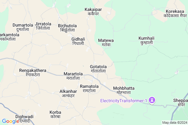
Matewa ( 3 KM ) , Saroli ( 5 KM ) , Pidingpar ( 6 KM ) , Chapatola ( 6 KM ) , Kakaipar ( 7 KM ) are the nearby Villages to Gotatola. Gotatola is surrounded by Dalli-Rajhara Tehsil towards East , Manpur (Td) Tehsil towards South , A.Chowki (Td) Tehsil towards North , Dondi Tehsil towards East .
Dalli-Rajhara , Balod , Rajnandgaon , Dongargarh are the near by Cities to Gotatola.
Gotatola 2011 Census Details
Gotatola Local Language is Chhattisgarhi. Gotatola Village Total population is 3110 and number of houses are 670. Female Population is 50.9%. Village literacy rate is 68.9% and the Female Literacy rate is 30.7%.
Population
| Census Parameter | Census Data |
| Total Population | 3110 |
| Total No of Houses | 670 |
| Female Population % | 50.9 % ( 1583) |
| Total Literacy rate % | 68.9 % ( 2142) |
| Female Literacy rate | 30.7 % ( 954) |
| Scheduled Tribes Population % | 45.7 % ( 1421) |
| Scheduled Caste Population % | 7.3 % ( 228) |
| Working Population % | 65.0 % |
| Child(0 -6) Population by 2011 | 380 |
| Girl Child(0 -6) Population % by 2011 | 52.9 % ( 201) |
Gotatola Census More Deatils.
Politics in Gotatola
Bharatiya Janata Party , BJP , INC are the major political parties in this area.Polling Stations /Booths near Gotatola
1)Gorratola2)Gotatola
3)Gotatola
4)Kaneri
5)Marapitola
HOW TO REACH Gotatola
By Rail
There is no railway station near to Gotatola in less than 10 km.Colleges near Gotatola
Chhatishgarh Ayurved Medical CollageSchools in Gotatola
S.s.m. GotatolaGovt Health Centers near Gotatola
1) SHC Gotatola , Sub Health Center Gotatola , ,2) Gidhali , Sub Health Center Gidhali , ,
3) SHC Kebattola , Sub Health Center Kebattola , ,
Hospitals in Gotatola,Mohala (td)
Community Health Centre (सामुदायिक स्वाथ्य केंद्र)
Mohala; Chhattisgarh 491666; India
16.3 KM distance Detail
Government Hospital Mangchuva
Sanjari Rd; Turmuda; Chhattisgarh 491665; India
18.3 KM distance Detail
more ..
Petrol Bunks in Gotatola,Mohala (td)
CENTRAL AUTO SERVICE
Durg Dalli Rajhara Rail Line; Ward Number 26; Dalli Rajhara; Chhattisgarh 491228; India
23.0 KM distance Detail
more ..
Local Parks in Gotatola,Mohala (td)
Governement Offices near Gotatola,Mohala (td)
Senior Agriculture Development Officer Mohala
Manpur Mohla Rd; Mohala; Chhattisgarh 491666; India
16.6 KM distance Detail
How to reach Gotatola
Tourist Places Near By Gotatola
Schools in Gotatola
Colleges in Gotatola
Temperature & weather of Gotatola
places in Gotatola
Gotatola photos
More Information
Village Talk
Post News or Events about this Village
Dalli-Rajhara 23 KM near
Balod 42 KM near
Rajnandgaon 64 KM near
Dongargarh 74 KM near
Mohala (Td) 9 KM near
Dalli-Rajhara 23 KM near
Manpur (Td) 29 KM near
A.Chowki (Td) 30 KM near
Raipur Airport 123 KM near
Sonegaon Airport 220 KM near
Jabalpur Airport 280 KM near
Rajahmundry Airport 448 KM near
Rajnandgaon 64 KM near
Dhamtari 79 KM near
Kanker 83 KM near
Durg 86 KM near
Bhilai 95 KM near
Rajnandgaon 64 KM near
Dhamtari 78 KM near
Kanker 81 KM near
Durg 86 KM near
Raj Nandgaon Rail Way Station 65 KM near
Dongargarh Rail Way Station 74 KM near