| Home | City Bus | Maps | Villages | Cities | Rail | Tourist Places | School | College | Pin Codes | Corona Cases Count |
| Distance Calculator Bus Services IFSC Codes Trace Mobile Number Weather Search Place Trace IP Available Cash ATM/Banks Locate Polling Booth Report an Error contact People |
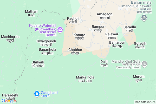
Chobhar
Chobhar Map
EDIT Map
Add Your House
 ..
..
Current Corona Virus Infected Patients Count in Rajnandgaon District
| City Name | District Name | Total Covid cases |
|---|---|---|
| Rajnandgaon | Rajnandgaon | 1 |
Locality Name :
Chobhar
( चोभर )
Tehsil Name : Chhuikhadan
District : Rajnandgaon
State : Chattisgarh
Language : Chhattisgarhi and Hindi
Current Time 12:21 AM
Date: Friday , May 02,2025 (IST)
Time zone: IST (UTC+5:30)
Elevation / Altitude: 319 meters. Above Seal level
Telephone Code / Std Code: 07743
Assembly constituency : Khairagarh assembly constituency
Assembly MLA : Yashoda Nilamber Verma
Lok Sabha constituency : Rajnandgaon parliamentary constituency
Parliament MP : SANTOSH PANDEY
Serpanch Name :
Pin Code : 491888
Post Office Name : Gandai Pandaria
Commodities Prices : Gandai Market / Mandi
Rivers Near Chobhar
Shivnath :Seonath
Tanda
Shivnath :Seonath
Tanda
About Chobhar
Correct below Info and add more info about ChobharChobhar is a Village in Chhuikhadan Tehsil in Rajnandgaon District of Chattisgarh State, India. It is located 85 KM towards North from District head quarters Rajnandgaon. 27 KM from Chhuikhadan. 117 KM from State capital Raipur
Chobhar Pin code is 491888 and postal head office is Gandai Pandaria .
Khadi ( 10 KM ) , Gerukhadan ( 10 KM ) , Salhewara ( 11 KM ) , Kumharwada ( 13 KM ) , Bakarkatta ( 13 KM ) are the nearby Villages to Chobhar. Chobhar is surrounded by Birsa Tehsil towards North , Khairagarh Tehsil towards South , Lanji Tehsil towards west , S.Lohara Tehsil towards East .
Malajkhand , Kawardha , Dongargarh , Balaghat are the near by Cities to Chobhar.
Chobhar 2011 Census Details
Chobhar Local Language is Chhattisgarhi. Chobhar Village Total population is 892 and number of houses are 185. Female Population is 50.7%. Village literacy rate is 57.8% and the Female Literacy rate is 22.5%.
Population
| Census Parameter | Census Data |
| Total Population | 892 |
| Total No of Houses | 185 |
| Female Population % | 50.7 % ( 452) |
| Total Literacy rate % | 57.8 % ( 516) |
| Female Literacy rate | 22.5 % ( 201) |
| Scheduled Tribes Population % | 16.7 % ( 149) |
| Scheduled Caste Population % | 0.0 % ( 0) |
| Working Population % | 56.2 % |
| Child(0 -6) Population by 2011 | 110 |
| Girl Child(0 -6) Population % by 2011 | 45.5 % ( 50) |
Chobhar Census More Deatils.
Politics in Chobhar
Bharatiya Janata Party , BJP , INC are the major political parties in this area.Polling Stations /Booths near Chobhar
1)Kopebhatha2)Kopro
3)Bafra
4)Korrai
5)Rajabar
HOW TO REACH Chobhar
By Rail
There is no railway station near to Chobhar in less than 10 km.Colleges near Chobhar
Veerangana Avanti Bai Govt. College
Address : Chhuikhadan, Raipur
Schools in Chobhar
P.s. Chobhar
Address : chobhar , chuikhadan , rajnandgaon , Chattisgarh . PIN- 491888 , Post - Gandai Pandaria
Govt Health Centers near Chobhar
1) Kopro , Sub Health Center Kopro , ,2) SHC Samnapur , Sub Health Center Samnapur , ,
3) SHC Goalgundi , Sub Health Center Goalgundi , ,
Super Markets in Chobhar,Chhuikhadan
Local Parks in Chobhar,Chhuikhadan
Police Stations near Chobhar,Chhuikhadan
Governement Offices near Chobhar,Chhuikhadan
About Chobhar &
History
How to reach Chobhar
Tourist Places Near By Chobhar
Schools in Chobhar
Colleges in Chobhar
Temperature & weather of Chobhar
places in Chobhar
Chobhar photos
More Information
How to reach Chobhar
Tourist Places Near By Chobhar
Schools in Chobhar
Colleges in Chobhar
Temperature & weather of Chobhar
places in Chobhar
Chobhar photos
More Information
Village Talk
Post News or Events about this Village
Near Cities
Malajkhand 37 KM near
Kawardha 65 KM near
Dongargarh 65 KM near
Balaghat 71 KM near
Malajkhand 37 KM near
Kawardha 65 KM near
Dongargarh 65 KM near
Balaghat 71 KM near
Near By Taluks
Chhuikhadan 25 KM near
Birsa 33 KM near
Khairagarh 42 KM near
Lanji 43 KM near
Chhuikhadan 25 KM near
Birsa 33 KM near
Khairagarh 42 KM near
Lanji 43 KM near
Near By Air Ports
Raipur Airport 127 KM near
Jabalpur Airport 156 KM near
Sonegaon Airport 216 KM near
Khajuraho Airport 400 KM near
Raipur Airport 127 KM near
Jabalpur Airport 156 KM near
Sonegaon Airport 216 KM near
Khajuraho Airport 400 KM near
Near By Tourist Places
Kawardha 62 KM near
Kanha National park 74 KM near
Rajnandgaon 80 KM near
Durg 85 KM near
Bhilai 91 KM near
Kawardha 62 KM near
Kanha National park 74 KM near
Rajnandgaon 80 KM near
Durg 85 KM near
Bhilai 91 KM near
Near By Districts
Kabirdham 61 KM near
Balaghat 72 KM near
Gondia 76 KM near
Rajnandgaon 81 KM near
Kabirdham 61 KM near
Balaghat 72 KM near
Gondia 76 KM near
Rajnandgaon 81 KM near
Near By RailWay Station
Dongargarh Rail Way Station 65 KM near
Amgaon Rail Way Station 65 KM near
Dongargarh Rail Way Station 65 KM near
Amgaon Rail Way Station 65 KM near