| Home | City Bus | Maps | Villages | Cities | Rail | Tourist Places | School | College | Pin Codes | Corona Cases Count |
| Distance Calculator Bus Services IFSC Codes Trace Mobile Number Weather Search Place Trace IP Available Cash ATM/Banks Locate Polling Booth Report an Error contact People |
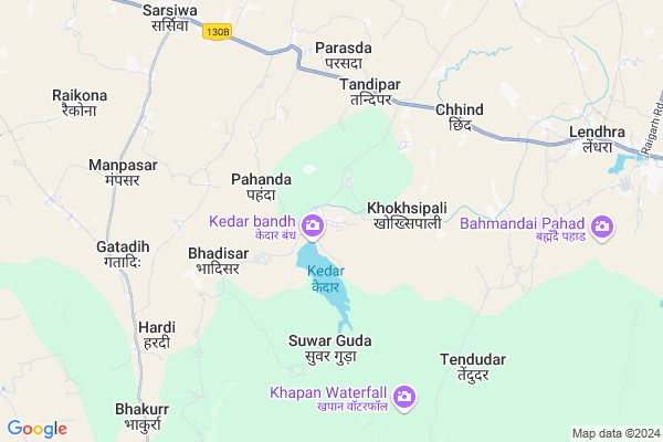
Kedar
Kedar Map
EDIT Map
Add Your House
 ..
..
Current Corona Virus Infected Patients Count in Raigarh District
| City Name | District Name | Total Covid cases |
|---|
Locality Name :
Kedar
( केदार )
Tehsil Name : Sarangarh
District : Raigarh
State : Chattisgarh
Language : Chhattisgarhi and Hindi, Oriya
Current Time 03:43 AM
Date: Saturday , May 03,2025 (IST)
Time zone: IST (UTC+5:30)
Elevation / Altitude: 259 meters. Above Seal level
Telephone Code / Std Code: 07768
Assembly constituency : Sarangarh assembly constituency
Assembly MLA : Uttari Ganpat Jangde
Lok Sabha constituency : Raigarh parliamentary constituency
Parliament MP : GOMATI SAI
Serpanch Name :
Pin Code : 496445
Post Office Name : Sarangarh
Commodities Prices : Sarsiwan Market / Mandi
Kedar Live Weather
Temperature: 28.8 °C
clear sky
Humidity: 48%
Wind : 1.45 mt/sec towards SE
StationName : "SÄ\u0081rangarh"
observed on 1 Mins Back
Temperature: 28.8 °C
clear sky
Humidity: 48%
Wind : 1.45 mt/sec towards SE
StationName : "SÄ\u0081rangarh"
observed on 1 Mins Back
Kedar Weather Forecast for Next 5 days
04-05-2025
26.0°C to 38.4°C
light rain, clear sky, scattered clouds, broken clouds
26.0°C to 38.4°C
light rain, clear sky, scattered clouds, broken clouds
05-05-2025
25.1°C to 40.7°C
scattered clouds, few clouds, clear sky, broken clouds
25.1°C to 40.7°C
scattered clouds, few clouds, clear sky, broken clouds
06-05-2025
27.9°C to 41.8°C
scattered clouds, clear sky, few clouds, broken clouds
27.9°C to 41.8°C
scattered clouds, clear sky, few clouds, broken clouds
07-05-2025
28.7°C to 42.2°C
scattered clouds, clear sky, few clouds
28.7°C to 42.2°C
scattered clouds, clear sky, few clouds
Rivers Near Kedar
Dongadarha Nadi :Dongadarha Nadi
Jhaun Jhor :Jhaun Jhor
Dongadarha Nadi :Dongadarha Nadi
Jhaun Jhor :Jhaun Jhor
About Kedar
Correct below Info and add more info about KedarKedar is a Village in Sarangarh Tehsil in Raigarh District of Chattisgarh State, India. It is located 66 KM towards west from District head quarters Raigarh. 17 KM from Sarangarh. 168 KM from State capital Raipur
Kedar Pin code is 496445 and postal head office is Sarangarh .
Limgaon ( 3 KM ) , Bhadisar ( 4 KM ) , Tandipar ( 4 KM ) , Khoksipali ( 5 KM ) , Kudhri ( 6 KM ) are the nearby Villages to Kedar. Kedar is surrounded by Bilaigarh Tehsil towards west , Basna Tehsil towards South , Dabhara Tehsil towards North , Saraipali Tehsil towards South .
Basna , Sakti , Raigarh , Champa are the near by Cities to Kedar.
Kedar 2011 Census Details
Kedar Local Language is Chhattisgarhi. Kedar Village Total population is 1237 and number of houses are 359. Female Population is 50.4%. Village literacy rate is 59.4% and the Female Literacy rate is 24.7%.
Population
| Census Parameter | Census Data |
| Total Population | 1237 |
| Total No of Houses | 359 |
| Female Population % | 50.4 % ( 624) |
| Total Literacy rate % | 59.4 % ( 735) |
| Female Literacy rate | 24.7 % ( 306) |
| Scheduled Tribes Population % | 9.4 % ( 116) |
| Scheduled Caste Population % | 9.9 % ( 123) |
| Working Population % | 44.8 % |
| Child(0 -6) Population by 2011 | 149 |
| Girl Child(0 -6) Population % by 2011 | 44.3 % ( 66) |
Kedar Census More Deatils.
Politics in Kedar
Bharatiya Janata Party , BJP , INC are the major political parties in this area.Polling Stations /Booths near Kedar
1)Kauvatal2)Khairvani Bad
3)Dhuta
4)Amlidipa
5)Amakoni Bade 2
HOW TO REACH Kedar
By Rail
There is no railway station near to Kedar in less than 10 km.Colleges near Kedar
P. Lochan.prasad Panday Mahavidyalay Sarangarh
Address :
Schools in Kedar
M.s. Kedar
Address : kedar , sarangarh , raigarh (chhattisgarh) , Chattisgarh . PIN- 496445 , Post - Sarangarh
Govt Health Centers near Kedar
1) KEDAR , , ,2) BHADISAR , , kedar road ,
3) TANDIPAR , , sarsiwan road , aganbadi
Hospitals in Kedar,Sarangarh
उप स्वास्थ्य केन्द्र कटेली
हाई स्कूल मार्ग; होल्धर पाली; छत्तीसगढ़ 496445; India
6.7 KM distance Detail
TULSI VATIKA PIKARIPALI
Sarangarh Rd; Tendubhatha; Chhattisgarh 493559; India
6.9 KM distance Detail
D.G AJAY PHYSIOTHERAPY CENTER
Sarangarh Rd; Tendubhatha; Chhattisgarh 493559; India
6.9 KM distance Detail
more ..
Petrol Bunks in Kedar,Sarangarh
Essar Oil Petrol Pump
Sasiwa; Tilaipali; Saswia; Raigarh; NH-200; Bilaspur Road; Baloda Bazar; Baloda Bazar; Chhattisgarh 493559; India
6.9 KM distance Detail
Hindustan Petroleum
Sarsiwa; Kodwa; Saraiwa; Raipur; NH-200; Bilaspur Road; Baloda Bazar; Baloda Bazar; Chhattisgarh 493559; India
7.6 KM distance Detail
more ..
Colleges in Kedar,Sarangarh
I.T.Career Computer Collage & CSC Center
Chhatauna Main Road; Parsada; Chhattisgarh 496445; India
6.4 KM distance Detail
more ..
Schools in Kedar,Sarangarh
Aadarsh Jyoti Higher Secendry School Chhind
Barbhantha; Chhattisgarh 496445; India
4.4 KM distance Detail
Local Parks in Kedar,Sarangarh
Guru Ghasi Das Pusp Vatika
Bilaspur Rd; Sarangarh; Chhattisgarh 496445; India
11.7 KM distance Detail
About Kedar &
History
How to reach Kedar
Tourist Places Near By Kedar
Schools in Kedar
Colleges in Kedar
Temperature & weather of Kedar
places in Kedar
Kedar photos
More Information
How to reach Kedar
Tourist Places Near By Kedar
Schools in Kedar
Colleges in Kedar
Temperature & weather of Kedar
places in Kedar
Kedar photos
More Information
Village Talk
Post News or Events about this Village
Near Cities
Basna 40 KM near
Sakti 56 KM near
Raigarh 61 KM near
Champa 69 KM near
Basna 40 KM near
Sakti 56 KM near
Raigarh 61 KM near
Champa 69 KM near
Near By Taluks
Sarangarh 15 KM near
Bilaigarh 27 KM near
Basna 32 KM near
Dabhara 33 KM near
Sarangarh 15 KM near
Bilaigarh 27 KM near
Basna 32 KM near
Dabhara 33 KM near
Near By Air Ports
Raipur Airport 151 KM near
Ranchi Airport 346 KM near
Bhubaneswar Airport 368 KM near
Jabalpur Airport 377 KM near
Raipur Airport 151 KM near
Ranchi Airport 346 KM near
Bhubaneswar Airport 368 KM near
Jabalpur Airport 377 KM near
Near By Tourist Places
Raigarh 63 KM near
Janjgir 71 KM near
Janjgir-Champa 91 KM near
Korba 103 KM near
Hirakud 106 KM near
Raigarh 63 KM near
Janjgir 71 KM near
Janjgir-Champa 91 KM near
Korba 103 KM near
Hirakud 106 KM near
Near By Districts
Janjgir-Champa 53 KM near
Raigarh 63 KM near
Bargarh 80 KM near
Korba 102 KM near
Janjgir-Champa 53 KM near
Raigarh 63 KM near
Bargarh 80 KM near
Korba 102 KM near
Near By RailWay Station
Kharsia Rail Way Station 54 KM near
Sakti Rail Way Station 55 KM near
Kharsia Rail Way Station 54 KM near
Sakti Rail Way Station 55 KM near