| Home | City Bus | Maps | Villages | Cities | Rail | Tourist Places | School | College | Pin Codes | Corona Cases Count |
| Distance Calculator Bus Services IFSC Codes Trace Mobile Number Weather Search Place Trace IP Available Cash ATM/Banks Locate Polling Booth Report an Error contact People |
Bataupali B
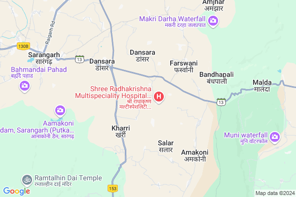
Bataupali B Map
EDIT Map
Add Your House
 ..
..
Current Corona Virus Infected Patients Count in Raigarh District
| City Name | District Name | Total Covid cases |
|---|
Locality Name :
Bataupali B
( बताउपलि बी )
Tehsil Name : Sarangarh
District : Raigarh
State : Chattisgarh
Language : Chhattisgarhi and Hindi, Oriya
Current Time 01:14 PM
Date: Saturday , May 03,2025 (IST)
Time zone: IST (UTC+5:30)
Elevation / Altitude: 259 meters. Above Seal level
Telephone Code / Std Code: 07768
Assembly constituency : Sarangarh assembly constituency
Assembly MLA : Uttari Ganpat Jangde
Lok Sabha constituency : Raigarh parliamentary constituency
Parliament MP : GOMATI SAI
Serpanch Name :
Alternate Village Name : Bataupali-B
Commodities Prices : Sarangarh Market / Mandi
Rivers Near Bataupali B
Dongadarha Nadi :Dongadarha Nadi
Jhaun Jhor :Jhaun Jhor
Dongadarha Nadi :Dongadarha Nadi
Jhaun Jhor :Jhaun Jhor
About Bataupali B
Correct below Info and add more info about Bataupali BBataupali B is a Village in Sarangarh Tehsil in Raigarh District of Chattisgarh State, India. It is located 53 KM towards South from District head quarters Raigarh. 7 KM from Sarangarh. 187 KM from State capital Raipur
Barpali ( 2 KM ) , Madhopali ( 3 KM ) , Goda ( 4 KM ) , Salar ( 4 KM ) , Dansara ( 4 KM ) are the nearby Villages to Bataupali B. Bataupali B is surrounded by Baramkela Tehsil towards East , Dabhara Tehsil towards North , Saraipali Tehsil towards South , Ambabhona Tehsil towards East .
Raigarh , Basna , Bargarh , Sakti are the near by Cities to Bataupali B.
Bataupali 2011 Census Details
Bataupali B Local Language is Chhattisgarhi. Bataupali Village Total population is 1080 and number of houses are 214. Female Population is 51.2%. Village literacy rate is 60.9% and the Female Literacy rate is 25.6%.
Population
| Census Parameter | Census Data |
| Total Population | 1080 |
| Total No of Houses | 214 |
| Female Population % | 51.2 % ( 553) |
| Total Literacy rate % | 60.9 % ( 658) |
| Female Literacy rate | 25.6 % ( 276) |
| Scheduled Tribes Population % | 0.0 % ( 0) |
| Scheduled Caste Population % | 78.1 % ( 844) |
| Working Population % | 36.1 % |
| Child(0 -6) Population by 2011 | 146 |
| Girl Child(0 -6) Population % by 2011 | 52.1 % ( 76) |
Bataupali Census More Deatils.
Politics in Bataupali B
Bharatiya Janata Party , BJP , INC are the major political parties in this area.Polling Stations /Booths near Bataupali B
1)Boirdih2)Machgorha
3)Goda 1
4)Khairgadhi
5)Basinbahra
HOW TO REACH Bataupali B
By Rail
There is no railway station near to Bataupali B in less than 10 km.Pincodes near Bataupali B
496450 ( Hardi (Raigarh) ) , 496445 ( Sarangarh ) , 496551 ( Baramkela )Colleges near Bataupali B
P. Lochan.prasad Panday Mahavidyalay Sarangarh
Address :
Schools near Bataupali B
Vaidik Vidya Mandir Ms Kosir
Address : kosir , sarangarh , raigarh (chhattisgarh) , Chattisgarh . PIN- 496445 , Post - Sarangarh
Ashoka Public Ms Sarangarh
Address : sarangarh , sarangarh , raigarh (chhattisgarh) , Chattisgarh . PIN- 496445 , Post - Sarangarh
Shining Public School Suwatal
Address : suwatal , sarangarh , raigarh (chhattisgarh) , Chattisgarh . PIN- 496450 , Post - Hardi (Raigarh)
Ums Bhadra
Address : bhadra , sarangarh , raigarh (chhattisgarh) , Chattisgarh . PIN- 496445 , Post - Sarangarh
Govt Health Centers near Bataupali B
1) MALDA , , baramkela road ,2) DANSARA , , NH53 Road ,
3) SALAR , , NH53 Road ,
Petrol Bunks in Bataupali B,Sarangarh
Indian Oil Petrol Pump
Khairaha; Raigarh; NH-200; Bilaspur Road; Sarangarh; Sarangarh; Chhattisgarh 496445; India
10.7 KM distance Detail
more ..
Colleges in Bataupali B,Sarangarh
CPM Private College
National Highway 216; Sarangarh; Chhattisgarh 496445; India
9.8 KM distance Detail
more ..
Schools in Bataupali B,Sarangarh
K P Higher Secondary School
Sarangar; Bandhapali; Raigarh; SH-13; Baramkela Marg; Sarangarh; Sarangarh; Chhattisgarh 496445; India
2.3 KM distance Detail
Local Parks in Bataupali B,Sarangarh
Guru Ghasi Das Pusp Vatika
Bilaspur Rd; Sarangarh; Chhattisgarh 496445; India
9.9 KM distance Detail
Police Stations near Bataupali B,Sarangarh
Baramkela Police Station
496551; Chote Khol Para; Kapartunga; Baramkela; Chhattisgarh 496551; India
13.6 KM distance Detail
About Bataupali B &
History
How to reach Bataupali B
Tourist Places Near By Bataupali B
Schools in Bataupali B
Colleges in Bataupali B
Temperature & weather of Bataupali B
places in Bataupali B
Bataupali B photos
More Information
How to reach Bataupali B
Tourist Places Near By Bataupali B
Schools in Bataupali B
Colleges in Bataupali B
Temperature & weather of Bataupali B
places in Bataupali B
Bataupali B photos
More Information
Village Talk
Post News or Events about this Village
Near Cities
Raigarh 50 KM near
Basna 50 KM near
Bargarh 59 KM near
Sakti 61 KM near
Raigarh 50 KM near
Basna 50 KM near
Bargarh 59 KM near
Sakti 61 KM near
Near By Taluks
Sarangarh 7 KM near
Baramkela 17 KM near
Dabhara 29 KM near
Saraipali 34 KM near
Sarangarh 7 KM near
Baramkela 17 KM near
Dabhara 29 KM near
Saraipali 34 KM near
Near By Air Ports
Raipur Airport 170 KM near
Ranchi Airport 332 KM near
Bhubaneswar Airport 350 KM near
Jabalpur Airport 396 KM near
Raipur Airport 170 KM near
Ranchi Airport 332 KM near
Bhubaneswar Airport 350 KM near
Jabalpur Airport 396 KM near
Near By Tourist Places
Raigarh 51 KM near
Janjgir 86 KM near
Hirakud 86 KM near
Sambalpur 96 KM near
Janjgir-Champa 105 KM near
Raigarh 51 KM near
Janjgir 86 KM near
Hirakud 86 KM near
Sambalpur 96 KM near
Janjgir-Champa 105 KM near
Near By Districts
Raigarh 50 KM near
Bargarh 61 KM near
Janjgir-Champa 64 KM near
Sambalpur 97 KM near
Raigarh 50 KM near
Bargarh 61 KM near
Janjgir-Champa 64 KM near
Sambalpur 97 KM near
Near By RailWay Station
Raigarh Rail Way Station 49 KM near
Kharsia Rail Way Station 54 KM near
Raigarh Rail Way Station 49 KM near
Kharsia Rail Way Station 54 KM near