| Home | City Bus | Maps | Villages | Cities | Rail | Tourist Places | School | College | Pin Codes | Corona Cases Count |
| Distance Calculator Bus Services IFSC Codes Trace Mobile Number Weather Search Place Trace IP Available Cash ATM/Banks Locate Polling Booth Report an Error contact People |
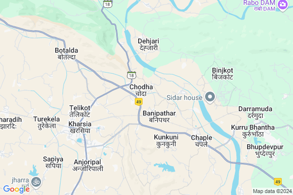
Chodha
Chodha Map
EDIT Map
Add Your House
 ..
..
Current Corona Virus Infected Patients Count in Raigarh District
| City Name | District Name | Total Covid cases |
|---|
Locality Name :
Chodha
( छोड़ा )
Tehsil Name : Kharsia
District : Raigarh
State : Chattisgarh
Language : Chhattisgarhi and Hindi, Oriya
Current Time 08:34 AM
Date: Saturday , May 03,2025 (IST)
Time zone: IST (UTC+5:30)
Elevation / Altitude: 259 meters. Above Seal level
Telephone Code / Std Code: 07757
Assembly constituency : Kharsia assembly constituency
Assembly MLA : Umesh Patel
Lok Sabha constituency : Raigarh parliamentary constituency
Parliament MP : GOMATI SAI
Serpanch Name :
Pin Code : 496661
Post Office Name : Kharsia
Commodities Prices : Kharsiya Market / Mandi
Chodha Live Weather
Temperature: 27.5 °C
clear sky
Humidity: 51%
Wind : 1.56 mt/sec towards E
StationName : "Kharsia"
observed on 2 Hours Back
Temperature: 27.5 °C
clear sky
Humidity: 51%
Wind : 1.56 mt/sec towards E
StationName : "Kharsia"
observed on 2 Hours Back
Chodha Weather Forecast for Next 5 days
04-05-2025
25.5°C to 38.1°C
light rain, clear sky, broken clouds, scattered clouds
25.5°C to 38.1°C
light rain, clear sky, broken clouds, scattered clouds
05-05-2025
24.4°C to 41.0°C
few clouds, scattered clouds, clear sky, light rain, broken clouds
24.4°C to 41.0°C
few clouds, scattered clouds, clear sky, light rain, broken clouds
06-05-2025
26.9°C to 42.3°C
scattered clouds, few clouds, clear sky, broken clouds
26.9°C to 42.3°C
scattered clouds, few clouds, clear sky, broken clouds
07-05-2025
28.4°C to 42.2°C
scattered clouds, few clouds, clear sky
28.4°C to 42.2°C
scattered clouds, few clouds, clear sky
08-05-2025
29.0°C to 42.8°C
scattered clouds, overcast clouds, few clouds
29.0°C to 42.8°C
scattered clouds, overcast clouds, few clouds
Rivers Near Chodha
Dongadarha Nadi :Dongadarha Nadi
Samarsuta
Dongadarha Nadi :Dongadarha Nadi
Samarsuta
About Chodha
Correct below Info and add more info about ChodhaChodha is a Village in Kharsia Tehsil in Raigarh District of Chattisgarh State, India. It is located 33 KM towards west from District head quarters Raigarh. 2 KM from Kharsia. 208 KM from State capital Raipur
Chodha Pin code is 496661 and postal head office is Kharsia .
Madanpur ( 2 KM ) , Bhelwadih ( 2 KM ) , Banipathar ( 2 KM ) , Ranisagar ( 3 KM ) , Dehjari ( 3 KM ) are the nearby Villages to Chodha. Chodha is surrounded by Malkharoda Tehsil towards west , Sakti Tehsil towards west , Dabhara Tehsil towards South , Raigarh Tehsil towards East .
Sakti , Raigarh , Champa , Korba are the near by Cities to Chodha.
This Place is in the border of the Raigarh District and Janjgir-champa District. Janjgir-champa District Sakti is west towards this place .
Chondha 2011 Census Details
Chodha Local Language is Chhattisgarhi. Chondha Village Total population is 1149 and number of houses are 262. Female Population is 46.5%. Village literacy rate is 72.0% and the Female Literacy rate is 26.7%.
Population
| Census Parameter | Census Data |
| Total Population | 1149 |
| Total No of Houses | 262 |
| Female Population % | 46.5 % ( 534) |
| Total Literacy rate % | 72.0 % ( 827) |
| Female Literacy rate | 26.7 % ( 307) |
| Scheduled Tribes Population % | 57.9 % ( 665) |
| Scheduled Caste Population % | 12.2 % ( 140) |
| Working Population % | 39.7 % |
| Child(0 -6) Population by 2011 | 126 |
| Girl Child(0 -6) Population % by 2011 | 50.8 % ( 64) |
Chondha Census More Deatils.
Politics in Chodha
Bharatiya Janata Party , BJP , INC are the major political parties in this area.Polling Stations /Booths near Chodha
1)Banhar2)Chirpani
3)Bansiya
4)Bhainapara
5)Raitarai
HOW TO REACH Chodha
By Rail
Robertson Rail Way Station , Kharsia Rail Way Station are the very nearby railway stations to Chodha.Colleges near Chodha
Salhewana, Batmul Aashram Collage, Mahapalli
Address :
P. Lochan.prasad Panday Mahavidyalay Sarangarh
Address :
Pandit Lochan Prashad Pandey Mahavidyalay Baramkela
Address : Near High School Baramkela
Batmul Ashram College Mahabali
Address : Batmul Ashram Mahapalli
Agriculture Collage
Address : Jorapali
Schools in Chodha
Eklavya M Ash Hr Chodha
Address : chodha , kharsia , raigarh (chhattisgarh) , Chattisgarh . PIN- 496661 , Post - Kharsia
M.s.chodha
Address : chodha , kharsia , raigarh (chhattisgarh) , Chattisgarh . PIN- 496661 , Post - Kharsia
Govt Health Centers near Chodha
1) BANIPATHAR , , Scholl Near , Banipather2) PAMGARH , , Basti ,
3) GURDA , , Main Road , Gurda
Hospitals in Chodha,Kharsia
Sub Health Center Pamgarh
Vill-Pamgarh;Post-Pamgarh;Block- Kharsia;Dist-Raigarh;(C. G; 496661; India
3.0 KM distance Detail
S.S. Clinic & Pathology
Overhead Water Tank;; Kharsia; Chhattisgarh 496661; India
5.9 KM distance Detail
more ..
Petrol Bunks in Chodha,Kharsia
BENI PRASAD GAJANAND
KHARSIA ROAD KHARSIA; RAIGARH; Chhattisgarh 496661; India
5.1 KM distance Detail
more ..
Colleges in Chodha,Kharsia
M. G. Govt Arts and Science College Kharsia
Kharsia Rd; Mishra Colony; Kharsia; Chhattisgarh 496661; India
6.1 KM distance Detail
Girls Arts and Commerce College
Ajit Singh Nagar; Kharsia; Chhattisgarh 496661; India
6.5 KM distance Detail
more ..
Schools in Chodha,Kharsia
Bachpan Academic Brights Public School
Rajghatta;; Kharsia; Chhattisgarh 496661; India
1.5 KM distance Detail
Alok International School
Shobha Vatika; Rajghatta; Kharsia; Banipathar; Chhattisgarh; India
1.5 KM distance Detail
Super Markets in Chodha,Kharsia
Chhuhipali Sahil Kiranastors
Kharsia - Dabhara Rd; Purani Basti; Kharsia; Chhattisgarh 496661; India
6.1 KM distance Detail
Governement Offices near Chodha,Kharsia
Samudaiya Bhawan
Mahuapali Rd; Purani Basti; Kharsia; Chhattisgarh 496661; India
6.3 KM distance Detail
About Chodha &
History
How to reach Chodha
Tourist Places Near By Chodha
Schools in Chodha
Colleges in Chodha
Temperature & weather of Chodha
places in Chodha
Chodha photos
More Information
How to reach Chodha
Tourist Places Near By Chodha
Schools in Chodha
Colleges in Chodha
Temperature & weather of Chodha
places in Chodha
Chodha photos
More Information
Village Talk
Post News or Events about this Village
Near Cities
Sakti 20 KM near
Raigarh 27 KM near
Champa 57 KM near
Korba 58 KM near
Sakti 20 KM near
Raigarh 27 KM near
Champa 57 KM near
Korba 58 KM near
Near By Taluks
Kharsia 2 KM near
Malkharoda 22 KM near
Dabhara 26 KM near
Sakti 26 KM near
Kharsia 2 KM near
Malkharoda 22 KM near
Dabhara 26 KM near
Sakti 26 KM near
Near By Air Ports
Raipur Airport 192 KM near
Ranchi Airport 298 KM near
Bhubaneswar Airport 379 KM near
Jabalpur Airport 380 KM near
Raipur Airport 192 KM near
Ranchi Airport 298 KM near
Bhubaneswar Airport 379 KM near
Jabalpur Airport 380 KM near
Near By Tourist Places
Raigarh 31 KM near
Janjgir 66 KM near
Korba 68 KM near
Janjgir-Champa 78 KM near
Hirakud 104 KM near
Raigarh 31 KM near
Janjgir 66 KM near
Korba 68 KM near
Janjgir-Champa 78 KM near
Hirakud 104 KM near
Near By Districts
Raigarh 31 KM near
Janjgir-Champa 39 KM near
Korba 66 KM near
Bargarh 99 KM near
Raigarh 31 KM near
Janjgir-Champa 39 KM near
Korba 66 KM near
Bargarh 99 KM near
Near By RailWay Station
Robertson Rail Way Station 4.9 KM near
Kharsia Rail Way Station 7.1 KM near
Sakti Rail Way Station 22 KM near
Robertson Rail Way Station 4.9 KM near
Kharsia Rail Way Station 7.1 KM near
Sakti Rail Way Station 22 KM near