| Home | City Bus | Maps | Villages | Cities | Rail | Tourist Places | School | College | Pin Codes | Corona Cases Count |
| Distance Calculator Bus Services IFSC Codes Trace Mobile Number Weather Search Place Trace IP Available Cash ATM/Banks Locate Polling Booth Report an Error contact People |
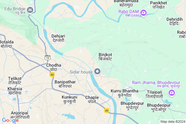
Binjkot
Binjkot Map
EDIT Map
Add Your House
 ..
..
Current Corona Virus Infected Patients Count in Raigarh District
| City Name | District Name | Total Covid cases |
|---|
Locality Name :
Binjkot
( बिंजकोट )
Tehsil Name : Kharsia
District : Raigarh
State : Chattisgarh
Language : Chhattisgarhi and Hindi, Oriya
Current Time 02:51 AM
Date: Saturday , May 03,2025 (IST)
Time zone: IST (UTC+5:30)
Elevation / Altitude: 259 meters. Above Seal level
Telephone Code / Std Code: 07757
Assembly constituency : Kharsia assembly constituency
Assembly MLA : Umesh Patel
Lok Sabha constituency : Raigarh parliamentary constituency
Parliament MP : GOMATI SAI
Serpanch Name :
Pin Code : 496661
Post Office Name : Kharsia
Commodities Prices : Kharsiya Market / Mandi
Rivers Near Binjkot
Dongadarha Nadi :Dongadarha Nadi
Samarsuta
Dongadarha Nadi :Dongadarha Nadi
Samarsuta
About Binjkot
Correct below Info and add more info about BinjkotBinjkot is a Village in Kharsia Tehsil in Raigarh District of Chattisgarh State, India. It is located 29 KM towards west from District head quarters Raigarh. 8 KM from Kharsia. 214 KM from State capital Raipur
Binjkot Pin code is 496661 and postal head office is Kharsia .
Pamgarh ( 1 KM ) , Badedumarpali ( 3 KM ) , Gurda ( 4 KM ) , Rajghata ( 4 KM ) , Badejampali ( 5 KM ) are the nearby Villages to Binjkot. Binjkot is surrounded by Raigarh Tehsil towards East , Malkharoda Tehsil towards west , Dabhara Tehsil towards South , Gharghoda Tehsil towards North .
Raigarh , Sakti , Korba , Champa are the near by Cities to Binjkot.
This Place is in the border of the Raigarh District and Janjgir-champa District. Janjgir-champa District Sakti is west towards this place .
Binjkot 2011 Census Details
Binjkot Local Language is Chhattisgarhi. Binjkot Village Total population is 1176 and number of houses are 278. Female Population is 49.5%. Village literacy rate is 57.5% and the Female Literacy rate is 23.8%.
Population
| Census Parameter | Census Data |
| Total Population | 1176 |
| Total No of Houses | 278 |
| Female Population % | 49.5 % ( 582) |
| Total Literacy rate % | 57.5 % ( 676) |
| Female Literacy rate | 23.8 % ( 280) |
| Scheduled Tribes Population % | 41.4 % ( 487) |
| Scheduled Caste Population % | 7.0 % ( 82) |
| Working Population % | 39.7 % |
| Child(0 -6) Population by 2011 | 156 |
| Girl Child(0 -6) Population % by 2011 | 47.4 % ( 74) |
Binjkot Census More Deatils.
Politics in Binjkot
Bharatiya Janata Party , BJP , INC are the major political parties in this area.Polling Stations /Booths near Binjkot
1)Hardijhariya2)Bilaspur
3)Jatri
4)Chuhipali
5)Aadajhar
HOW TO REACH Binjkot
By Rail
Robertson Rail Way Station , Bhupdeopur Rail Way Station are the very nearby railway stations to Binjkot.Colleges near Binjkot
Salhewana, Batmul Aashram Collage, Mahapalli
Address :
P. Lochan.prasad Panday Mahavidyalay Sarangarh
Address :
Pandit Lochan Prashad Pandey Mahavidyalay Baramkela
Address : Near High School Baramkela
Batmul Ashram College Mahabali
Address : Batmul Ashram Mahapalli
Agriculture Collage
Address : Jorapali
Schools in Binjkot
M.s.binjkot
Address : binjkot , kharsia , raigarh (chhattisgarh) , Chattisgarh . PIN- 496661 , Post - Kharsia
Govt Health Centers near Binjkot
1) BINJKOT , , Near Primary School , Binjkot2) BINJKOT , , ,
3) BINJKOT , , Near SKS Plant , SKS Power Plant Binjkot
Hospitals in Binjkot,Kharsia
Sub Health Center Pamgarh
Vill-Pamgarh;Post-Pamgarh;Block- Kharsia;Dist-Raigarh;(C. G; 496661; India
2.1 KM distance Detail
more ..
Colleges in Binjkot,Kharsia
M. G. Govt Arts and Science College Kharsia
Kharsia Rd; Mishra Colony; Kharsia; Chhattisgarh 496661; India
10.8 KM distance Detail
Girls Arts and Commerce College
Ajit Singh Nagar; Kharsia; Chhattisgarh 496661; India
11.4 KM distance Detail
more ..
Electronic Shops in Binjkot,Kharsia
Malakar Mobile & Electronics
Bayang chowk chaple; Raigarh; Chhattisgarh 496661; India
5.0 KM distance Detail
Super Markets in Binjkot,Kharsia
Chhuhipali Sahil Kiranastors
Kharsia - Dabhara Rd; Purani Basti; Kharsia; Chhattisgarh 496661; India
11.0 KM distance Detail
Governement Offices near Binjkot,Kharsia
Samudaiya Bhawan
Mahuapali Rd; Purani Basti; Kharsia; Chhattisgarh 496661; India
11.2 KM distance Detail
About Binjkot &
History
How to reach Binjkot
Tourist Places Near By Binjkot
Schools in Binjkot
Colleges in Binjkot
Temperature & weather of Binjkot
places in Binjkot
Binjkot photos
More Information
How to reach Binjkot
Tourist Places Near By Binjkot
Schools in Binjkot
Colleges in Binjkot
Temperature & weather of Binjkot
places in Binjkot
Binjkot photos
More Information
Village Talk
Post News or Events about this Village
Near Cities
Raigarh 24 KM near
Sakti 25 KM near
Korba 61 KM near
Champa 61 KM near
Raigarh 24 KM near
Sakti 25 KM near
Korba 61 KM near
Champa 61 KM near
Near By Taluks
Kharsia 7 KM near
Raigarh 25 KM near
Malkharoda 27 KM near
Dabhara 28 KM near
Kharsia 7 KM near
Raigarh 25 KM near
Malkharoda 27 KM near
Dabhara 28 KM near
Near By Air Ports
Raipur Airport 197 KM near
Ranchi Airport 293 KM near
Bhubaneswar Airport 376 KM near
Jabalpur Airport 384 KM near
Raipur Airport 197 KM near
Ranchi Airport 293 KM near
Bhubaneswar Airport 376 KM near
Jabalpur Airport 384 KM near
Near By Tourist Places
Raigarh 28 KM near
Janjgir 70 KM near
Korba 71 KM near
Janjgir-Champa 83 KM near
Hirakud 101 KM near
Raigarh 28 KM near
Janjgir 70 KM near
Korba 71 KM near
Janjgir-Champa 83 KM near
Hirakud 101 KM near
Near By Districts
Raigarh 28 KM near
Janjgir-Champa 44 KM near
Korba 69 KM near
Jharsuguda 98 KM near
Raigarh 28 KM near
Janjgir-Champa 44 KM near
Korba 69 KM near
Jharsuguda 98 KM near
Near By RailWay Station
Robertson Rail Way Station 4.1 KM near
Kharsia Rail Way Station 11 KM near
Sakti Rail Way Station 26 KM near
Robertson Rail Way Station 4.1 KM near
Kharsia Rail Way Station 11 KM near
Sakti Rail Way Station 26 KM near