| Home | City Bus | Maps | Villages | Cities | Rail | Tourist Places | School | College | Pin Codes | Corona Cases Count |
| Distance Calculator Bus Services IFSC Codes Trace Mobile Number Weather Search Place Trace IP Available Cash ATM/Banks Locate Polling Booth Report an Error contact People |
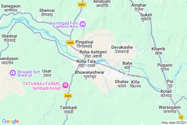
Anantwadi
Anantwadi Map
EDIT Map
Add Your House
 ..
..
Current Corona Virus Infected Patients Count in Raigad District
| City Name | District Name | Total Covid cases |
|---|
Locality Name :
Anantwadi
( अनंतवाडी )
Taluka Name : Tala
District : Raigad
State : Maharashtra
Region : Konkan
Division : Konkan
Language : Marathi and Hindi
Current Time 11:14 PM
Date: Friday , May 02,2025 (IST)
Time zone: IST (UTC+5:30)
Elevation / Altitude: 20 meters. Above Seal level
Telephone Code / Std Code: 02194
Assembly constituency : Shrivardhan assembly constituency
Assembly MLA : Aditi Sunil Tatkare
Lok Sabha constituency : Raigad parliamentary constituency
Parliament MP : Tatkare Sunil Dattatray
Serpanch Name :
Pin Code : 402111
Post Office Name : Tala (Raigarh(MH))
Main Village Name : Tala
Commodities Prices : Roha Market / Mandi
Anantwadi Live Weather
Temperature: 26.5 °C
clear sky
Humidity: 61%
Wind : 1.25 mt/sec towards N
StationName : "Roha"
observed on 15 Mins Back
Temperature: 26.5 °C
clear sky
Humidity: 61%
Wind : 1.25 mt/sec towards N
StationName : "Roha"
observed on 15 Mins Back
Anantwadi Weather Forecast for Next 5 days
03-05-2025
26.1°C to 27.2°C
clear sky
26.1°C to 27.2°C
clear sky
04-05-2025
25.6°C to 38.4°C
clear sky
25.6°C to 38.4°C
clear sky
05-05-2025
25.2°C to 35.8°C
clear sky, few clouds
25.2°C to 35.8°C
clear sky, few clouds
06-05-2025
24.4°C to 36.2°C
clear sky, scattered clouds
24.4°C to 36.2°C
clear sky, scattered clouds
07-05-2025
26.1°C to 36.4°C
few clouds, overcast clouds, scattered clouds, clear sky, light rain
26.1°C to 36.4°C
few clouds, overcast clouds, scattered clouds, clear sky, light rain
National Highways Reachable To Anantwadi
Nationa High Way :NH66
Nationa High Way :NH66
Rivers Near Anantwadi
Kanandi :कानंदी
Kanandi :कानंदी
Kanandi :कानंदी
Kanandi :कानंदी
About Anantwadi
Correct below Info and add more info about AnantwadiAnantwadi is a small Village/hamlet in Tala Taluka in Raigad District of Maharashtra State, India. It comes under Tala Panchayath. It belongs to Konkan region . It belongs to Konkan Division . It is located 42 KM towards East from District head quarters Alibag. 20 KM from Tala. 82 KM from State capital Mumbai
Anantwadi Pin code is 402111 and postal head office is Tala (Raigarh(MH)).
Anantwadi is surrounded by Tala Taluka towards South , Murud Taluka towards west , Sudhagad Taluka towards North , Mangaon Taluka towards South .
Nandgaon , Pen , Lonavla , Mahad are the near by Cities to Anantwadi.
It is near to arabian sea. There is a chance of humidity in the weather.
Demographics of Anantwadi
Marathi is the Local Language here.Politics in Anantwadi
Nationalist Congress Party , NCP , SHS , INC are the major political parties in this area.Polling Stations /Booths near Anantwadi
1)Varathi2)Varse 1
3)Roha N.p.4
4)Roha N.p.5
5)Bhuvaneshwar 2
HOW TO REACH Anantwadi
By Rail
Roha Rail Way Station , Roha Rail Way Station are the very nearby railway stations to Anantwadi. Roha Rail Way Station (near to Roha Ashtami) , Veer Rail Way Station (near to Mahad) , Sape Wamne Rail Way Station (near to Mahad) , Roha Rail Way Station (near to Roha Ashtami) are the Rail way stations reachable from near by towns.By Road
Roha Ashtami , Shrivardhan , Mahad are the nearby by towns to Anantwadi having road connectivity to AnantwadiColleges near Anantwadi
J.b.sawant Edu.societys Tmc College
Address :
G.b.wader Collage Pali
Address :
S A K Juniour College Pangloli
Address :
Doshi Vakil Arts & G.c.u.b Sci & Com Collage - Goregaon
Address :
M.t.e.s. Doshi Vakil Arts & G.c.u.b Sci & Com Collage - Goregaon
Address :
Schools in Anantwadi
G.m. Vedak Vidyamandir Tale
Address : tala , tala , raigarh (maharashtra) , Maharashtra . PIN- 402111 , Post - Tala (Raigarh(MH))
Haji Tahir Jalgaonkar U. High Sch
Address : tala , tala , raigarh (maharashtra) , Maharashtra . PIN- 402111 , Post - Tala (Raigarh(MH))
S.s.nikam English M. Tala
Address : tala , tala , raigarh (maharashtra) , Maharashtra . PIN- 402111 , Post - Tala (Raigarh(MH))
Zpps Urdu School Tala
Address : tala , tala , raigarh (maharashtra) , Maharashtra . PIN- 402111 , Post - Tala (Raigarh(MH))
Govt Health Centers near Anantwadi
1) Roha , Sub District Hospital Roha , Tilak Road , Nagpalika Road2) Uruli Kanchan , Ap.Uralikanchan Tal Haveli Dist Pune , Railyway Station Near , Railyway Station Near
3) Urulikanchan , Ap.Uralikanchan Tal Haveli Dist Pune , Railyway Station Near , Railyway Station Near
Schools in Anantwadi,Tala
Electronic Shops in Anantwadi,Tala
Super Markets in Anantwadi,Tala
Local Parks in Anantwadi,Tala
Police Stations near Anantwadi,Tala
Governement Offices near Anantwadi,Tala
About Anantwadi &
History
How to reach Anantwadi
Tourist Places Near By Anantwadi
Schools in Anantwadi
Colleges in Anantwadi
Temperature & weather of Anantwadi
places in Anantwadi
Anantwadi photos
More Information
How to reach Anantwadi
Tourist Places Near By Anantwadi
Schools in Anantwadi
Colleges in Anantwadi
Temperature & weather of Anantwadi
places in Anantwadi
Anantwadi photos
More Information
Village Talk
Post News or Events about this Village
Near Cities
Nandgaon 25 KM near
Pen 37 KM near
Lonavla 50 KM near
Mahad 53 KM near
Nandgaon 25 KM near
Pen 37 KM near
Lonavla 50 KM near
Mahad 53 KM near
Near By Taluks
Roha 1 KM near
Tala 19 KM near
Murud 21 KM near
Sudhagad 23 KM near
Roha 1 KM near
Tala 19 KM near
Murud 21 KM near
Sudhagad 23 KM near
Near By Air Ports
Chhatrapati Shivaji International Airport 86 KM near
Lohegaon Airport 95 KM near
Gandhinagar Airport 206 KM near
Kolhapur Airport 263 KM near
Chhatrapati Shivaji International Airport 86 KM near
Lohegaon Airport 95 KM near
Gandhinagar Airport 206 KM near
Kolhapur Airport 263 KM near
Near By Tourist Places
Kolad 9 KM near
Raigad 11 KM near
Nagothane 13 KM near
Kashid 26 KM near
Murud Janjira 26 KM near
Kolad 9 KM near
Raigad 11 KM near
Nagothane 13 KM near
Kashid 26 KM near
Murud Janjira 26 KM near
Near By Districts
Raigad 40 KM near
Mumbai 75 KM near
Pune 87 KM near
Thane 104 KM near
Raigad 40 KM near
Mumbai 75 KM near
Pune 87 KM near
Thane 104 KM near
Near By RailWay Station
Roha Rail Way Station 1.2 KM near
Roha Rail Way Station 1.2 KM near
Nidi Rail Way Station 5.1 KM near
Mangaon Rail Way Station 29 KM near
Roha Rail Way Station 1.2 KM near
Roha Rail Way Station 1.2 KM near
Nidi Rail Way Station 5.1 KM near
Mangaon Rail Way Station 29 KM near