| Home | City Bus | Maps | Villages | Cities | Rail | Tourist Places | School | College | Pin Codes | Corona Cases Count |
| Distance Calculator Bus Services IFSC Codes Trace Mobile Number Weather Search Place Trace IP Available Cash ATM/Banks Locate Polling Booth Report an Error contact People |
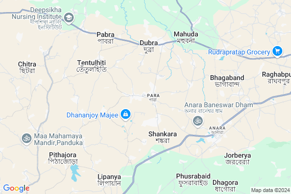
Udaypur-joynagar
Udaypur-joynagar Map
EDIT Map
Add Your House
 ..
..
Current Corona Virus Infected Patients Count in Purulia District
| City Name | District Name | Total Covid cases |
|---|
Locality Name :
Udaypur-joynagar
( Udaypur-জয়নগর )
Block Name : Para
District : Purulia
State : West Bengal
Division : Burdwan
Language : Bengali and English
Current Time 10:37 PM
Date: Saturday , May 03,2025 (IST)
Time zone: IST (UTC+5:30)
Elevation / Altitude: 192 meters. Above Seal level
Telephone Code / Std Code: 03251
Assembly constituency : Para assembly constituency
Assembly MLA : Nadiar Chand Bouri
Lok Sabha constituency : Purulia parliamentary constituency
Parliament MP : JYOTIRMAY SINGH MAHATO
Serpanch Name :
Pin Code : 723147
Post Office Name : Vivekananda Nagar
Commodities Prices : Kasipur Market / Mandi
National Highways Reachable To Udaypur-joynagar
Nationa High Way :NH19
Nationa High Way :NH19
Rivers Near Udaypur-joynagar
Barakar River
Kumari River
Barakar River
Kumari River
About Udaypur-joynagar
Correct below Info and add more info about Udaypur-joynagarUdaypur-joynagar is a Village in Para Block in Purulia District of West Bengal State, India. It belongs to Burdwan Division . It is located 29 KM towards North from District head quarters Purulia. 252 KM from State capital Kolkata
Udaypur-joynagar Pin code is 723147 and postal head office is Vivekananda Nagar .
Udaypur-joynagar is surrounded by Raghunathpur-Ii Block towards North , Raghunath Pur-I Block towards East , Purulia-Ii Block towards South , Hura Block towards South .
Adra, Purulia , Raghunathpur , Dhanbad , Chirkunda are the near by Cities to Udaypur-joynagar.
This Place is in the border of the Purulia District and Bokaro District. Bokaro District Chandankiyari is west towards this place . It is near to the Jharkhand State Border.
Demographics of Udaypur-joynagar
Bengali is the Local Language here.Politics in Udaypur-joynagar
CPM , Bharatiya Janata Party , CPI(M) , AITC , AIFB , INC are the major political parties in this area.Polling Stations /Booths near Udaypur-joynagar
1)Para Board Pry.school Room 12)Para Girls High School Room 2
3)Panduka Junior Basic School Room 1
4)Para Girls High School Room 1
5)Para New Pry.school Room 2
HOW TO REACH Udaypur-joynagar
By Rail
Anara Rail Way Station , Rukni Rail Way Station are the very nearby railway stations to Udaypur-joynagar.Colleges near Udaypur-joynagar
Panchakot Mahavidyalaya
Address :
G.m.m.t.t.i Pirrah,kenda,purulia
Address :
Kotshila Mahavidyalaya
Address : Vill+po-jiudaru,ps-kotshila,dist-purulia
Schools near Udaypur-joynagar
Deoli Pahargora High School
Address : deoli / i , para , puruliya , West Bengal . PIN- 723146 , Post - Santaldih T.P.
S.t.p. Girls High School(h.s.)
Address : deoli / xi , para , puruliya , West Bengal . PIN- 723146 , Post - Santaldih T.P.
S.t.p. Boys High School (h.s.)
Address : deoli / xi , para , puruliya , West Bengal . PIN- 723146 , Post - Santaldih T.P.
Jhapra High School (h.s.)
Address : j.jhapra-i / viii , para , puruliya , West Bengal . PIN- 723126 , Post - Anara RS
Govt Health Centers near Udaypur-joynagar
1) INSTITUTE FOR MENTAL CARE , PURULIA , Purulia , Institute for Mental Care2) Belkuri PHC , Belkuri PHC , Belkuri , Belkuri PHC
3) KENDA SC , KENDA SC building , Kenda Village ,
Petrol Bunks in Udaypur-joynagar,Para
Mittal dharamkanta 60 Ton
Purulia - Barakar Road; Shankara; West Bengal 723126; India
4.9 KM distance Detail
HP PETROL PUMP - SARKHEL AUTO SERVICE
Jhapramore P O Raghunathpurt W B; Durgapur; West Bengal 723133; India
5.0 KM distance Detail
HP PETROL PUMP - SINDRI PETROL SUPPLY
HP Petrol Pump Rohra Bandh P.o-sindri; Sindri; Jharkhand 828122; India
18.7 KM distance Detail
more ..
Colleges in Udaypur-joynagar,Para
PURNADISHA JOYCHANDI TEACHER TRAINING COLLEGE
Opp. S.D. Hospital Staff Quarters; Barakar-Purulia Road; Near New Bus Stand; P.O.& P.S. Raghunathpur; Purulia; West Bengal 722133; India
18.1 KM distance Detail
Dr. Shyama Prasad Mukherjee Inter College Sindri
Deuli - Khairpal Road; Rohraband; Jharkhand 828107; India
18.6 KM distance Detail
more ..
Schools in Udaypur-joynagar,Para
Adra Mission High School Panchudanga High School
Mission para; Village - Panchudanga; P. O- Adra; Dist; West Bengal; India
0.7 KM distance Detail
Para Computer School
vill-para;po-para;ps-para;dist-purulia;pin no-723155; raghunathpuer; West Bengal 723155; India
1.1 KM distance Detail
Electronic Shops in Udaypur-joynagar,Para
Lenovo Store - Kataruka Forms & Computers
Rajasthan Brahman Dharmasalla Building; Amla Para; Purulia; West Bengal 723101; India
0.7 KM distance Detail
About Udaypur-joynagar &
History
How to reach Udaypur-joynagar
Tourist Places Near By Udaypur-joynagar
Schools in Udaypur-joynagar
Colleges in Udaypur-joynagar
Temperature & weather of Udaypur-joynagar
places in Udaypur-joynagar
Udaypur-joynagar photos
More Information
How to reach Udaypur-joynagar
Tourist Places Near By Udaypur-joynagar
Schools in Udaypur-joynagar
Colleges in Udaypur-joynagar
Temperature & weather of Udaypur-joynagar
places in Udaypur-joynagar
Udaypur-joynagar photos
More Information
Village Talk
Post News or Events about this Village
Near Cities
Adra, Purulia 18 KM near
Raghunathpur 18 KM near
Dhanbad 35 KM near
Chirkunda 43 KM near
Adra, Purulia 18 KM near
Raghunathpur 18 KM near
Dhanbad 35 KM near
Chirkunda 43 KM near
Near By Taluks
Para 0 KM near
Raghunathpur-Ii 17 KM near
Raghunath Pur-I 20 KM near
Purulia-Ii 20 KM near
Para 0 KM near
Raghunathpur-Ii 17 KM near
Raghunath Pur-I 20 KM near
Purulia-Ii 20 KM near
Near By Air Ports
Ranchi Airport 137 KM near
Gaya Airport 235 KM near
Netaji Subhas Chandra Bose Airport 245 KM near
Patna Airport 305 KM near
Ranchi Airport 137 KM near
Gaya Airport 235 KM near
Netaji Subhas Chandra Bose Airport 245 KM near
Patna Airport 305 KM near
Near By Tourist Places
Dhanbad 36 KM near
Maithan 47 KM near
Bokaro Steel City 51 KM near
Purulia 51 KM near
Asansol 57 KM near
Dhanbad 36 KM near
Maithan 47 KM near
Bokaro Steel City 51 KM near
Purulia 51 KM near
Asansol 57 KM near
Near By Districts
Purulia 27 KM near
Dhanbad 36 KM near
Bokaro 44 KM near
Jamtara 65 KM near
Purulia 27 KM near
Dhanbad 36 KM near
Bokaro 44 KM near
Jamtara 65 KM near
Near By RailWay Station
Anara Rail Way Station 7.0 KM near
Rukni Rail Way Station 7.1 KM near
Bagalia Rail Way Station 8.3 KM near
Bhojudih Junction Rail Way Station 17 KM near
Anara Rail Way Station 7.0 KM near
Rukni Rail Way Station 7.1 KM near
Bagalia Rail Way Station 8.3 KM near
Bhojudih Junction Rail Way Station 17 KM near