| Home | City Bus | Maps | Villages | Cities | Rail | Tourist Places | School | College | Pin Codes | Corona Cases Count |
| Distance Calculator Bus Services IFSC Codes Trace Mobile Number Weather Search Place Trace IP Available Cash ATM/Banks Locate Polling Booth Report an Error contact People |
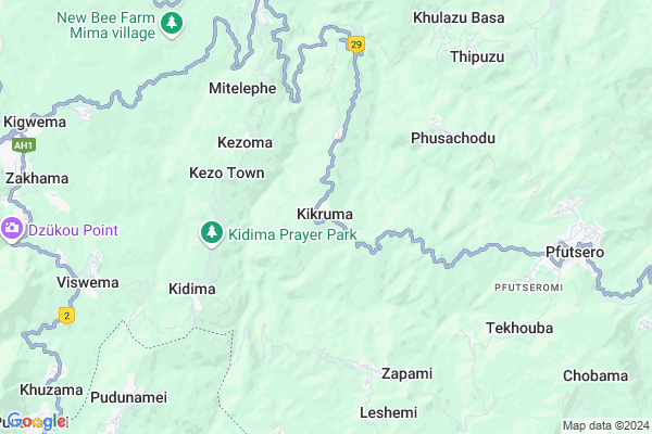
K. Basa Map
EDIT Map
Add Your House
 ..
..
Current Corona Virus Infected Patients Count in Phek District
| City Name | District Name | Total Covid cases |
|---|
Locality Name :
K. Basa
( K. बसा )
Tehsil Name : Kikruma
District : Phek
State : Nagaland
Language : English
Current Time 08:12 AM
Date: Saturday , May 03,2025 (IST)
Time zone: IST (UTC+5:30)
Elevation / Altitude: 156 meters. Above Seal level
Telephone Code / Std Code: 0370
Assembly constituency : assembly constituency
Assembly MLA :
Lok Sabha constituency : parliamentary constituency
Parliament MP :
Serpanch Name :
Commodities Prices : Pfatsero Market / Mandi
K. Basa Live Weather
Temperature: 22.0 °C
scattered clouds
Humidity: 62%
Wind : 0.58 mt/sec towards NE
StationName : "Kohima"
observed on Now
Temperature: 22.0 °C
scattered clouds
Humidity: 62%
Wind : 0.58 mt/sec towards NE
StationName : "Kohima"
observed on Now
K. Basa Weather Forecast for Next 5 days
04-05-2025
15.4°C to 23.9°C
light rain, moderate rain, few clouds
15.4°C to 23.9°C
light rain, moderate rain, few clouds
05-05-2025
16.0°C to 24.9°C
clear sky, light rain, few clouds
16.0°C to 24.9°C
clear sky, light rain, few clouds
06-05-2025
16.9°C to 24.6°C
clear sky, light rain, broken clouds
16.9°C to 24.6°C
clear sky, light rain, broken clouds
07-05-2025
18.3°C to 28.6°C
broken clouds, light rain, overcast clouds
18.3°C to 28.6°C
broken clouds, light rain, overcast clouds
08-05-2025
17.7°C to 27.2°C
overcast clouds, few clouds, light rain, moderate rain
17.7°C to 27.2°C
overcast clouds, few clouds, light rain, moderate rain
National Highways Reachable To K. Basa
Nationa High Way :NH129A
Nationa High Way :NH129A
Rivers Near K. Basa
Dzuza River
Dzükou River
Dzuza River
Dzükou River
About K. Basa
Correct below Info and add more info about K. BasaK. Basa is a Village in Kikruma Tehsil in Phek District of Nagaland State, India. It is located 32 KM towards west from District head quarters Phek. 17 KM from State capital Kohima
K. Basa is surrounded by Jakhama Tehsil towards west , Pfutsero Tehsil towards East , Paomata Tehsil towards South , Kohima Tehsil towards west .
Kohima , Zunheboto , Wokha , Dimapur are the near by Cities to K. Basa.
This Place is in the border of the Phek District and Kohima District. Kohima District Jakhama is west towards this place .
Demographics of K. Basa
English is the Local Language here.HOW TO REACH K. Basa
By Rail
There is no railway station near to K. Basa in less than 10 km.Pincodes near K. Basa
797107 ( Pfutsero ) , 797005 ( Kohima PWD ) , 797001 ( Kohima )Schools near K. Basa
Govt Health Centers near K. Basa
1) Khezhakeno PHC , Khezhakeno PHC , ,2) Tuophema PHC , Tuophema PHC , ,
3) Thenyizu SC , Thenyizu SC , SC Thenyizu P.O Chozuba , Near Panchayat Building
About K. Basa &
History
How to reach K. Basa
Tourist Places Near By K. Basa
Schools in K. Basa
Colleges in K. Basa
Temperature & weather of K. Basa
places in K. Basa
K. Basa photos
More Information
How to reach K. Basa
Tourist Places Near By K. Basa
Schools in K. Basa
Colleges in K. Basa
Temperature & weather of K. Basa
places in K. Basa
K. Basa photos
More Information
Village Talk
Post News or Events about this Village
Near Cities
Kohima 16 KM near
Zunheboto 59 KM near
Wokha 64 KM near
Dimapur 65 KM near
Kohima 16 KM near
Zunheboto 59 KM near
Wokha 64 KM near
Dimapur 65 KM near
Near By Taluks
Kikruma 0 KM near
Jakhama 8 KM near
Pfutsero 11 KM near
Paomata 14 KM near
Kikruma 0 KM near
Jakhama 8 KM near
Pfutsero 11 KM near
Paomata 14 KM near
Near By Air Ports
Dimapur Airport 62 KM near
Imphal Municipal Airport 107 KM near
Rowriah Airport 143 KM near
Kumbhirgram Airport 162 KM near
Dimapur Airport 62 KM near
Imphal Municipal Airport 107 KM near
Rowriah Airport 143 KM near
Kumbhirgram Airport 162 KM near
Near By Tourist Places
Kohima 15 KM near
Phek 33 KM near
Wokha 64 KM near
Diphu 95 KM near
Mokokchung 97 KM near
Kohima 15 KM near
Phek 33 KM near
Wokha 64 KM near
Diphu 95 KM near
Mokokchung 97 KM near
Near By Districts
Kohima 16 KM near
Phek 31 KM near
Senapati 44 KM near
Peren 54 KM near
Kohima 16 KM near
Phek 31 KM near
Senapati 44 KM near
Peren 54 KM near
Near By RailWay Station
Dimapur Rail Way Station 68 KM near
Bokajan Rail Way Station 73 KM near
Dimapur Rail Way Station 68 KM near
Bokajan Rail Way Station 73 KM near