| Home | City Bus | Maps | Villages | Cities | Rail | Tourist Places | School | College | Pin Codes | Corona Cases Count |
| Distance Calculator Bus Services IFSC Codes Trace Mobile Number Weather Search Place Trace IP Available Cash ATM/Banks Locate Polling Booth Report an Error contact People |
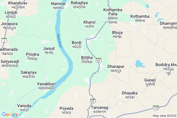
Kotaria
Kotaria Map
EDIT Map
Add Your House
 ..
..
Current Corona Virus Infected Patients Count in Panch Mahals District
| City Name | District Name | Total Covid cases |
|---|
Locality Name :
Kotaria
( કોતરીએ )
Taluka Name : Shehera
District : Panch Mahals
State : Gujarat
Language : Gujarati and Hindi
Current Time 06:53 AM
Date: Saturday , May 03,2025 (IST)
Time zone: IST (UTC+5:30)
Elevation / Altitude: 138 meters. Above Seal level
Telephone Code / Std Code: 02670
Assembly constituency : Shehra assembly constituency
Assembly MLA : Ahir(Bharvad) Jethabhai Ghelabhai
Lok Sabha constituency : Panchmahal parliamentary constituency
Parliament MP : Ratansinh Magansinh Rathod
Serpanch Name :
Pin Code : 389220
Post Office Name : Kothamba
Main Village Name : Bilitha
Commodities Prices : Godhra(Kakanpur) Market / Mandi
National Highways Reachable To Kotaria
Nationa High Way :NH47
Nationa High Way :NH47;NH56
Nationa High Way :NH47
Nationa High Way :NH47;NH56
Rivers Near Kotaria
Machhan
Anas
Machhan
Anas
About Kotaria
Correct below Info and add more info about KotariaKotaria is a small Village/hamlet in Shehera Taluka in Panch Mahals District of Gujarat State, India. It comes under Bilitha Panchayath. It is located 32 KM towards North from District head quarters Godhra. 21 KM from . 102 KM from State capital Gandhinagar
Kotaria Pin code is 389220 and postal head office is Kothamba .
Kotaria is surrounded by Shehera Taluka towards East , Lunawada Taluka towards North , Godhra Taluka towards South , Virpur Taluka towards North .
Lunawada , Godhra , Kapadvanj , Umreth are the near by Cities to Kotaria.
Demographics of Kotaria
Gujarati is the Local Language here.Politics in Kotaria
Bharatiya Janata Party , BJP , INC are the major political parties in this area.Polling Stations /Booths near Kotaria
1)Bhurkhal-22)Bilitha-1
3)Bodindkhurd-4
4)Boradi-1
5)Sadara-2
HOW TO REACH Kotaria
By Rail
There is no railway station near to Kotaria in less than 10 km.Colleges near Kotaria
Smt. Chandrika Rashmikant Gardi Arts College, Munpur
Address :
S.p.patel Arts Colege Simaliya
Address :
Kalol Institute Of Pharmacy
Address : Kalol Institute Of Pharmacy, Kalol, Ahmadabad
Shri Shamlaji Homeopathic Medical College & Institute
Address : Shri Shamlaji Homeopathic Medical College & Instit
M. & V. Arts And Commerce College
Address : B/h S. T. Workshop, Godhara Road, Halol – 389 350.
Schools in Kotaria
Bilitha - 2 P.shala
Address : bilitha , shahera , panch mahals , Gujarat . PIN- 389220 , Post - Kothamba
Bilitha - 1 P.shala
Address : bilitha , shahera , panch mahals , Gujarat . PIN- 389220 , Post - Kothamba
Govt Health Centers near Kotaria
1) Govt. Hospital Lulavada , , godhra highway road , Govt. Hospital.Lulavada2) Sunda , Sub Centre Sunda , ,
3) nada , nada , near high school , high school
Hospitals in Kotaria,Shehera
SHRI RAM HOSPITAL ; Opp. BANK OF BARODA ; KHAROL
Kharol; Gujarat 389220; India
3.1 KM distance Detail
more ..
Colleges in Kotaria,Shehera
ITI MORVA
Nr Mahadev Temple; Gujarat State Highway 175; Rena; Godhra; Morva; Gujarat 389220; India
8.9 KM distance Detail
more ..
About Kotaria &
History
How to reach Kotaria
Tourist Places Near By Kotaria
Schools in Kotaria
Colleges in Kotaria
Temperature & weather of Kotaria
places in Kotaria
Kotaria photos
More Information
How to reach Kotaria
Tourist Places Near By Kotaria
Schools in Kotaria
Colleges in Kotaria
Temperature & weather of Kotaria
places in Kotaria
Kotaria photos
More Information
Village Talk
Post News or Events about this Village
Near Cities
Lunawada 25 KM near
Godhra 29 KM near
Kapadvanj 45 KM near
Umreth 53 KM near
Lunawada 25 KM near
Godhra 29 KM near
Kapadvanj 45 KM near
Umreth 53 KM near
Near By Taluks
Balasinor 12 KM near
Shehera 20 KM near
Lunawada 23 KM near
Godhra 27 KM near
Balasinor 12 KM near
Shehera 20 KM near
Lunawada 23 KM near
Godhra 27 KM near
Near By Air Ports
Vadodara Airport 86 KM near
Ahmedabad Airport 97 KM near
Dabok Airport 209 KM near
Bhavnagar Airport 212 KM near
Vadodara Airport 86 KM near
Ahmedabad Airport 97 KM near
Dabok Airport 209 KM near
Bhavnagar Airport 212 KM near
Near By Tourist Places
Champaner 62 KM near
Pavagadh 64 KM near
Anand 80 KM near
Baroda 90 KM near
Dahod 90 KM near
Champaner 62 KM near
Pavagadh 64 KM near
Anand 80 KM near
Baroda 90 KM near
Dahod 90 KM near
Near By Districts
Panch Mahals 31 KM near
Anand 78 KM near
Vadodara 91 KM near
Dohad 92 KM near
Panch Mahals 31 KM near
Anand 78 KM near
Vadodara 91 KM near
Dohad 92 KM near
Near By RailWay Station
Godhra Junction Rail Way Station 29 KM near
Derol Rail Way Station 43 KM near
Godhra Junction Rail Way Station 29 KM near
Derol Rail Way Station 43 KM near