| Home | City Bus | Maps | Villages | Cities | Rail | Tourist Places | School | College | Pin Codes | Corona Cases Count |
| Distance Calculator Bus Services IFSC Codes Trace Mobile Number Weather Search Place Trace IP Available Cash ATM/Banks Locate Polling Booth Report an Error contact People |
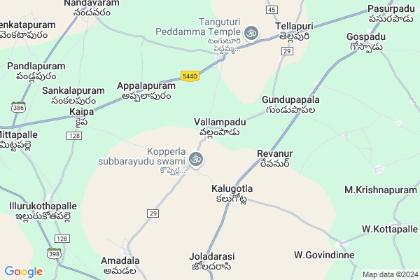
Vallampadu
Vallampadu Map
EDIT Map
Add Your House
 ..
..
Current Corona Virus Infected Patients Count in Kurnool District
| City Name | District Name | Total Covid cases |
|---|---|---|
| Kurnool District | Kurnool | 191 |
| Kurnool | Kurnool | 16 |
| Nandyal | Kurnool | 8 |
| Nandyala | Kurnool | 6 |
| Ganigali Street | Kurnool | 4 |
| Maddur | Kurnool | 3 |
| Banaganapalli | Kurnool | 3 |
| Habeeb Mubarak Nagar | Kurnool | 3 |
| Gani Gali Street | Kurnool | 2 |
| - | Kurnool | 2 |
| Gadivemula | Kurnool | 2 |
| Nandyal Town | Kurnool | 1 |
| Bedamcherla | Kurnool | 1 |
| Nadyal | Kurnool | 1 |
| Osmania College Road | Kurnool | 1 |
| Chagala Marri | Kurnool | 1 |
| Khadakpura | Kurnool | 1 |
| Atmukur | Kurnool | 1 |
| Gonampalle | Kurnool | 1 |
| Budhavur Petta | Kurnool | 1 |
| Atmakur | Kurnool | 1 |
| Pedda | Kurnool | 1 |
| Sangaih Pet | Kurnool | 1 |
| Revenue Colony | Kurnool | 1 |
| Ayyaluru | Kurnool | 1 |
| Kodumur | Kurnool | 1 |
| Chittari | Kurnool | 1 |
| Prakasam Nagar | Kurnool | 1 |
| Kotaveedhi | Kurnool | 1 |
| Budhawarapetta | Kurnool | 1 |
| Chandabada | Kurnool | 1 |
| KVR Garden | Kurnool | 1 |
| Banaganapalle Mandal | Kurnool | 1 |
| Nandavaram | Kurnool | 1 |
| Nandikotkur | Kurnool | 1 |
| Padidempadu | Kurnool | 1 |
| A-park road | Kurnool | 1 |
| Devanagar | Kurnool | 1 |
| Kodaru | Kurnool | 1 |
| Ganigalli | Kurnool | 1 |
| Islam petta, Atmakur | Kurnool | 1 |
| Nagappa Street | Kurnool | 1 |
| Athmakur | Kurnool | 1 |
| Panyam | Kurnool | 1 |
| Shalisaheb Street | Kurnool | 1 |
| Malyala Village | Kurnool | 1 |
| Nandyala Mandal | Kurnool | 1 |
| SriLakshmi Nagar | Kurnool | 1 |
| Budhavarpeta | Kurnool | 1 |
| Narsingh Rao Pet | Kurnool | 1 |
Locality Name :
Vallampadu
( వల్లంపాడు )
Mandal Name : Koilakuntla
District : Kurnool
State : Andhra Pradesh
Region : Rayalaseema
Language : Telugu and Urdu
Current Time 08:37 PM
Date: Saturday , May 03,2025 (IST)
Time zone: IST (UTC+5:30)
Elevation / Altitude: 227 meters. Above Seal level
Telephone Code / Std Code: 08510
Assembly constituency : assembly constituency
Assembly MLA : KATASANI RAMI REDDY
Lok Sabha constituency : parliamentary constituency
Parliament MP : POCHA . BRAHMANANDA REDDY
Serpanch Name :
Pin Code : 518134
Post Office Name : Koilakuntla
Commodities Prices : Banaganapalli Market / Mandi
Rivers Near Vallampadu
Sagileru :సగిలేరు
Kundu River
Sagileru :సగిలేరు
Kundu River
About Vallampadu
Correct below Info and add more info about VallampaduVallampadu is a Village in Koilakuntla Mandal in Kurnool District of Andhra Pradesh State, India. It belongs to Rayalaseema region . It is located 75 KM towards South from District head quarters Kurnool. 7 KM from Koilkuntla. 270 KM from State capital Hyderabad
Vallampadu Pin code is 518134 and postal head office is Koilakuntla .
Kalugotla ( 3 KM ) , Tangutoor ( 4 KM ) , Revanur ( 4 KM ) , Appalapuram ( 4 KM ) , Pedda Kopperla ( 5 KM ) are the nearby Villages to Vallampadu. Vallampadu is surrounded by Banaganapalle Mandal towards west , Gospadu Mandal towards East , Dornipadu Mandal towards East , Sirivel Mandal towards East .
Banganapalle , Chapirevula , Nandyal , Bethamcherla are the near by Cities to Vallampadu.
Vallampadu 2011 Census Details
Vallampadu Local Language is Telugu. Vallampadu Village Total population is 846 and number of houses are 215. Female Population is 48.6%. Village literacy rate is 54.1% and the Female Literacy rate is 21.0%.
Population
| Census Parameter | Census Data |
| Total Population | 846 |
| Total No of Houses | 215 |
| Female Population % | 48.6 % ( 411) |
| Total Literacy rate % | 54.1 % ( 458) |
| Female Literacy rate | 21.0 % ( 178) |
| Scheduled Tribes Population % | 0.0 % ( 0) |
| Scheduled Caste Population % | 29.0 % ( 245) |
| Working Population % | 62.9 % |
| Child(0 -6) Population by 2011 | 99 |
| Girl Child(0 -6) Population % by 2011 | 44.4 % ( 44) |
Vallampadu Census More Deatils.
HOW TO REACH Vallampadu
By Road
Nandyal is the Nearest Town to Vallampadu. Nandyal is 28 km from Vallampadu. Road connectivity is there from Nandyal to Vallampadu.By Rail
There is no railway station near to Vallampadu in less than 10 km. How ever there are railway Stations from Near By town Nandyal. are the railway Stations near to Nandyal. You can reach from Nandyal to Vallampadu by road after .By Bus
Koyalakuntla APSRTC Bus Station , Banaganapally APSRTC Bus Station , Sirivella Metta APSRTC Bus Station are the nearby by Bus Stations to Vallampadu .APSRTC runs Number of busses from major cities to here.Colleges near Vallampadu
Tirumala Industrial Training Center
Address :
Svu Degree College
Address : D.no.10-543/16 A & B, Near Rtc Bus Stand, Koilkun
Schools in Vallampadu
Mpups Vallampadu
Address : vallampadu , koilakuntla , kurnool , Andhra Pradesh . PIN- 518124 , Post - Banaganapalle South
Govt Health Centers near Vallampadu
1) Koilkuntla - II , 7-96/2 , SANTAPETA , NEAR VASAVI KANYAKAPARAMESHAWI TEMPLE2) Koilkuntla - I , 7-96/1 , SANTAPETA , NEAR VASAVI KANYAKAPARAMESHAWI TEMPLE
3) Koilkuntla - III , 14TH WARD , KUMMARI STREET , NEAR WATER PLANT
Petrol Bunks in Vallampadu,Koilakuntla
M/s Avva Pulla Reddy KSK (IOCL Petrol Pump)
Sy No: 334/2; Tangatoor; Andhra Pradesh 518124; India
4.6 KM distance Detail
Petrol Pump
Tadipatri - Banaganapalle - Nandayal Hwy; Tangaturu; Andhra Pradesh 518124; India
4.6 KM distance Detail
more ..
Colleges in Vallampadu,Koilakuntla
G.s.r & P.A.M.R College
10; R.T.C. Rd; Seetharama Nagar; Koilkuntla; Andhra Pradesh 518134; India
10.9 KM distance Detail
S.B.Narasimha Reddy
10-330-1a; Opp:sbh;R.T.C. Rd; Koilkuntla; Andhra Pradesh 518134; India
10.9 KM distance Detail
more ..
Electronic Shops in Vallampadu,Koilakuntla
Godrej Service Center
Anantapur - Tadipatri - Guntur Highway; Koilkuntla; Andhra Pradesh 518134; India
10.5 KM distance Detail
Police Stations near Vallampadu,Koilakuntla
Police Station
Nandyal Road; Tadipatri - Nandyal Hwy; Koilkuntla; Andhra Pradesh 518134; India
10.9 KM distance Detail
Koilakuntla Police Station
10; R.T.C. Rd; Koilkuntla; Andhra Pradesh 518134; India
10.9 KM distance Detail
Governement Offices near Vallampadu,Koilakuntla
Sai Xerox & MeeSeva Center
1; Sai Xerox; S.L.V.T Complex; Koilkuntla; Andhra Pradesh 518134; India
10.7 KM distance Detail
Koilakuntla Gram Panchayat Office
10; R.T.C. Rd; Koilkuntla; Andhra Pradesh 518134; India
10.9 KM distance Detail
About Vallampadu &
History
How to reach Vallampadu
Tourist Places Near By Vallampadu
Schools in Vallampadu
Colleges in Vallampadu
Temperature & weather of Vallampadu
places in Vallampadu
Vallampadu photos
More Information
How to reach Vallampadu
Tourist Places Near By Vallampadu
Schools in Vallampadu
Colleges in Vallampadu
Temperature & weather of Vallampadu
places in Vallampadu
Vallampadu photos
More Information
Village Talk
Post News or Events about this Village
Near Cities
Banganapalle 12 KM near
Chapirevula 21 KM near
Nandyal 28 KM near
Bethamcherla 30 KM near
Banganapalle 12 KM near
Chapirevula 21 KM near
Nandyal 28 KM near
Bethamcherla 30 KM near
Near By Taluks
Koilakuntla 7 KM near
Gospadu 13 KM near
Banaganapalle 14 KM near
Dornipadu 16 KM near
Koilakuntla 7 KM near
Gospadu 13 KM near
Banaganapalle 14 KM near
Dornipadu 16 KM near
Near By Air Ports
Rajiv Gandhi International Airport 240 KM near
Tirupati Airport 253 KM near
Bengaluru International Airport 273 KM near
Vijayawada Airport 331 KM near
Rajiv Gandhi International Airport 240 KM near
Tirupati Airport 253 KM near
Bengaluru International Airport 273 KM near
Vijayawada Airport 331 KM near
Near By Tourist Places
Kurnool 72 KM near
Srisailam 114 KM near
Kadapa 120 KM near
Mantralayam 134 KM near
Puttaparthi 156 KM near
Kurnool 72 KM near
Srisailam 114 KM near
Kadapa 120 KM near
Mantralayam 134 KM near
Puttaparthi 156 KM near
Near By Districts
Kurnool 72 KM near
Anantapur 118 KM near
Cuddapah 120 KM near
Raichur 162 KM near
Kurnool 72 KM near
Anantapur 118 KM near
Cuddapah 120 KM near
Raichur 162 KM near
Near By RailWay Station
Nandyal Junction Rail Way Station 25 KM near
Betamcherla Rail Way Station 28 KM near
Nandyal Junction Rail Way Station 25 KM near
Betamcherla Rail Way Station 28 KM near