| Home | City Bus | Maps | Villages | Cities | Rail | Tourist Places | School | College | Pin Codes | Corona Cases Count |
| Distance Calculator Bus Services IFSC Codes Trace Mobile Number Weather Search Place Trace IP Available Cash ATM/Banks Locate Polling Booth Report an Error contact People |
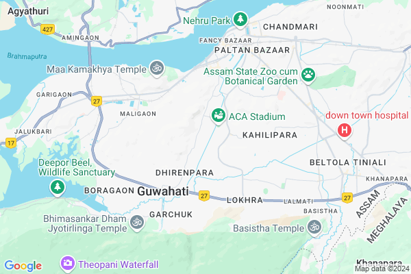
National Highway 27, Dhirenpara Map
EDIT Map
Add Your House
 ..
..
Current Corona Virus Infected Patients Count in Kamrup District
| City Name | District Name | Total Covid cases |
|---|---|---|
| Kamrup District | Kamrup | 1 |
Village Name :
National Highway 27, Dhirenpara
( नेशनल हाईवे २७ धीरेंपरा )
City Name : Guwahati
District : Kamrup
State : Assam
Language : Assamese and Bodo, Karbi, Rabha, Boro, Garo, Tiwa
Current Time 03:35 PM
Date: Saturday , May 03,2025 (IST)
Time zone: IST (UTC+5:30)
Elevation / Altitude: 51 meters. Above Seal level
Telephone Code / Std Code: 0361
Ward : Ward
Assembly constituency : Gauhati East assembly constituency
Assembly MLA : Siddhartha Bhattacharya
Lok Sabha constituency : Gauhati parliamentary constituency
Parliament MP : QUEEN OJA
Pin Code : 781035
Post Office Name : Garchuk
Commodities Prices : Mawiong Regulated Market Market / Mandi
National Highways Reachable To National Highway 27, Dhirenpara
Nationa High Way :NH27
Nationa High Way :NH27
Rivers Near National Highway 27, Dhirenpara
Digaru
Brahmaputra :ব্ৰহ্মপুত্ৰ :ব্রহ্মপুত্র :Brahmaputra :Brahmaputra :ब्रह्मपुत्र :ಬ್ರಹ್ಮಪುತ್ರ :பிரம்மபுத்திரா :బ్రహ్మపుత్రా :Брахмапутра :雅鲁藏布江
Digaru
Brahmaputra :ব্ৰহ্মপুত্ৰ :ব্রহ্মপুত্র :Brahmaputra :Brahmaputra :ब्रह्मपुत्र :ಬ್ರಹ್ಮಪುತ್ರ :பிரம்மபுத்திரா :బ్రహ్మపుత్రా :Брахмапутра :雅鲁藏布江
About National Highway 27, Dhirenpara
Correct below Info and add more info about National Highway 27, DhirenparaNational Highway 27, Dhirenpara is a Locality in Guwahati City in Assam State, India.
National Highway 27, Dhirenpara Pin code is 781035 and postal head office is Garchuk .
Dispur , Guwahati , Rangia , Nalbari are the nearby Cities to Guwahati.
Demographics of National Highway 27, Dhirenpara
Assamese is the Local Language here.Politics in National Highway 27, Dhirenpara
Bharatiya Janata Party , 83358 , BJP , 79.21% , INC are the major political parties in this area.Polling Stations /Booths near National Highway 27, Dhirenpara
1)Cotton Collegiate H.s School2)Dakhin Guwahati High School (e/w)
3)Dakhin Guwahati High School (l/w)
4)Dakhin Guwahati High School (m/w)
5)Bengali Girls High School
HOW TO REACH National Highway 27, Dhirenpara
By Rail
Kamakhya Junction Rail Way Station , Guwahati Rail Way Station are the very nearby railway station to National Highway 27, Dhirenpara.Govt Health Centers near National Highway 27, Dhirenpara
1) Krishnanagar UHC , , , Uruli Bibah Bhawan, Joy Dutta Press2) Birkuchi UHC , , Ward No-52 , Near Shiv Mandir
3) Gotanagar UHC , , Trishuldhari Temple , PAdmanath Gohain Path
Hospitals in National Highway 27, Dhirenpara,Guwahati
Jay Guru Ayurvedic
781025; Kailash Apartment; Bishnu Rabha Nagar; Athgaon; Guwahati; Assam 781001; India
0.7 KM distance Detail
Dr. Rintee Das
Sitala Mandir Rd; Manpara; Khalpara; Siliguri; West Bengal 734001; India
0.8 KM distance Detail
more ..
Petrol Bunks in National Highway 27, Dhirenpara,Guwahati
HP Fuel Station
Dev; By-lane no-4; AK Dev Rd; Ganeshpara; Dhirenpara; Guwahati; Assam 781025; India
0.5 KM distance Detail
HP PETROL PUMP - HP MAA DURGASWARI SERVICE CENTER
HP Petrol Pump Fatasil Ganeshpara; Guwahati A K Bathu Mandir; AK Dev Rd; Gauri Sarma Colony; Fatasil Ambari; Guwahati; Assam 781025; India
0.5 KM distance Detail
HP Durgeswari Filling Station Gonespara
781009; Manpara; Dhirenpara; Guwahati; Assam 781009; India
0.8 KM distance Detail
more ..
Colleges in National Highway 27, Dhirenpara,Guwahati
Royal Global University
Betkuchi Terminal IOCL; AHOM GAON; Guwahati; Assam 781009; India
0.9 KM distance Detail
Hayat Institute Of Nursing Education
RG Baruah Road; SUNDARPUR; HOUSE NO 171; DD COMPLEX-II; Guwahati; Assam 781005; India
0.9 KM distance Detail
Kautilya College
Lokhra Rd; Batallian Gate;4th APBn Gate Bus Stop 4th APBn Gate;; Lutuma; Lal Ganesh; Guwahati; Assam 781018; India
1.6 KM distance Detail
more ..
Schools in National Highway 27, Dhirenpara,Guwahati
VIBES SCHOOL OF MUSIC
Rajat Kamal Path; Subash Pally; Zoo Tiniali; Guwahati; Assam 781009; India
0.8 KM distance Detail
Gyan Educational Institution
3; KC Deka Path; Jyotikuchi; Guwahati; Assam 781034; India
1.2 KM distance Detail
Electronic Shops in National Highway 27, Dhirenpara,Guwahati
Namo Enterprises And Display Solution
Dhirenpara; Guwahati; Assam 781009; India
0.4 KM distance Detail
Hoque Enterprises
Deben Khaklari Path; Dhirenpara; Guwahati; Assam 781009; India
0.7 KM distance Detail
Choudhury Engeeniaring
Suravi path kailash nagar guwahati; Assam 781025; India
0.7 KM distance Detail
Super Markets in National Highway 27, Dhirenpara,Guwahati
Down Town Complex; Pantaloons Building; 7th Floor; Six mile.
Pantaloons Building; 7th Floor; Six mile; Guwahati; Assam; India
0.9 KM distance Detail
Ulu Bazar
Subhash Pally; Bhupen Hazarika Path; Subash Pally; Barsapara; Guwahati; Assam 781025; Sawkuchi Tiniali Hockey Stadium Rd; Subash Pally; Barsapara; Guwahati; Assam 781025; India
0.9 KM distance Detail
Swastika Enterprise
781025; Dhirenpara Main Rd; Dhirenpara; Guwahati; Assam 781009; India
1.0 KM distance Detail
Police Stations near National Highway 27, Dhirenpara,Guwahati
Odalbakra Police Outpost
Lokhra Rd; Odalbakra; Barsapara; Guwahati; Assam 781034; India
1.0 KM distance Detail
Adagudam Police Satation
Lokhra Rd; Lal Ganesh; Guwahati; Assam 781034; India
1.0 KM distance Detail
Fatasil Ambari Police Station
Fayal Ahmed Road; Binowa Nagar; Kala Pahar; Guwahati; Assam 781016; India
2.8 KM distance Detail
Governement Offices near National Highway 27, Dhirenpara,Guwahati
Family Court Kamrup
Family court road; Barsapara; Guwahati; Assam 781009; India
0.9 KM distance Detail
FinaTax Consultancy
House No -25; Bye Lane Shankar Dev Path; Raghunath Path; A K Dev Road;; Dhirenpar; Guwahati; Assam 781025; India
1.1 KM distance Detail
About National Highway 27, Dhirenpara &
History
How to reach National Highway 27, Dhirenpara
Tourist Places Near By National Highway 27, Dhirenpara
Schools in National Highway 27, Dhirenpara
Colleges in National Highway 27, Dhirenpara
Temperature & weather of National Highway 27, Dhirenpara
places in National Highway 27, Dhirenpara
National Highway 27, Dhirenpara photos
More Information
Locality Talk
Post News or Events about this Locality
Near Cities
Dispur 4 KM near
Guwahati 5 KM near
Rangia 40 KM near
Nalbari 48 KM near
Dispur 4 KM near
Guwahati 5 KM near
Rangia 40 KM near
Nalbari 48 KM near
Near By Taluks
Guwahati 4 KM near
Rani (Pt) 14 KM near
Kamrup Metro 18 KM near
Sualkuchi 19 KM near
Guwahati 4 KM near
Rani (Pt) 14 KM near
Kamrup Metro 18 KM near
Sualkuchi 19 KM near
Near By Air Ports
Borjhar Airport 16 KM near
Shillong Airport 73 KM near
Salonibari Airport 138 KM near
Rupsi Airport 202 KM near
Borjhar Airport 16 KM near
Shillong Airport 73 KM near
Salonibari Airport 138 KM near
Rupsi Airport 202 KM near
Near By Tourist Places
Guwahati 1 KM near
Dispur 6 KM near
Hajo 26 KM near
Nongpoh 34 KM near
Mangaldai 49 KM near
Guwahati 1 KM near
Dispur 6 KM near
Hajo 26 KM near
Nongpoh 34 KM near
Mangaldai 49 KM near
Near By Districts
Kamrup Metro 19 KM near
Kamrup 19 KM near
Ri Bhoi 34 KM near
Nalbari 49 KM near
Kamrup Metro 19 KM near
Kamrup 19 KM near
Ri Bhoi 34 KM near
Nalbari 49 KM near
Near By RailWay Station
Kamakhya Junction Rail Way Station 5.0 KM near
Guwahati Rail Way Station 6.0 KM near
Amin Gaon Rail Way Station 9.0 KM near
Kamakhya Junction Rail Way Station 5.0 KM near
Guwahati Rail Way Station 6.0 KM near
Amin Gaon Rail Way Station 9.0 KM near