| Home | City Bus | Maps | Villages | Cities | Rail | Tourist Places | School | College | Pin Codes | Corona Cases Count |
| Distance Calculator Bus Services IFSC Codes Trace Mobile Number Weather Search Place Trace IP Available Cash ATM/Banks Locate Polling Booth Report an Error contact People |
Trilochan
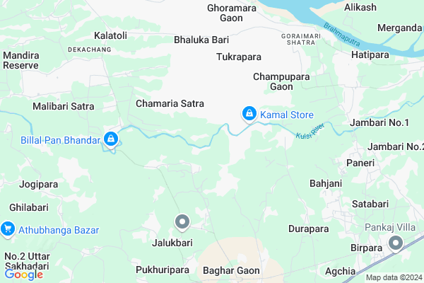
Trilochan Map
EDIT Map
Add Your House
 ..
..
Current Corona Virus Infected Patients Count in Kamrup District
| City Name | District Name | Total Covid cases |
|---|---|---|
| Kamrup District | Kamrup | 1 |
Locality Name :
Trilochan
( त्रिलोचन )
Tehsil Name : Chamaria(pt.)
District : Kamrup
State : Assam
Language : Assamese and Bodo, Karbi, Rabha, Boro, Garo, Tiwa
Current Time 03:28 PM
Date: Saturday , May 03,2025 (IST)
Time zone: IST (UTC+5:30)
Elevation / Altitude: 48 meters. Above Seal level
Telephone Code / Std Code: 03621
Assembly constituency : Boko Sc assembly constituency
Assembly MLA : Nandita Das
Lok Sabha constituency : Gauhati parliamentary constituency
Parliament MP : QUEEN OJA
Serpanch Name :
Pin Code : 781136
Post Office Name : Pachim Samaria
Commodities Prices : Shillong Market / Mandi
National Highways Reachable To Trilochan
Nationa High Way :NH27
Nationa High Way :NH27
Rivers Near Trilochan
Kulsi
Singra
Kulsi
Singra
About Trilochan
Correct below Info and add more info about TrilochanTrilochan is a Village in Chamaria(pt.) Tehsil in Kamrup District of Assam State, India. It is located 42 KM towards west from District head quarters Goroimari. 14 KM from Chamaria. 61 KM from State capital Dispur
Trilochan Pin code is 781136 and postal head office is Pachim Samaria .
Majortop ( 7 KM ) , Bagariguri ( 8 KM ) , Jorsimalu ( 9 KM ) , Hatipara ( 9 KM ) , Achalpara ( 10 KM ) are the nearby Villages to Trilochan. Trilochan is surrounded by Boko Tehsil towards South , Chamaria(Pt.) Tehsil towards west , Chhaygaon(Pt.) Tehsil towards East , Rampur Tehsil towards East .
Barpeta , Nalbari , Guwahati , Barpeta Road are the near by Cities to Trilochan.
This Place is in the border of the Kamrup District and Barpeta District. Barpeta District Gomaphulbari is west towards this place .
Trilochan 2011 Census Details
Trilochan Local Language is Assamese. Trilochan Village Total population is 2523 and number of houses are 486. Female Population is 46.7%. Village literacy rate is 60.4% and the Female Literacy rate is 24.2%.
Population
| Census Parameter | Census Data |
| Total Population | 2523 |
| Total No of Houses | 486 |
| Female Population % | 46.7 % ( 1179) |
| Total Literacy rate % | 60.4 % ( 1525) |
| Female Literacy rate | 24.2 % ( 611) |
| Scheduled Tribes Population % | 0.0 % ( 1) |
| Scheduled Caste Population % | 52.2 % ( 1316) |
| Working Population % | 56.3 % |
| Child(0 -6) Population by 2011 | 351 |
| Girl Child(0 -6) Population % by 2011 | 49.3 % ( 173) |
Trilochan Census More Deatils.
Politics in Trilochan
Bharatiya Janata Party , BJP , INC are the major political parties in this area.Polling Stations /Booths near Trilochan
1)Sutirpar Lp School2)Tamuldi Lp School (l/w)
3)Durapara Lp School (l/w)
4)Rupnagar Anchalik Me School
5)Rupnagar High School (l/w)
HOW TO REACH Trilochan
By Rail
Boko Rail Way Station is the very nearby railway stations to Trilochan.Colleges near Trilochan
Bpc College
Address :
Chhamaria Anchalik College
Address : Venue- Chamaria (kahibari)
Schools in Trilochan
Trilochan Anchalik Mes
Address : trilochan , chamaria , kamrup , Assam . PIN- 781136 , Post - Pachim Samaria
Govt Health Centers near Trilochan
1) BIKALI MODEL HOSPITAL , Dhupdhara , Rangjuli ,2) Kharghuli MPHC , 148/241 , Yuvajyouti Path , Near Jatiya Bidyalaya
3) Simlitola Char PHC(New) , Simlitola Char PHC , Simlitola Char PHC ,
Petrol Bunks in Trilochan,Chamaria(pt.)
HP PETROL PUMP - STAR FUELLING CENTRE
Hpcl Pump Satra Gaon Mouza Goraimari; Goraimari Shatra; Assam 781137; India
6.7 KM distance Detail
more ..
Super Markets in Trilochan,Chamaria(pt.)
Rimu Automobile
Chhaygaon - Guwahati Road; Ratanpur; Chhaygaon; Assam 781124; India
20.6 KM distance Detail
Governement Offices near Trilochan,Chamaria(pt.)
শিংমাৰী পুখুৰীপাৰ সমূহীয়া কৃষিপাম সমবায় সমিতি
Champupara Pathar; Assam 781137; India
6.1 KM distance Detail
Singimari Pukhuripar Cooperative Collective Farming Society Limited
Champupara Pathar; Assam 781137; India
6.1 KM distance Detail
About Trilochan &
History
How to reach Trilochan
Tourist Places Near By Trilochan
Schools in Trilochan
Colleges in Trilochan
Temperature & weather of Trilochan
places in Trilochan
Trilochan photos
More Information
How to reach Trilochan
Tourist Places Near By Trilochan
Schools in Trilochan
Colleges in Trilochan
Temperature & weather of Trilochan
places in Trilochan
Trilochan photos
More Information
Village Talk
Post News or Events about this Village
Near Cities
Barpeta 39 KM near
Nalbari 51 KM near
Guwahati 60 KM near
Barpeta Road 60 KM near
Barpeta 39 KM near
Nalbari 51 KM near
Guwahati 60 KM near
Barpeta Road 60 KM near
Near By Taluks
Goroimari 7 KM near
Boko 10 KM near
Chamaria(Pt.) 13 KM near
Chhaygaon(Pt.) 19 KM near
Goroimari 7 KM near
Boko 10 KM near
Chamaria(Pt.) 13 KM near
Chhaygaon(Pt.) 19 KM near
Near By Air Ports
Borjhar Airport 42 KM near
Shillong Airport 97 KM near
Rupsi Airport 145 KM near
Salonibari Airport 194 KM near
Borjhar Airport 42 KM near
Shillong Airport 97 KM near
Rupsi Airport 145 KM near
Salonibari Airport 194 KM near
Near By Tourist Places
Hajo 42 KM near
Nalbari 54 KM near
Guwahati 59 KM near
Barpeta 60 KM near
Dispur 65 KM near
Hajo 42 KM near
Nalbari 54 KM near
Guwahati 59 KM near
Barpeta 60 KM near
Dispur 65 KM near
Near By Districts
Barpeta 39 KM near
Kamrup Metro 41 KM near
Kamrup 41 KM near
Nalbari 54 KM near
Barpeta 39 KM near
Kamrup Metro 41 KM near
Kamrup 41 KM near
Nalbari 54 KM near
Near By RailWay Station
Boko Rail Way Station 7.9 KM near
Nalbari Rail Way Station 55 KM near
Kamakhya Junction Rail Way Station 55 KM near
Boko Rail Way Station 7.9 KM near
Nalbari Rail Way Station 55 KM near
Kamakhya Junction Rail Way Station 55 KM near