| Home | City Bus | Maps | Villages | Cities | Rail | Tourist Places | School | College | Pin Codes | Corona Cases Count |
| Distance Calculator Bus Services IFSC Codes Trace Mobile Number Weather Search Place Trace IP Available Cash ATM/Banks Locate Polling Booth Report an Error contact People |
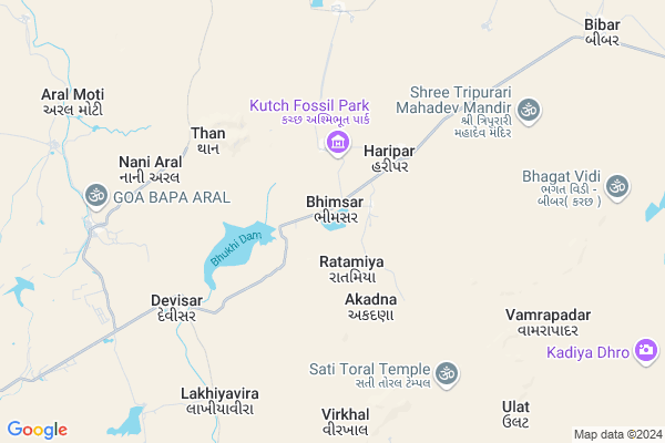
Bhimsar
Bhimsar Map
EDIT Map
Add Your House
 ..
..
Current Corona Virus Infected Patients Count in Kachchh District
| City Name | District Name | Total Covid cases |
|---|
Locality Name :
Bhimsar
( ભીમાસર )
Taluka Name : Nakhatrana
District : Kachchh
State : Gujarat
Language : Gujarati and Sindhi, And Hindi, Kutchi
Current Time 08:38 PM
Date: Saturday , May 03,2025 (IST)
Time zone: IST (UTC+5:30)
Elevation / Altitude: 89 meters. Above Seal level
Telephone Code / Std Code: 02835
Assembly constituency : Abdasa assembly constituency
Assembly MLA : Jadeja Pradhyumansinh Mahipatsinh
Lok Sabha constituency : Kutch parliamentary constituency
Parliament MP : CHAVDA VINOD LAKHAMSHI
Serpanch Name :
Pin Code : 370665
Post Office Name : Virani
National Highways Reachable To Bhimsar
Nationa High Way :NH341
Nationa High Way :NH341
About Bhimsar
Correct below Info and add more info about BhimsarBhimsar is a Village in Nakhatrana Taluka in Kachchh District of Gujarat State, India. It is located 42 KM towards west from District head quarters Bhuj. 13 KM from Nakhatrana Nana. 391 KM from State capital Gandhinagar
Bhimsar Pin code is 370665 and postal head office is Virani .
Devsar ( 6 KM ) , Dador ( 7 KM ) , Vamrapadar ( 9 KM ) , Devisar ( 9 KM ) , Aral Nani ( 10 KM ) are the nearby Villages to Bhimsar. Bhimsar is surrounded by Bhuj Taluka towards East , Abdasa Taluka towards west , Mandvi Taluka towards South , Lakhpat Taluka towards west .
Bhuj , Mandvi , Adipur , Gandhidham are the near by Cities to Bhimsar.
Bhimsar 2011 Census Details
Bhimsar Local Language is Gujarati. Bhimsar Village Total population is 219 and number of houses are 50. Female Population is 50.2%. Village literacy rate is 34.2% and the Female Literacy rate is 12.8%.
Population
| Census Parameter | Census Data |
| Total Population | 219 |
| Total No of Houses | 50 |
| Female Population % | 50.2 % ( 110) |
| Total Literacy rate % | 34.2 % ( 75) |
| Female Literacy rate | 12.8 % ( 28) |
| Scheduled Tribes Population % | 0.0 % ( 0) |
| Scheduled Caste Population % | 0.0 % ( 0) |
| Working Population % | 35.6 % |
| Child(0 -6) Population by 2011 | 46 |
| Girl Child(0 -6) Population % by 2011 | 54.3 % ( 25) |
Bhimsar Census More Deatils.
Politics in Bhimsar
Bharatiya Janata Party , BJP , INC are the major political parties in this area.Polling Stations /Booths near Bhimsar
1)Hingariya2)Angiya Mota
3)Deshlpar(g.)
4)Dadamapar
5)Khanay
HOW TO REACH Bhimsar
By Rail
There is no railway station near to Bhimsar in less than 10 km.Colleges near Bhimsar
Srk Institute Of Social Science
Address : Srk Institute Of Social Science,sapeda, Tal. Anjar
Schools in Bhimsar
Bhimsar Primary Shala
Address : bhimsar , nakhatrana , kachchh , Gujarat . PIN- 370615 , Post - Nakhatrana
Govt Health Centers near Bhimsar
1) Ref. Hospital Mandvi , 2-Dec , Layja Road Mandvi , Near nana bus standPetrol Bunks in Bhimsar,Nakhatrana
Essar Petrol Pump
Bhuj - Nakhatrana Rd; Sahjanand nagar; Mirjapar; Bhuj; Gujarat 370040; India
16.0 KM distance Detail
more ..
Police Stations near Bhimsar,Nakhatrana
Governement Offices near Bhimsar,Nakhatrana
Virani Moti Gram Panchayat
opp. of BOB bank ; village: virani moti ;ta. nakhatrana; dist; Gujarat; India
14.7 KM distance Detail
HEMANG C JOSHI RTO & INSURANCE & PUC ADVISOR
Nakhatrana; Gujarat 370615; India
17.3 KM distance Detail
Nakhatrana Juth Gram panchayat
Nakhtrana Lakhapat Highway Road Sadguru Enterprise; Nr. Kanya High School; 간디덤; Nakhatrana; Gujarat 370615; India
17.4 KM distance Detail
About Bhimsar &
History
How to reach Bhimsar
Tourist Places Near By Bhimsar
Schools in Bhimsar
Colleges in Bhimsar
Temperature & weather of Bhimsar
places in Bhimsar
Bhimsar photos
More Information
How to reach Bhimsar
Tourist Places Near By Bhimsar
Schools in Bhimsar
Colleges in Bhimsar
Temperature & weather of Bhimsar
places in Bhimsar
Bhimsar photos
More Information
Village Talk
Post News or Events about this Village
Near Cities
Bhuj 39 KM near
Mandvi 70 KM near
Adipur 91 KM near
Gandhidham 100 KM near
Bhuj 39 KM near
Mandvi 70 KM near
Adipur 91 KM near
Gandhidham 100 KM near
Near By Taluks
Nakhatrana 12 KM near
Bhuj 40 KM near
Abdasa 58 KM near
Mandvi 61 KM near
Nakhatrana 12 KM near
Bhuj 40 KM near
Abdasa 58 KM near
Mandvi 61 KM near
Near By Air Ports
Rudra Mata Airport 37 KM near
Kandla Airport 91 KM near
Govardhanpur Airport 140 KM near
Civil Airport 213 KM near
Rudra Mata Airport 37 KM near
Kandla Airport 91 KM near
Govardhanpur Airport 140 KM near
Civil Airport 213 KM near
Near By Tourist Places
Bhuj 40 KM near
Mandvi 70 KM near
Gandhidham 97 KM near
Dholavira 110 KM near
Kutch 127 KM near
Bhuj 40 KM near
Mandvi 70 KM near
Gandhidham 97 KM near
Dholavira 110 KM near
Kutch 127 KM near
Near By Districts
Kachchh 40 KM near
Jamnagar 144 KM near
Rajkot 215 KM near
Porbandar 223 KM near
Kachchh 40 KM near
Jamnagar 144 KM near
Rajkot 215 KM near
Porbandar 223 KM near
Near By RailWay Station
Bhuj Rail Way Station 39 KM near
Anjar Rail Way Station 84 KM near
Bhuj Rail Way Station 39 KM near
Anjar Rail Way Station 84 KM near