| Home | City Bus | Maps | Villages | Cities | Rail | Tourist Places | School | College | Pin Codes | Corona Cases Count |
| Distance Calculator Bus Services IFSC Codes Trace Mobile Number Weather Search Place Trace IP Available Cash ATM/Banks Locate Polling Booth Report an Error contact People |
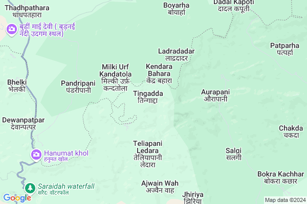
Tingadda
Tingadda Map
EDIT Map
Add Your House
 ..
..
Current Corona Virus Infected Patients Count in Kabirdham District
| City Name | District Name | Total Covid cases |
|---|
Locality Name :
Tingadda
( तिंगड़ा )
Tehsil Name : Pandariya
District : Kabirdham
State : Chattisgarh
Language : Chhattisgarhi and Hindi, Agariya
Current Time 12:37 PM
Date: Saturday , May 03,2025 (IST)
Time zone: IST (UTC+5:30)
Elevation / Altitude: 325 meters. Above Seal level
Telephone Code / Std Code: 07754
Assembly constituency : Pandariya assembly constituency
Assembly MLA : Bhawna Bohra
Lok Sabha constituency : Rajnandgaon parliamentary constituency
Parliament MP : SANTOSH PANDEY
Serpanch Name :
Pin Code : 491559
Post Office Name : Pandaria
Main Village Name : TINGADDA
Commodities Prices : Pandariya Market / Mandi
Rivers Near Tingadda
Halon
Aagar
Halon
Aagar
About Tingadda
Correct below Info and add more info about TingaddaTingadda is a small Village/hamlet in Pandariya Tehsil in Kabirdham District of Chattisgarh State, India. It comes under TINGADDA Panchayath. It is located 68 KM towards North from District head quarters Kawardha. 35 KM from Pandatarai. 161 KM from State capital Raipur
Tingadda Pin code is 491559 and postal head office is Pandaria .
Bhedagarh ( 15 KM ) , Polmi ( 15 KM ) , Putputa ( 16 KM ) are the nearby Villages to Tingadda. Tingadda is surrounded by Karanjiya Tehsil towards North , Pandariya Tehsil towards South , Lormi Tehsil towards South , Bodla Tehsil towards South .
Mungeli , Kawardha , Bilaspur , Bilaspur are the near by Cities to Tingadda.
Tingadda 2011 Census Details
Tingadda Local Language is Chhattisgarhi. Tingadda Village Total population is 244 and number of houses are 53. Female Population is 53.7%. Village literacy rate is 49.2% and the Female Literacy rate is 23.0%.
Population
| Census Parameter | Census Data |
| Total Population | 244 |
| Total No of Houses | 53 |
| Female Population % | 53.7 % ( 131) |
| Total Literacy rate % | 49.2 % ( 120) |
| Female Literacy rate | 23.0 % ( 56) |
| Scheduled Tribes Population % | 78.3 % ( 191) |
| Scheduled Caste Population % | 0.0 % ( 0) |
| Working Population % | 49.6 % |
| Child(0 -6) Population by 2011 | 50 |
| Girl Child(0 -6) Population % by 2011 | 58.0 % ( 29) |
Tingadda Census More Deatils.
Politics in Tingadda
Bharatiya Janata Party , BJP , INC are the major political parties in this area.Polling Stations /Booths near Tingadda
1)Teliyapani Dhobe2)Bodtarakhurd
3)Bhedagarh
4)Chhitapar Kala
5)Achankpur
HOW TO REACH Tingadda
By Rail
There is no railway station near to Tingadda in less than 10 km.Colleges near Tingadda
Shekh Sameer College Mungeli Road,pandariya
Address : Shekh Sameer College Mungeli Road,pandariya
Shekh Sameer Pg College Pandariya
Address : Shekh Sameer Auto Care Mungeli Road,pandariya Distt.-kabirdham(c.g.)491559 Pass Pandariya
Schools in Tingadda
U.p.s. Tingadda
Address : tingadda , pandariya , kawardha , Chattisgarh . PIN- 491559 , Post - Pandaria
Govt Health Centers near Tingadda
1) SHC Bhelki , , ,2) SHC Chiyandand , , ,
3) SHC Bhakur , SHC Bhakur , ,
Schools in Tingadda,Pandariya
Electronic Shops in Tingadda,Pandariya
Super Markets in Tingadda,Pandariya
Local Parks in Tingadda,Pandariya
Police Stations near Tingadda,Pandariya
Governement Offices near Tingadda,Pandariya
About Tingadda &
History
How to reach Tingadda
Tourist Places Near By Tingadda
Schools in Tingadda
Colleges in Tingadda
Temperature & weather of Tingadda
places in Tingadda
Tingadda photos
More Information
How to reach Tingadda
Tourist Places Near By Tingadda
Schools in Tingadda
Colleges in Tingadda
Temperature & weather of Tingadda
places in Tingadda
Tingadda photos
More Information
Village Talk
Post News or Events about this Village
Near Cities
Mungeli 57 KM near
Kawardha 63 KM near
Bilaspur 89 KM near
Bilaspur 92 KM near
Mungeli 57 KM near
Kawardha 63 KM near
Bilaspur 89 KM near
Bilaspur 92 KM near
Near By Taluks
Bajag 29 KM near
Karanjiya 33 KM near
Pandariya 33 KM near
Lormi 35 KM near
Bajag 29 KM near
Karanjiya 33 KM near
Pandariya 33 KM near
Lormi 35 KM near
Near By Air Ports
Raipur Airport 164 KM near
Jabalpur Airport 179 KM near
Sonegaon Airport 328 KM near
Khajuraho Airport 340 KM near
Raipur Airport 164 KM near
Jabalpur Airport 179 KM near
Sonegaon Airport 328 KM near
Khajuraho Airport 340 KM near
Near By Tourist Places
Amarkantak 41 KM near
Kawardha 64 KM near
Bilaspur 91 KM near
Kanha National park 101 KM near
Janjgir-Champa 123 KM near
Amarkantak 41 KM near
Kawardha 64 KM near
Bilaspur 91 KM near
Kanha National park 101 KM near
Janjgir-Champa 123 KM near
Near By Districts
Kabirdham 65 KM near
Dindori 72 KM near
Anuppur 82 KM near
Bilaspur 94 KM near
Kabirdham 65 KM near
Dindori 72 KM near
Anuppur 82 KM near
Bilaspur 94 KM near
Near By RailWay Station
Pendra Road Rail Way Station 60 KM near
Belgahna Rail Way Station 65 KM near
Pendra Road Rail Way Station 60 KM near
Belgahna Rail Way Station 65 KM near