| Home | City Bus | Maps | Villages | Cities | Rail | Tourist Places | School | College | Pin Codes | Corona Cases Count |
| Distance Calculator Bus Services IFSC Codes Trace Mobile Number Weather Search Place Trace IP Available Cash ATM/Banks Locate Polling Booth Report an Error contact People |
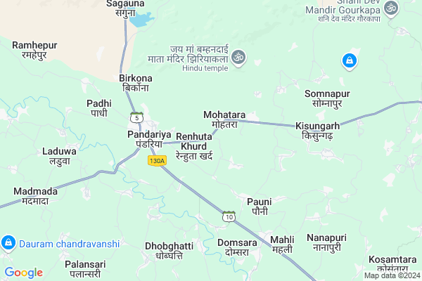
Manjholiravan
Manjholiravan Map
EDIT Map
Add Your House
 ..
..
Current Corona Virus Infected Patients Count in Kabirdham District
| City Name | District Name | Total Covid cases |
|---|
Locality Name :
Manjholiravan
( मँझोलिरावण )
Tehsil Name : Pandariya
District : Kabirdham
State : Chattisgarh
Language : Chhattisgarhi and Hindi, Agariya
Current Time 12:58 PM
Date: Saturday , May 03,2025 (IST)
Time zone: IST (UTC+5:30)
Elevation / Altitude: 325 meters. Above Seal level
Telephone Code / Std Code: 07754
Assembly constituency : Pandariya assembly constituency
Assembly MLA : Bhawna Bohra
Lok Sabha constituency : Rajnandgaon parliamentary constituency
Parliament MP : SANTOSH PANDEY
Serpanch Name :
Main Village Name : MANJHOLIRAVAN
Commodities Prices : Pandariya Market / Mandi
Manjholiravan Live Weather
Temperature: 38.0 °C
overcast clouds
Humidity: 21%
Wind : 1.77 mt/sec towards W
StationName : "Pandaria"
observed on 14 Mins Back
Temperature: 38.0 °C
overcast clouds
Humidity: 21%
Wind : 1.77 mt/sec towards W
StationName : "Pandaria"
observed on 14 Mins Back
Manjholiravan Weather Forecast for Next 5 days
04-05-2025
24.7°C to 36.4°C
light rain, scattered clouds, clear sky
24.7°C to 36.4°C
light rain, scattered clouds, clear sky
05-05-2025
24.2°C to 41.3°C
clear sky, scattered clouds, broken clouds, light rain
24.2°C to 41.3°C
clear sky, scattered clouds, broken clouds, light rain
06-05-2025
25.9°C to 41.9°C
scattered clouds, broken clouds, few clouds
25.9°C to 41.9°C
scattered clouds, broken clouds, few clouds
07-05-2025
26.2°C to 40.9°C
broken clouds, scattered clouds, few clouds, overcast clouds
26.2°C to 40.9°C
broken clouds, scattered clouds, few clouds, overcast clouds
08-05-2025
29.8°C to 40.4°C
overcast clouds, broken clouds
29.8°C to 40.4°C
overcast clouds, broken clouds
Rivers Near Manjholiravan
Halon
Aagar
Halon
Aagar
About Manjholiravan
Correct below Info and add more info about ManjholiravanManjholiravan is a small Village/hamlet in Pandariya Tehsil in Kabirdham District of Chattisgarh State, India. It comes under MANJHOLIRAVAN Panchayath. It is located 36 KM towards North from District head quarters Kawardha. 127 KM from State capital Raipur
Manjholiravan is surrounded by Lormi Tehsil towards East , Bodla Tehsil towards west , Kawardha Tehsil towards South , Mungeli Tehsil towards East .
Kawardha , Mungeli , Bemetra , Bilaspur are the near by Cities to Manjholiravan.
Demographics of Manjholiravan
Chhattisgarhi is the Local Language here.Politics in Manjholiravan
Bharatiya Janata Party , BJP , INC are the major political parties in this area.Polling Stations /Booths near Manjholiravan
1)Somnapurkhurd2)Bamhaipur
3)Teliyapani(leddra)
4)Pratappur
5)Mohtarakla
HOW TO REACH Manjholiravan
By Rail
There is no railway station near to Manjholiravan in less than 10 km.Pincodes near Manjholiravan
491559 ( Pandaria ) , 495334 ( Mungeli ) , 495115 ( Lormi )Colleges near Manjholiravan
Shekh Sameer College Mungeli Road,pandariya
Address : Shekh Sameer College Mungeli Road,pandariya
Shekh Sameer Pg College Pandariya
Address : Shekh Sameer Auto Care Mungeli Road,pandariya Distt.-kabirdham(c.g.)491559 Pass Pandariya
Schools near Manjholiravan
Keshaw M.s.rohra
Address : rohra , pandariya , kawardha , Chattisgarh . PIN- 491559 , Post - Pandaria
School Name
Address : dhobghatti , pandariya , kawardha , Chattisgarh . PIN- 0
S.s.m. Pandatarai
Address : pandatarai , pandariya , kawardha , Chattisgarh . PIN- 491559 , Post - Pandaria
Govt.m.s.bagragpara
Address : bagragpara , pandariya , kawardha , Chattisgarh . PIN- 491995 , Post - Kawardha
Govt Health Centers near Manjholiravan
1) SHC Mainpua , , ,2) PANDARIYA-A , PANDARIYA-A , ,
3) SHC Ramtala , , ,
Sub Villages in Manjholiravan
Colleges in Manjholiravan,Pandariya
Government Naveen College; Pandatarai
Pandatarai; Chhattisgarh 491559; India
11.3 KM distance Detail
Barmha kumaris centre
High School Rd; Pandatarai; Chhattisgarh 491559; India
14.4 KM distance Detail
more ..
Schools in Manjholiravan,Pandariya
Kasturba Gandhi Awasiy Vidyalay Dullapur Bazar
Dullapur Bazar;; Bhadrali; Chhattisgarh 491559; India
13.1 KM distance Detail
Local Parks in Manjholiravan,Pandariya
Police Stations near Manjholiravan,Pandariya
Police Thana
police thana post pandatarai; Pandatarai; Chhattisgarh 491559; India
14.6 KM distance Detail
About Manjholiravan &
History
How to reach Manjholiravan
Tourist Places Near By Manjholiravan
Schools in Manjholiravan
Colleges in Manjholiravan
Temperature & weather of Manjholiravan
places in Manjholiravan
Manjholiravan photos
More Information
How to reach Manjholiravan
Tourist Places Near By Manjholiravan
Schools in Manjholiravan
Colleges in Manjholiravan
Temperature & weather of Manjholiravan
places in Manjholiravan
Manjholiravan photos
More Information
Village Talk
Post News or Events about this Village
Near Cities
Kawardha 33 KM near
Mungeli 34 KM near
Bemetra 65 KM near
Bilaspur 80 KM near
Kawardha 33 KM near
Mungeli 34 KM near
Bemetra 65 KM near
Bilaspur 80 KM near
Near By Taluks
Pandariya 0 KM near
Lormi 25 KM near
Bodla 28 KM near
Mungeli 31 KM near
Pandariya 0 KM near
Lormi 25 KM near
Bodla 28 KM near
Mungeli 31 KM near
Near By Air Ports
Raipur Airport 133 KM near
Jabalpur Airport 183 KM near
Sonegaon Airport 309 KM near
Khajuraho Airport 367 KM near
Raipur Airport 133 KM near
Jabalpur Airport 183 KM near
Sonegaon Airport 309 KM near
Khajuraho Airport 367 KM near
Near By Tourist Places
Kawardha 34 KM near
Amarkantak 68 KM near
Bilaspur 82 KM near
Kanha National park 95 KM near
Janjgir-Champa 120 KM near
Kawardha 34 KM near
Amarkantak 68 KM near
Bilaspur 82 KM near
Kanha National park 95 KM near
Janjgir-Champa 120 KM near
Near By Districts
Kabirdham 35 KM near
Bilaspur 85 KM near
Dindori 98 KM near
Anuppur 114 KM near
Kabirdham 35 KM near
Bilaspur 85 KM near
Dindori 98 KM near
Anuppur 114 KM near
Near By RailWay Station
Kargi Road Rail Way Station 67 KM near
Belgahna Rail Way Station 73 KM near
Kargi Road Rail Way Station 67 KM near
Belgahna Rail Way Station 73 KM near