| Home | City Bus | Maps | Villages | Cities | Rail | Tourist Places | School | College | Pin Codes | Corona Cases Count |
| Distance Calculator Bus Services IFSC Codes Trace Mobile Number Weather Search Place Trace IP Available Cash ATM/Banks Locate Polling Booth Report an Error contact People |
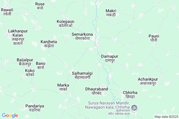
Gobarra
Gobarra Map
EDIT Map
Add Your House
 ..
..
Current Corona Virus Infected Patients Count in Kabirdham District
| City Name | District Name | Total Covid cases |
|---|
Locality Name :
Gobarra
( गोबररा )
Tehsil Name : Pandariya
District : Kabirdham
State : Chattisgarh
Language : Chhattisgarhi and Hindi, Agariya
Current Time 12:57 AM
Date: Sunday , May 04,2025 (IST)
Time zone: IST (UTC+5:30)
Elevation / Altitude: 325 meters. Above Seal level
Telephone Code / Std Code: 07754
Assembly constituency : Pandariya assembly constituency
Assembly MLA : Bhawna Bohra
Lok Sabha constituency : Rajnandgaon parliamentary constituency
Parliament MP : SANTOSH PANDEY
Serpanch Name :
Pin Code : 491559
Post Office Name : Pandaria
Main Village Name : GOBARRA
Commodities Prices : Pipriya Market / Mandi
Rivers Near Gobarra
Halon
Aagar
Halon
Aagar
About Gobarra
Correct below Info and add more info about GobarraGobarra is a small Village/hamlet in Pandariya Tehsil in Kabirdham District of Chattisgarh State, India. It comes under GOBARRA Panchayath. It is located 27 KM towards East from District head quarters Kawardha. 22 KM from Pandatarai. 105 KM from State capital Raipur
Gobarra Pin code is 491559 and postal head office is Pandaria .
Khairwar ( 5 KM ) , Marka ( 5 KM ) , Kolegaon ( 5 KM ) , Kanjheta ( 6 KM ) , Kheltukri ( 6 KM ) are the nearby Villages to Gobarra. Gobarra is surrounded by Pandariya Tehsil towards North , Kabirdham Tehsil towards west , Mungeli Tehsil towards East , Bodla Tehsil towards west .
Kawardha , Mungeli , Bemetra , Bhatapara are the near by Cities to Gobarra.
Gobarra 2011 Census Details
Gobarra Local Language is Chhattisgarhi. Gobarra Village Total population is 794 and number of houses are 208. Female Population is 48.5%. Village literacy rate is 45.1% and the Female Literacy rate is 17.0%.
Population
| Census Parameter | Census Data |
| Total Population | 794 |
| Total No of Houses | 208 |
| Female Population % | 48.5 % ( 385) |
| Total Literacy rate % | 45.1 % ( 358) |
| Female Literacy rate | 17.0 % ( 135) |
| Scheduled Tribes Population % | 6.9 % ( 55) |
| Scheduled Caste Population % | 4.9 % ( 39) |
| Working Population % | 51.6 % |
| Child(0 -6) Population by 2011 | 148 |
| Girl Child(0 -6) Population % by 2011 | 46.6 % ( 69) |
Gobarra Census More Deatils.
Politics in Gobarra
Bharatiya Janata Party , BJP , INC are the major political parties in this area.Polling Stations /Booths near Gobarra
1)Kodvagodan2)Girdharikanpa
3)Prankanpa
4)Newaspur
5)Andhiyarkhor
HOW TO REACH Gobarra
By Rail
There is no railway station near to Gobarra in less than 10 km.Colleges near Gobarra
Shekh Sameer College Mungeli Road,pandariya
Address : Shekh Sameer College Mungeli Road,pandariya
Shekh Sameer Pg College Pandariya
Address : Shekh Sameer Auto Care Mungeli Road,pandariya Distt.-kabirdham(c.g.)491559 Pass Pandariya
Schools near Gobarra
Keshaw M.s.rohra
Address : rohra , pandariya , kawardha , Chattisgarh . PIN- 491559 , Post - Pandaria
School Name
Address : dhobghatti , pandariya , kawardha , Chattisgarh . PIN- 0
S.s.m. Pandatarai
Address : pandatarai , pandariya , kawardha , Chattisgarh . PIN- 491559 , Post - Pandaria
Govt.m.s.bagragpara
Address : bagragpara , pandariya , kawardha , Chattisgarh . PIN- 491995 , Post - Kawardha
Govt Health Centers near Gobarra
1) SHC Damapur , , ,2) PHC Damapur , , ,
3) SHC Dhourabandh , , ,
Sub Villages in Gobarra
Schools in Gobarra,Pandariya
Government Higher Secondary School
Kathautiya; Chhattisgarh; India 491337; Bemetara; Chhattisgarh; India 491337; Chhattisgarh 491337; India
6.5 KM distance Detail
Electronic Shops in Gobarra,Pandariya
Hemant Computers
Kathautiya; Chhattisgarh; India 491337; Bemetara; Chhattisgarh; India 491337; Chhattisgarh 491337; India
6.6 KM distance Detail
Super Markets in Gobarra,Pandariya
Chandrakar Fal&Jus Corner
Kathautiya Road; Damapur; Chhattisgarh 491559; India
6.6 KM distance Detail
तुकाराम पान सेंटर&जनरल स्टोर्स & ice cream parlour
Kathautiya; Chhattisgarh 491559; India
7.0 KM distance Detail
Local Parks in Gobarra,Pandariya
Police Stations near Gobarra,Pandariya
Police Station
Birampur - Thengabhat Road; Darhi; Chhattisgarh 491335; India
18.5 KM distance Detail
About Gobarra &
History
How to reach Gobarra
Tourist Places Near By Gobarra
Schools in Gobarra
Colleges in Gobarra
Temperature & weather of Gobarra
places in Gobarra
Gobarra photos
More Information
How to reach Gobarra
Tourist Places Near By Gobarra
Schools in Gobarra
Colleges in Gobarra
Temperature & weather of Gobarra
places in Gobarra
Gobarra photos
More Information
Village Talk
Post News or Events about this Village
Near Cities
Kawardha 21 KM near
Mungeli 27 KM near
Bemetra 43 KM near
Bhatapara 68 KM near
Kawardha 21 KM near
Mungeli 27 KM near
Bemetra 43 KM near
Bhatapara 68 KM near
Near By Taluks
Kawardha 16 KM near
Kabirdham 21 KM near
Pandariya 21 KM near
Mungeli 27 KM near
Kawardha 16 KM near
Kabirdham 21 KM near
Pandariya 21 KM near
Mungeli 27 KM near
Near By Air Ports
Raipur Airport 111 KM near
Jabalpur Airport 192 KM near
Sonegaon Airport 301 KM near
Khajuraho Airport 387 KM near
Raipur Airport 111 KM near
Jabalpur Airport 192 KM near
Sonegaon Airport 301 KM near
Khajuraho Airport 387 KM near
Near By Tourist Places
Kawardha 24 KM near
Bilaspur 79 KM near
Amarkantak 87 KM near
Raipur 100 KM near
Kanha National park 100 KM near
Kawardha 24 KM near
Bilaspur 79 KM near
Amarkantak 87 KM near
Raipur 100 KM near
Kanha National park 100 KM near
Near By Districts
Kabirdham 25 KM near
Bilaspur 82 KM near
Raipur 101 KM near
Durg 107 KM near
Kabirdham 25 KM near
Bilaspur 82 KM near
Raipur 101 KM near
Durg 107 KM near
Near By RailWay Station
Bhatapara Rail Way Station 68 KM near
Tilda Rail Way Station 72 KM near
Bhatapara Rail Way Station 68 KM near
Tilda Rail Way Station 72 KM near