| Home | City Bus | Maps | Villages | Cities | Rail | Tourist Places | School | College | Pin Codes | Corona Cases Count |
| Distance Calculator Bus Services IFSC Codes Trace Mobile Number Weather Search Place Trace IP Available Cash ATM/Banks Locate Polling Booth Report an Error contact People |
 ..
..
Current Corona Virus Infected Patients Count in Kabirdham District
| City Name | District Name | Total Covid cases |
|---|
Tehsil Name : Pandariya
District : Kabirdham
State : Chattisgarh
Language : Chhattisgarhi and Hindi, Agariya
Current Time 11:53 PM
Date: Saturday , May 03,2025 (IST)
Time zone: IST (UTC+5:30)
Elevation / Altitude: 325 meters. Above Seal level
Telephone Code / Std Code: 07754
Assembly constituency : Pandariya assembly constituency
Assembly MLA : Bhawna Bohra
Lok Sabha constituency : Rajnandgaon parliamentary constituency
Parliament MP : SANTOSH PANDEY
Serpanch Name :
Pin Code : 491559
Post Office Name : Pandaria
Main Village Name : Bakela
Commodities Prices : Pandariya Market / Mandi
OverView of Bakela
Ch. Arjun singh gurjar :zamindar of village tudila and near by other 11 villages(gurikha, ekhara, tukeda, nounera, mahe, lahchura, katwah haji, malanpur, singhwari, madhou ka pura, jhawalpura) who was famous for his self-styled kingship. He rose his sword against scindia to safe guard famous dacoits donger and buturi sikarwar from scindia and opposed his offer of zagir of two more village in return of the dacoits. He attacked many zamindar's of bhind, gwalior and collected taxes from them. He gave thousands of land to jats, brahmans, harijans in his tenure.
Edit below overview about Bakela
Halon
Aagar
About Bakela
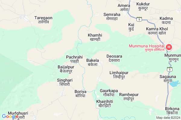
Bakela is a small Village/hamlet in Pandariya Tehsil in Kabirdham District of Chattisgarh State, India. It comes under Bakela Panchayath. It is located 39 KM towards North from District head quarters Kawardha. 18 KM from Pandatarai. 141 KM from State capital Raipur
Bakela Pin code is 491559 and postal head office is Pandaria .
Boda ( 7 KM ) , Gangpur ( 7 KM ) , Damgarh ( 9 KM ) , Lokhan ( 9 KM ) , Madmada ( 10 KM ) are the nearby Villages to Bakela. Bakela is surrounded by Bodla Tehsil towards South , Kabirdham Tehsil towards South , Kawardha Tehsil towards South , Lormi Tehsil towards East .
Kawardha , Mungeli , Malajkhand , Bemetra are the near by Cities to Bakela.
Bakela 2011 Census Details
Bakela Local Language is Chhattisgarhi. Bakela Village Total population is 231 and number of houses are 44. Female Population is 49.4%. Village literacy rate is 57.6% and the Female Literacy rate is 20.3%.
Population
| Census Parameter | Census Data |
| Total Population | 231 |
| Total No of Houses | 44 |
| Female Population % | 49.4 % ( 114) |
| Total Literacy rate % | 57.6 % ( 133) |
| Female Literacy rate | 20.3 % ( 47) |
| Scheduled Tribes Population % | 87.0 % ( 201) |
| Scheduled Caste Population % | 0.0 % ( 0) |
| Working Population % | 61.9 % |
| Child(0 -6) Population by 2011 | 40 |
| Girl Child(0 -6) Population % by 2011 | 47.5 % ( 19) |
Bakela Census More Deatils.
Politics in Bakela
Bharatiya Janata Party , BJP , INC are the major political parties in this area.Polling Stations /Booths near Bakela
1)Devgarhiya2)Lalpur Kala
3)Gaurjhoomar
4)Khairwarkala
5)Khairdongri
HOW TO REACH Bakela
By Rail
There is no railway station near to Bakela in less than 10 km.Colleges near Bakela
Shekh Sameer College Mungeli Road,pandariyaSchools in Bakela
G.p.s. BakelaGovt Health Centers near Bakela
1) SHC Narsinghpur , , ,2) SHC Khairjhiti , , ,
3) PHC Taregaon , , ,
Petrol Bunks in Bakela,Pandariya
Hindustan Petroleum
Bodla; Mudiya Para; Kabirdham; NH-12A; Chillip Highway; Kawardha; Kawardha; Chhattisgarh 491995; India
21.1 KM distance Detail
Asha Fuels Indian Oil Petrol Pump
Bodla; Mudiya Para; Kabirdham; NH-12A; Chillip Highway; Kawardha; Kawardha; Chhattisgarh 491995; India
21.9 KM distance Detail
more ..
Colleges in Bakela,Pandariya
Government Naveen College; Pandatarai
Pandatarai; Chhattisgarh 491559; India
14.0 KM distance Detail
Barmha kumaris centre
High School Rd; Pandatarai; Chhattisgarh 491559; India
14.4 KM distance Detail
more ..
Schools in Bakela,Pandariya
Govt Higher Sec School Pandatarai
College Rd; Pandatarai; Chhattisgarh 491559; India
14.3 KM distance Detail
Local Parks in Bakela,Pandariya
Police Stations near Bakela,Pandariya
Police Thana
police thana post pandatarai; Pandatarai; Chhattisgarh 491559; India
14.5 KM distance Detail
How to reach Bakela
Tourist Places Near By Bakela
Schools in Bakela
Colleges in Bakela
Temperature & weather of Bakela
places in Bakela
Bakela photos
More Information
Village Talk
Post News or Events about this Village
Kawardha 37 KM near
Mungeli 52 KM near
Malajkhand 78 KM near
Bemetra 78 KM near
Pandariya 17 KM near
Bodla 21 KM near
Kabirdham 37 KM near
Kawardha 39 KM near
Raipur Airport 147 KM near
Jabalpur Airport 165 KM near
Sonegaon Airport 301 KM near
Khajuraho Airport 351 KM near
Kawardha 37 KM near
Amarkantak 70 KM near
Kanha National park 79 KM near
Bilaspur 99 KM near
Raipur 135 KM near
Kabirdham 37 KM near
Dindori 84 KM near
Bilaspur 102 KM near
Anuppur 110 KM near
Kargi Road Rail Way Station 82 KM near
Belgahna Rail Way Station 84 KM near