| Home | City Bus | Maps | Villages | Cities | Rail | Tourist Places | School | College | Pin Codes | Corona Cases Count |
| Distance Calculator Bus Services IFSC Codes Trace Mobile Number Weather Search Place Trace IP Available Cash ATM/Banks Locate Polling Booth Report an Error contact People |
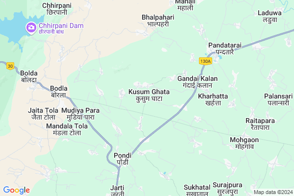
Kusumghata
Kusumghata Map
EDIT Map
Add Your House
 ..
..
Current Corona Virus Infected Patients Count in Kabirdham District
| City Name | District Name | Total Covid cases |
|---|
Locality Name :
Kusumghata
( कुसुमघटा )
Tehsil Name : Bodla
District : Kabirdham
State : Chattisgarh
Language : Chhattisgarhi and Hindi, Agariya
Current Time 01:01 PM
Date: Thursday , May 01,2025 (IST)
Time zone: IST (UTC+5:30)
Elevation / Altitude: 325 meters. Above Seal level
Telephone Code / Std Code: 07740
Assembly constituency : Kawardha assembly constituency
Assembly MLA : Vijay Sharma
Lok Sabha constituency : Rajnandgaon parliamentary constituency
Parliament MP : SANTOSH PANDEY
Serpanch Name :
Pin Code : 491995
Post Office Name : Kawardha
Commodities Prices : Pandariya Market / Mandi
Edit below overview about Kusumghata
Edit below overview about Kusumghata
OverView of Kusumghata
kusumghata is Central villege of politics in kawardha.most of the rural politicians are lived here. there is a beautiful tourism place "ausarpath dham".Edit below overview about Kusumghata
Rivers Near Kusumghata
Baniar
Tannor
Baniar
Tannor
About Kusumghata
Kusumghata is a Village in Bodla Tehsil in Kabirdham District of Chattisgarh State, India. It is located 21 KM towards North from District head quarters Kawardha. 9 KM from Bodla. 125 KM from State capital Raipur
Kusumghata Pin code is 491995 and postal head office is Kawardha .
Manikpur ( 2 KM ) , Neurgaonkhurd ( 3 KM ) , Taregaon (maidan) ( 4 KM ) , Lenjakhar ( 5 KM ) , Bagharra ( 5 KM ) are the nearby Villages to Kusumghata. Kusumghata is surrounded by Pandariya Tehsil towards East , Kabirdham Tehsil towards South , Kawardha Tehsil towards South , Lormi Tehsil towards East .
Kawardha , Mungeli , Bemetra , Malajkhand are the near by Cities to Kusumghata.
Kusum Ghata 2011 Census Details
Kusumghata Local Language is Chhattisgarhi. Kusum Ghata Village Total population is 1863 and number of houses are 407. Female Population is 48.6%. Village literacy rate is 50.5% and the Female Literacy rate is 18.7%.
Population
| Census Parameter | Census Data |
| Total Population | 1863 |
| Total No of Houses | 407 |
| Female Population % | 48.6 % ( 906) |
| Total Literacy rate % | 50.5 % ( 941) |
| Female Literacy rate | 18.7 % ( 349) |
| Scheduled Tribes Population % | 2.5 % ( 46) |
| Scheduled Caste Population % | 6.2 % ( 116) |
| Working Population % | 52.9 % |
| Child(0 -6) Population by 2011 | 286 |
| Girl Child(0 -6) Population % by 2011 | 44.8 % ( 128) |
Kusum Ghata Census More Deatils.
Politics in Kusumghata
Bharatiya Janata Party , BJP , INC are the major political parties in this area.Polling Stations /Booths near Kusumghata
1)Kusumghata2)Kuroova
3)Bodla
4)Manikchori
5)Manikpur
HOW TO REACH Kusumghata
By Rail
There is no railway station near to Kusumghata in less than 10 km.Colleges near Kusumghata
Government Swami Vivekanand Collage Bodla
Address :
Schools near Kusumghata
Ms.aamapani (ssa)
Address : aamapani , bodla , kawardha , Chattisgarh . PIN- 491995 , Post - Kawardha
Govt.m.s.sarenda(s.s.a)
Address : sarenda , bodla , kawardha , Chattisgarh . PIN- 491995 , Post - Kawardha
Ms Sarvati Gyandeep Mandir
Address : bodla , bodla , kawardha , Chattisgarh . PIN- 491995 , Post - Kawardha
Kanya Ms Bodla
Address : bodla , bodla , kawardha , Chattisgarh . PIN- 491995 , Post - Kawardha
Govt Health Centers near Kusumghata
1) SHC Kusumghata , SHC Kusumghata , ,2) SHC Gandaikala , , ,
3) SHC Newurgaonkhurd , , ,
Petrol Bunks in Kusumghata,Bodla
Asha Fuels Indian Oil Petrol Pump
Bodla; Mudiya Para; Kabirdham; NH-12A; Chillip Highway; Kawardha; Kawardha; Chhattisgarh 491995; India
5.4 KM distance Detail
Hindustan Petroleum
Bodla; Mudiya Para; Kabirdham; NH-12A; Chillip Highway; Kawardha; Kawardha; Chhattisgarh 491995; India
6.4 KM distance Detail
more ..
Schools in Kusumghata,Bodla
Govt High School Kharhattaशासकीय हाई स्कूल खर्हट्टा
Kharhatta; Chhattisgarh 491995; India
4.8 KM distance Detail
Brahmadev Public School
Charkhura Kalan; Kabirdham; SH-5; Lormi Kota Road; Pandatarai; Pandatarai; Chhattisgarh 491995; India
5.7 KM distance Detail
Govt Higher Sec School Pandatarai
College Rd; Pandatarai; Chhattisgarh 491559; India
6.4 KM distance Detail
Police Stations near Kusumghata,Bodla
Police Thana
police thana post pandatarai; Pandatarai; Chhattisgarh 491559; India
6.5 KM distance Detail
About Kusumghata &
History
How to reach Kusumghata
Tourist Places Near By Kusumghata
Schools in Kusumghata
Colleges in Kusumghata
Temperature & weather of Kusumghata
places in Kusumghata
Kusumghata photos
More Information
How to reach Kusumghata
Tourist Places Near By Kusumghata
Schools in Kusumghata
Colleges in Kusumghata
Temperature & weather of Kusumghata
places in Kusumghata
Kusumghata photos
More Information
Village Talk
Post News or Events about this Village
Near Cities
Kawardha 19 KM near
Mungeli 48 KM near
Bemetra 64 KM near
Malajkhand 68 KM near
Kawardha 19 KM near
Mungeli 48 KM near
Bemetra 64 KM near
Malajkhand 68 KM near
Near By Taluks
Bodla 9 KM near
Pandariya 19 KM near
Kabirdham 19 KM near
Kawardha 23 KM near
Bodla 9 KM near
Pandariya 19 KM near
Kabirdham 19 KM near
Kawardha 23 KM near
Near By Air Ports
Raipur Airport 132 KM near
Jabalpur Airport 168 KM near
Sonegaon Airport 289 KM near
Khajuraho Airport 365 KM near
Raipur Airport 132 KM near
Jabalpur Airport 168 KM near
Sonegaon Airport 289 KM near
Khajuraho Airport 365 KM near
Near By Tourist Places
Kawardha 19 KM near
Kanha National park 77 KM near
Amarkantak 85 KM near
Bilaspur 99 KM near
Bhilai 118 KM near
Kawardha 19 KM near
Kanha National park 77 KM near
Amarkantak 85 KM near
Bilaspur 99 KM near
Bhilai 118 KM near
Near By Districts
Kabirdham 19 KM near
Dindori 100 KM near
Bilaspur 102 KM near
Mandla 118 KM near
Kabirdham 19 KM near
Dindori 100 KM near
Bilaspur 102 KM near
Mandla 118 KM near
Near By RailWay Station
Kargi Road Rail Way Station 87 KM near
Belgahna Rail Way Station 93 KM near
Kargi Road Rail Way Station 87 KM near
Belgahna Rail Way Station 93 KM near