| Home | City Bus | Maps | Villages | Cities | Rail | Tourist Places | School | College | Pin Codes | Corona Cases Count |
| Distance Calculator Bus Services IFSC Codes Trace Mobile Number Weather Search Place Trace IP Available Cash ATM/Banks Locate Polling Booth Report an Error contact People |
 ..
..
Current Corona Virus Infected Patients Count in Jind District
| City Name | District Name | Total Covid cases |
|---|---|---|
| Jind District | Jind | 2 |
Tehsil Name : Uchana
District : Jind
State : Haryana
Division : Hisar
Language : Hindi and Punjabi, English, Haryanvi
Current Time 06:38 AM
Date: Saturday , May 03,2025 (IST)
Time zone: IST (UTC+5:30)
Elevation / Altitude: 225 meters. Above Seal level
Telephone Code / Std Code: 01749
Assembly constituency : Uchana Kalan assembly constituency
Assembly MLA : Dushyant Chautala
Lok Sabha constituency : Hisar parliamentary constituency
Parliament MP : BRIJENDRA SINGH
Serpanch Name :
Pin Code : 126152
Post Office Name : Dhanoda Kalan
Commodities Prices : Narwana Market / Mandi
OverView of Mangalpur
Mangalpur is situated on Narwana-Kakrod Road (Named after Shaheed Major Vinay Choudhary), 15 KM away from Narwana. It is a big Village. The population of Village is above 5k. There are many facilities in the Village like; Govt. Sr. School, Girls Middle School, S.D. Sr. Sec. School, PHC, Veterinary Hospital, Mini Bank, Anganwaries, Community Choupals, Water Supply, pow er house andprivate Bus Service for Narwana and Jind. There is a famous Temple of Goddess Durga mata, Dada Khera , Baba khara and other angles.The village has Rich and prosperous History. There are many historical building like Baniyon ki Haveli and Water Ghats made by dada Basdi attri , Dada Syo Lal attri and Koshik pandit and Gumani jat shows the art and prosperity of the ancient Village. The villagers had participated in Indian Freedom Movement and villager Basanta Ram had worked with Azad Hind Fouj. In present the villager have proud on Shaheed Major Vinay Choudhary (Shourya Chakra Awardees) who scarified his live for the Nation.
The people of the village live peacefully and like brotherhood. The main occupation of the villagers is Agriculture and Dairy Farming. The nature has gifted the village with River and land water and fertile land. Farmers worked very hard with new technologies and the land grows gold.
Edit below overview about Mangalpur
Nationa High Way :NH152D
Nationa High Way :NH52
About Mangalpur
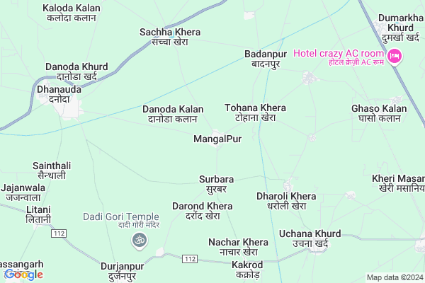
Mangalpur is a Village in Uchana Tehsil in Jind District of Haryana State, India. It belongs to Hisar Division . It is located 37 KM towards west from District head quarters Jind. 9 KM from Uchana Khurd. 177 KM from State capital Chandigarh
Mangalpur Pin code is 126152 and postal head office is Dhanoda Kalan .
Danoda Kalan ( 2 KM ) , Daroli Khera ( 4 KM ) , Dohana Khera ( 4 KM ) , Badanpur ( 5 KM ) , Jheel ( 5 KM ) are the nearby Villages to Mangalpur. Mangalpur is surrounded by Narwana Tehsil towards North , Uklana Tehsil towards west , Barwala Tehsil towards South , Kalayat Tehsil towards East .
Narwana , Barwala , Tohana , Jind are the near by Cities to Mangalpur.
Mangalpur 2011 Census Details
Mangalpur Local Language is Hindi. Mangalpur Village Total population is 4395 and number of houses are 845. Female Population is 47.0%. Village literacy rate is 54.1% and the Female Literacy rate is 20.8%.
Population
| Census Parameter | Census Data |
| Total Population | 4395 |
| Total No of Houses | 845 |
| Female Population % | 47.0 % ( 2066) |
| Total Literacy rate % | 54.1 % ( 2379) |
| Female Literacy rate | 20.8 % ( 915) |
| Scheduled Tribes Population % | 0.0 % ( 0) |
| Scheduled Caste Population % | 22.6 % ( 993) |
| Working Population % | 51.5 % |
| Child(0 -6) Population by 2011 | 603 |
| Girl Child(0 -6) Population % by 2011 | 47.6 % ( 287) |
Mangalpur Census More Deatils.
Politics in Mangalpur
JJP , Bharatiya Janata Party , BJP , INLD , INC are the major political parties in this area.Polling Stations /Booths near Mangalpur
1)Mandi Kalan2)Mangalpur
3)Mangalpur
4)Surbrah
5)Thua
HOW TO REACH Mangalpur
By Rail
Ghaso Rail Way Station , Narwana Junction Rail Way Station are the very nearby railway stations to Mangalpur.Colleges near Mangalpur
Dav Poltechnical CollegeSchools in Mangalpur
Govt. High SchoolGovt Health Centers near Mangalpur
1) S-C Litani , , ,2) S-C Sandlana , , ,
3) PHC Hasangarh , , ,
Petrol Bunks in Mangalpur,Uchana
DANODA ENERGY STATION
DANODA; NH65; KAITHAL HISS; Jind; Haryana 126153; India
7.7 KM distance Detail
Raja Oil Filling Station
Narwana - Fatehabad Road; Danoda Khurd; Haryana 126152; India
7.7 KM distance Detail
more ..
Colleges in Mangalpur,Uchana
Sidhi Vinayaka College Of Education; Kakrod
Kakrod; Narwana Tehsil; Jind Dist; Nachar Khera; Haryana 126115; India
6.0 KM distance Detail
Mittaso College of Education
Kaithal - Hisar Road; Chamela Colony; Narwana; Haryana 126116; India
10.2 KM distance Detail
Jagdamba Medical Hall
Railway Station Rd; Patram Nagar; Narwana; Haryana 126116; India
11.4 KM distance Detail
more ..
Schools in Mangalpur,Uchana
SHIVANI INSTITUTE
NEAR; SACHH KHERA ROAD; Sachha Khera; Haryana 126152; India
0.2 KM distance Detail
Police Stations near Mangalpur,Uchana
Police Station
Old Ct Rd; FCI Area; Gandhi Nagar; Narwana; Haryana 126116; India
11.6 KM distance Detail
City Police Station
Railway Station Rd; Model Town; Narwana; Haryana 126116; India
11.9 KM distance Detail
Governement Offices near Mangalpur,Uchana
Csc And Rativ Ghandhi Panchayat House
MDR112; Nachar Khera; Haryana 126152; India
6.9 KM distance Detail
How to reach Mangalpur
Tourist Places Near By Mangalpur
Schools in Mangalpur
Colleges in Mangalpur
Temperature & weather of Mangalpur
places in Mangalpur
Mangalpur photos
More Information
Village Talk
Post News or Events about this Village
Narwana 12 KM near
Barwala 22 KM near
Tohana 31 KM near
Jind 35 KM near
Uchana 9 KM near
Narwana 15 KM near
Uklana 21 KM near
Barwala 27 KM near
Indira Gandhi International Airport 163 KM near
Chandigarh Airport 164 KM near
Muzaffarnagar Airport 173 KM near
Ludhiana Airport 174 KM near
Hansi 52 KM near
Bhiwani 91 KM near
Mansa 95 KM near
Sangrur 95 KM near
Kurukshetra 97 KM near
Jind 35 KM near
Kaithal 51 KM near
Hisar 57 KM near
Fatehabad 64 KM near
Ghaso Rail Way Station 8.8 KM near
Narwana Junction Rail Way Station 10 KM near
Tohana Rail Way Station 31 KM near