| Home | City Bus | Maps | Villages | Cities | Rail | Tourist Places | School | College | Pin Codes | Corona Cases Count |
| Distance Calculator Bus Services IFSC Codes Trace Mobile Number Weather Search Place Trace IP Available Cash ATM/Banks Locate Polling Booth Report an Error contact People |
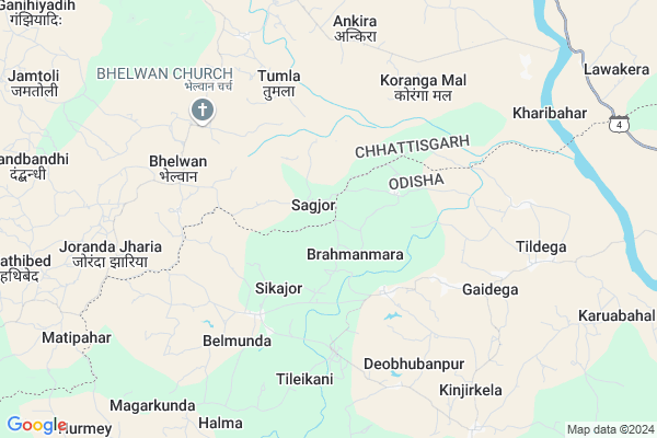
Sagjor
Sagjor Map
EDIT Map
Add Your House
 ..
..
Current Corona Virus Infected Patients Count in Jashpur District
| City Name | District Name | Total Covid cases |
|---|
Locality Name :
Sagjor
( सागजोर )
Tehsil Name : Pharsabahar
District : Jashpur
State : Chattisgarh
Language : Chhattisgarhi and Hindi
Current Time 10:15 PM
Date: Saturday , May 03,2025 (IST)
Time zone: IST (UTC+5:30)
Elevation / Altitude: 229 meters. Above Seal level
Telephone Code / Std Code: 07761
Assembly constituency : Kunkuri assembly constituency
Assembly MLA : Vishnu Deo Sai
Lok Sabha constituency : Raigarh parliamentary constituency
Parliament MP : GOMATI SAI
Serpanch Name :
Pin Code : 496245
Post Office Name : Lawakera
Alternate Village Name : SOGJOR
Commodities Prices : Kotba Market / Mandi
Sagjor Live Weather
Temperature: 25.6 °C
few clouds
Humidity: 67%
Wind : 3.02 mt/sec towards S
StationName : "Sundargarh"
observed on Now
Temperature: 25.6 °C
few clouds
Humidity: 67%
Wind : 3.02 mt/sec towards S
StationName : "Sundargarh"
observed on Now
Sagjor Weather Forecast for Next 5 days
04-05-2025
24.4°C to 25.4°C
few clouds, clear sky
24.4°C to 25.4°C
few clouds, clear sky
05-05-2025
23.7°C to 40.0°C
clear sky, scattered clouds, light rain
23.7°C to 40.0°C
clear sky, scattered clouds, light rain
06-05-2025
25.5°C to 41.2°C
scattered clouds, few clouds
25.5°C to 41.2°C
scattered clouds, few clouds
07-05-2025
27.3°C to 41.4°C
scattered clouds, clear sky, broken clouds
27.3°C to 41.4°C
scattered clouds, clear sky, broken clouds
08-05-2025
29.1°C to 42.3°C
broken clouds, scattered clouds, overcast clouds
29.1°C to 42.3°C
broken clouds, scattered clouds, overcast clouds
Rivers Near Sagjor
Gahira
Drongjor
Gahira
Drongjor
About Sagjor
Correct below Info and add more info about SagjorSagjor is a Village in Pharsabahar Tehsil in Jashpur District of Chattisgarh State, India. It is located 75 KM towards South from District head quarters Jashpur Nagar. 12 KM from Pharsabahar. 308 KM from State capital Raipur
Sagjor Pin code is 496245 and postal head office is Lawakera .
Bhelwan ( 5 KM ) , Ankira ( 6 KM ) , Korangamaal ( 7 KM ) , Daltoli ( 8 KM ) , Babusajbahar ( 9 KM ) are the nearby Villages to Sagjor. Sagjor is surrounded by Balisankara Tehsil towards East , Subdega Tehsil towards East , Lephripara Tehsil towards South , Tangarpali Tehsil towards South .
Sundargarh , Bamra , Jharsuguda , Brajrajnagar are the near by Cities to Sagjor.
Sagjor 2011 Census Details
Sagjor Local Language is Chhattisgarhi. Sagjor Village Total population is 1501 and number of houses are 361. Female Population is 51.8%. Village literacy rate is 51.0% and the Female Literacy rate is 23.1%.
Population
| Census Parameter | Census Data |
| Total Population | 1501 |
| Total No of Houses | 361 |
| Female Population % | 51.8 % ( 778) |
| Total Literacy rate % | 51.0 % ( 765) |
| Female Literacy rate | 23.1 % ( 347) |
| Scheduled Tribes Population % | 86.7 % ( 1302) |
| Scheduled Caste Population % | 1.2 % ( 18) |
| Working Population % | 66.2 % |
| Child(0 -6) Population by 2011 | 231 |
| Girl Child(0 -6) Population % by 2011 | 50.6 % ( 117) |
Sagjor Census More Deatils.
Politics in Sagjor
Bharatiya Janata Party , BJP , INC are the major political parties in this area.Polling Stations /Booths near Sagjor
1)Rengarghat2)Sagjor
3)Bhagora 1
4)Bhelvantoli
5)Bhelvan ~1
HOW TO REACH Sagjor
By Rail
There is no railway station near to Sagjor in less than 10 km.Colleges near Sagjor
Government Girls College, Kansabel
Address : Church Road, Near High School
New Government College Kansabel
Address :
Govt. Vbsd Girls College Jashpur Nagar
Address : Major-priti Road, Basant Vihar, Jashpur
Schools in Sagjor
Navin P.m.s. Sagjor
Address : sagjor , farsabahar , jashpur , Chattisgarh . PIN- 496245 , Post - Lawakera
Govt Health Centers near Sagjor
1) SHC Saagjor , Saagjor , Saagjor , Saagjor2) PHC Bhelwan , Bhelwan , Bhelwan , Bhelwan
3) SHC Bhelwan , Bhelwan , Bhelwan , Bhelwan
Hospitals in Sagjor,Pharsabahar
N.K. ELECTROTECH;Subdega Road
Hospital Chowk; Balisankara; Odisha 770015; India
17.5 KM distance Detail
more ..
Schools in Sagjor,Pharsabahar
Anganwadi;Jun Wain;Kharibahar;Jashpur;Chhatishgarh
Panchayat-Kharibahar; Jun Wain; Chhattisgarh 496245; India
6.8 KM distance Detail
Local Parks in Sagjor,Pharsabahar
About Sagjor &
History
How to reach Sagjor
Tourist Places Near By Sagjor
Schools in Sagjor
Colleges in Sagjor
Temperature & weather of Sagjor
places in Sagjor
Sagjor photos
More Information
How to reach Sagjor
Tourist Places Near By Sagjor
Schools in Sagjor
Colleges in Sagjor
Temperature & weather of Sagjor
places in Sagjor
Sagjor photos
More Information
Village Talk
Post News or Events about this Village
Near Cities
Sundargarh 31 KM near
Bamra 58 KM near
Jharsuguda 60 KM near
Brajrajnagar 65 KM near
Sundargarh 31 KM near
Bamra 58 KM near
Jharsuguda 60 KM near
Brajrajnagar 65 KM near
Near By Taluks
Pharsabahar 12 KM near
Balisankara 16 KM near
Subdega 26 KM near
Lephripara 30 KM near
Pharsabahar 12 KM near
Balisankara 16 KM near
Subdega 26 KM near
Lephripara 30 KM near
Near By Air Ports
Ranchi Airport 203 KM near
Raipur Airport 288 KM near
Gaya Airport 322 KM near
Bhubaneswar Airport 342 KM near
Ranchi Airport 203 KM near
Raipur Airport 288 KM near
Gaya Airport 322 KM near
Bhubaneswar Airport 342 KM near
Near By Tourist Places
Jashpur 73 KM near
Simdega 77 KM near
Raigarh 79 KM near
Hirakud 100 KM near
Sambalpur 109 KM near
Jashpur 73 KM near
Simdega 77 KM near
Raigarh 79 KM near
Hirakud 100 KM near
Sambalpur 109 KM near
Near By Districts
Sundargarh 31 KM near
Jharsuguda 60 KM near
Jashpur 72 KM near
Simdega 75 KM near
Sundargarh 31 KM near
Jharsuguda 60 KM near
Jashpur 72 KM near
Simdega 75 KM near
Near By RailWay Station
Bamra Rail Way Station 57 KM near
Jharsuguda Junction Rail Way Station 60 KM near
Bamra Rail Way Station 57 KM near
Jharsuguda Junction Rail Way Station 60 KM near