| Home | City Bus | Maps | Villages | Cities | Rail | Tourist Places | School | College | Pin Codes | Corona Cases Count |
| Distance Calculator Bus Services IFSC Codes Trace Mobile Number Weather Search Place Trace IP Available Cash ATM/Banks Locate Polling Booth Report an Error contact People |
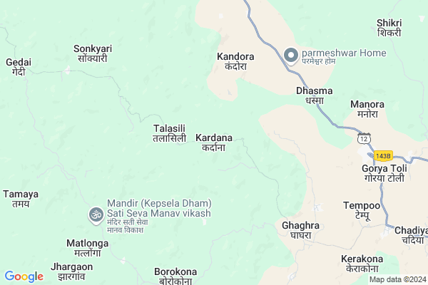
Kardana
Kardana Map
EDIT Map
Add Your House
 ..
..
Current Corona Virus Infected Patients Count in Jashpur District
| City Name | District Name | Total Covid cases |
|---|
Locality Name :
Kardana
( करदना )
Tehsil Name : Manora
District : Jashpur
State : Chattisgarh
Language : Chhattisgarhi and Hindi
Current Time 12:37 AM
Date: Saturday , May 03,2025 (IST)
Time zone: IST (UTC+5:30)
Elevation / Altitude: 619 meters. Above Seal level
Telephone Code / Std Code: 07769
Assembly constituency : Jashpur assembly constituency
Assembly MLA : Raymuni Bhagat
Lok Sabha constituency : Raigarh parliamentary constituency
Parliament MP : GOMATI SAI
Serpanch Name :
Pin Code : 496330
Post Office Name : Manora (Jashpur)
Commodities Prices : Jaspur Market / Mandi
Kardana Live Weather
Temperature: 22.9 °C
clear sky
Humidity: 44%
Wind : 0.71 mt/sec towards SW
StationName : "Jashpurnagar"
observed on 32 Mins Back
Temperature: 22.9 °C
clear sky
Humidity: 44%
Wind : 0.71 mt/sec towards SW
StationName : "Jashpurnagar"
observed on 32 Mins Back
Kardana Weather Forecast for Next 5 days
03-05-2025
22.1°C to 23.5°C
clear sky
22.1°C to 23.5°C
clear sky
04-05-2025
19.5°C to 30.4°C
few clouds, clear sky, light rain, broken clouds, scattered clouds
19.5°C to 30.4°C
few clouds, clear sky, light rain, broken clouds, scattered clouds
05-05-2025
19.2°C to 34.7°C
clear sky, broken clouds, light rain
19.2°C to 34.7°C
clear sky, broken clouds, light rain
06-05-2025
22.3°C to 37.1°C
broken clouds, scattered clouds, few clouds, light rain, overcast clouds
22.3°C to 37.1°C
broken clouds, scattered clouds, few clouds, light rain, overcast clouds
07-05-2025
24.5°C to 37.7°C
broken clouds, clear sky, scattered clouds
24.5°C to 37.7°C
broken clouds, clear sky, scattered clouds
Rivers Near Kardana
Lawa
Chirra
Lawa
Chirra
About Kardana
Correct below Info and add more info about KardanaKardana is a Village in Manora Tehsil in Jashpur District of Chattisgarh State, India. It is located 24 KM towards west from District head quarters Jashpur Nagar. 4 KM from Manora. 363 KM from State capital Raipur
Kardana Pin code is 496330 and postal head office is Manora (Jashpur).
Pandarsili ( 4 KM ) , Remne ( 6 KM ) , Alori ( 7 KM ) , Ordih ( 7 KM ) , Sonkyari ( 8 KM ) are the nearby Villages to Kardana. Kardana is surrounded by Kunkuri Tehsil towards South , Dumri Tehsil towards East , Jashpur Tehsil towards East , Bagicha Tehsil towards west .
Jashpurnagar , Gumla , Simdega , Ambikapur are the near by Cities to Kardana.
Kardana 2011 Census Details
Kardana Local Language is Chhattisgarhi. Kardana Village Total population is 710 and number of houses are 132. Female Population is 49.2%. Village literacy rate is 61.0% and the Female Literacy rate is 26.6%.
Population
| Census Parameter | Census Data |
| Total Population | 710 |
| Total No of Houses | 132 |
| Female Population % | 49.2 % ( 349) |
| Total Literacy rate % | 61.0 % ( 433) |
| Female Literacy rate | 26.6 % ( 189) |
| Scheduled Tribes Population % | 96.2 % ( 683) |
| Scheduled Caste Population % | 0.0 % ( 0) |
| Working Population % | 51.7 % |
| Child(0 -6) Population by 2011 | 122 |
| Girl Child(0 -6) Population % by 2011 | 48.4 % ( 59) |
Kardana Census More Deatils.
Politics in Kardana
Bharatiya Janata Party , BJP , INC are the major political parties in this area.Polling Stations /Booths near Kardana
1)Deviddgaon2)Sutri
3)Paikoo
4)Kanchi
5)Pasiya 1
HOW TO REACH Kardana
By Rail
There is no railway station near to Kardana in less than 10 km.Colleges near Kardana
Government Girls College, Kansabel
Address : Church Road, Near High School
New Government College Kansabel
Address :
Govt. Vbsd Girls College Jashpur Nagar
Address : Major-priti Road, Basant Vihar, Jashpur
Schools in Kardana
Nav. P.m.s. Kardana
Address : kardana , manora , jashpur , Chattisgarh . PIN- 496330 , Post - Manora (Jashpur)
Govt Health Centers near Kardana
1) SHC Talasilli , Sub Health Centre , Talasilli , Block Manora , Talasilli2) SHC Patiya , Sub Health Centre , Patiya, Tahsil Manora , Patiya
3) SHC Ghaghra , Sub Health Centre , Ghaghra , Tahsil Manora , Ghaghra
Hospitals in Kardana,Manora
Primary Health Center
Jashpur; SH-12; Jashpur Road; Manora; Manora; Chhattisgarh 496331; India
9.0 KM distance Detail
more ..
Schools in Kardana,Manora
Youngster English Medium
Jashpur; SH-12; Jashpur Road; Manora; Manora; Chhattisgarh 496331; India
8.8 KM distance Detail
Local Parks in Kardana,Manora
About Kardana &
History
How to reach Kardana
Tourist Places Near By Kardana
Schools in Kardana
Colleges in Kardana
Temperature & weather of Kardana
places in Kardana
Kardana photos
More Information
How to reach Kardana
Tourist Places Near By Kardana
Schools in Kardana
Colleges in Kardana
Temperature & weather of Kardana
places in Kardana
Kardana photos
More Information
Village Talk
Post News or Events about this Village
Near Cities
Jashpurnagar 23 KM near
Gumla 64 KM near
Simdega 76 KM near
Ambikapur 90 KM near
Jashpurnagar 23 KM near
Gumla 64 KM near
Simdega 76 KM near
Ambikapur 90 KM near
Near By Taluks
Manora 4 KM near
Kunkuri 25 KM near
Dumri 26 KM near
Jashpur 28 KM near
Manora 4 KM near
Kunkuri 25 KM near
Dumri 26 KM near
Jashpur 28 KM near
Near By Air Ports
Ranchi Airport 158 KM near
Gaya Airport 243 KM near
Varanasi Airport 330 KM near
Raipur Airport 343 KM near
Ranchi Airport 158 KM near
Gaya Airport 243 KM near
Varanasi Airport 330 KM near
Raipur Airport 343 KM near
Near By Tourist Places
Jashpur 23 KM near
Gumla 64 KM near
Netarhat 67 KM near
Simdega 77 KM near
Ambikapur 90 KM near
Jashpur 23 KM near
Gumla 64 KM near
Netarhat 67 KM near
Simdega 77 KM near
Ambikapur 90 KM near
Near By Districts
Jashpur 23 KM near
Gumla 64 KM near
Simdega 75 KM near
Surguja 90 KM near
Jashpur 23 KM near
Gumla 64 KM near
Simdega 75 KM near
Surguja 90 KM near
Near By RailWay Station
Latehar Rail Way Station 106 KM near
Barwadih Junction Rail Way Station 106 KM near
Latehar Rail Way Station 106 KM near
Barwadih Junction Rail Way Station 106 KM near