| Home | City Bus | Maps | Villages | Cities | Rail | Tourist Places | School | College | Pin Codes | Corona Cases Count |
| Distance Calculator Bus Services IFSC Codes Trace Mobile Number Weather Search Place Trace IP Available Cash ATM/Banks Locate Polling Booth Report an Error contact People |
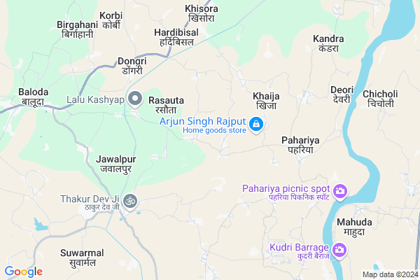
Ponch
Ponch Map
EDIT Map
Add Your House
 ..
..
Current Corona Virus Infected Patients Count in Janjgir-champa District
| City Name | District Name | Total Covid cases |
|---|
Locality Name :
Ponch
( पांच )
Tehsil Name : Baloda
District : Janjgir-champa
State : Chattisgarh
Language : Chhattisgarhi and Hindi
Current Time 03:14 AM
Date: Sunday , May 04,2025 (IST)
Time zone: IST (UTC+5:30)
Elevation / Altitude: 263 meters. Above Seal level
Telephone Code / Std Code: 07813
Assembly constituency : Akaltara assembly constituency
Assembly MLA : Raghavendra Kumar Singh
Lok Sabha constituency : Janjgir-Champa parliamentary constituency
Parliament MP : GUHARAM AJGALLEY
Serpanch Name :
Pin Code : 495559
Post Office Name : Baloda
Commodities Prices : Baloda(Janjgir Campus) Market / Mandi
Ponch Live Weather
Temperature: 26.9 °C
clear sky
Humidity: 49%
Wind : 1.23 mt/sec towards SE
StationName : "ChÄ\u0081mpa"
observed on 54 Mins Back
Temperature: 26.9 °C
clear sky
Humidity: 49%
Wind : 1.23 mt/sec towards SE
StationName : "ChÄ\u0081mpa"
observed on 54 Mins Back
Ponch Weather Forecast for Next 5 days
04-05-2025
26.7°C to 26.7°C
clear sky
26.7°C to 26.7°C
clear sky
05-05-2025
25.6°C to 38.6°C
clear sky, scattered clouds, few clouds, light rain, overcast clouds
25.6°C to 38.6°C
clear sky, scattered clouds, few clouds, light rain, overcast clouds
06-05-2025
27.2°C to 39.6°C
broken clouds, clear sky, few clouds, scattered clouds
27.2°C to 39.6°C
broken clouds, clear sky, few clouds, scattered clouds
07-05-2025
28.6°C to 40.5°C
scattered clouds, few clouds, clear sky, broken clouds, overcast clouds
28.6°C to 40.5°C
scattered clouds, few clouds, clear sky, broken clouds, overcast clouds
08-05-2025
29.5°C to 41.7°C
overcast clouds, few clouds, broken clouds
29.5°C to 41.7°C
overcast clouds, few clouds, broken clouds
National Highways Reachable To Ponch
Nationa High Way :NH130A
Nationa High Way :NH49
Nationa High Way :NH130A
Nationa High Way :NH49
Rivers Near Ponch
Lilagar
Hasdeo :Hasdeo River
Lilagar
Hasdeo :Hasdeo River
About Ponch
Correct below Info and add more info about PonchPonch is a Village in Baloda Tehsil in Janjgir-champa District of Chattisgarh State, India. It is located 34 KM towards west from District head quarters Janjgir. 2 KM from Baloda. 160 KM from State capital Raipur
Ponch Pin code is 495559 and postal head office is Baloda .
Khoha ( 2 KM ) , Dahkoni ( 3 KM ) , Khaija ( 4 KM ) , Rasouta ( 4 KM ) , Karmanda ( 4 KM ) are the nearby Villages to Ponch. Ponch is surrounded by Akaltara Tehsil towards west , Kartala Tehsil towards East , Nawagarh Tehsil towards South , Bamhindih Tehsil towards South .
Naila Janjgir , Champa , Akaltara , Dipka are the near by Cities to Ponch.
Ponch 2011 Census Details
Ponch Local Language is Chhattisgarhi. Ponch Village Total population is 1483 and number of houses are 392. Female Population is 49.4%. Village literacy rate is 60.8% and the Female Literacy rate is 24.7%.
Population
| Census Parameter | Census Data |
| Total Population | 1483 |
| Total No of Houses | 392 |
| Female Population % | 49.4 % ( 733) |
| Total Literacy rate % | 60.8 % ( 901) |
| Female Literacy rate | 24.7 % ( 367) |
| Scheduled Tribes Population % | 3.3 % ( 49) |
| Scheduled Caste Population % | 28.9 % ( 428) |
| Working Population % | 73.4 % |
| Child(0 -6) Population by 2011 | 225 |
| Girl Child(0 -6) Population % by 2011 | 48.9 % ( 110) |
Ponch Census More Deatils.
Politics in Ponch
INC , BJP , BJP , BSP , INC are the major political parties in this area.Polling Stations /Booths near Ponch
1)Podidalha2)Gatwa 119
3)Kirari 43 ~kh
4)Bokramudha
5)Chhitapali
HOW TO REACH Ponch
By Rail
There is no railway station near to Ponch in less than 10 km.Colleges near Ponch
Iti Baloda (mahuda) Janjgir Champa
Address : Baloda (mahuda)
Lal Bahadur Shastri Education College
Address :
Schools in Ponch
Govt. Ms Ponch
Address : ponch , baloda , janjgir - champa , Chattisgarh . PIN- 495559 , Post - Baloda
Govt Health Centers near Ponch
1) SHC Ponch , Sub Centre Ponch , Block Baloda , Tehsil Baloda2) SHC Nawgawan , Sub Centre Nawgawan , Block Baloda , Tehsil Baloda
3) PHC Pahariya , Primary Health Centre Pahariya , Block Baloda , Tehsil Baloda
Petrol Bunks in Ponch,Baloda
HP PETROL PUMP - SHARMA FUELS
Naila-baloda Road; Seoni; Raipur; Chhattisgarh 495668; India
9.8 KM distance Detail
more ..
Schools in Ponch,Baloda
GOVT. MIDDLE SCHOOL PONCH
Mahuda - Champa Road; Ponch; Chhattisgarh 495559; India
0.9 KM distance Detail
About Ponch &
History
How to reach Ponch
Tourist Places Near By Ponch
Schools in Ponch
Colleges in Ponch
Temperature & weather of Ponch
places in Ponch
Ponch photos
More Information
How to reach Ponch
Tourist Places Near By Ponch
Schools in Ponch
Colleges in Ponch
Temperature & weather of Ponch
places in Ponch
Ponch photos
More Information
Village Talk
Post News or Events about this Village
Near Cities
Naila Janjgir 12 KM near
Champa 14 KM near
Akaltara 21 KM near
Dipka 28 KM near
Naila Janjgir 12 KM near
Champa 14 KM near
Akaltara 21 KM near
Dipka 28 KM near
Near By Taluks
Baloda 2 KM near
Akaltara 19 KM near
Kartala 28 KM near
Nawagarh 29 KM near
Baloda 2 KM near
Akaltara 19 KM near
Kartala 28 KM near
Nawagarh 29 KM near
Near By Air Ports
Raipur Airport 151 KM near
Jabalpur Airport 312 KM near
Ranchi Airport 349 KM near
Varanasi Airport 415 KM near
Raipur Airport 151 KM near
Jabalpur Airport 312 KM near
Ranchi Airport 349 KM near
Varanasi Airport 415 KM near
Near By Tourist Places
Janjgir-Champa 10 KM near
Janjgir 14 KM near
Korba 31 KM near
Bilaspur 49 KM near
Raigarh 99 KM near
Janjgir-Champa 10 KM near
Janjgir 14 KM near
Korba 31 KM near
Bilaspur 49 KM near
Raigarh 99 KM near
Near By Districts
Korba 31 KM near
Janjgir-Champa 32 KM near
Bilaspur 47 KM near
Raigarh 99 KM near
Korba 31 KM near
Janjgir-Champa 32 KM near
Bilaspur 47 KM near
Raigarh 99 KM near
Near By RailWay Station
Janjgir Naila Rail Way Station 12 KM near
Champa Junction Rail Way Station 15 KM near
Janjgir Naila Rail Way Station 12 KM near
Champa Junction Rail Way Station 15 KM near