| Home | City Bus | Maps | Villages | Cities | Rail | Tourist Places | School | College | Pin Codes | Corona Cases Count |
| Distance Calculator Bus Services IFSC Codes Trace Mobile Number Weather Search Place Trace IP Available Cash ATM/Banks Locate Polling Booth Report an Error contact People |
Bhilai
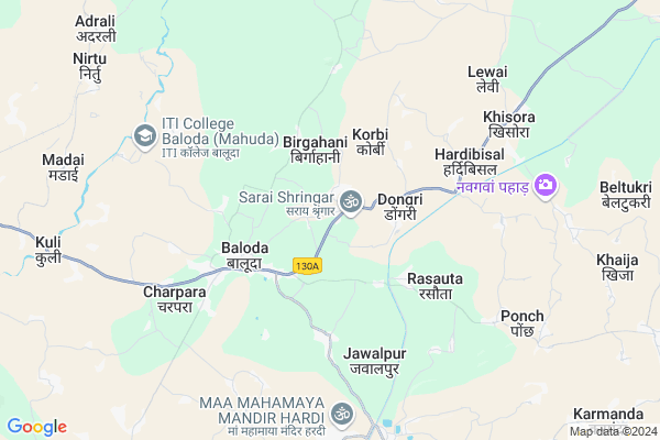
Bhilai Map
EDIT Map
Add Your House
 ..
..
Current Corona Virus Infected Patients Count in Janjgir-champa District
| City Name | District Name | Total Covid cases |
|---|
Locality Name :
Bhilai
( भिलाई )
Tehsil Name : Baloda
District : Janjgir-champa
State : Chattisgarh
Language : Chhattisgarhi and Hindi
Current Time 08:17 AM
Date: Saturday , May 03,2025 (IST)
Time zone: IST (UTC+5:30)
Elevation / Altitude: 263 meters. Above Seal level
Telephone Code / Std Code: 07813
Assembly constituency : Akaltara assembly constituency
Assembly MLA : Raghavendra Kumar Singh
Lok Sabha constituency : Janjgir-Champa parliamentary constituency
Parliament MP : GUHARAM AJGALLEY
Serpanch Name :
Pin Code : 495559
Post Office Name : Baloda
Commodities Prices : Baloda(Janjgir Campus) Market / Mandi
Bhilai Live Weather
Temperature: 32.2 °C
clear sky
Humidity: 38%
Wind : 2.11 mt/sec towards S
StationName : "Baloda"
observed on Now
Temperature: 32.2 °C
clear sky
Humidity: 38%
Wind : 2.11 mt/sec towards S
StationName : "Baloda"
observed on Now
Bhilai Weather Forecast for Next 5 days
04-05-2025
26.1°C to 38.3°C
clear sky, light rain, scattered clouds, few clouds
26.1°C to 38.3°C
clear sky, light rain, scattered clouds, few clouds
05-05-2025
24.8°C to 40.0°C
clear sky, few clouds, light rain, broken clouds, scattered clouds
24.8°C to 40.0°C
clear sky, few clouds, light rain, broken clouds, scattered clouds
06-05-2025
26.4°C to 41.8°C
scattered clouds, few clouds, clear sky
26.4°C to 41.8°C
scattered clouds, few clouds, clear sky
07-05-2025
28.2°C to 41.1°C
scattered clouds, clear sky, broken clouds
28.2°C to 41.1°C
scattered clouds, clear sky, broken clouds
08-05-2025
30.0°C to 41.9°C
scattered clouds, broken clouds, few clouds
30.0°C to 41.9°C
scattered clouds, broken clouds, few clouds
National Highways Reachable To Bhilai
Nationa High Way :NH130A
Nationa High Way :NH49
Nationa High Way :NH130A
Nationa High Way :NH49
Rivers Near Bhilai
Lilagar
Hasdeo :Hasdeo River
Lilagar
Hasdeo :Hasdeo River
About Bhilai
Correct below Info and add more info about BhilaiBhilai is a Village in Baloda Tehsil in Janjgir-champa District of Chattisgarh State, India. It is located 42 KM towards west from District head quarters Janjgir. 10 KM from Baloda. 158 KM from State capital Raipur
Bhilai Pin code is 495559 and postal head office is Baloda .
Birgahani (cha) ( 2 KM ) , Dogari ( 2 KM ) , Rasouta ( 3 KM ) , Baloda ( 3 KM ) , Hardivishal ( 4 KM ) are the nearby Villages to Bhilai. Bhilai is surrounded by Akaltara Tehsil towards South , Pali Tehsil towards North , Kartala Tehsil towards East , Masturi Tehsil towards west .
Naila Janjgir , Akaltara , Champa , Dipka are the near by Cities to Bhilai.
Bhilai 2011 Census Details
Bhilai Local Language is Chhattisgarhi. Bhilai Village Total population is 1540 and number of houses are 376. Female Population is 49.2%. Village literacy rate is 62.3% and the Female Literacy rate is 25.1%.
Population
| Census Parameter | Census Data |
| Total Population | 1540 |
| Total No of Houses | 376 |
| Female Population % | 49.2 % ( 757) |
| Total Literacy rate % | 62.3 % ( 960) |
| Female Literacy rate | 25.1 % ( 386) |
| Scheduled Tribes Population % | 5.5 % ( 84) |
| Scheduled Caste Population % | 43.2 % ( 665) |
| Working Population % | 52.1 % |
| Child(0 -6) Population by 2011 | 254 |
| Girl Child(0 -6) Population % by 2011 | 50.4 % ( 128) |
Bhilai Census More Deatils.
Politics in Bhilai
INC , BJP , BJP , BSP , INC are the major political parties in this area.Polling Stations /Booths near Bhilai
1)Bhaistara Ma. Gu.2)Dongi Pendri Vangram
3)Dongri 97 ~k
4)Bhili 93
5)Kolihadevri
HOW TO REACH Bhilai
By Rail
There is no railway station near to Bhilai in less than 10 km.Colleges near Bhilai
Iti Baloda (mahuda) Janjgir Champa
Address : Baloda (mahuda)
Lal Bahadur Shastri Education College
Address :
Schools in Bhilai
Govt.ms Bhilai
Address : bhilai , baloda , janjgir - champa , Chattisgarh . PIN- 495559 , Post - Baloda
Govt Health Centers near Bhilai
1) SHC Dongri , Sub Centre Dongri , Block Baloda , Tehsil Baloda2) SHC Baloda B , Sub Centre Baloda B , Block Baloda , Tehsil Baloda
3) SHC Baloda A , Sub Centre Baloda A , Block Baloda , Tehsil Baloda
Hospitals in Bhilai,Baloda
Baloda Shwasth Kendra
495559; Police Station Rd; Balauda; Chhattisgarh 495557; India
3.5 KM distance Detail
more ..
Petrol Bunks in Bhilai,Baloda
HP PETROL PUMP - BHAWANI FUELS
HP Petrol Pump Baloda-hardibazar Road Baloda; Raipur; Chhattisgarh 495559; India
3.7 KM distance Detail
more ..
Super Markets in Bhilai,Baloda
Alfa & Omega Project Site
oppsite guru gashi das chowkBaloda; Chhattisgarh; India
4.1 KM distance Detail
About Bhilai &
History
How to reach Bhilai
Tourist Places Near By Bhilai
Schools in Bhilai
Colleges in Bhilai
Temperature & weather of Bhilai
places in Bhilai
Bhilai photos
More Information
How to reach Bhilai
Tourist Places Near By Bhilai
Schools in Bhilai
Colleges in Bhilai
Temperature & weather of Bhilai
places in Bhilai
Bhilai photos
More Information
Village Talk
Post News or Events about this Village
Near Cities
Naila Janjgir 17 KM near
Akaltara 18 KM near
Champa 22 KM near
Dipka 25 KM near
Naila Janjgir 17 KM near
Akaltara 18 KM near
Champa 22 KM near
Dipka 25 KM near
Near By Taluks
Baloda 9 KM near
Akaltara 16 KM near
Pali 31 KM near
Kartala 33 KM near
Baloda 9 KM near
Akaltara 16 KM near
Pali 31 KM near
Kartala 33 KM near
Near By Air Ports
Raipur Airport 149 KM near
Jabalpur Airport 304 KM near
Ranchi Airport 354 KM near
Varanasi Airport 412 KM near
Raipur Airport 149 KM near
Jabalpur Airport 304 KM near
Ranchi Airport 354 KM near
Varanasi Airport 412 KM near
Near By Tourist Places
Janjgir-Champa 3 KM near
Janjgir 19 KM near
Korba 31 KM near
Bilaspur 43 KM near
Raigarh 107 KM near
Janjgir-Champa 3 KM near
Janjgir 19 KM near
Korba 31 KM near
Bilaspur 43 KM near
Raigarh 107 KM near
Near By Districts
Korba 32 KM near
Janjgir-Champa 40 KM near
Bilaspur 41 KM near
Raigarh 107 KM near
Korba 32 KM near
Janjgir-Champa 40 KM near
Bilaspur 41 KM near
Raigarh 107 KM near
Near By RailWay Station
Janjgir Naila Rail Way Station 17 KM near
Akaltara Rail Way Station 18 KM near
Janjgir Naila Rail Way Station 17 KM near
Akaltara Rail Way Station 18 KM near