| Home | City Bus | Maps | Villages | Cities | Rail | Tourist Places | School | College | Pin Codes | Corona Cases Count |
| Distance Calculator Bus Services IFSC Codes Trace Mobile Number Weather Search Place Trace IP Available Cash ATM/Banks Locate Polling Booth Report an Error contact People |
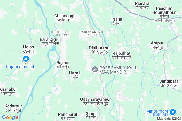
Rampur-dihibhusut Asanda
Rampur-dihibhusut Asanda Map
EDIT Map
Add Your House
 ..
..
Current Corona Virus Infected Patients Count in Howrah District
| City Name | District Name | Total Covid cases |
|---|---|---|
| Howrah District | Howrah | 1 |
Locality Name :
Rampur-dihibhusut Asanda
( Rampur-দিহিভূসুট বাসন্ডা )
Block Name : Udaynarayanpur
District : Howrah
State : West Bengal
Division : Presidency
Language : Bengali and English
Current Time 07:03 PM
Date: Friday , May 02,2025 (IST)
Time zone: IST (UTC+5:30)
Elevation / Altitude: 7 meters. Above Seal level
Telephone Code / Std Code: 03212
Assembly constituency : Udaynarayanpur assembly constituency
Assembly MLA : Samir Kumar Panja
Lok Sabha constituency : Uluberia parliamentary constituency
Parliament MP : SAJDA AHMED
Serpanch Name :
Pin Code : 711226
Post Office Name : Udaynarayanpur
Commodities Prices : Champadanga Market / Mandi
Rampur-dihibhusut Asanda Live Weather
Temperature: 30.6 °C
clear sky
Humidity: 42%
Wind : 3.28 mt/sec towards NE
StationName : "Tarakeswar"
observed on 12 Mins Back
Temperature: 30.6 °C
clear sky
Humidity: 42%
Wind : 3.28 mt/sec towards NE
StationName : "Tarakeswar"
observed on 12 Mins Back
Rampur-dihibhusut Asanda Weather Forecast for Next 5 days
03-05-2025
26.3°C to 31.5°C
clear sky
26.3°C to 31.5°C
clear sky
04-05-2025
21.4°C to 36.8°C
clear sky, broken clouds, moderate rain, heavy intensity rain, overcast clouds, scattered clouds
21.4°C to 36.8°C
clear sky, broken clouds, moderate rain, heavy intensity rain, overcast clouds, scattered clouds
05-05-2025
23.3°C to 37.3°C
few clouds, clear sky, light rain, broken clouds
23.3°C to 37.3°C
few clouds, clear sky, light rain, broken clouds
06-05-2025
25.9°C to 39.4°C
scattered clouds, clear sky, few clouds, light rain, broken clouds, overcast clouds
25.9°C to 39.4°C
scattered clouds, clear sky, few clouds, light rain, broken clouds, overcast clouds
07-05-2025
27.2°C to 40.6°C
overcast clouds, scattered clouds, few clouds, light rain
27.2°C to 40.6°C
overcast clouds, scattered clouds, few clouds, light rain
National Highways Reachable To Rampur-dihibhusut Asanda
Nationa High Way :NH12
Nationa High Way :NH34
Nationa High Way :NH12
Nationa High Way :NH34
About Rampur-dihibhusut Asanda
Correct below Info and add more info about Rampur-dihibhusut AsandaRampur-dihibhusut Asanda is a Village in Udaynarayanpur Block in Howrah District of West Bengal State, India. It belongs to Presidency Division . It is located 47 KM towards west from District head quarters Howrah. 10 KM from Harali Udaynarayanpur. 53 KM from State capital Kolkata
Rampur-dihibhusut Asanda Pin code is 711226 and postal head office is Udaynarayanpur .
Singti ( 8 KM ) , Pancharul ( 8 KM ) , Harishpur ( 9 KM ) , Kanupat Mansuka ( 12 KM ) , Debipur ( 12 KM ) are the nearby Villages to Rampur-dihibhusut Asanda. Rampur-dihibhusut Asanda is surrounded by Udaynarayanpur Block towards South , Pursurah Block towards North , Khanakul-I Block towards west , Tarakeswar Block towards North .
Tarakeswar , Arambagh , Panchla , Monoharpur are the near by Cities to Rampur-dihibhusut Asanda.
This Place is in the border of the Howrah District and Hooghly District. Hooghly District Jangipara is East towards this place .
Demographics of Rampur-dihibhusut Asanda
Bengali is the Local Language here.Politics in Rampur-dihibhusut Asanda
CPM , CPI(M) , AITC , All India Trinamool Congress are the major political parties in this area.Polling Stations /Booths near Rampur-dihibhusut Asanda
1)Anulia Mahamaya Vidyamandir R-12)Asanda Adarsha Siksha Sadan R-2
3)Ramchandrapur Sc Pry School R-1
4)Rampur Board Primary School (room - 1)
5)Asanda Adarsha Siksha Sadan R-1
HOW TO REACH Rampur-dihibhusut Asanda
By Rail
There is no railway station near to Rampur-dihibhusut Asanda in less than 10 km.Schools near Rampur-dihibhusut Asanda
Khalatpur High Madrasa
Address : rampur dehibhursat asanda/viii , udaynarayanpur , haora , West Bengal . PIN- 712408 , Post - Rajbalhat
Bireswar Balika Vidyalaya
Address : harali-u.n.pur/xiv , udaynarayanpur , haora , West Bengal . PIN- 711226 , Post - Udaynarayanpur
Kanupat Pallimangal Harendra S
Address : kanupat-monsuka/i , udaynarayanpur , haora , West Bengal . PIN- 711412 , Post - Chitrasenpur
Ashanda Adarsha Sikshasadan
Address : rampur dehibhursat asanda/i , udaynarayanpur , haora , West Bengal . PIN- 712408 , Post - Rajbalhat
Govt Health Centers near Rampur-dihibhusut Asanda
1) Rampur PHC SC , , Adhikari Para , attached to Dehibhursut PHC2) Dehibhursuit SC , , Bauri Para , Hospital
3) Panthahari SC , PANTHAHARI SUB-CENTER , , PANTHAHARI PRIMARY SCHOOL
Hospitals in Rampur-dihibhusut Asanda,Udaynarayanpur
Spandan Diagnostic Centre
Birkulti - Joynagar Rd; Udaynarayanpur; West Bengal 711226; India
5.3 KM distance Detail
John Diagnostic Centre
Harali - Udaynarayanpur Road; Udaynarayanpur; West Bengal 711226; India
5.3 KM distance Detail
more ..
Petrol Bunks in Rampur-dihibhusut Asanda,Udaynarayanpur
Udaynarayanpur Petrol Diesel Station
Udaynarayanpur; West Bengal 711226; India
5.2 KM distance Detail
more ..
Colleges in Rampur-dihibhusut Asanda,Udaynarayanpur
Udaynarayanpur Madhabilata Mahavidyalaya
Udaynarayanpur-Jagatballabhpur 1; West Bengal 711226; India
5.4 KM distance Detail
Raja Rammohan Roy Primary Teachers Training Institute
Radhanagar; Khanakul; West Bengal 712418; India
12.7 KM distance Detail
more ..
Electronic Shops in Rampur-dihibhusut Asanda,Udaynarayanpur
কমলা ডেকৱেটাৱ এন্ড ইলেকটিক
Balipur Bazar Rd; Balipur; West Bengal 712412; India
3.2 KM distance Detail
Swastim Electrical Stor
Harali - Udaynarayanpur Road; Ambagan; Udaynarayanpur; West Bengal 711226; India
4.6 KM distance Detail
Police Stations near Rampur-dihibhusut Asanda,Udaynarayanpur
Udaynarayanpur Police Station
Harali-Udaynarayanpur Road; Near BDO Office; Udaynarayanpur; West Bengal 711226; India
5.2 KM distance Detail
Governement Offices near Rampur-dihibhusut Asanda,Udaynarayanpur
GST SOLUTIONS
Nobonari Tala P. School; Udaynarayanpur; West Bengal 711226; India
4.4 KM distance Detail
R I Office For Khajna In Udaynarayanpur
Udaynarayanpur; West Bengal 711226; India
5.2 KM distance Detail
About Rampur-dihibhusut Asanda &
History
How to reach Rampur-dihibhusut Asanda
Tourist Places Near By Rampur-dihibhusut Asanda
Schools in Rampur-dihibhusut Asanda
Colleges in Rampur-dihibhusut Asanda
Temperature & weather of Rampur-dihibhusut Asanda
places in Rampur-dihibhusut Asanda
Rampur-dihibhusut Asanda photos
More Information
How to reach Rampur-dihibhusut Asanda
Tourist Places Near By Rampur-dihibhusut Asanda
Schools in Rampur-dihibhusut Asanda
Colleges in Rampur-dihibhusut Asanda
Temperature & weather of Rampur-dihibhusut Asanda
places in Rampur-dihibhusut Asanda
Rampur-dihibhusut Asanda photos
More Information
Village Talk
Post News or Events about this Village
Near Cities
Tarakeswar 16 KM near
Arambagh 26 KM near
Panchla 33 KM near
Monoharpur 39 KM near
Tarakeswar 16 KM near
Arambagh 26 KM near
Panchla 33 KM near
Monoharpur 39 KM near
Near By Taluks
Jangipara 8 KM near
Udaynarayanpur 9 KM near
Pursurah 11 KM near
Khanakul-I 12 KM near
Jangipara 8 KM near
Udaynarayanpur 9 KM near
Pursurah 11 KM near
Khanakul-I 12 KM near
Near By Air Ports
Netaji Subhas Chandra Bose Airport 55 KM near
Ranchi Airport 311 KM near
Bhubaneswar Airport 399 KM near
Singerbhil Airport 400 KM near
Netaji Subhas Chandra Bose Airport 55 KM near
Ranchi Airport 311 KM near
Bhubaneswar Airport 399 KM near
Singerbhil Airport 400 KM near
Near By Tourist Places
Shankarpur 21 KM near
Howrah 39 KM near
Jairambati 44 KM near
Alipore 50 KM near
Kolkata 51 KM near
Shankarpur 21 KM near
Howrah 39 KM near
Jairambati 44 KM near
Alipore 50 KM near
Kolkata 51 KM near
Near By Districts
Howrah 44 KM near
Hooghly 51 KM near
Kolkata 52 KM near
24 Paraganas South 56 KM near
Howrah 44 KM near
Hooghly 51 KM near
Kolkata 52 KM near
24 Paraganas South 56 KM near
Near By RailWay Station
Uluberia Rail Way Station 38 KM near
Seoraphuli Junction Rail Way Station 41 KM near
Uluberia Rail Way Station 38 KM near
Seoraphuli Junction Rail Way Station 41 KM near