| Home | City Bus | Maps | Villages | Cities | Rail | Tourist Places | School | College | Pin Codes | Corona Cases Count |
| Distance Calculator Bus Services IFSC Codes Trace Mobile Number Weather Search Place Trace IP Available Cash ATM/Banks Locate Polling Booth Report an Error contact People |
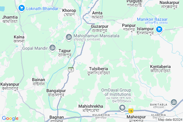
Khardah
Khardah Map
EDIT Map
Add Your House
 ..
..
Current Corona Virus Infected Patients Count in Howrah District
| City Name | District Name | Total Covid cases |
|---|---|---|
| Howrah District | Howrah | 1 |
Locality Name :
Khardah
( খড়দহ )
Block Name : Amta-i
District : Howrah
State : West Bengal
Division : Presidency
Language : Bengali and English
Current Time 07:31 PM
Date: Saturday , May 03,2025 (IST)
Time zone: IST (UTC+5:30)
Elevation / Altitude: 6 meters. Above Seal level
Telephone Code / Std Code: 03214
Assembly constituency : Uluberia Uttar assembly constituency
Assembly MLA : Dr. Nirmal Maji
Lok Sabha constituency : Uluberia parliamentary constituency
Parliament MP : SAJDA AHMED
Serpanch Name :
Pin Code : 711401
Post Office Name : Amta
Commodities Prices : Uluberia Market / Mandi
Khardah Live Weather
Temperature: 28.9 °C
scattered clouds
Humidity: 60%
Wind : 6.09 mt/sec towards S
StationName : "Ä\u0080mta"
observed on Now
Temperature: 28.9 °C
scattered clouds
Humidity: 60%
Wind : 6.09 mt/sec towards S
StationName : "Ä\u0080mta"
observed on Now
Khardah Weather Forecast for Next 5 days
04-05-2025
25.8°C to 28.4°C
scattered clouds, few clouds
25.8°C to 28.4°C
scattered clouds, few clouds
05-05-2025
25.5°C to 37.2°C
clear sky, broken clouds, few clouds, light rain
25.5°C to 37.2°C
clear sky, broken clouds, few clouds, light rain
06-05-2025
27.3°C to 38.5°C
few clouds, clear sky, light rain, broken clouds
27.3°C to 38.5°C
few clouds, clear sky, light rain, broken clouds
07-05-2025
27.8°C to 40.1°C
few clouds, clear sky, broken clouds, overcast clouds
27.8°C to 40.1°C
few clouds, clear sky, broken clouds, overcast clouds
08-05-2025
28.2°C to 40.4°C
broken clouds, overcast clouds, scattered clouds
28.2°C to 40.4°C
broken clouds, overcast clouds, scattered clouds
Edit below overview about Khardah
Edit below overview about Khardah
OverView of Khardah
Khardah High School (Amta, Howrah-711 401) :-Howrah Rly. Station to Kulgachia Stn. and Kulgachia to Tulsiberia by BUS and 15 to 20 minutes to rich Khardah High School, by walk via Tulsiberia Village.Edit below overview about Khardah
National Highways Reachable To Khardah
Nationa High Way :NH12
Nationa High Way :NH12
Rivers Near Khardah
Damodar
Damodar
About Khardah
Khardah is a Village in Amta-i Block in Howrah District of West Bengal State, India. It belongs to Presidency Division . It is located 36 KM towards west from District head quarters Howrah. 8 KM from Amta. 43 KM from State capital Kolkata
Khardah Pin code is 711401 and postal head office is Amta .
Tajpur ( 3 KM ) , Bangalpur ( 6 KM ) , Kusberia ( 6 KM ) , Chandipur ( 6 KM ) , Amta ( 6 KM ) are the nearby Villages to Khardah. Khardah is surrounded by Amta-I Block towards North , Uluberia-Ii Block towards East , Bagnan-Ii Block towards South , Amta-Ii Block towards west .
Uluberia , Panchla , Tamluk , Howrah are the near by Cities to Khardah.
Demographics of Khardah
Bengali is the Local Language here.Politics in Khardah
CPM , CPI(M) , AITC , All India Trinamool Congress are the major political parties in this area.Polling Stations /Booths near Khardah
1)Khanpara Pry. School2)Khardaha Final Pry.school (room No. 1)
3)Khardaha Final Pry.school (room No.2)
4)Khardaha High School(r-1)
5)Basudebpur Tapshili Pry. School(r-2)
HOW TO REACH Khardah
By Rail
Amta Rail Way Station , Kulgachia Rail Way Station are the very nearby railway stations to Khardah.Schools near Khardah
Purba Gazipur G.k.b.r.high Sch
Address : udong-ii/iv , amta-i , haora , West Bengal . PIN- 711401 , Post - Amta
Udang Girls High School
Address : udang-i/i , amta-i , haora , West Bengal . PIN- 711401 , Post - Amta
Baramahara Jatindra Vidyapith
Address : khosalpur/x , amta-i , haora , West Bengal . PIN- 711401 , Post - Amta
Siberhana High School
Address : khardah/v , amta-i , haora , West Bengal . PIN- 711316 , Post - Uluberia R.S
Govt Health Centers near Khardah
1) Uluberia Sub Divisional Hospital , ULUBERIA STATION ROAD , ULUBERIA BAZARPARA , OPP. ULUBERIA I, BLOCK DEVELOPMENT OFFICE2) Mugkalyan BPHC SC , , Sahora , Mugkalyan-Benapur G.P
3) Ajangachi SC , , Takipara , Kashmoli gp office
Petrol Bunks in Khardah,Amta-i
JAIPUR SERVICE STATION
KHARIOP;JAIPUR;HOWRAH; HOWRAH; West Bengal 711401; India
5.1 KM distance Detail
HP PETROL PUMP - SHIVAM SERVICE STATION
Amta Betai Bridge Appch Amta PO; Amta Rd; Kolkata; West Bengal 711401; India
5.1 KM distance Detail
M/s Ganaraj Filling Station.
Amta-Udaynarayanpur Rd; Amta; West Bengal 711401; India
5.3 KM distance Detail
more ..
Colleges in Khardah,Amta-i
TULSIBERIA YOUTH COMPUTER TRANING CENTRE
Kulgachia Tulsiberia Rd; Tulsiberia; West Bengal 711401; India
1.9 KM distance Detail
Hilful Fuzul College Of Education And Research ( B Ed)
Hilful Fuzul College Of Education And Research Olanpara; Bagnan; West Bengal 711303; India
2.4 KM distance Detail
Hilful Fuzul College Of Education And Research
olanpara; West Bengal 711303; India
4.7 KM distance Detail
more ..
Schools in Khardah,Amta-i
Khardah Final Prathamik Vidyalaya খড়দহ ফাইনাল প্রাথমিক বিদ্যালয়
Khardaha; West Bengal 711401; India
0.4 KM distance Detail
Tulsiberia West Primary School
Udang-Tulshiberia Rd; Tulsiberia; West Bengal 711401; India
1.0 KM distance Detail
Super Markets in Khardah,Amta-i
maatara elctronic
super market; Mata Monmohini Nagar; Kadam Tala; Howrah; West Bengal 711101; India
6.4 KM distance Detail
About Khardah &
History
How to reach Khardah
Tourist Places Near By Khardah
Schools in Khardah
Colleges in Khardah
Temperature & weather of Khardah
places in Khardah
Khardah photos
More Information
How to reach Khardah
Tourist Places Near By Khardah
Schools in Khardah
Colleges in Khardah
Temperature & weather of Khardah
places in Khardah
Khardah photos
More Information
Village Talk
Post News or Events about this Village
Near Cities
Uluberia 13 KM near
Panchla 15 KM near
Tamluk 29 KM near
Howrah 31 KM near
Uluberia 13 KM near
Panchla 15 KM near
Tamluk 29 KM near
Howrah 31 KM near
Near By Taluks
Amta-I 7 KM near
Bagnan-I 8 KM near
Uluberia-Ii 9 KM near
Bagnan-Ii 11 KM near
Amta-I 7 KM near
Bagnan-I 8 KM near
Uluberia-Ii 9 KM near
Bagnan-Ii 11 KM near
Near By Air Ports
Netaji Subhas Chandra Bose Airport 51 KM near
Ranchi Airport 323 KM near
Bhubaneswar Airport 380 KM near
Singerbhil Airport 407 KM near
Netaji Subhas Chandra Bose Airport 51 KM near
Ranchi Airport 323 KM near
Bhubaneswar Airport 380 KM near
Singerbhil Airport 407 KM near
Near By Tourist Places
Howrah 30 KM near
Shankarpur 33 KM near
Alipore 36 KM near
Kolkata 41 KM near
Raichak 41 KM near
Howrah 30 KM near
Shankarpur 33 KM near
Alipore 36 KM near
Kolkata 41 KM near
Raichak 41 KM near
Near By Districts
Medinipur East 31 KM near
Howrah 35 KM near
Kolkata 38 KM near
24 Paraganas South 40 KM near
Medinipur East 31 KM near
Howrah 35 KM near
Kolkata 38 KM near
24 Paraganas South 40 KM near
Near By RailWay Station
Amta Rail Way Station 5.9 KM near
Harishdadpur P.h. Rail Way Station 7.1 KM near
Kulgachia Rail Way Station 7.5 KM near
Uluberia Rail Way Station 11 KM near
Mecheda Rail Way Station 22 KM near
Amta Rail Way Station 5.9 KM near
Harishdadpur P.h. Rail Way Station 7.1 KM near
Kulgachia Rail Way Station 7.5 KM near
Uluberia Rail Way Station 11 KM near
Mecheda Rail Way Station 22 KM near