| Home | City Bus | Maps | Villages | Cities | Rail | Tourist Places | School | College | Pin Codes | Corona Cases Count |
| Distance Calculator Bus Services IFSC Codes Trace Mobile Number Weather Search Place Trace IP Available Cash ATM/Banks Locate Polling Booth Report an Error contact People |
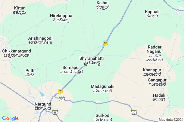
Bhiranahatti Map
EDIT Map
Add Your House
 ..
..
Current Corona Virus Infected Patients Count in Gadag District
| City Name | District Name | Total Covid cases |
|---|---|---|
| Gadag District | Gadag | 4 |
Locality Name :
Bhiranahatti
( ಭಿರನಹಟ್ಟಿ )
Taluk Name : Naragund
District : Gadag
State : Karnataka
Division : Belgaum
Language : Kannada and English & Hindi
Current Time 06:54 AM
Date: Saturday , May 03,2025 (IST)
Time zone: IST (UTC+5:30)
Elevation / Altitude: 596 meters. Above Seal level
Telephone Code / Std Code: 08380
Assembly constituency : Nargund assembly constituency
Assembly MLA : C. C. Patil
Lok Sabha constituency : Bagalkot parliamentary constituency
Parliament MP : Gaddigoudar Parvatagouda Chandanagouda
Serpanch Name :
Pin Code : 582207
Post Office Name : Nargund
Alternate Village Name : Bhiranahatti
Commodities Prices : Nargunda Market / Mandi
Bhiranahatti Live Weather
Temperature: 24.8 °C
clear sky
Humidity: 75%
Wind : 3.47 mt/sec towards W
StationName : "Nargund"
observed on Now
Temperature: 24.8 °C
clear sky
Humidity: 75%
Wind : 3.47 mt/sec towards W
StationName : "Nargund"
observed on Now
Bhiranahatti Weather Forecast for Next 5 days
04-05-2025
25.4°C to 37.9°C
clear sky, few clouds, scattered clouds, broken clouds
25.4°C to 37.9°C
clear sky, few clouds, scattered clouds, broken clouds
05-05-2025
24.0°C to 37.5°C
broken clouds, clear sky
24.0°C to 37.5°C
broken clouds, clear sky
06-05-2025
25.2°C to 37.9°C
few clouds, clear sky
25.2°C to 37.9°C
few clouds, clear sky
07-05-2025
26.9°C to 37.8°C
scattered clouds, few clouds, clear sky, broken clouds
26.9°C to 37.8°C
scattered clouds, few clouds, clear sky, broken clouds
08-05-2025
26.0°C to 36.2°C
broken clouds, scattered clouds, overcast clouds
26.0°C to 36.2°C
broken clouds, scattered clouds, overcast clouds
National Highways Reachable To Bhiranahatti
Nationa High Way :NH367
Nationa High Way :NH367
Rivers Near Bhiranahatti
Handigana Halla :ಹಂದಿಗನ ಹಳ್ಳ
Bennihalla :ಬೆಣ್ಣಿಹಳ್ಳ
Handigana Halla :ಹಂದಿಗನ ಹಳ್ಳ
Bennihalla :ಬೆಣ್ಣಿಹಳ್ಳ
About Bhiranahatti
Correct below Info and add more info about BhiranahattiBhiranahatti is a Village in Naragund Taluk in Gadag District of Karnataka State, India. It belongs to Belgaum Division . It is located 50 KM towards North from District head quarters Gadag. 5 KM from Naragund. 454 KM from State capital Bangalore
Bhiranahatti Pin code is 582207 and postal head office is Nargund .
Hadli ( 10 KM ) , Radder-naganur ( 11 KM ) , Chikkanaragund ( 12 KM ) , Yavagal ( 13 KM ) , Vasan ( 13 KM ) are the nearby Villages to Bhiranahatti. Bhiranahatti is surrounded by Navalgund Taluk towards South , Ramdurg Taluk towards North , Ron Taluk towards East , Badami Taluk towards East .
Nargund , Navalgund , Ramdurg , Ron are the near by Cities to Bhiranahatti.
Demographics of Bhiranahatti
Kannada is the Local Language here.Politics in Bhiranahatti
Bharatiya Janata Party , BJP , Bharatiya Janata Party (BJP) , INC are the major political parties in this area.Polling Stations /Booths near Bhiranahatti
1)Govt. Kannada Higher Primary Boys School (left Wing) Bhairanahatti2)Govt. Kannada Higher Primary School Papanashi
3)Govt. Kannada Higher Primary Boys School Left Wing Hunasikatti
4)Govt. Kannada Higher Primary Boys School No.3 Room No. 8 Naragund
5)Govt. Kannada Higher Primary Boys School No. 3 Room No. 2 Somapur Naragund
HOW TO REACH Bhiranahatti
By Rail
There is no railway station near to Bhiranahatti in less than 10 km. are the Rail way stations reachable from near by towns.By Road
Nargund are the nearby by towns to Bhiranahatti having road connectivity to BhiranahattiColleges near Bhiranahatti
Governnent Puc College
Address : Jg155
Sss Pu Callege
Address :
Sss College
Address :
Govt Pu College
Address :
Govt Pu College
Address :
Schools near Bhiranahatti
Muraj Desai Resi School Naragd
Address : naragund , naragund , gadag , Karnataka . PIN- 582207 , Post - Nargund
Navodaya English Med Hs Naragund
Address : naragund , naragund , gadag , Karnataka . PIN- 582207 , Post - Nargund
Lions English Med Hs Naragund
Address : naragund , naragund , gadag , Karnataka . PIN- 582207 , Post - Nargund
Ghps Khanapur
Address : khanapur , naragund , gadag , Karnataka . PIN- 582207 , Post - Nargund
Govt Health Centers near Bhiranahatti
1) Hebasur , Govrment Sub Center Building , Hebsur Main Road , Hebsur2) Kiresur , Govrment Sub Center Building , Kiresur , Hubli Bijapur Road
3) Ingalahalli A , Rentbuilding Ingalahalli A , Ingalahalli A , Govrnament School Near Ingalahalli A
Hospitals in Bhiranahatti,Naragund
Basaveshwara Medical
Hanuman Temple; Kere Rd; Tirlapur; Karnataka 582208; India
10.8 KM distance Detail
Siddheshwar Clinic Paralysis Hospital
Chikkanargund; Karnataka 582207; India
12.5 KM distance Detail
Dr Hanumanta Rao
Konnur Post; District Gadag; Vasan; Karnataka 582206; India
13.1 KM distance Detail
more ..
Petrol Bunks in Bhiranahatti,Naragund
Hindustan Petroleum
Konnur; Belgaum; NH-218; Gulbarga Bijapur Hubli Road; Gadag; Gadag; Karnataka 582206; India
12.2 KM distance Detail
HP PETROL PUMP - SHRI NAGARESHWAR OIL DISTRIBUT
AT Nargund; Hubli-bijapur Road; NH-218; Konnur; Taluk Nargund;; Belgaum; Karnataka 582206; India
12.3 KM distance Detail
Indian Oil Petrol Pump
Vasan; Belgaum; SH-83; Salahalli Konnur Shirol Holealur Ron Road; Gadag; Gadag; Karnataka 582207; India
12.3 KM distance Detail
more ..
Colleges in Bhiranahatti,Naragund
Composite Pre University Arts and Commerce College
Konnur; Nargund; Belgaum; NH-218; Gulbarga Bijapur Hubli Road; Gadag; Gadag; Karnataka 582206; India
12.4 KM distance Detail
more ..
Schools in Bhiranahatti,Naragund
Government High School
Nargund; Gadag; NH-218; Gulbarga Bijapur Hubli Road; Gadag; Gadag; Karnataka 582206; India
0.1 KM distance Detail
Government Primary School
Nargund; Gadag; NH-218; Gulbarga Bijapur Hubli Road; Gadag; Gadag; Karnataka 582206; India
2.1 KM distance Detail
Higher Primary School; Udachammanagar
Chikkoppa S.K.; Karnataka 591127; India
3.2 KM distance Detail
Super Markets in Bhiranahatti,Naragund
Beeralingeshwar Photo And Xerox Center Konnur
Gadag; Karnataka 582206; India
13.6 KM distance Detail
Local Parks in Bhiranahatti,Naragund
Police Stations near Bhiranahatti,Naragund
Ramdurga Police Station
Sureban out post ;Ramdurga Taluq; Sureban; Karnataka 591127; India
17.1 KM distance Detail
About Bhiranahatti &
History
How to reach Bhiranahatti
Tourist Places Near By Bhiranahatti
Schools in Bhiranahatti
Colleges in Bhiranahatti
Temperature & weather of Bhiranahatti
places in Bhiranahatti
Bhiranahatti photos
More Information
How to reach Bhiranahatti
Tourist Places Near By Bhiranahatti
Schools in Bhiranahatti
Colleges in Bhiranahatti
Temperature & weather of Bhiranahatti
places in Bhiranahatti
Bhiranahatti photos
More Information
Village Talk
Post News or Events about this Village
Near Cities
Nargund 9 KM near
Navalgund 26 KM near
Ramdurg 27 KM near
Ron 37 KM near
Nargund 9 KM near
Navalgund 26 KM near
Ramdurg 27 KM near
Ron 37 KM near
Near By Taluks
Naragund 5 KM near
Navalgund 29 KM near
Ramdurg 30 KM near
Ron 36 KM near
Naragund 5 KM near
Navalgund 29 KM near
Ramdurg 30 KM near
Ron 36 KM near
Near By Air Ports
Hubli Airport 66 KM near
Sambre Airport 99 KM near
Kolhapur Airport 173 KM near
Dabolim Airport 197 KM near
Hubli Airport 66 KM near
Sambre Airport 99 KM near
Kolhapur Airport 173 KM near
Dabolim Airport 197 KM near
Near By Tourist Places
Badami 33 KM near
Pattadakkal 50 KM near
Aihole 61 KM near
Hubli 66 KM near
Dandeli 107 KM near
Badami 33 KM near
Pattadakkal 50 KM near
Aihole 61 KM near
Hubli 66 KM near
Dandeli 107 KM near
Near By Districts
Gadag 48 KM near
Bagalkot 58 KM near
Dharwad 64 KM near
Koppal 101 KM near
Gadag 48 KM near
Bagalkot 58 KM near
Dharwad 64 KM near
Koppal 101 KM near
Near By RailWay Station
Badami Rail Way Station 30 KM near
Annigeri Rail Way Station 42 KM near
Badami Rail Way Station 30 KM near
Annigeri Rail Way Station 42 KM near