| Home | City Bus | Maps | Villages | Cities | Rail | Tourist Places | School | College | Pin Codes | Corona Cases Count |
| Distance Calculator Bus Services IFSC Codes Trace Mobile Number Weather Search Place Trace IP Available Cash ATM/Banks Locate Polling Booth Report an Error contact People |
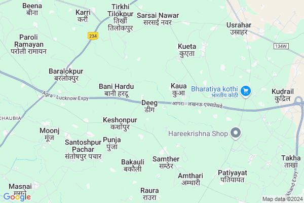
Deeg
Deeg Map
EDIT Map
Add Your House
 ..
..
Current Corona Virus Infected Patients Count in Etawah District
| City Name | District Name | Total Covid cases |
|---|---|---|
| Etawah District | Etawah | 4 |
Locality Name :
Deeg
( डीग )
Block Name : Takha
District : Etawah
State : Uttar Pradesh
Division : Kanpur
Language : Hindi and Urdu
Current Time 04:30 PM
Date: Thursday , May 01,2025 (IST)
Time zone: IST (UTC+5:30)
Elevation / Altitude: 147 meters. Above Seal level
Telephone Code / Std Code: 05680
Assembly constituency : Jaswantnagar assembly constituency
Assembly MLA : Shivpal Singh Yadav
Lok Sabha constituency : Mainpuri parliamentary constituency
Parliament MP : MULAYAM SINGH YADAV
Serpanch Name :
Pin Code : 206123
Post Office Name : Baralokpur
Commodities Prices : Bharthna Market / Mandi
Deeg Live Weather
Temperature: 38.7 °C
clear sky
Humidity: 17%
Wind : 4.55 mt/sec towards E
StationName : "Kishni"
observed on 2 Hours Back
Temperature: 38.7 °C
clear sky
Humidity: 17%
Wind : 4.55 mt/sec towards E
StationName : "Kishni"
observed on 2 Hours Back
Deeg Weather Forecast for Next 5 days
02-05-2025
30.9°C to 39.1°C
clear sky
30.9°C to 39.1°C
clear sky
03-05-2025
29.0°C to 42.1°C
clear sky, scattered clouds, few clouds, overcast clouds
29.0°C to 42.1°C
clear sky, scattered clouds, few clouds, overcast clouds
04-05-2025
30.0°C to 42.6°C
overcast clouds, broken clouds, scattered clouds, clear sky, light rain
30.0°C to 42.6°C
overcast clouds, broken clouds, scattered clouds, clear sky, light rain
05-05-2025
29.3°C to 41.5°C
broken clouds, overcast clouds
29.3°C to 41.5°C
broken clouds, overcast clouds
06-05-2025
27.7°C to 42.5°C
broken clouds, overcast clouds, scattered clouds
27.7°C to 42.5°C
broken clouds, overcast clouds, scattered clouds
National Highways Reachable To Deeg
Nationa High Way :NH34
Nationa High Way :NH34
About Deeg
Correct below Info and add more info about DeegDeeg is a Village in Takha Block in Etawah District of Uttar Pradesh State, India. It belongs to Kanpur Division . It is located 30 KM towards East from District head quarters Etawah. 6 KM from Takha. 199 KM from State capital Lucknow
Deeg Pin code is 206123 and postal head office is Baralokpur .
Keshonpur ( 2 KM ) , Bani Hardu ( 2 KM ) , Punja ( 4 KM ) , Samther ( 4 KM ) , Hidupur Baidpur ( 4 KM ) are the nearby Villages to Deeg. Deeg is surrounded by Basrehar Block towards west , Bharthana Block towards South , Erwa Katra Block towards East , Kishni Block towards North .
Bharthana , Etawah , Achhalda , Sikanderpur are the near by Cities to Deeg.
This Place is in the border of the Etawah District and Auraiya District. Auraiya District Erwa Katra is East towards this place . Also it is in the Border of other district Mainpuri .
Deeg 2011 Census Details
Deeg Local Language is Hindi. Deeg Village Total population is 3453 and number of houses are 600. Female Population is 43.6%. Village literacy rate is 65.5% and the Female Literacy rate is 24.1%.
Population
| Census Parameter | Census Data |
| Total Population | 3453 |
| Total No of Houses | 600 |
| Female Population % | 43.6 % ( 1505) |
| Total Literacy rate % | 65.5 % ( 2261) |
| Female Literacy rate | 24.1 % ( 831) |
| Scheduled Tribes Population % | 0.0 % ( 0) |
| Scheduled Caste Population % | 16.0 % ( 552) |
| Working Population % | 27.0 % |
| Child(0 -6) Population by 2011 | 508 |
| Girl Child(0 -6) Population % by 2011 | 43.5 % ( 221) |
Deeg Census More Deatils.
Politics in Deeg
SP , BSP , INC are the major political parties in this area.Polling Stations /Booths near Deeg
1)Primary School Kathua2)Primary School Kurakhar
3)Kannya Primary School Gangapur
4)Kanya Junior High School Samthar East
5)Primary School Banamai
HOW TO REACH Deeg
By Rail
There is no railway station near to Deeg in less than 10 km.Colleges near Deeg
Nandram Ramchandra Inter College Nandgaon Takha Etawah
Address :
Lala Siya Ram Inter Collage Etawah
Address :
Schools near Deeg
Smt I. Gandhi I C Khargupur
Address : kharagpur saraiya , takha , etawah , Uttar Pradesh . PIN- 206123 , Post - Baralokpur
S.b.s.i.c. Nagaria Yadavan
Address : nagaria yadavan , takha , etawah , Uttar Pradesh . PIN- 206242 , Post - Bharthana
C.j.s.i.c. Sutyani
Address : sutyani , takha , etawah , Uttar Pradesh . PIN- 206132
Lala Siyaram I C Sarsainawar
Address : sarsai nawar , takha , etawah , Uttar Pradesh . PIN- 206123 , Post - Baralokpur
Govt Health Centers near Deeg
1) Udaypur kala , SUB CENTRE UDAYPUR KALA , UDAYPURKALA 22098 ON MCTS , PRIMARY SCHOOL UDAYPUR KALA2) PHC Umrain , Umain , sutyani road ,
3) Killi , 8683(MCTS) , Killi , PRIMARI SCHOOL
Sub Villages in Deeg
Hospitals in Deeg,Takha
संत शिरोमणि श्री रविदास औषधालय
village-:SANTOSHPUR PACHAR; Punja; Uttar Pradesh 206123; India
6.2 KM distance Detail
more ..
Petrol Bunks in Deeg,Takha
Indian Oil Petrol Pump
Baralokpur; Etawah; NH-92; Farrukhabad Road; Etawah; Etawah; Uttar Pradesh 206123; India
6.8 KM distance Detail
more ..
Colleges in Deeg,Takha
Devi Dayal Junior High School
Bewar - Etawah Road; Sarsai Nawar; Uttar Pradesh 206123; India
6.5 KM distance Detail
more ..
Electronic Shops in Deeg,Takha
Hirdesh Mobale Center
Sidharthnagar; Sarsai Nawar; Uttar Pradesh 206123; India
6.7 KM distance Detail
Super Markets in Deeg,Takha
Sakshi computers
Usrahar Road; deshi theka; Sarsai Nawar; Uttar Pradesh 206123; India
6.8 KM distance Detail
Think Big Area ( Yadav Nagar )
NH234; Baralokpur; Uttar Pradesh 206123; India
7.2 KM distance Detail
DHL fu kvh
Kishani - Usrahar - Bharthana Road; Rudauli; Uttar Pradesh 206242; India
7.3 KM distance Detail
About Deeg &
History
How to reach Deeg
Tourist Places Near By Deeg
Schools in Deeg
Colleges in Deeg
Temperature & weather of Deeg
places in Deeg
Deeg photos
More Information
How to reach Deeg
Tourist Places Near By Deeg
Schools in Deeg
Colleges in Deeg
Temperature & weather of Deeg
places in Deeg
Deeg photos
More Information
Village Talk
Post News or Events about this Village
Near Cities
Bharthana 13 KM near
Etawah 28 KM near
Achhalda 31 KM near
Sikanderpur 49 KM near
Bharthana 13 KM near
Etawah 28 KM near
Achhalda 31 KM near
Sikanderpur 49 KM near
Near By Taluks
Takha 5 KM near
Basrehar 17 KM near
Bharthana 19 KM near
Kishni 21 KM near
Takha 5 KM near
Basrehar 17 KM near
Bharthana 19 KM near
Kishni 21 KM near
Near By Air Ports
Gwalior Airport 135 KM near
Kheria Airport 143 KM near
Kanpur Airport 145 KM near
Amausi Airport 184 KM near
Gwalior Airport 135 KM near
Kheria Airport 143 KM near
Kanpur Airport 145 KM near
Amausi Airport 184 KM near
Near By Tourist Places
Kannauj 79 KM near
Bithur 121 KM near
Kanpur 135 KM near
Agra 139 KM near
Gwalior 144 KM near
Kannauj 79 KM near
Bithur 121 KM near
Kanpur 135 KM near
Agra 139 KM near
Gwalior 144 KM near
Near By Districts
Etawah 29 KM near
Mainpuri 46 KM near
Auraiya 63 KM near
Bhind 63 KM near
Etawah 29 KM near
Mainpuri 46 KM near
Auraiya 63 KM near
Bhind 63 KM near
Near By RailWay Station
Bharthana Rail Way Station 19 KM near
Etawah Junction Rail Way Station 27 KM near
Bharthana Rail Way Station 19 KM near
Etawah Junction Rail Way Station 27 KM near