| Home | City Bus | Maps | Villages | Cities | Rail | Tourist Places | School | College | Pin Codes | Corona Cases Count |
| Distance Calculator Bus Services IFSC Codes Trace Mobile Number Weather Search Place Trace IP Available Cash ATM/Banks Locate Polling Booth Report an Error contact People |
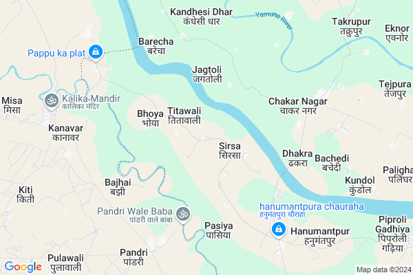
Kola
Kola Map
EDIT Map
Add Your House
 ..
..
Current Corona Virus Infected Patients Count in Etawah District
| City Name | District Name | Total Covid cases |
|---|---|---|
| Etawah District | Etawah | 4 |
Locality Name :
Kola
( कोला )
Block Name : Chakarnagar
District : Etawah
State : Uttar Pradesh
Division : Kanpur
Language : Hindi and Urdu
Current Time 06:31 AM
Date: Saturday , May 03,2025 (IST)
Time zone: IST (UTC+5:30)
Elevation / Altitude: 150 meters. Above Seal level
Telephone Code / Std Code: 05680
Assembly constituency : Bharthana assembly constituency
Assembly MLA : Raghvendra Kumar Singh
Lok Sabha constituency : Etawah parliamentary constituency
Parliament MP : Dr RAM SHANKAR KATHERIA
Serpanch Name :
Pin Code : 206125
Post Office Name : Chakar Nagar
Commodities Prices : Etawah Market / Mandi
Kola Live Weather
Temperature: 27.6 °C
clear sky
Humidity: 36%
Wind : 1.92 mt/sec towards E
StationName : "LakhnÄ\u0081"
observed on 57 Mins Back
Temperature: 27.6 °C
clear sky
Humidity: 36%
Wind : 1.92 mt/sec towards E
StationName : "LakhnÄ\u0081"
observed on 57 Mins Back
Kola Weather Forecast for Next 5 days
04-05-2025
29.0°C to 39.7°C
light rain, overcast clouds, scattered clouds
29.0°C to 39.7°C
light rain, overcast clouds, scattered clouds
05-05-2025
28.4°C to 41.4°C
light rain, overcast clouds, broken clouds, scattered clouds
28.4°C to 41.4°C
light rain, overcast clouds, broken clouds, scattered clouds
06-05-2025
28.6°C to 41.4°C
scattered clouds, few clouds, broken clouds, light rain
28.6°C to 41.4°C
scattered clouds, few clouds, broken clouds, light rain
07-05-2025
28.8°C to 40.8°C
broken clouds, scattered clouds, few clouds, clear sky
28.8°C to 40.8°C
broken clouds, scattered clouds, few clouds, clear sky
08-05-2025
30.1°C to 41.6°C
scattered clouds, clear sky, few clouds
30.1°C to 41.6°C
scattered clouds, clear sky, few clouds
National Highways Reachable To Kola
Nationa High Way :NH552
Nationa High Way :NH552
Rivers Near Kola
Kunwari
Yamuna :যমুনা :યમુના :यमुना :ಯಮುನಾ :यमुना :யமுனை :Ямуна :https://1drv.ms/b/s!Ar-WXIFaX7UdgQuO6WpVrTr6YYsQ
Kunwari
Yamuna :যমুনা :યમુના :यमुना :ಯಮುನಾ :यमुना :யமுனை :Ямуна :https://1drv.ms/b/s!Ar-WXIFaX7UdgQuO6WpVrTr6YYsQ
About Kola
Correct below Info and add more info about KolaKola is a Village in Chakarnagar Block in Etawah District of Uttar Pradesh State, India. It belongs to Kanpur Division . It is located 27 KM towards South from District head quarters Etawah. 12 KM from Chakar Nagar. 223 KM from State capital Lucknow
Kola Pin code is 206125 and postal head office is Chakar Nagar .
Jagtoli ( 3 KM ) , Garhaiya ( 3 KM ) , Bhoya ( 3 KM ) , Dadara ( 3 KM ) , Chakar Nagar ( 5 KM ) are the nearby Villages to Kola. Kola is surrounded by Bhind Block towards west , Mahewa Block towards East , Barhpura Block towards North , Etawah Block towards North .
Bhajanpura , Etawah , Bharthana , Achhalda are the near by Cities to Kola.
Kola 2011 Census Details
Kola Local Language is Hindi. Kola Village Total population is 725 and number of houses are 130. Female Population is 45.8%. Village literacy rate is 69.2% and the Female Literacy rate is 28.3%.
Population
| Census Parameter | Census Data |
| Total Population | 725 |
| Total No of Houses | 130 |
| Female Population % | 45.8 % ( 332) |
| Total Literacy rate % | 69.2 % ( 502) |
| Female Literacy rate | 28.3 % ( 205) |
| Scheduled Tribes Population % | 0.0 % ( 0) |
| Scheduled Caste Population % | 13.9 % ( 101) |
| Working Population % | 21.0 % |
| Child(0 -6) Population by 2011 | 101 |
| Girl Child(0 -6) Population % by 2011 | 51.5 % ( 52) |
Kola Census More Deatils.
Politics in Kola
SP , BSP , INC are the major political parties in this area.Polling Stations /Booths near Kola
1)Primary School Khushalpur2)Primary School Tilokpur
3)Junior High School Sunbarsa (r.n.2)
4)Primary School Sirkora
5)Primary School Gansara South
HOW TO REACH Kola
By Rail
There is no railway station near to Kola in less than 10 km.Colleges near Kola
R.d.pathak Inter Collage
Address :
R.d Pathak Inter Collage,
Address :
Lok Manya Rural Inter Collage,mahewa
Address :
Jansahyogi Inter College Morhi Bharthana
Address :
Ch J S I C Sutiyani
Address :
Schools in Kola
S. Baba Ram Chere M.v. Kola
Address : kola , chakarnagar , etawah , Uttar Pradesh . PIN- 206125 , Post - Chakar Nagar
Govt Health Centers near Kola
1) PHC Bijauli , PHC BIJAULI , 1422 , NEAR BAJAR2) Madaiyan Angdhela , govt building , , out of village
3) Basti Mahewa , SUB CENTRE BASTI MAHEWA , 8749 , NEAR CHC MAHEWA
Petrol Bunks in Kola,Chakarnagar
sanjay singh k.s.k Indian oil petrol pump
chandai; Chakar Nagar; Uttar Pradesh; India
8.0 KM distance Detail
Indian Oil Petrol Pump
Sarai Mithey; Etawah; NH-2; AH 1; Etawah; Etawah; Uttar Pradesh 206124; India
19.9 KM distance Detail
more ..
Colleges in Kola,Chakarnagar
Gaya Prasad Verma Mahavidyalaya
CHAKAR NAGAR; Etawah; Uttar Pradesh 206125; India
5.6 KM distance Detail
more ..
Schools in Kola,Chakarnagar
shri baba ramchere madhyamik school kola chakarnagar etawah
Kola; Uttar Pradesh 206125; India
0.2 KM distance Detail
Shri Baba Ramchere Madhyamik School Kola Sahson Chakarnagar Etawah
Kola; Uttar Pradesh 206125; India
0.5 KM distance Detail
Governement Offices near Kola,Chakarnagar
Up Dak Ghar Bakewar
Bakewar; Etawah; NH-2; AH 1; Etawah; Etawah; Uttar Pradesh 206124; India
19.8 KM distance Detail
About Kola &
History
How to reach Kola
Tourist Places Near By Kola
Schools in Kola
Colleges in Kola
Temperature & weather of Kola
places in Kola
Kola photos
More Information
How to reach Kola
Tourist Places Near By Kola
Schools in Kola
Colleges in Kola
Temperature & weather of Kola
places in Kola
Kola photos
More Information
Village Talk
Post News or Events about this Village
Near Cities
Bhajanpura 22 KM near
Etawah 28 KM near
Bharthana 35 KM near
Achhalda 45 KM near
Bhajanpura 22 KM near
Etawah 28 KM near
Bharthana 35 KM near
Achhalda 45 KM near
Near By Taluks
Chakarnagar 12 KM near
Bhind 17 KM near
Mahewa 19 KM near
Barhpura 27 KM near
Chakarnagar 12 KM near
Bhind 17 KM near
Mahewa 19 KM near
Barhpura 27 KM near
Near By Air Ports
Gwalior Airport 97 KM near
Kheria Airport 141 KM near
Kanpur Airport 153 KM near
Amausi Airport 205 KM near
Gwalior Airport 97 KM near
Kheria Airport 141 KM near
Kanpur Airport 153 KM near
Amausi Airport 205 KM near
Near By Tourist Places
Gwalior 105 KM near
Kannauj 115 KM near
Datia 128 KM near
Sonagir 129 KM near
Bithur 136 KM near
Gwalior 105 KM near
Kannauj 115 KM near
Datia 128 KM near
Sonagir 129 KM near
Bithur 136 KM near
Near By Districts
Etawah 26 KM near
Bhind 28 KM near
Auraiya 53 KM near
Jalaun 60 KM near
Etawah 26 KM near
Bhind 28 KM near
Auraiya 53 KM near
Jalaun 60 KM near
Near By RailWay Station
Etawah Junction Rail Way Station 28 KM near
Bharthana Rail Way Station 30 KM near
Etawah Junction Rail Way Station 28 KM near
Bharthana Rail Way Station 30 KM near