| Home | City Bus | Maps | Villages | Cities | Rail | Tourist Places | School | College | Pin Codes | Corona Cases Count |
| Distance Calculator Bus Services IFSC Codes Trace Mobile Number Weather Search Place Trace IP Available Cash ATM/Banks Locate Polling Booth Report an Error contact People |
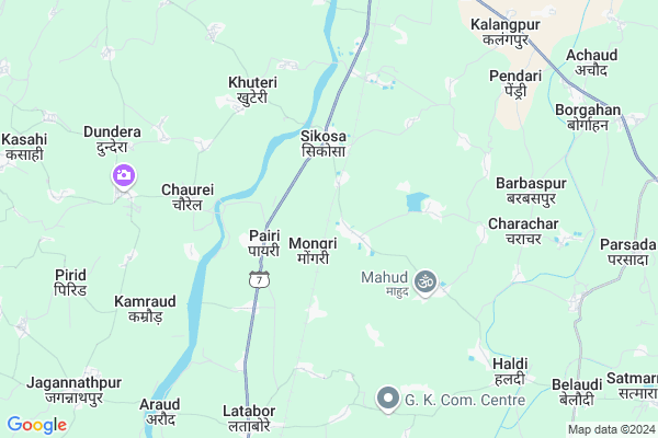
Biretara
Biretara Map
EDIT Map
Add Your House
 ..
..
Current Corona Virus Infected Patients Count in Durg District
| City Name | District Name | Total Covid cases |
|---|---|---|
| Bhilai | Durg | 1 |
Locality Name :
Biretara
( बिरेटर )
Tehsil Name : Gunderdehi
District : Durg
State : Chattisgarh
Language : Chhattisgarhi and Hindi, Urdu
Current Time 10:41 PM
Date: Saturday , May 03,2025 (IST)
Time zone: IST (UTC+5:30)
Elevation / Altitude: 308 meters. Above Seal level
Telephone Code / Std Code: 0788
Assembly constituency : Gunderdehi assembly constituency
Assembly MLA : Kunwer Singh Nishad
Lok Sabha constituency : Kanker parliamentary constituency
Parliament MP : MOHAN MANDAVI
Serpanch Name :
Pin Code : 491335
Post Office Name : Bemetara
Commodities Prices : Balod Market / Mandi
Rivers Near Biretara
Mahanadi :Mahanadi River :महानदी नदी :ಮಹಾನದಿ
Kharun River
Mahanadi :Mahanadi River :महानदी नदी :ಮಹಾನದಿ
Kharun River
About Biretara
Correct below Info and add more info about BiretaraBiretara is a Village in Gunderdehi Tehsil in Durg District of Chattisgarh State, India. It is located 43 KM towards South from District head quarters Durg. 10 KM from Gunderdehi. 67 KM from State capital Raipur
Biretara Pin code is 491335 and postal head office is Bemetara .
Mongari ( 3 KM ) , Sarekha ( 4 KM ) , Bhoinapar ( 4 KM ) , Iragudha ( 5 KM ) , Sikosa ( 5 KM ) are the nearby Villages to Biretara. Biretara is surrounded by Balod Tehsil towards South , Dondilohara Tehsil towards west , Gurur Tehsil towards South , Durg Tehsil towards North .
Balod , Dhamtari , Dalli-Rajhara , Rajnandgaon are the near by Cities to Biretara.
Biretara 2011 Census Details
Biretara Local Language is Chhattisgarhi. Biretara Village Total population is 1091 and number of houses are 222. Female Population is 51.8%. Village literacy rate is 71.9% and the Female Literacy rate is 33.5%.
Population
| Census Parameter | Census Data |
| Total Population | 1091 |
| Total No of Houses | 222 |
| Female Population % | 51.8 % ( 565) |
| Total Literacy rate % | 71.9 % ( 784) |
| Female Literacy rate | 33.5 % ( 366) |
| Scheduled Tribes Population % | 4.7 % ( 51) |
| Scheduled Caste Population % | 6.0 % ( 66) |
| Working Population % | 49.0 % |
| Child(0 -6) Population by 2011 | 147 |
| Girl Child(0 -6) Population % by 2011 | 55.8 % ( 82) |
Biretara Census More Deatils.
Politics in Biretara
Bharatiya Janata Party , BJP , INC are the major political parties in this area.Polling Stations /Booths near Biretara
1)Bijabhatha2)Bhathagaon B
3)Joratrai
4)Achaud
5)Tiloda
HOW TO REACH Biretara
By Rail
Sikosa Rail Way Station , Latabor Rail Way Station are the very nearby railway stations to Biretara.Colleges near Biretara
Demo Mobile Colllege
Address :
Takshshila Mahavidyalaya
Address : Takshshila Mahavidyalayaengineer S Bhawancivic Cen
Mata Karma Arts/comm. College
Address : Gunderdehi, Raipur
Schools in Biretara
Govt Ps
Address : biretara , gunderdehi , durg , Chattisgarh . PIN- 491222 , Post - Sikosa
Govt Health Centers near Biretara
1) SHC Bhothipar , SHC BHOTHIPAR , BHOTHIPAR ,2) SHC Bhathagaon B , SHC BHATHAGAON B , BHATHAGAON B ,
3) SHC Pairi , SHC PAIRI , PAIRI ,
Petrol Bunks in Biretara,Gunderdehi
Aadya Fuels Aroud
sh -7 village around distt; Balod; Chhattisgarh 491226; India
6.5 KM distance Detail
more ..
Colleges in Biretara,Gunderdehi
Goverment College Arjunda
Arjunda; Tehsil Gunderdehi; Balod; Durg; Chhattisgarh 491225; India
12.1 KM distance Detail
more ..
Schools in Biretara,Gunderdehi
Nehru Higher Secondry School Bhathagaon (B)
Biretara; Chhattisgarh 491222; India
1.7 KM distance Detail
Bachpan...a play school
KH NO - 1638; NJ - 12A; Post - Lolesara; Bemetara;; Kawardha Main Road; Bemetara; Dist. Durg.; Durg; Chhattisgarh 491001; India
2.6 KM distance Detail
Sunrise computer of Education center sikosa
Sikosa; Chhattisgarh 491222; India
2.8 KM distance Detail
Governement Offices near Biretara,Gunderdehi
Gram Panchayat Latabod
near bus stand village latabod distt; Balod; Chhattisgarh; India
8.6 KM distance Detail
About Biretara &
History
How to reach Biretara
Tourist Places Near By Biretara
Schools in Biretara
Colleges in Biretara
Temperature & weather of Biretara
places in Biretara
Biretara photos
More Information
How to reach Biretara
Tourist Places Near By Biretara
Schools in Biretara
Colleges in Biretara
Temperature & weather of Biretara
places in Biretara
Biretara photos
More Information
Village Talk
Post News or Events about this Village
Near Cities
Balod 16 KM near
Dhamtari 33 KM near
Dalli-Rajhara 40 KM near
Rajnandgaon 42 KM near
Balod 16 KM near
Dhamtari 33 KM near
Dalli-Rajhara 40 KM near
Rajnandgaon 42 KM near
Near By Taluks
Gunderdehi 10 KM near
Balod 12 KM near
Dondilohara 22 KM near
Gurur 24 KM near
Gunderdehi 10 KM near
Balod 12 KM near
Dondilohara 22 KM near
Gurur 24 KM near
Near By Air Ports
Raipur Airport 67 KM near
Sonegaon Airport 260 KM near
Jabalpur Airport 275 KM near
Vishakhapatnam Airport 451 KM near
Raipur Airport 67 KM near
Sonegaon Airport 260 KM near
Jabalpur Airport 275 KM near
Vishakhapatnam Airport 451 KM near
Near By Tourist Places
Dhamtari 35 KM near
Durg 42 KM near
Rajnandgaon 42 KM near
Bhilai 46 KM near
Raipur 64 KM near
Dhamtari 35 KM near
Durg 42 KM near
Rajnandgaon 42 KM near
Bhilai 46 KM near
Raipur 64 KM near
Near By Districts
Dhamtari 36 KM near
Rajnandgaon 41 KM near
Durg 42 KM near
Raipur 63 KM near
Dhamtari 36 KM near
Rajnandgaon 41 KM near
Durg 42 KM near
Raipur 63 KM near
Near By RailWay Station
Sikosa Rail Way Station 2.5 KM near
Latabor Rail Way Station 8.1 KM near
Raj Nandgaon Rail Way Station 41 KM near
Durg Junction Rail Way Station 43 KM near
Sikosa Rail Way Station 2.5 KM near
Latabor Rail Way Station 8.1 KM near
Raj Nandgaon Rail Way Station 41 KM near
Durg Junction Rail Way Station 43 KM near